
Most people assume we’ve mapped the ocean floor about as well as we’ve mapped the moon. We haven’t. Less than a quarter of the seafloor has ever been surveyed in high resolution, which means the deep ocean is still handing scientists things they genuinely cannot explain.
Rows of holes that shouldn’t exist. Rocks that produce oxygen in total darkness. A sound that has repeated every single year since 1991 with no confirmed source. These aren’t internet legends – they’re findings published by NOAA, university researchers, and peer-reviewed journals, and they remain unsolved to this day. Here’s what oceanographers actually say about the seafloor mysteries science still can’t close the book on.
#13 – The Mid-Atlantic Ridge’s Rows of Perfect Holes
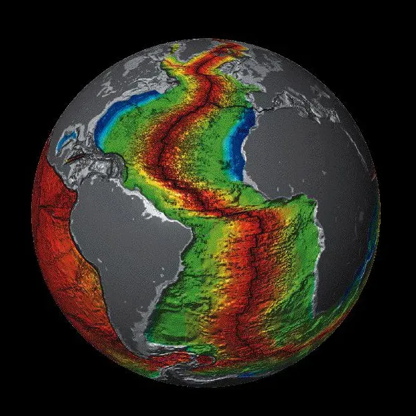
In 2022, a NOAA expedition mapping the Mid-Atlantic Ridge stumbled onto something that looked almost engineered. Small, oblong cavities sat spaced about 10 centimeters apart, repeating in tidy rows for several meters at a time, roughly 2,700 meters down. The pattern was so precise that researchers openly wondered if it was human-made, until they remembered nobody has a submarine drilling perfect polka-dots into the abyssal plain.
It wasn’t even the first sighting. Similar tracks turned up in 2003 near the same region, and scientists were just as stumped then as they are now. A Norwegian team later caught a previously undocumented digging crustacean near similar holes elsewhere and floated it as a likely culprit, but even NOAA’s own lead researcher won’t call it solved.
“I’m thinking that this truly is something that nobody knows the answer to.”
Michael Vecchione, NOAA Fisheries scientist
#12 – California’s Field of 500 Perfectly Spaced Craters
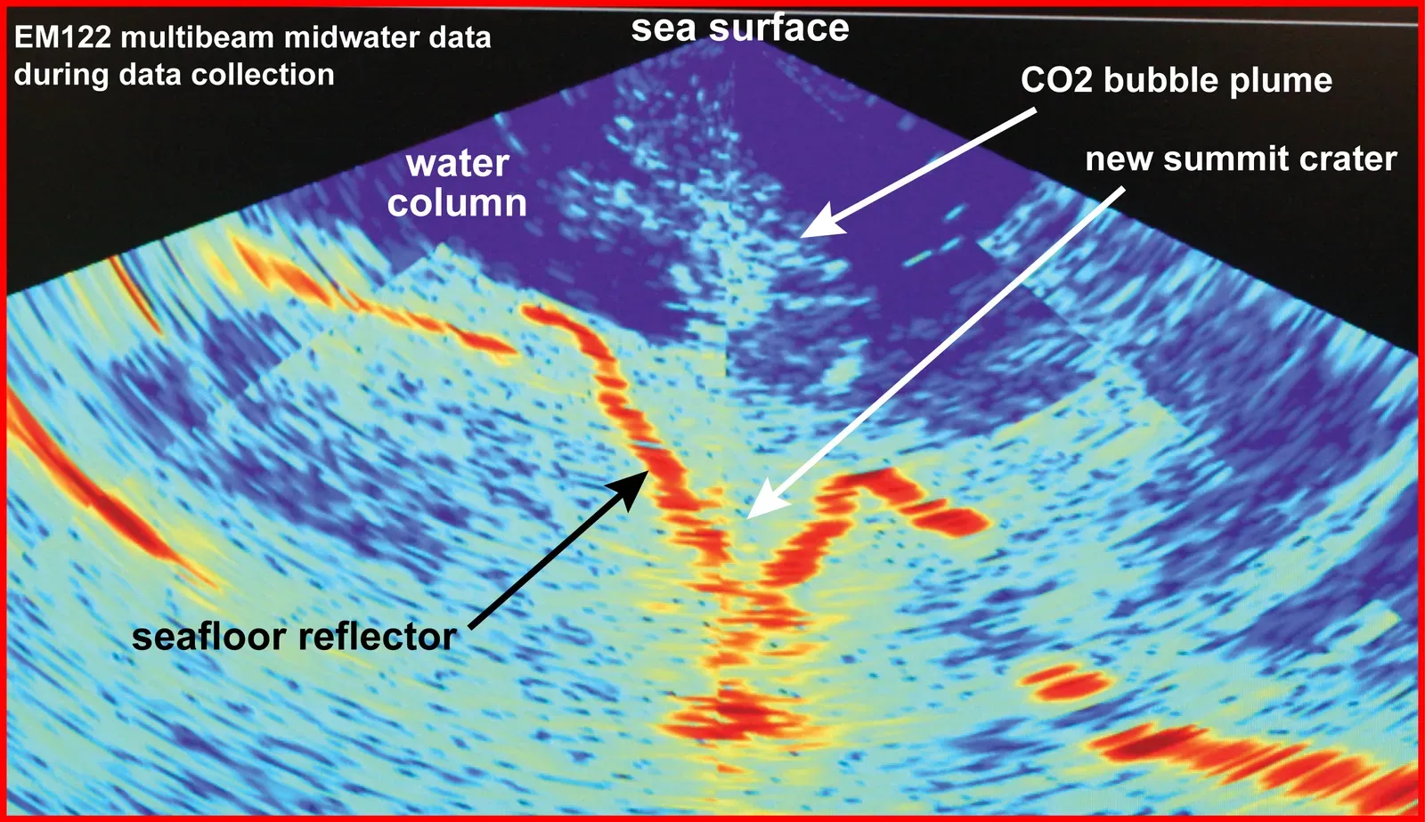
Off the coast of Big Sur sits one of the strangest landscapes in the Pacific: thousands of evenly spaced pockmarks spread across roughly 500 square miles, each one sinking up to 16 feet deep. For decades, the textbook explanation was simple – escaping methane gas had punched the holes into the mud one bubble at a time.
Then new mapping using an ROV and more than 500 sediment cores blew that theory apart. Each depression measured roughly 656 feet across, and instead of pockets of trapped gas, the layers underneath were packed with sand sheets left by ancient sediment flows. Twenty years of accepted science, quietly wrong the whole time – and the real cause is still being pieced together, with real stakes for how offshore wind farms get planned in the area.
Fast Facts
- Field size: roughly 500 square miles off Big Sur, California
- Individual craters: up to 16 feet deep and about 656 feet across
- Old theory: escaping methane gas punching through mud
- New evidence: 500+ sediment cores show sand sheets from ancient flows, not gas pockets
#11 – The Sound That Has Repeated Every Year Since 1991
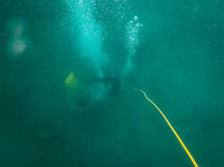
Forget the Bloop – that one got solved (it was an icequake). The sound nobody has cracked is called Upsweep, and it’s been playing on a loop since NOAA’s hydrophones first switched on. Recorded in August 1991 using the Pacific Marine Environmental Laboratory’s underwater sound surveillance system, it’s loud enough to register clear across the entire Pacific Ocean, arriving as a long train of narrow, upsweeping tones a few seconds apart.
Scientists have roughly located it, deep in the remote South Pacific near suspected volcanic activity, which makes underwater volcanism the leading suspect. But NOAA stops short of calling it solved, because the sound rises and falls with the seasons every single year, growing more prominent during the Southern Hemisphere’s spring and autumn. Nobody can say whether that’s the source itself changing, or just sound behaving differently as the ocean’s temperature layers shift with the seasons.
#10 – Rocks That Make Oxygen With No Sunlight at All
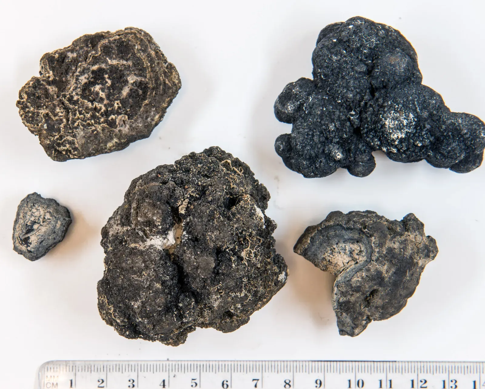
For over a decade, one marine ecologist kept getting oxygen readings on the deep Pacific floor that made no sense. Photosynthesis needs light, and at 13,000 feet down there is none – yet oxygen levels kept climbing instead of falling, upending the basic assumption that all deep-ocean oxygen trickles down from sunlit plankton and algae above.
The suspected source turned out to be polymetallic nodules, the same metallic lumps deep-sea mining companies are racing to scoop up. The idea clicked when the researcher heard someone on a video describe the nodules as “a battery in a rock” – potentially charged enough to split seawater into hydrogen and oxygen on their own.
“Amazingly, there was almost a volt of electric charge on the surface of these nodules.”
Andrew Sweetman, marine ecologist
#9 – The Baltic Sea’s Unclassified Stone Disc
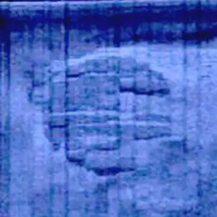
In 2011, a Swedish diving team scanning for shipwrecks picked up a sonar image of something sitting on the Baltic seafloor with straight edges, sharp right angles, and drag marks trailing hundreds of feet behind it. It measured 60 meters wide, 210 meters long, and 4 meters tall, its flat top marked with strange ridges and symmetrical lines. Naturally, the internet decided it was a crashed spacecraft.
The far more grounded explanation, offered by a Stockholm University geologist who examined recovered rock samples, points to the Ice Age – a volcanic boulder possibly dragged into place by ancient glaciers. That’s the leading theory, but here’s the friction point most people skip: no research team has ever drilled a core sample straight through the main structure. Which means “solved” is really just shorthand for “nobody’s disproven it yet.”
#8 – The Arctic Craters That Blew Out From Below
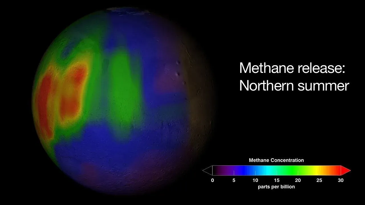
Scattered across parts of the Arctic seafloor and nearby permafrost zones sit giant craters that weren’t carved by erosion, waves, or grinding ice. They were punched out from underneath by trapped gas that finally gave way, first mapped in detail in the Barents Sea and looking almost identical to the Siberian permafrost craters that occasionally make headlines when a fresh one blows open on land.
What keeps researchers uneasy isn’t that these ancient craters exist – it’s whether the same gas-charged conditions that built them are quietly reloading somewhere else right now. Warming Arctic waters are known to destabilize methane hydrates, the icy, gas-trapping compounds buried in cold sediment, but pinpointing exactly where the next blowout-sized pocket is building remains one of polar oceanography’s genuinely unsolved forecasting problems. It’s less a “what happened” mystery and more a “where’s the next one” mystery, which is exactly why monitoring stations keep multiplying across the region.
Worth Knowing
- First mapped in detail in the Barents Sea
- Formed by trapped gas blowing out from underneath, not erosion or ice
- Nearly identical to Siberian permafrost craters that appear on land
- Warming Arctic waters can destabilize the methane hydrates that build these pockets
- Monitoring stations are expanding to catch the next one before it blows
#7 – The Hydrothermal Field That Might Explain How Life Began
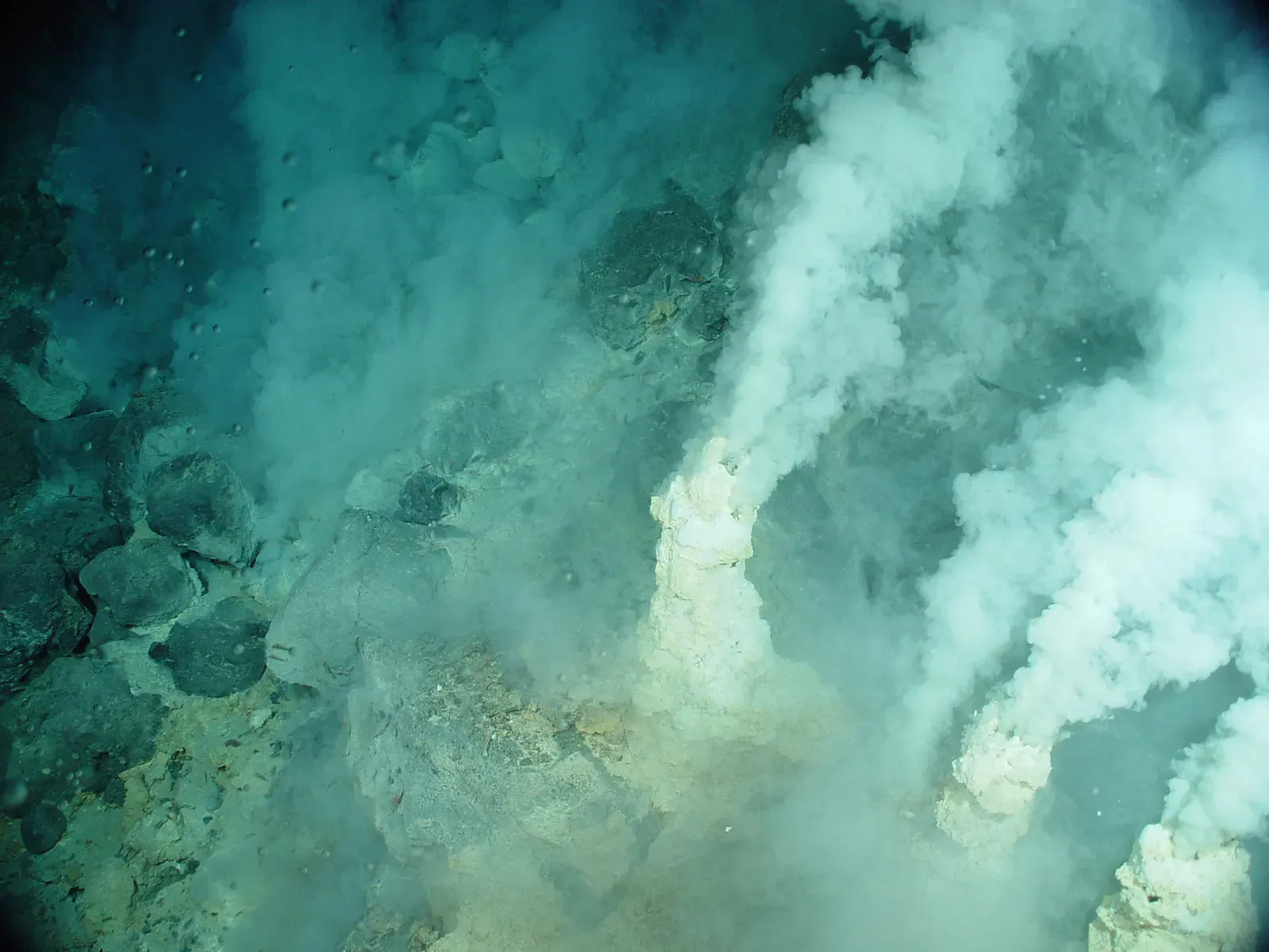
Deep in the mid-Atlantic sits a hydrothermal system unlike the famous “black smoker” vents most people picture. Instead of scalding, acidic, mineral-blasted water, this field vents cooler, alkaline fluid through towering white carbonate chimneys, some as tall as a 20-story building, powered not by volcanic magma but by a slow chemical reaction between seawater and mantle rock called serpentinization.
That chemistry matters because it produces hydrogen and simple organic molecules with no sunlight, no biology, and no volcanic heat involved – essentially assembling the raw ingredients for life from nothing but rock and water. Researchers have long floated the idea that vent fields like this one resemble the actual conditions where life first sparked on early Earth, but nobody has proven it happened this way rather than some other route entirely. Decades after the first white chimneys were mapped, origin-of-life researchers are still arguing about it.
#6 – Microbes Pulled From the Seafloor After 100 Million Years Asleep
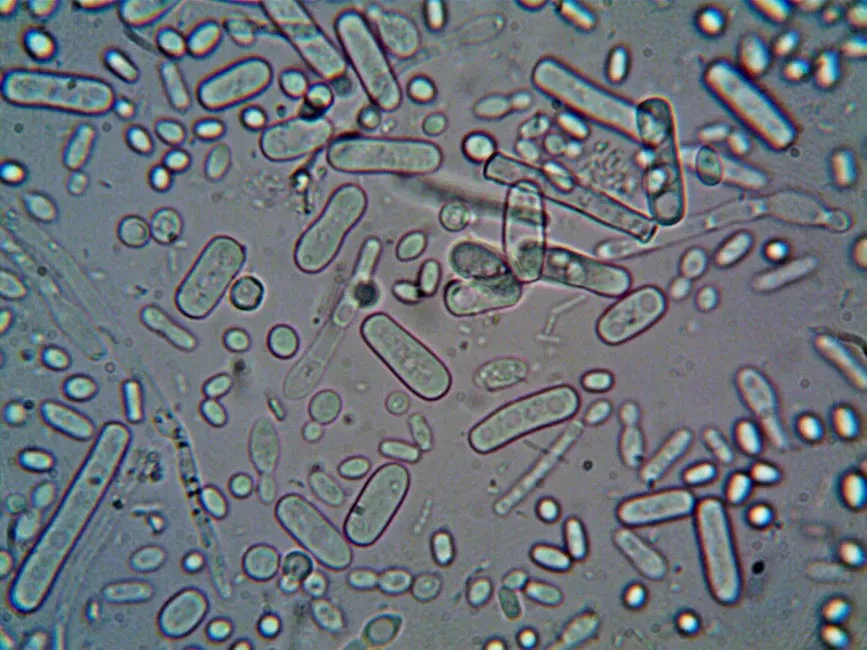
Deep drilling programs that punch cores into ancient seafloor sediment have turned up something that sounds almost impossible: microbial cells buried tens of meters below the ocean floor, cut off from sunlight, oxygen, and fresh nutrients for tens of millions of years, that woke up and started multiplying again once given food and time in a lab.
These weren’t hardy surface bacteria – they were sealed inside sediment layers so old they predate most dinosaurs, surviving on almost immeasurably tiny amounts of energy the entire time. The part that genuinely stumps microbiologists isn’t that the cells survived; extreme dormancy is well documented elsewhere. It’s how they avoided the DNA and cellular damage that should have piled up over such an enormous stretch of time with virtually no metabolic activity to repair it, and nobody has a clean mechanism for that kind of preservation on geologic timescales.
#5 – The Underwater Lakes That Kill Anything That Touches Their Edge
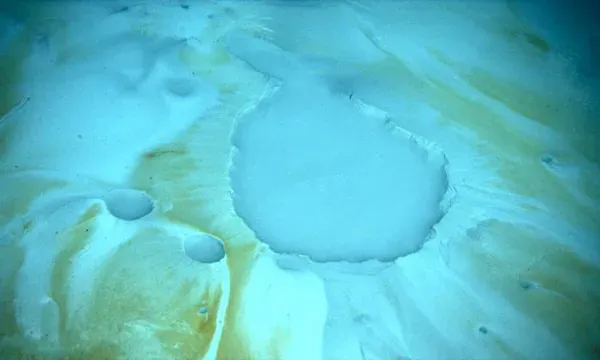
Scattered across the Gulf of Mexico and parts of the Mediterranean seafloor are pools of water so salty they refuse to mix with the ocean around them. They pool into their own miniature lakes, complete with shorelines, at depths of a thousand feet or more. Nicknamed things like the “Jacuzzi of Despair,” these brine pools are several times saltier than normal seawater and almost completely oxygen-free.
Crabs and other creatures occasionally wander in looking for an easy meal and simply don’t come back out – the hypersaline, anoxic water preserves them where they die at the pool’s edge, ringing the perimeter with tiny graveyards. What still isn’t fully mapped is the microbial life sealed inside these pockets. Some brine lakes have likely been chemically cut off from the surrounding ocean for thousands of years, and nearly every new one sampled turns up organisms that don’t match anything already catalogued.
#4 – The Blue Holes Nobody Has Fully Mapped
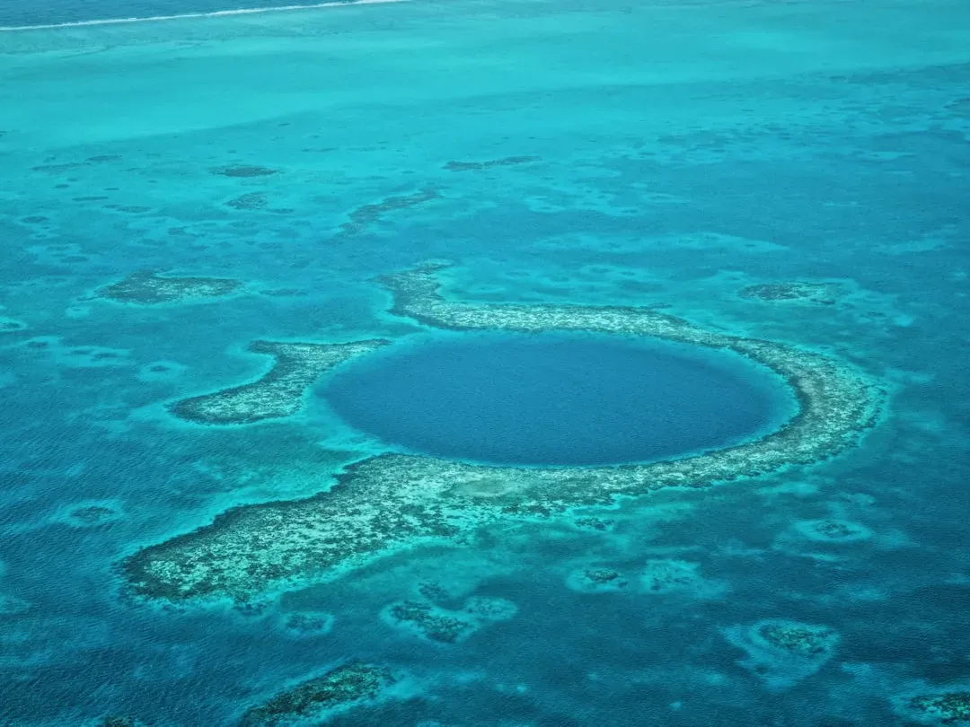
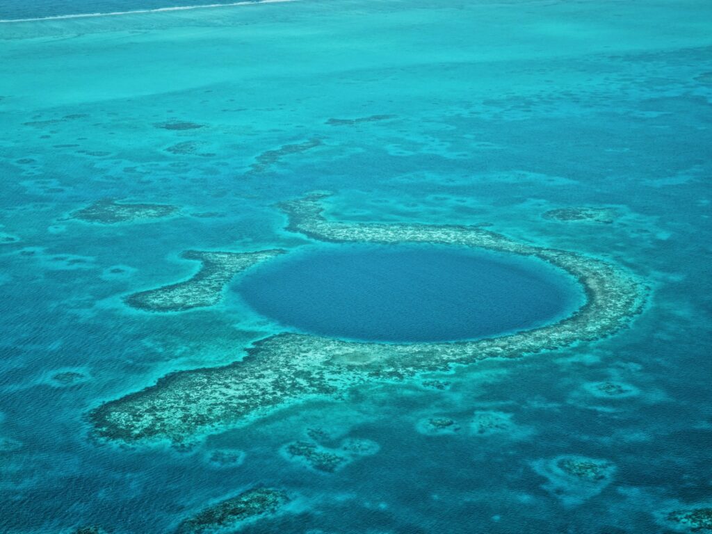
Giant sinkholes puncture reef systems and continental shelves around the world, plunging straight down into darkness. The most famous sits off Belize, but an even deeper one, found more recently in the South China Sea, drops further than the length of two football fields stacked end to end. These blue holes were carved out during past ice ages when sea levels sat far lower, then flooded again as the ice melted.
What keeps them a live mystery rather than a closed case is what’s underneath the visible entrance. Many blue holes branch into networks of underwater caves and tunnels that divers and submersibles have only partially explored, some reportedly connecting to other holes miles away through passages nobody has fully traced. The deepest layers of several blue holes hold water so stagnant it hasn’t mixed with the surface in centuries, quietly preserving chemical and fossil records scientists are still learning to read. We genuinely don’t know how far some of these tunnel systems go.
Quick Compare
- Belize Blue Hole – the most famous of the group, made a global icon by early exploration
- South China Sea Blue Hole – discovered more recently, drops deeper than two football fields stacked end to end
- Shared origin – both carved during past ice ages, then flooded as sea levels rose
- Shared mystery – both hide cave and tunnel networks that remain only partially explored
#3 – Japan’s Underwater “Monument” That Splits Geologists
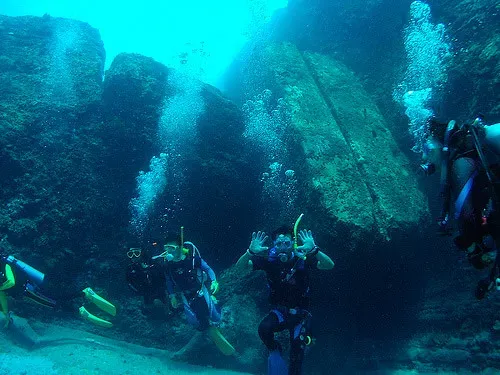
Off the coast of Yonaguni, Japan’s westernmost island, divers found a massive rock formation sitting roughly 80 feet underwater – flat terraces, sharp right-angle edges, and what look like carved steps, all in a region tied to old legends of a sunken landmass. One prominent local geologist has spent decades arguing it’s an intentionally shaped, human-made structure, possibly thousands of years old.
Most geologists outside that camp disagree, pointing out that the local sandstone naturally fractures along straight lines and flat planes, the same way certain rock types split into stair-like ledges on land. Neither side has managed to settle it completely. No tool marks conclusive enough to end the debate have ever been agreed upon, and no dig has definitively dated when the terraces took their current shape – making this one of the very few seafloor sites where trained geologists still publicly disagree on natural versus artificial origin.
#2 – The Hidden Rivers Eating Antarctica’s Ice From Below
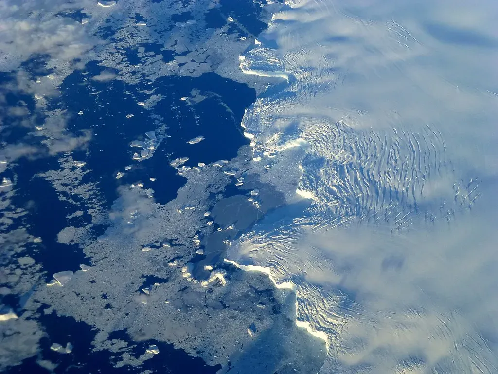
Beneath some of Antarctica’s most unstable glaciers, researchers have found cavities and channel-like conduits carved into the underside of the ice where it meets the seafloor. These hidden pathways let warmer ocean water sneak deep underneath the ice shelf and melt it from the inside out, far faster than anyone predicted from surface observations alone.
What’s unsettling isn’t just that these channels exist – it’s that satellite and radar surveys keep finding new ones in places models never flagged as vulnerable. Scientists don’t yet have a reliable way to predict where the next hidden conduit will form, which makes forecasting how fast specific glaciers will destabilize a genuinely open problem rather than a settled equation. Every expedition that maps a new one seems to reveal that these under-ice waterways are more widespread, and more erratic, than the last model assumed.
#1 – Nobody Actually Knows How Many Fish Live on the Ocean Floor’s Edge
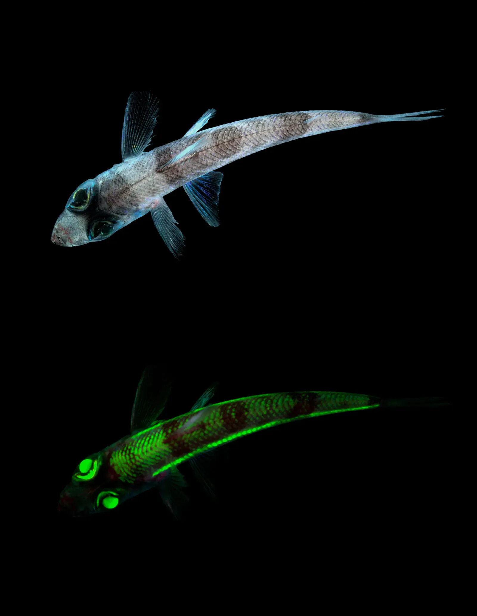
This is the seafloor mystery with the biggest real-world stakes, and almost nobody outside oceanography has heard of it. In the mesopelagic “twilight zone,” the deep water layer hugging the upper edge of much of the world’s continental slopes and open-ocean floor, acoustic surveys have picked up biomass signals suggesting there may be far more fish down there than every historical catch record and population model combined ever accounted for.
The scale of the discrepancy is what makes this genuinely unresolved. Some survey-based estimates put potential twilight-zone fish biomass at levels that dwarf the combined weight of every other fish population humans currently track, yet nobody can say with confidence how much of that acoustic signal is fish versus other organisms, or how that biomass moves carbon between the surface and the deep sea. That carbon question isn’t a minor footnote – it directly shapes how accurately climate models can account for how much carbon dioxide the ocean actually locks away each year. We’re talking about a potentially massive, uncounted population that could be reshaping global carbon estimates, and scientists still can’t agree on the number.
At a Glance
- Location: the mesopelagic “twilight zone,” along the upper edge of continental slopes and open-ocean floor
- Detection method: acoustic biomass surveys, not direct counts
- Scale: potential biomass estimates that dwarf every other tracked fish population combined
- Open question: how much of the signal is fish versus other organisms
- Why it matters: directly affects how climate models calculate ocean carbon storage
If there’s one thread running through all thirteen of these findings, it’s this: the ocean floor keeps outpacing our ability to explain it, and that should bother us more than it does. We’ve sent probes to Mars with more confidence than we’ve mapped our own seafloor.
The truth is uncomfortable but simple. Most of these mysteries aren’t unsolved because the science is bad – they’re unsolved because so little of the deep ocean has actually been surveyed. Every fresh expedition seems to replace one settled answer with three new questions, and honestly, that’s the part that keeps me hooked. My money’s on the Baltic disc getting a real core sample within the decade; my money’s also on that twilight-zone fish count staying a mess far longer than anyone in a climate meeting would like to admit. Which of these thirteen findings do you think gets solved first – and which one do you think never will? Drop your theory in the comments.