Every river is a restless storyteller. It shifts, it floods, it dries, and in those changes it quietly buries and then reveals entire human worlds. Again and again, archaeologists have walked into a dried riverbed or a newly cut channel and realized, almost in disbelief, that a lost city, a forgotten temple, or an ancient battlefield has been sitting there in the mud the whole time. When a river moves, the past sometimes floats back to the surface.
This list looks at twelve real places around the world where changing rivers – whether through natural shifts, climate, or dams – helped reveal major archaeological sites. Some are now UNESCO showpieces, others were only caught just in time before being re-flooded, and a few are still quietly eroding out of a bank. What connects them is simple: if the water had not moved, we might not know they existed.
We’ll move from the Nile to the Tigris, from the Danube to the Mississippi, and look at the science of how rivers migrate, the politics of dam-building, and the human stories rediscovered in silt and sand. You’ll notice a pattern: rivers do not just shape landscapes, they shape what we remember – and what we forget. Some of these discoveries are almost cinematic; others are messy, incomplete, and still debated. That’s what makes them fascinating.
#1 – Abu Simbel and the Nile’s Forced Detour
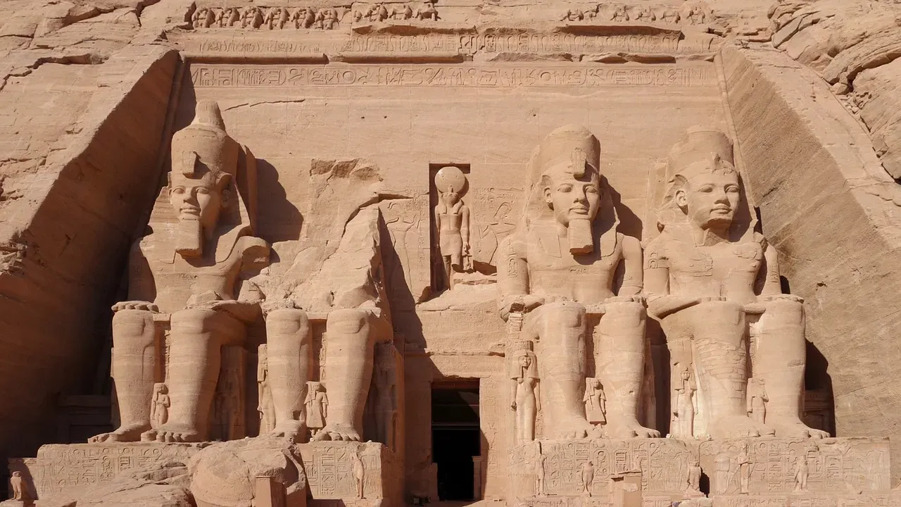
One of the most dramatic examples of a river changing course revealing (and nearly erasing) archaeology comes from the Nile and the temples of Abu Simbel in southern Egypt. When Egypt began constructing the Aswan High Dam in the mid twentieth century, engineers knew the Nile’s annual flooding would be transformed into a huge reservoir, Lake Nasser. Suddenly, ancient temples that had always sat above the seasonal flood line were doomed to disappear under permanent water. Their fate forced archaeologists to map, document, and in some cases literally move monuments that had been only partially understood before.
Abu Simbel – two massive rock-cut temples built under Ramesses II – became a global rescue project. Before the lake filled and the Nile’s local channel effectively shifted into a wide inland sea, teams of engineers and archaeologists cut the temples into blocks and reassembled them seventy meters higher and several hundred meters inland, on an artificial hill overlooking the new shoreline. In the process, detailed documentation, hidden inscriptions, and architectural features that had never been systematically studied were finally recorded. A change in the river’s course forced modern science to meet ancient engineering head-on.
The story of Abu Simbel is less about a sudden new discovery and more about a radical re-discovery. The temples had been known since the nineteenth century, but the impending change of the river landscape suddenly made every carved surface urgent. This is a pattern you’ll see again: once we know a river is about to inundate a region forever, we often race to record and, where possible, save what the old channel had quietly protected. The river, in effect, sets the deadline.
#2 – The Submerged Cities of Thonis-Heracleion in the Nile Delta
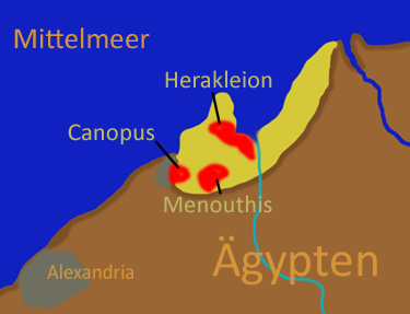
Far to the north, in the Nile Delta, another chapter of river-driven discovery unfolded underwater. The port city known today as Thonis-Heracleion was once a crucial gateway between Egypt and the Mediterranean world. Over time, the Nile’s distributary branches shifted, the delta subsided, and parts of the coastline sank. The result was that this important harbor city disappeared beneath the waves and mud, its existence remembered in texts but with no obvious ruins on land to match the descriptions.
Modern underwater archaeology in the early twenty-first century began to change that. As sediment patterns and old river channels were mapped off the present coastline, researchers realized they were dealing with former mouths of the Nile – essentially, fossil riverbeds now under the sea. Within these paleochannels and nearby submerged sandbars, divers found colossal statues, temple foundations, ships, docks, and everyday objects that confirmed the location of Thonis-Heracleion and neighboring sites.
What made the discovery possible was not just good luck but careful reconstruction of how the Nile’s many arms have moved over the last two millennia. By treating the seafloor as a former river delta rather than static seafloor, archaeologists could predict likely locations for harbors and canals. In a sense, once they could see where the river used to run, the city almost had to be there. The drowned port was never entirely lost; it was simply following the Nile’s long, slow dance with the Mediterranean.
#3 – Mohenjo-daro and the Shifting Indus System
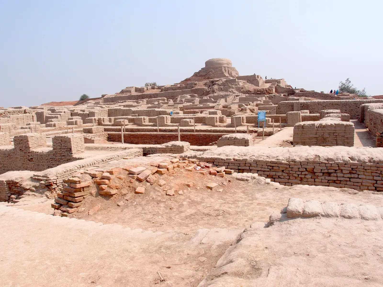
Mohenjo-daro, one of the greatest cities of the Bronze Age Indus civilization, stands today on a dusty plain in modern Pakistan, far from any big, roaring river. But the logic of its location – its gridded streets, its sophisticated drainage, its brick architecture – only makes sense if you realize that the Indus and its tributaries have not always flowed where they do now. Geological and geomorphological studies suggest that major river channels in this region have migrated significantly since antiquity, perhaps leaving once-riverine cities high and dry.
Early explorers in the nineteenth and early twentieth centuries were puzzled: why build such an advanced city in what looked like a marginal landscape? As they began to map ancient channels visible in satellite imagery and on the ground, they realized that Mohenjo-daro’s urban plan lines up with an older, now-abandoned course of the Indus or one of its branches. The modern river’s shift helped preserve the site under layers of windblown silt instead of eroding it away, but it also confused later observers, delaying its recognition as part of a broader, river-focused civilization.
By identifying these old channels, archaeologists have gone on to locate other Indus sites that hug vanished riverbanks, including along what many believe to be the course of the lost Saraswati or Ghaggar-Hakra River. The Indus system’s habit of jumping across its floodplain essentially turned parts of the desert into a time capsule. When we talk about river changes “revealing” sites here, it is partly literal – erosion exposing walls in a cut – and partly intellectual: understanding that the city and its neighbors only make sense when we mentally put the river back where it used to be.
#4 – The “Lost” Angkorian Ports along the Mekong and Tonlé Sap
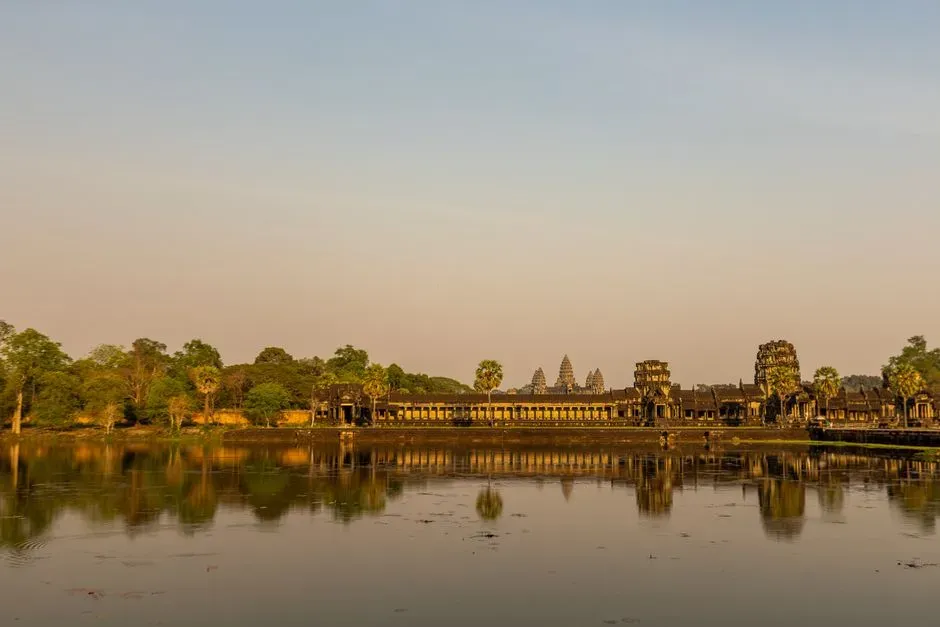
Angkor, in Cambodia, is famous for jungle temples and stone faces, but its real secret weapon was water. The Khmer Empire built and managed a huge hydrological network of canals, reservoirs, and modified channels connected to the Mekong and the Tonlé Sap. Over the centuries, natural shifts in these rivers and human interventions changed flows and silt patterns, burying some features and exposing others. Modern remote sensing and ground surveys have located ancient ports and occupation sites in places where today the main channels have wandered away.
As floods and dry-season lows subtly rearranged banks and backwaters, villagers occasionally reported pottery, bricks, or carved stones eroding from river edges. These finds, once taken seriously, guided archaeologists to clusters of levees, wharves, and urban features that had been misinterpreted as purely natural mounds. In some cases, meander cutoffs – when a river shortens its path and leaves a crescent oxbow – exposed buried material in the newly formed banks or abandoned loops.
What is particularly striking about the Mekong–Tonlé Sap system is how dynamic it still is. Seasonal flow reversals and long-term channel adjustments keep rewriting the landscape, which can feel like trying to study a moving target. Yet this same movement keeps nudging pieces of the Angkorian world back into view. When a river cuts a little deeper one year or floods slightly farther inland, it might scrape past a buried landing place or reveal the edge of an old embankment. The river is still editing Angkor’s story in real time.
#5 – The Ancient City of Lahun and the Old Bahr Yusef Channel
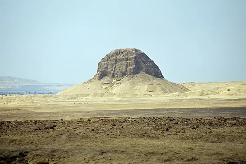
In Egypt’s Faiyum region, the relationship between changing river courses and archaeology is particularly intimate. The area is fed by a channel of the Nile known as the Bahr Yusef, which in antiquity was carefully managed to control water entering the Faiyum depression. Over the long term, shifts in the channel’s route and maintenance have changed where fertile land and settlement clusters could exist. The Middle Kingdom town of Lahun (or Kahun) sits near what was once a strategic node in this system, linked to a pyramid complex and irrigation works.
When nineteenth-century surveyors and archaeologists tried to map the site, they noticed that abandoned channels and levees near Lahun did not match the present watercourse. This realization helped them understand why a planned workmen’s town and a royal pyramid had been built there: they were hinged to an older alignment of the Bahr Yusef. Erosion along partially abandoned channels, and the exposure of ancient embankments when modern water levels dropped, revealed parts of the town and associated installations that would otherwise have been mistaken for natural ridges.
Key threads that tie Lahun to river changes include:
- Ancient embankments preserved because the main flow later shifted away.
- Canal cuts and silted basins visible only when modern flows receded.
- Settlement patterns that suddenly made sense once the old course was reconstructed.
In my view, Lahun is a reminder that not every dramatic discovery comes from a huge, headline-grabbing ruin. Sometimes it is the careful matching of modest mudbrick walls to an old water line that makes you realize you are looking at an entire vanished hydraulic landscape.
#6 – Mesopotamian Cities Rediscovered by the Wandering Tigris and Euphrates
![#6 – Mesopotamian Cities Rediscovered by the Wandering Tigris and Euphrates (Zekeriya, Kurşun (2012), “Does the Qatar Map of the Tigris and Euphrates belong to Evliya Çelebi?”, in Journal of Ottoman Studies [Osmanlı Araştırmaları][1], issue 39, pages 1–15[dead link], Public domain)](https://nvmwebsites-budwg5g9avh3epea.z03.azurefd.net/dws/a275f45b4f21def48bfc81b3d2069553.webp)
In Iraq and Syria, the Tigris and Euphrates have been wandering back and forth across their alluvial plains for thousands of years. Ancient cities that once sat directly on their banks now lie kilometers away in dusty fields; others became stranded on abandoned meanders. Modern geomorphology, satellite imagery, and, frankly, some timely erosion have helped re-identify settlements whose names were known from texts, but whose locations were uncertain. There is a striking irony here: the rivers that made Mesopotamian civilization possible also helped hide its cities from later generations.
Many tells – the mounded remains of ancient cities – were always visible as low hills, but their relationship to river courses was not well understood. As rivers shifted and cut along new lines, bank erosion exposed pottery and brickwork that drew attention to some otherwise ignored mounds. In other cases, drought years and lowered water levels revealed buried walls and harbor installations along cut-off meanders. When archaeologists overlaid these clues with evidence for old channels, it became clear that several Mesopotamian capitals had once stood right on major water routes that are now dry or minor.
A few recurring insights from this region stand out:
- Old canal and river traces can guide field surveys to likely city locations.
- Meander cutoffs may expose cross-sections of buried settlements.
- Changes in the river system can protect as well as destroy deposits, depending on where the active channel moves.
If you spend time with the maps, you start to feel like you are chasing the ghosts of rivers as much as the ghosts of cities. And once you follow those ghost channels, sites that seemed random on the plain suddenly fall into a logical riverine network.
#7 – Neolithic and Bronze Age Sites along the Danube’s Abandoned Arms
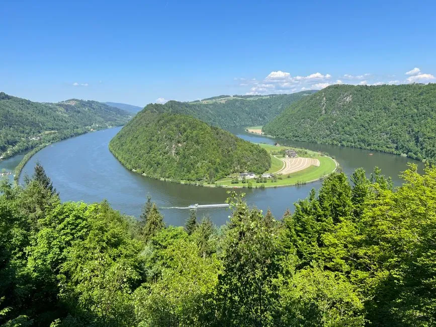
In Central and Eastern Europe, the Danube has long been a corridor of movement, trade, and settlement. But the river you see today is not exactly the one the first farmers or Bronze Age traders knew. Over millennia, the Danube has created and abandoned various branches, especially in floodplain zones. As it has done so, some prehistoric sites have ended up tucked against former banks, on natural levees now far from the modern channel. Drainage projects, cutoffs, and low water events have occasionally sliced into these older formations and exposed archaeological layers.
Archaeologists working in countries like Hungary, Serbia, and Romania frequently encounter sites where pottery, tools, and house remains line up with paleochannels rather than the current river. When the Danube or its smaller arms change course – sometimes very suddenly in flood years – they may undercut these deposits and drop artifacts into the water, where dredging or erosion brings them to light. In a few documented cases, erosional scarps created by modern channelization have literally revealed cross-sections of prehistoric settlements, including floors and hearths.
Summarizing how the Danube’s wandering helps discovery:
- Abandoned channels mark former riverbanks where people preferred to live.
- Modern river engineering exposes old deposits by cutting into these banks.
- Low water years reveal structures in what are now side arms or oxbow lakes.
To me, there is something strangely intimate about standing on a high, dry terrace and realizing it was once a riverside address, complete with a view and easy boat access. The Danube moved on, but the imprint of human choice is still there in the soil.
#8 – Mississippian Mounds Exposed by Shifting Channels of the Mississippi
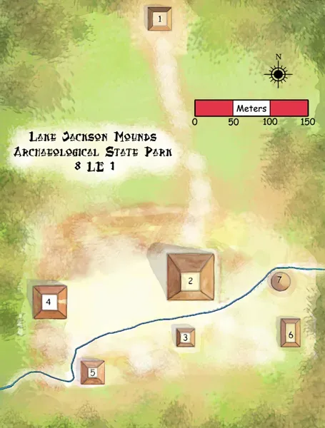
North America’s Mississippi River is famously restless. It meanders, it cuts off loops, it avulses into new channels. Long before modern levees tried to pin it down, Indigenous societies built mound complexes on natural levees and bluffs overlooking its waterways and their floodplains. Over centuries, as channels migrated, some of these sites were eroded; others ended up relatively protected on high ground with the main flow diverted away. A few mound sites came to wider attention because erosion along new cutbanks exposed artifacts and earthwork profiles.
In the lower Mississippi valley, archaeologists studying Mississippian and earlier Woodland cultures often start by mapping old channels – visible in aerial imagery as sinuous ridges and oxbow lakes – and then walking those features. When the active river shifts and slices into one of these traces, you occasionally get a kind of accidental test trench: pottery, stone tools, and mound fill tumble out, alerting locals and professionals that something significant is embedded in the bank. Some previously undocumented mound groups have been recognized this way.
There is a bittersweet feeling here. The same process that reveals a site is often the one that destroys it. A single flood season can eat several meters into a mound edge. Still, without the river’s changes, we might never know that certain communities invested so much labor in reshaping their landscape. The Mississippi’s wandering is a reminder that archaeological discovery is often entangled with loss, and decisions about river control today will quietly decide what future archaeologists do – or do not – get to find.
#9 – The Rhône and the Roman Wrecks of Arles
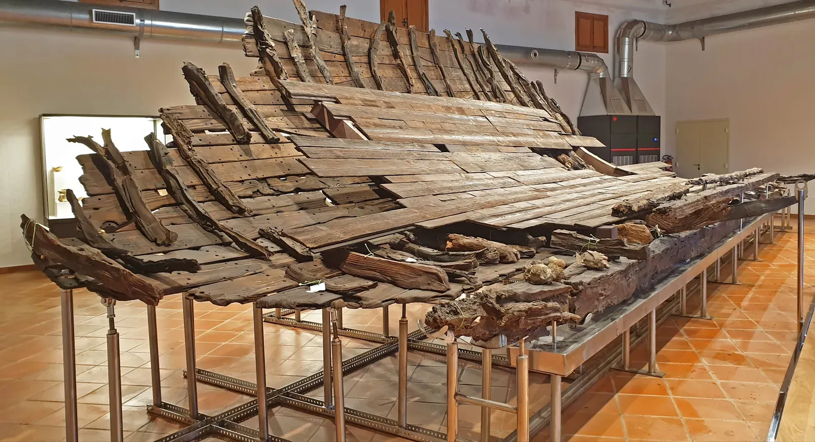
In southern France, the Rhône River meets the Mediterranean after winding past the ancient city of Arles. For centuries, shifts in the river’s course, silting, and dredging have relocated the navigable channel and left behind pockets of slack water and buried sediments. In these old arms and under modern quays, archaeologists have uncovered remarkably preserved Roman shipwrecks, cargoes, and waterfront structures. The finds sometimes come to light when the river’s level drops unusually low or when engineering works cut into former beds.
One striking aspect of the Arles discoveries is the vertical layering. Old quays, collapsed buildings, and ship hulls lie stacked under later river deposits, with the active channel having migrated slightly away over time. When the modern course was straightened and deepened, workers and archaeologists suddenly had windows into these buried layers. Because the river had gradually shifted its main erosive power elsewhere, organic materials like wood and leather survived in waterlogged conditions until their twentieth and twenty-first century excavation.
In a sense, the Rhône’s slow re-routing turned parts of the ancient port into a watery archive. Only when humans forced the river back with dredging did we cut into that archive. The pattern is clear:
- The river moves and leaves behind sheltered, low-energy zones.
- Harbor and city debris accumulates and is sealed in silt.
- Later changes to the channel, whether natural or engineered, slice back into these deposits and reveal them.
I find river ports like Arles particularly evocative because they show how closely trade, risk, and preservation are linked. Every ship that went down in a bend was a disaster then and a gift to archaeologists now.
#10 – The Yellow River’s Wild Swings and Forgotten Settlements
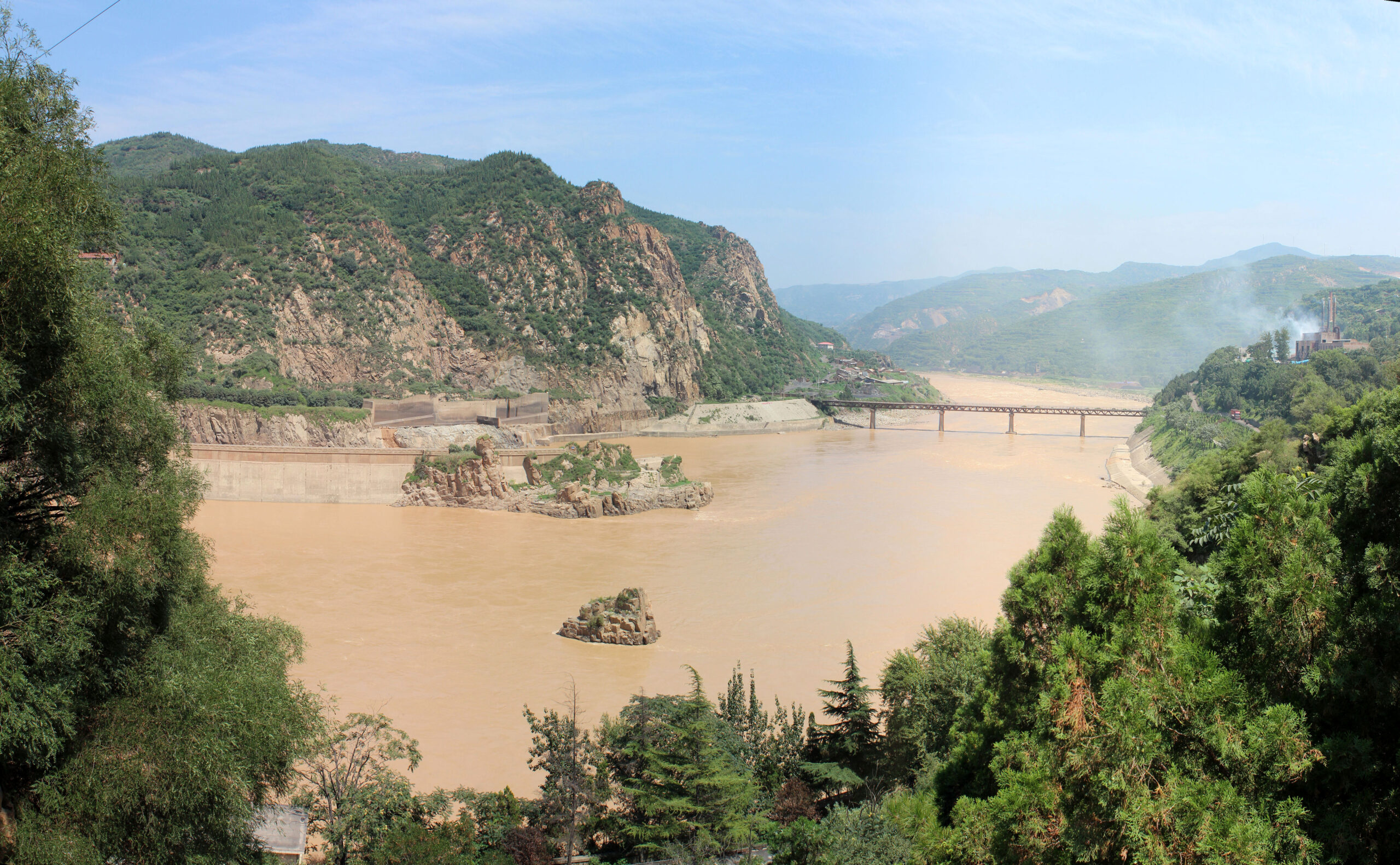
China’s Yellow River has a long, destructive reputation. Often called “China’s sorrow,” it has shifted course many times across the North China Plain, sometimes carving entirely new paths to the sea. These huge avulsions, combined with more subtle meander changes, have left layers of abandoned channels and flood sediments. In between and along these ancient courses lie the remains of Neolithic villages, Bronze Age towns, and later communities that once sat adjacent to now-vanished branches of the river.
Archaeologists using boreholes, sediment cores, and remote sensing have mapped these paleo-channels and then compared them with the distribution of known sites. Time and again, clusters of finds that once seemed oddly placed fall neatly onto the margins of an older Yellow River course. In some cases, modern erosion – when the current channel undercuts a bank or when a canal project slices through old levees – has physically exposed cultural layers, alerting researchers to previously unknown occupations.
Some key patterns stand out:
- Sites tend to hug the higher ground along fossil channels, where floodwaters were manageable but access to water was easy.
- Major shifts in the river’s course often correlate with phases of abandonment or relocation in the archaeological record.
- Newly exposed sections of bank after a channel move can yield artifacts that prompt more systematic excavation.
The Yellow River’s wildness has undoubtedly destroyed countless remains, but it has also scattered clues across a broad landscape. When I read field reports from this region, I get the sense of archaeologists patiently stitching together a moving puzzle, always aware that the main player in the story is still flowing right past them.
#11 – Olduvai Gorge and Fossil Streams in an East African Rift Valley
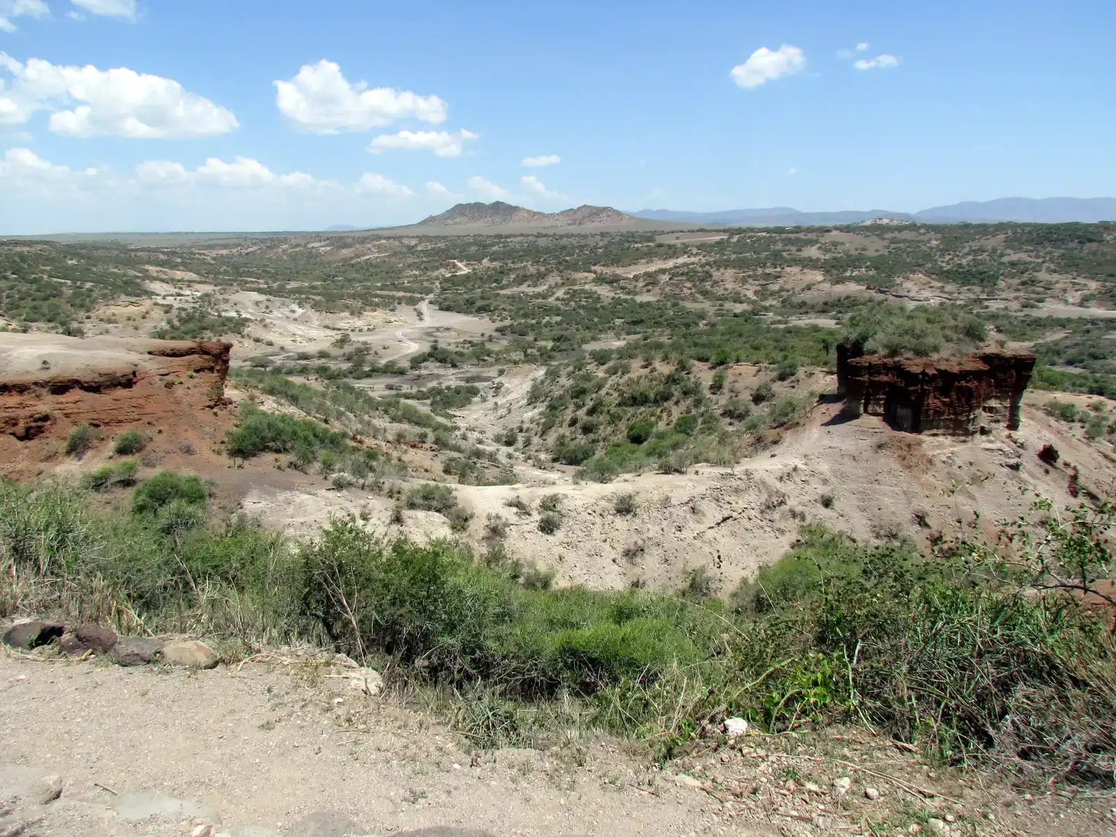
At first glance, Olduvai Gorge in Tanzania is all about rock and dust, not flowing rivers. But the gorge exists because streams and small rivers have been cutting down through layered sediments for a very long time, exposing some of the most famous early human sites on Earth. In the deep past, watercourses moved across the basin in different patterns, laying down lake margins, streambeds, and floodplain soils where hominins lived, butchered animals, and made tools. Later, as tectonics and climate changed, the drainage network reorganized, and modern channels began slicing through those old surfaces.
So although we often credit erosion in general for the finds at Olduvai, it is specifically the re-routing of streams and ephemeral rivers that has opened windows into old landscapes. Each time a channel cuts a bit deeper, it reveals a cross-section through a previously buried surface where stone tools, bones, and footprints might sit. Many classic sites there owe their visibility to the way water carved the gorge rather than to any deliberate search pattern. In a literal sense, the rivers changed course vertically more than horizontally, but the effect is the same: past activity surfaces in a new place.
What I find powerful about Olduvai is how it collapses vast timescales. A small modern gully, maybe only a few meters wide, might be exposing sediments that record hominin life hundreds of thousands of years ago, laid down by a stream that flowed in a slightly different direction under very different climatic conditions. You can stand there and watch a trickle of water doing the same job today that a wider river did long before our own species existed: cutting, moving, and, accidentally, telling stories.
#12 – The Tigris Drought Discoveries at Kemune in the Mosul Reservoir
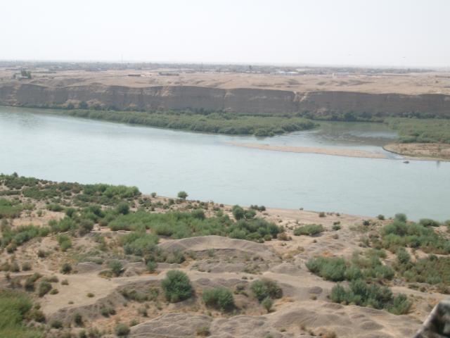
One of the most striking and very recent examples of a river system revealing a site because of changing water levels comes from the Tigris in northern Iraq. Climate-driven droughts have periodically lowered the water level in the Mosul Reservoir, an artificial lake formed behind a dam on the Tigris. When the water dropped dramatically in the early 2020s, a large Bronze Age city at Kemune emerged from the receding shoreline, astonishing even those who suspected something lay beneath. The site appears to be tied to the Mittani period and would once have stood near a major river channel, long before the dam existed.
Here, the “course change” is partly human-made and partly climatic. The dam had already transformed a stretch of the Tigris into a reservoir, altering flows and drowning everything in its footprint. Only when drought reduced inflow and managers released water downstream did the artificial river-lake shrink, exposing palace walls, storage rooms, and streets that had spent decades underwater. Archaeologists raced in, aware that the water could rise again at any time and erase their access. It was an extreme version of what smaller channel shifts do more slowly elsewhere.
What makes Kemune so compelling is the sense of urgency layered over deep time. A political decision to dam a river submerged an ancient city; then a modern climate crisis briefly returned it to the air. That sequence feels uncomfortably symbolic. We change rivers for short-term needs, often knowing we are burying history, and then extreme events remind us how thin our control really is. The Tigris, like every river in this list, is not just a backdrop to archaeology; it is an active, unpredictable force shaping what we can learn about ourselves.
Conclusion – Rivers as Reluctant Historians
Looking across these twelve examples, a pattern emerges that, to me, is both humbling and slightly unsettling. We like to imagine archaeologists as the main agents of discovery, armed with trowels, drones, and theories. In reality, rivers are often doing the heavy lifting. Their floods bury sites; their new channels slice them open again. Dams submerge cities; droughts uncover them just long enough to record. Our scientific brilliance usually arrives at the end of a chain of accidents set in motion by moving water.
I think we should take that seriously when we talk about managing rivers today. Reservoir projects on the Nile or the Tigris, channel engineering on the Mississippi, flood control along the Yellow River or Danube – all of these decisions do more than shape hydropower and agriculture. They decide which parts of the human story will be preserved under calm silt, which will be shredded by erosion, and which might briefly reappear in a future low-water crisis. We are now co-authors with the rivers, whether we like it or not.
There is also a quieter lesson here about patience and curiosity. A plain that looks empty may hide a fossil river and a forgotten city. A muddy cutbank might be the first page of an unexpected chapter in regional history. The next time you stand on a bridge and watch the water roll past, it might be worth asking yourself: somewhere upstream or downstream, what is this river quietly covering, and what is it about to reveal that we have not yet even imagined?