Beauty is supposed to be timeless, but America’s most stunning beaches are anything but static. From islands slowly migrating along the Atlantic coast to black sands born from violent eruptions in Hawaiʻi, these shorelines are laboratories where geology, climate, and history collide. Behind every postcard-perfect view is a quiet mystery: Why did this coast form here, and why is it changing now? As sea levels rise and storms intensify, the stories locked into dunes, reefs, and shipwrecks suddenly feel urgent, not just romantic. The ten beaches below are not just places to swim and sunbathe; they’re living archives where science, deep time, and human drama are written into the sand.
1. Cape Cod National Seashore, Massachusetts: The Shape-Shifting Hook

Cape Cod’s sweeping arm, curving defiantly into the Atlantic, looks like a simple sandbar on a map – but it is in fact a restless, migrating landform. The beaches that line the National Seashore sit atop glacial debris dumped here roughly ten to twenty thousand years ago, then endlessly reworked by waves and longshore currents. Each winter storm rearranges the shoreline, carving new inlets, erasing dunes, and sometimes swallowing old shipwrecks under fresh layers of sand. Standing on the outer beach near Race Point, you’re standing on a surface that did not exist in this exact configuration a few decades ago. In a very real sense, Cape Cod is not a fixed place but a moving wave of sand heading slowly west and south.
That mobility has always been both a gift and a curse to humans. Early European mariners called this section of coast a graveyard because its shifting shoals and fog led to hundreds of shipwrecks, many still buried offshore. Today, coastal ecologists use those same shoals and dunes as a natural observatory to study erosion rates, sea-level rise, and how barrier systems might respond over the next century. Roughly about one third of the seashore’s length is now closely monitored with lidar mapping and repeat aerial imaging to track changes year to year. For visitors, the result is a paradox: one of the most beautiful beaches in the country is also one of the least permanent. The exact line where land meets water today is a fleeting moment in a very long, very active geological story.
2. Waikīkī Beach, Oʻahu, Hawaiʻi: Engineering Paradise on a Volcanic Island
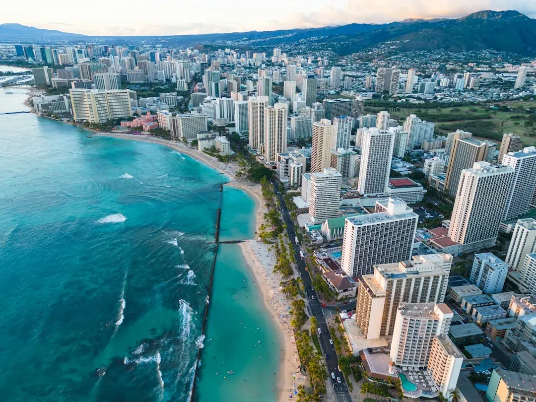
At first glance, Waikīkī looks like nature’s perfect design: white sand, turquoise water, and the volcanic silhouette of Diamond Head anchoring the horizon. The scientific reality is more complicated and, in many ways, more interesting. Much of Waikīkī’s famous sand has been artificially replenished over the last century, trucked or barged in to rebuild a shoreline that naturally wanted to narrow. Coral reefs offshore, formed by countless generations of tiny invertebrates, originally helped stabilize this coast by breaking incoming waves. As parts of the reef were damaged by development and sediment, energy hitting the shore increased, accelerating erosion and forcing engineers to intervene.
This makes Waikīkī an unusually vivid case study in how humans try to “fix” a dynamic system. Coastal scientists here experiment with different grain sizes of imported sand, new forms of breakwaters, and reef-restoration projects designed to let nature take back some of the work. There’s an uneasy trade-off: tourists expect wide, soft beaches, while the ecosystem evolved for something far more variable. On a busy day, the number of people in the water and on the sand can far exceed what the area would naturally support without runoff and crowding. Waikīkī’s beauty is undeniable, but it raises a quiet question for the future: How long can we engineer a beach to meet our desires before the physics and biology insist on a different plan?
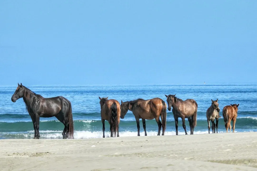
3. Assateague Island, Maryland–Virginia: Wild Horses on a Moving Barrier
Assateague Island looks like a classic Atlantic beach postcard, but it behaves like a slow-motion river of sand. This barrier island migrates landward over time as waves push sand from the ocean side to the bay side, a process known as “rollover.” The surf line you walk today may sit where salt marshes or forest once stood several human generations ago. Layered within those sands are storm overwash fans – thin sheets of displaced sand that record the passage of nor’easters and hurricanes like rings in a tree. For coastal geologists, each overwash layer is a timestamp of violent weather written directly into the dune system.
Then there are the famous feral horses, descendants of domestic animals that likely arrived here centuries ago, transforming the island’s ecology. Their grazing and trampling change dune vegetation patterns, sometimes thinning out grasses that help anchor the sand. That interplay between biology and geomorphology – the way hooves and plant roots affect the motion of an entire barrier island – is an active area of research. In recent decades, scientists have also used Assateague as a kind of test bench for “letting coasts be coasts,” pulling back hard infrastructure instead of endlessly rebuilding it. For visitors watching wild horses silhouetted against the surf, it’s easy to forget that this is also a frontline in how the United States chooses to live with, not against, a rising sea.
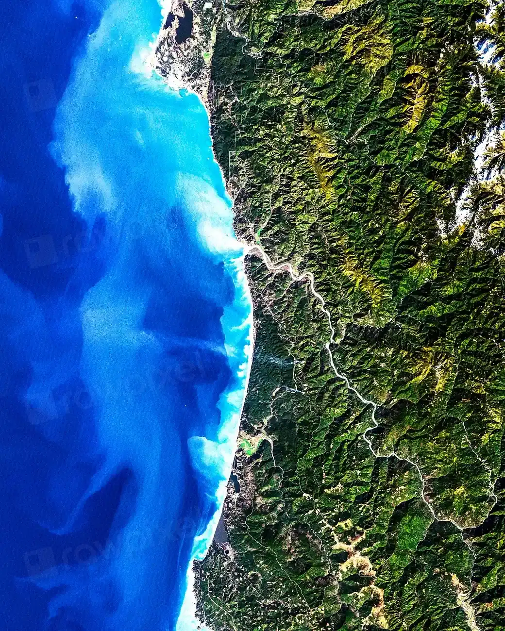
4. La Jolla Shores, California: Cliffs, Canyons, and the Submerged Frontier
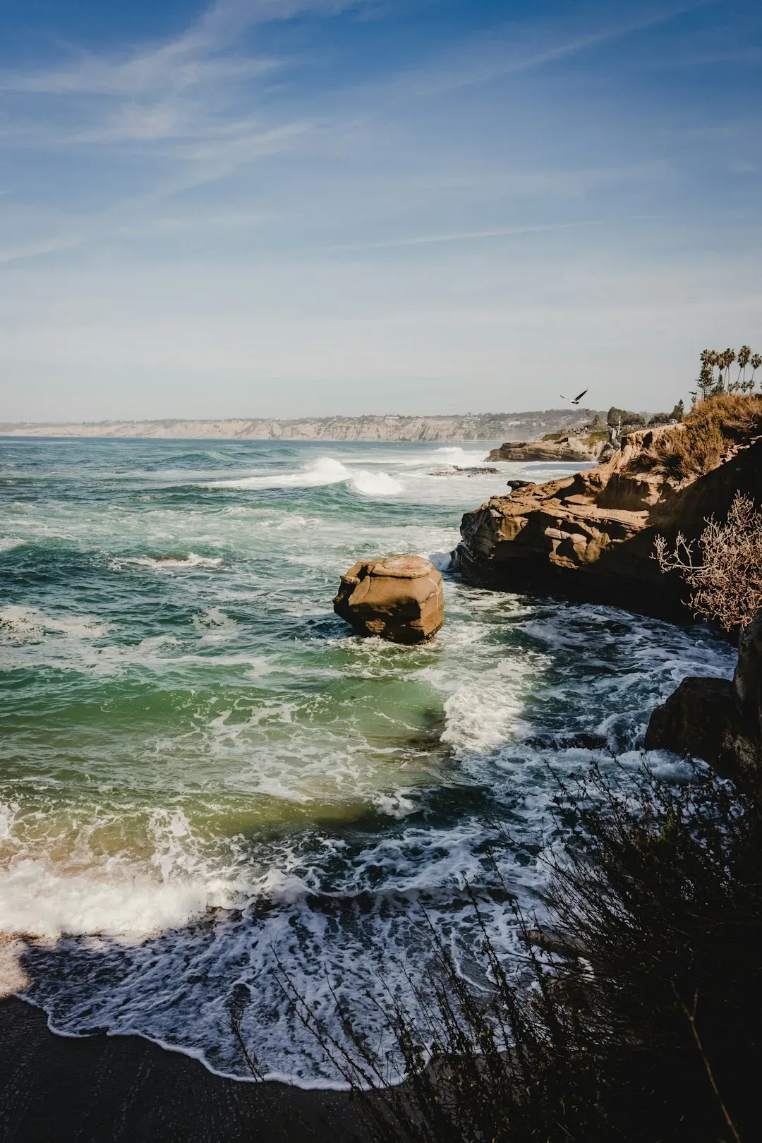
La Jolla Shores is the kind of Southern California beach that tempts you to stop at surface impressions: surfers, kayaks, golden light on sandstone cliffs. Just offshore, however, lies one of the country’s most dramatic underwater landscapes, the La Jolla Submarine Canyon, cutting from shallow coastal waters down into the deep Pacific. This canyon funnels cold, nutrient-rich water upward, feeding plankton blooms that support everything from anchovies to migrating whales. As a result, the beach is framed not only by scenic bluffs, but also by one of the densest concentrations of marine life in coastal California. It is a rare place where a family with a boogie board plays just meters above an area of active oceanographic research.
The cliffs themselves, composed of relatively young, soft sedimentary rock, quietly record changes in sea level, rainfall, and human development. They retreat bit by bit, with chunks calving off in landslides that are sometimes dramatic but scientifically predictable. Instrumented by nearby research institutions, these bluffs have sensors buried within them and high-resolution scans taken seasonally to measure exactly how, and how fast, they are crumbling. For scientists studying how future storms and higher seas may accelerate coastal cliff erosion worldwide, La Jolla serves as both a warning and a laboratory. From the perspective of deep time, the iconic homes perched on the edge are just temporary decorations on a shoreline already mid-transformation.
5. Clearwater Beach, Florida: White Quartz Sand and a Sinking Story
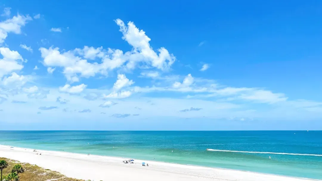
Clearwater Beach is famous for sand so white and fine it feels almost unreal underfoot, more like sifted flour than the coarse grains found elsewhere. That brightness comes from nearly pure quartz crystals, eroded from the Appalachian Mountains over millions of years and carried seaward by rivers. As the grains traveled, softer minerals broke down or dissolved, leaving behind this remarkably uniform residue. The result is a visually striking shoreline where sunsets seem to glow extra bright, thanks to the way this pale sand reflects and scatters light. What feels like a simple sensory delight is actually the end point of a long geological journey starting deep inland.
Yet Clearwater sits in one of the fastest-warming and most vulnerable coastal regions in the continental United States. Tide gauges along the Gulf Coast show sea levels climbing steadily, and even modest storm surges now more easily overtop low-lying areas behind the barrier islands. Local planners are beginning to reckon with projections suggesting that, within the lifetime of today’s children, some sections of this very beach could be narrower or even periodically flooded. That tension – between the beach as carefree playground and the beach as early warning system – defines much of the current scientific work here. Long-term monitoring programs are quietly turning Clearwater into a test case for how a popular tourist beach can adapt, or fail to adapt, to a changing climate.
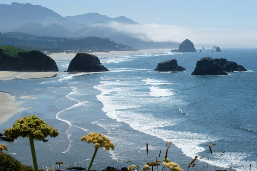
6. Cannon Beach, Oregon: Sea Stacks, Tsunami Risks, and Ancient Legends
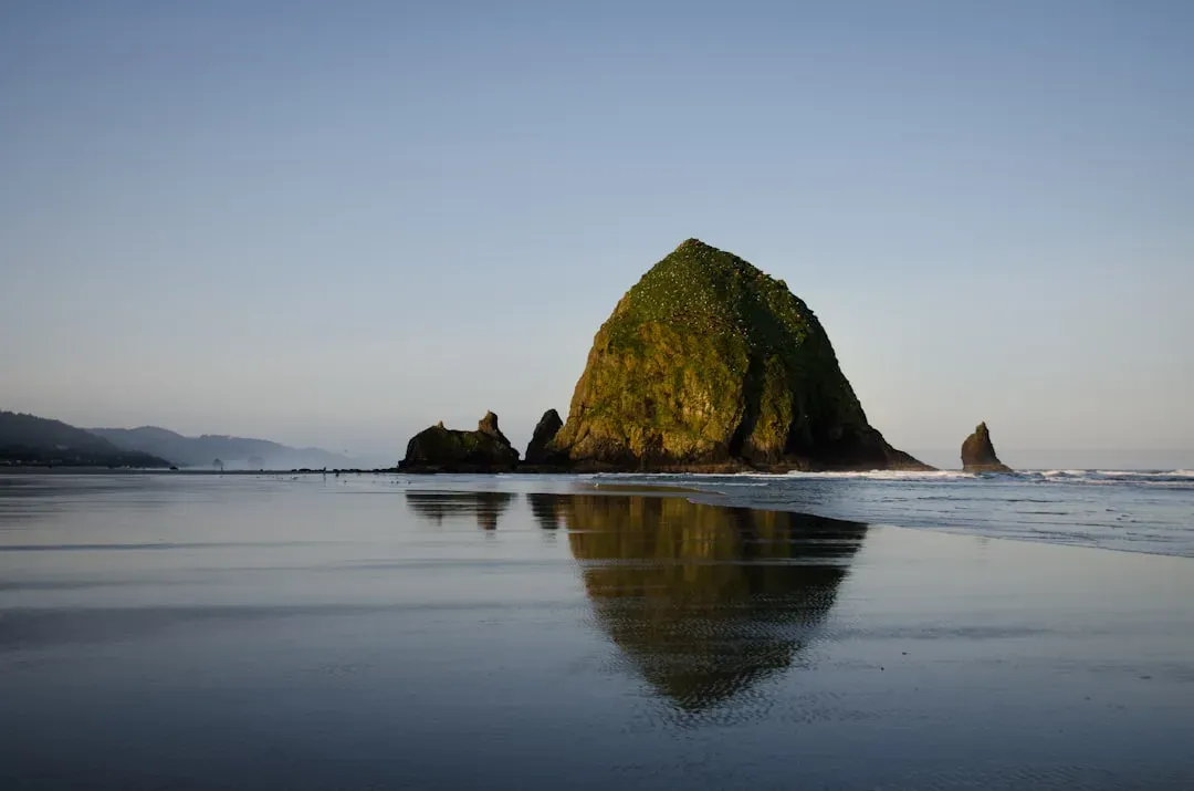
Cannon Beach is instantly recognizable thanks to Haystack Rock, a towering sea stack that rises from the surf like a misplaced mountain. These sea stacks are the resistant remnants of ancient lava flows and harder rock layers, left isolated as softer surrounding material eroded away. At low tide, the base of Haystack Rock turns into a jeweled world of tidepools, where starfish, anemones, and crabs coexist within a few square feet. For marine biologists, this intertidal zone is a natural experiment in survival under stress, from pounding waves to heat during midday low tides. Each tiny pool is a compressed version of a much larger ecological drama playing out across the Pacific.
But there is a more unsettling layer to Cannon Beach’s story. This stretch of coast lies above the Cascadia Subduction Zone, a massive fault capable of producing a powerful earthquake and tsunami. Geological evidence in buried soils and dead forests suggests such events have struck in cycles over thousands of years, with the last major one occurring in the early eighteenth century. Evacuation routes and sirens now thread through the charming town behind the beach, acknowledging that its beauty sits atop a significant geologic risk. Visitors may come for the views, but the land itself whispers a reminder: the same forces that carved these stacks can, in a single day, redraw the entire shoreline.
7. South Beach, Miami, Florida: Neon, Mangroves, and Rising Tides
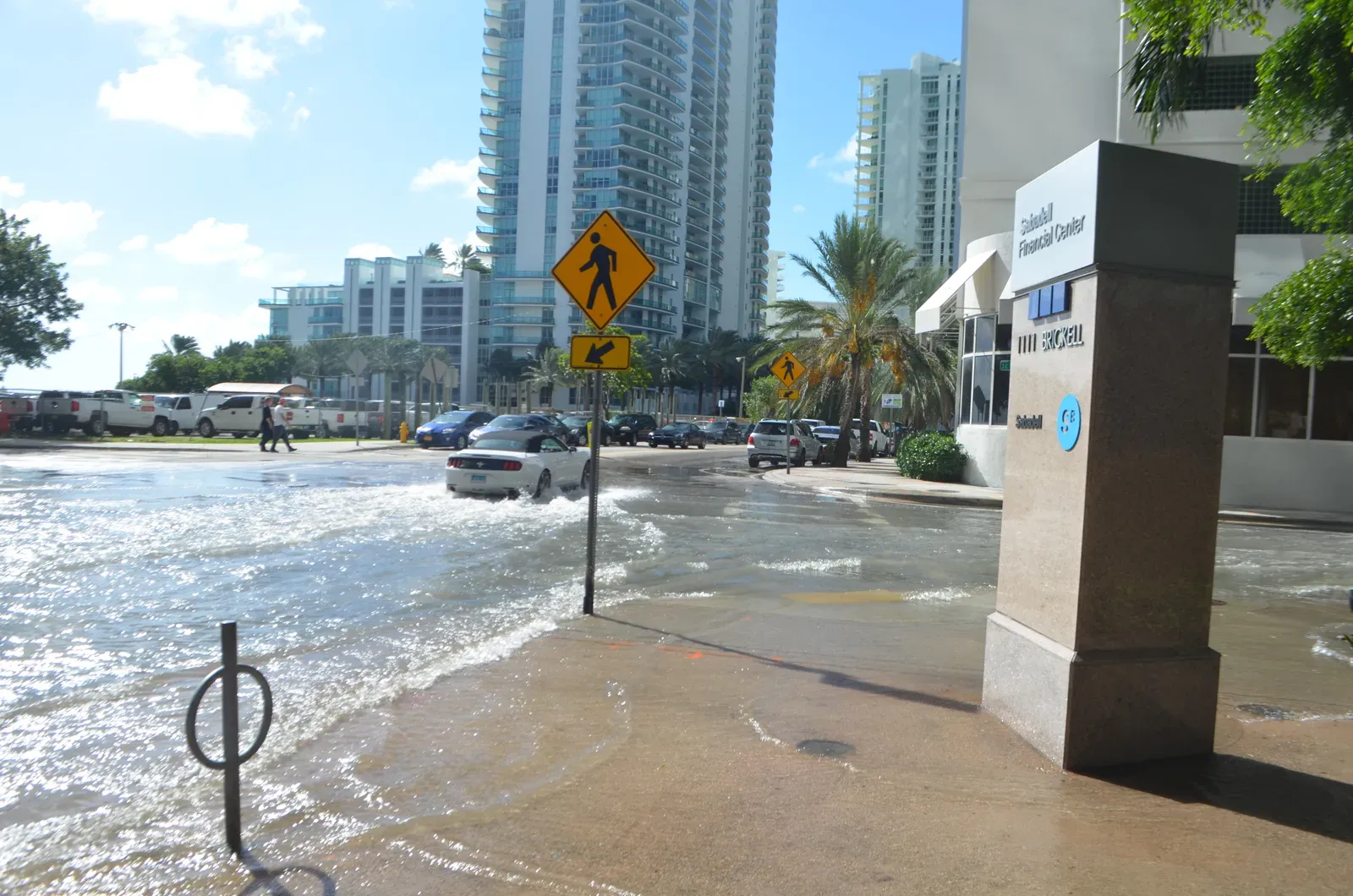
South Beach is usually framed in terms of nightlife and Art Deco architecture, but its scientific story is just as dramatic as its club scene. Much of today’s glamorous beachfront sits on land that was once mangrove swamp and sandbar, heavily dredged and filled in the early twentieth century. Those mangroves, with their tangle of roots, used to buffer the coast from wave energy and trap sediment; their removal traded natural resilience for real estate. The iconic pastel buildings and straight-edged seawalls that replaced them were never designed with accelerating sea-level rise in mind. As a result, even normal high tides now send salty water bubbling up through storm drains during so-called sunny-day floods.
For urban scientists and coastal engineers, South Beach is a high-profile case of what happens when human ambition outruns geologic reality. The city and county are investing heavily in pumps, raised roads, and seawall upgrades, but these are expensive, partial measures. Some streets that now flood a few times each year could see much more frequent inundation well within the lifespan of existing infrastructure. On any given day, tourists lying on the sand may have no sense that they are at the edge of a slow-burn engineering challenge. Yet South Beach’s future – whether it adapts, retreats, or doubles down on hard defenses – will likely influence planning decisions along low-lying coasts around the world.
8. Olympic National Park Beaches, Washington: Driftwood, Ghost Forests, and Deep Time
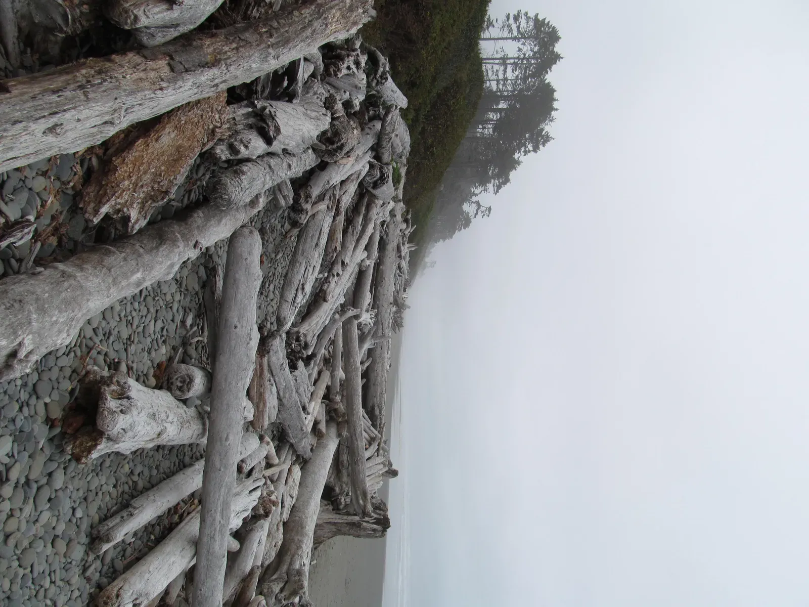
The wild beaches of Olympic National Park feel more like the edge of the world than a typical American coastline. Massive logs, bleached and weathered, lie tangled along the high-tide line, evidence of forests and storms upstream in the river basins that drain the Olympic Mountains. Offshore sea stacks and headlands are carved from ancient rocks that predate much of the continental crust east of the Rockies. Heavy winter waves pound this coast with a ferocity that sculpts new forms each decade, while summer fog and mist blur the boundaries between ocean, land, and sky. For geologists and ecologists alike, it’s a rare place where processes usually studied separately – uplift, erosion, forest dynamics, marine productivity – are visibly intertwined.
Hidden not far inland are “ghost forests,” stands of dead trees preserved in marshes, whose lower trunks bear evidence of sudden land subsidence and saltwater intrusion. These features are clues to past great earthquakes and tsunamis along the same Cascadia fault that threatens Oregon and northern California. By dating and mapping them, scientists have reconstructed a timeline of major seismic events stretching back many centuries. That record is helping refine models of how often the region might experience another catastrophic quake, and how high resulting tsunamis could reach on these otherwise serene beaches. In that sense, a walk along Rialto or Ruby Beach is also a walk across a living seismic archive.
9. Why These Beaches Matter: Beyond Postcards and Travel Guides
It’s tempting to rank beaches purely by aesthetics – softest sand, clearest water, best Instagram framing – but that misses why these places truly matter. Each of the shores described here is both a recreational haven and a scientific instrument, recording the combined effects of climate, tectonics, biology, and human decisions. Compared with traditional weather stations or tide gauges, beaches offer a more integrated, if messier, signal of environmental change. Eroding dunes, stressed coral reefs, altered tidal wetlands, and even the frequency of nuisance flooding events all tell us something valuable about the trajectory we’re on. Ignoring those signals because we see only leisure in these landscapes is a bit like ignoring symptoms because we like how we feel right now.
Historically, coastlines were treated as stable backdrops for ports and property, with science focusing on navigation and basic hazard mapping. Now, as seas rise and storms intensify, the same beaches are moving to the center of climate and resilience research. They serve as test beds for soft engineering approaches, such as dune restoration, living shorelines, and strategic retreat, that contrast sharply with the concrete-heavy defenses of the past. Decisions made on Cape Cod or in Miami Beach will shape not only local fates but also policy models exported to other vulnerable coasts. In a very real way, the stories written in American sand today will influence how coastal societies worldwide respond to a rapidly changing planet.
10. The Future Shoreline: Technology, Tough Choices, and What Comes Next
Looking ahead, the most beautiful beaches in the United States are also among the most closely watched and instrumented. Remote sensing, from satellite altimeters to drone-based lidar, is giving scientists unprecedented detail on how shorelines move season by season. Underwater, autonomous vehicles map reefs and submarine canyons, tracking how warming waters and acidification affect the ecosystems that stabilize many coasts. New materials and design concepts, such as permeable seawalls and hybrid reef-structure systems, aim to blur the line between engineering and ecology. The goal is not to freeze beaches in place – a near-impossible task – but to guide their evolution in ways that safeguard both nature and communities.
Yet technology can only delay, not erase, some of the toughest choices. In low-lying areas, it may become economically or physically impossible to maintain the current footprint of development. Some beloved stretches of sand will almost certainly narrow or transform, even under optimistic emissions scenarios. The question is whether we prepare for that transition with foresight, or let it arrive as a series of escalating crises after every storm. These ten beaches are, in that sense, both gifts and warnings. They show us what is at stake and hint at the futures we might still choose.
How Readers Can Engage: From Beach Towels to Better Futures
Engaging with these beaches starts with seeing them as more than vacation backdrops. On your next visit to any shoreline, notice the details that tell a deeper story: the position of the dune line, the health of dune grasses, the presence or absence of mangroves, the clarity of the water. Small choices matter, from staying on marked paths to avoid trampling vegetation, to packing out every bit of trash, to choosing reef-safe sunscreens where coral is present. Many parks and local groups run beach-monitoring programs where volunteers help record data on erosion, water quality, or wildlife sightings. These efforts may feel modest, but together they build the granular records scientists need to track change over time.
Beyond individual actions, there is power in paying attention to policy and supporting science-driven coastal planning. That might mean backing bond measures that fund dune restoration instead of only concrete seawalls, or supporting research institutions that maintain long-term observation networks. Public pressure can also encourage local officials to disclose flood and erosion risks transparently, so buyers and renters understand the stakes. If enough people begin to see beaches as living systems worthy of long-term care, rather than infinite, unchanging playgrounds, our collective decisions may shift. The next time you stand at the water’s edge, watching waves erase your footprints, it’s worth asking: what kind of shoreline do we want future generations to inherit?

Suhail Ahmed is a passionate digital professional and nature enthusiast with over 8 years of experience in content strategy, SEO, web development, and digital operations. Alongside his freelance journey, Suhail actively contributes to nature and wildlife platforms like Discover Wildlife, where he channels his curiosity for the planet into engaging, educational storytelling.
With a strong background in managing digital ecosystems — from ecommerce stores and WordPress websites to social media and automation — Suhail merges technical precision with creative insight. His content reflects a rare balance: SEO-friendly yet deeply human, data-informed yet emotionally resonant.
Driven by a love for discovery and storytelling, Suhail believes in using digital platforms to amplify causes that matter — especially those protecting Earth’s biodiversity and inspiring sustainable living. Whether he’s managing online projects or crafting wildlife content, his goal remains the same: to inform, inspire, and leave a positive digital footprint.