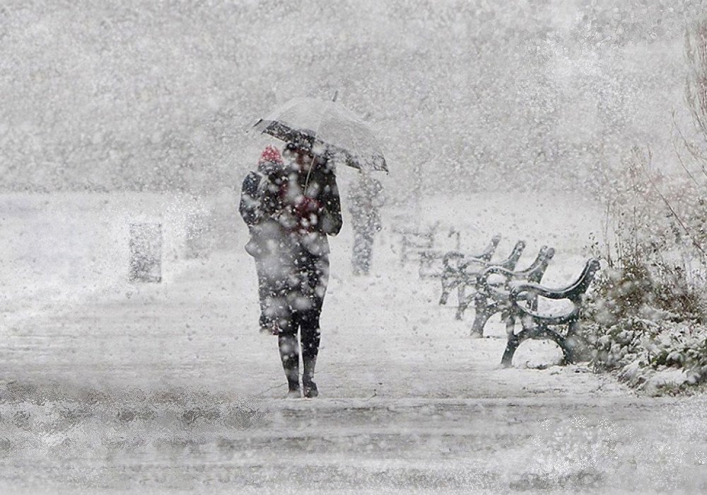

A Sudden Turn from Mild to Wintry (Image Credits: Flickr)
Denver – Residents enjoyed a mild Wednesday with temperatures in the 50s, but meteorologists predict a sharp shift toward colder, more active weather as the week progresses.
A Sudden Turn from Mild to Wintry
After several days of unusually warm conditions that broke records across the Front Range, the weather pattern undergoes a dramatic change starting Thursday. This transition brings a low-pressure system that promises widespread precipitation, including the first significant snow of the season in many areas. Forecasters at local stations noted the setup early in the week, with models consistently showing moisture funneling into the region from the Pacific.
The storm’s arrival marks the end of the brief thaw, replacing sunny skies with overcast conditions and gusty winds. Accumulations appear likely not just in the higher elevations of the Rockies, but also across the lower plains, catching some by surprise after the recent warmth. This event underscores the variability of Colorado’s winter climate, where mild spells often give way to intense cold snaps.
Forecast Details: Snow Timing and Amounts
Snow showers begin developing Thursday afternoon, potentially starting as rain before transitioning to flakes as temperatures cool. The heaviest bands move through during the evening commute, continuing overnight and tapering off by Friday morning. Expect 2 to 4 inches in the Denver metro area, with higher totals – up to 6 inches or more – in the foothills and mountains.
Lower elevations, including the eastern plains, face similar risks of light accumulations that could slick roads. The National Weather Service issued alerts emphasizing the potential for travel disruptions, as the snow falls on already variable surfaces. Visibility may drop below a mile in the strongest bursts, complicating drives along major corridors like I-25 and I-70.
Temperatures Plunge, Impacts Follow
Thursday’s highs struggle to reach the low to mid-40s, a noticeable drop from the day’s earlier warmth, before Friday confines readings to the 30s under partly cloudy skies. Overnight lows dip into the teens, fostering icy patches on untreated roads and walkways. This cold air mass lingers into the weekend, maintaining a wintry feel even as precipitation eases.
Power outages remain a concern if winds pick up, though current projections suggest moderate gusts rather than severe storms. Schools and businesses prepare for possible closures, drawing from past events where similar systems caused widespread delays. The colder pattern also benefits winter sports enthusiasts, freshening slopes in ski areas like Vail and Breckenridge.
Staying Prepared Amid the Shift
As the storm approaches, locals should stock essentials like extra blankets, non-perishable food, and rock salt for driveways. Monitoring updates from reliable sources ensures timely adjustments to plans. Vehicles benefit from winter tires and full fuel tanks, given the risk of stalled traffic in snowy conditions.
- Check road conditions via the Colorado Department of Transportation website before heading out.
- Layer clothing for fluctuating temperatures, especially during Thursday’s transition.
- Clear snow from roofs and gutters to prevent ice dams in vulnerable spots.
- Keep pets indoors to shield them from the chill.
- Charge devices for potential outages and have flashlights ready.
This proactive approach minimizes risks, allowing the community to navigate the weather change smoothly.
Key Takeaways
- Snow accumulations of 2-6 inches expected Thursday afternoon through Friday morning across elevations.
- Temperatures drop to the 30s by Friday, with overnight lows in the teens.
- Travel disruptions likely; preparation focuses on roads, homes, and safety supplies.
The return of winter weather reminds Coloradans of the season’s unpredictable nature, offering a timely reset after the unseasonal mildness. As snow blankets the landscape, it revitalizes the outdoors for those who embrace the cold. What preparations are you making for this incoming storm? Share your thoughts in the comments.