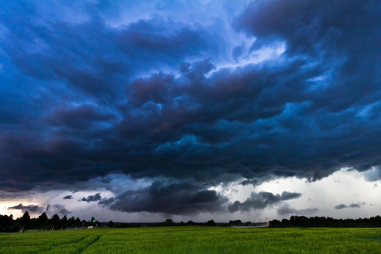
The air feels different these days when storm clouds roll in. There’s something more electric, more ominous about the rumbling darkness overhead. You might think you’re imagining things, but scientists have been tracking this shift for years now. Our thunderstorms aren’t just getting more frequent – they’re becoming powerhouses of destruction that would make previous generations’ storms look tame by comparison. From the corn fields of Kansas to the crowded streets of Beijing, weather researchers are documenting a troubling trend. The very atmosphere around us is transforming, creating perfect conditions for storms that pack more punch than ever before. It’s not just about getting caught without an umbrella anymore. We’re talking about storms that reshape landscapes, flood entire neighborhoods in minutes, and unleash lightning strikes that light up the sky like a cosmic fireworks display gone wild. Let’s dive into the fascinating and frankly unsettling world of supercharged storms.
The Warming Atmosphere Creates a Monster
Picture the atmosphere as a giant sponge that’s being slowly heated. Rising global temperatures due to climate change means warmer air, which allows it to hold more moisture, roughly 7% more moisture per 1°C of warming. This isn’t just a minor adjustment – it’s like giving thunderstorms access to unlimited ammunition.
When that moisture-laden air finally releases its cargo, the results are explosive. This boosts the chance of thunderstorms, leading to more violent storms and more lightning strikes. Think of it this way: if traditional thunderstorms were firecrackers, these new supercharged versions are like sticks of dynamite going off in the sky.
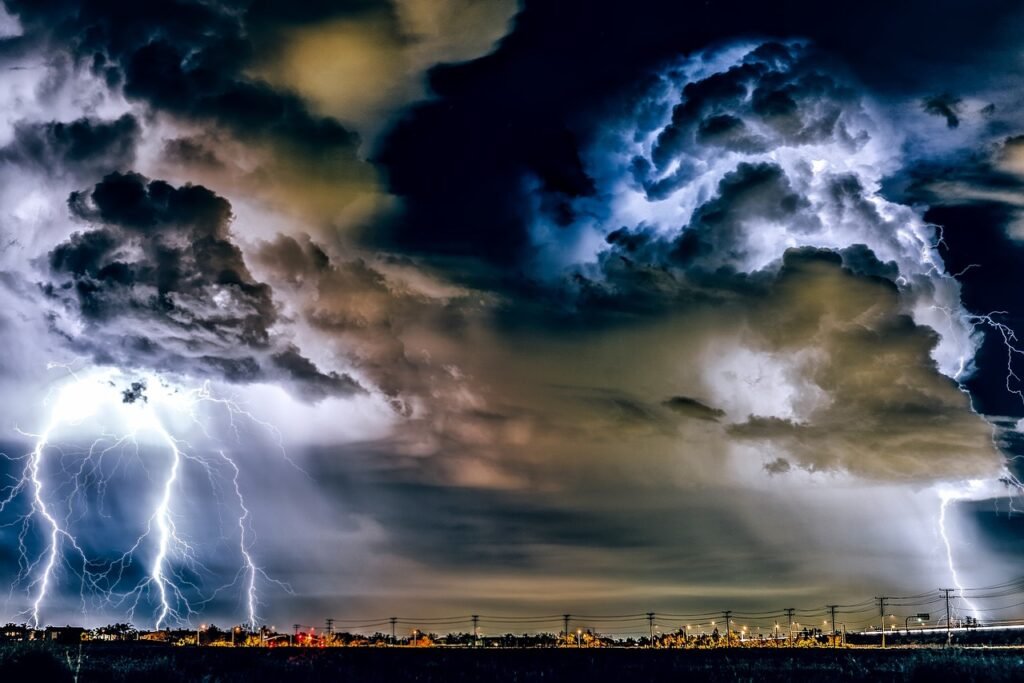
Lightning Strikes Back with a Vengeance
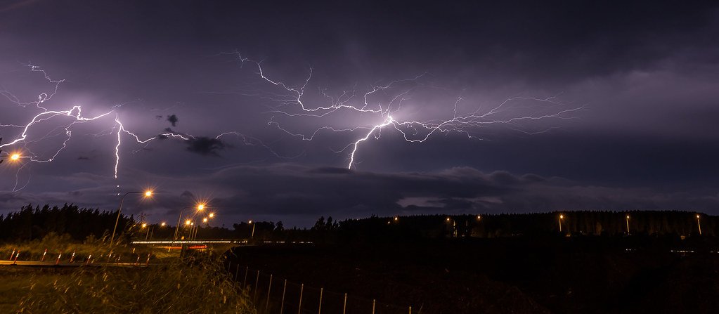
The electrical component of these intensifying storms tells a story that would make Thor himself nervous. We could expect to see a 12% increase in lightning activity for every 1°C of warming, meaning countries like the USA could see a 50% increase in the number of strikes by the end of the century. That’s not just more light shows – that’s more forest fires, more power outages, and more danger for anyone caught outdoors.
Currently, our planet experiences a staggering amount of electrical activity. Approximately 2000 thunderstorms are occurring at any given time around the world, with 100 lightning strikes every second and 8 million lightning strikes a day. With climate change accelerating this process, we’re essentially turning up the volume on Earth’s electrical symphony to ear-splitting levels.
Central United States Becomes Ground Zero
The American heartland is experiencing changes that would shock anyone familiar with traditional weather patterns. In step with climate change, the central U.S. has seen a dramatic fivefold increase in the area affected by thunderstorms and high winds over the past four decades. We’re not talking about a gradual change – this is meteorological whiplash happening in real time.
The mechanism behind this intensification reads like something from a physics textbook come to life. Climate change is likely intensifying this process. By increasing the temperature differential between the descending cool air and the warmer surrounding atmosphere, climate change is potentially enabling these downdrafts to plummet even faster, escalating the likelihood of thunderstorms birthing damaging winds.
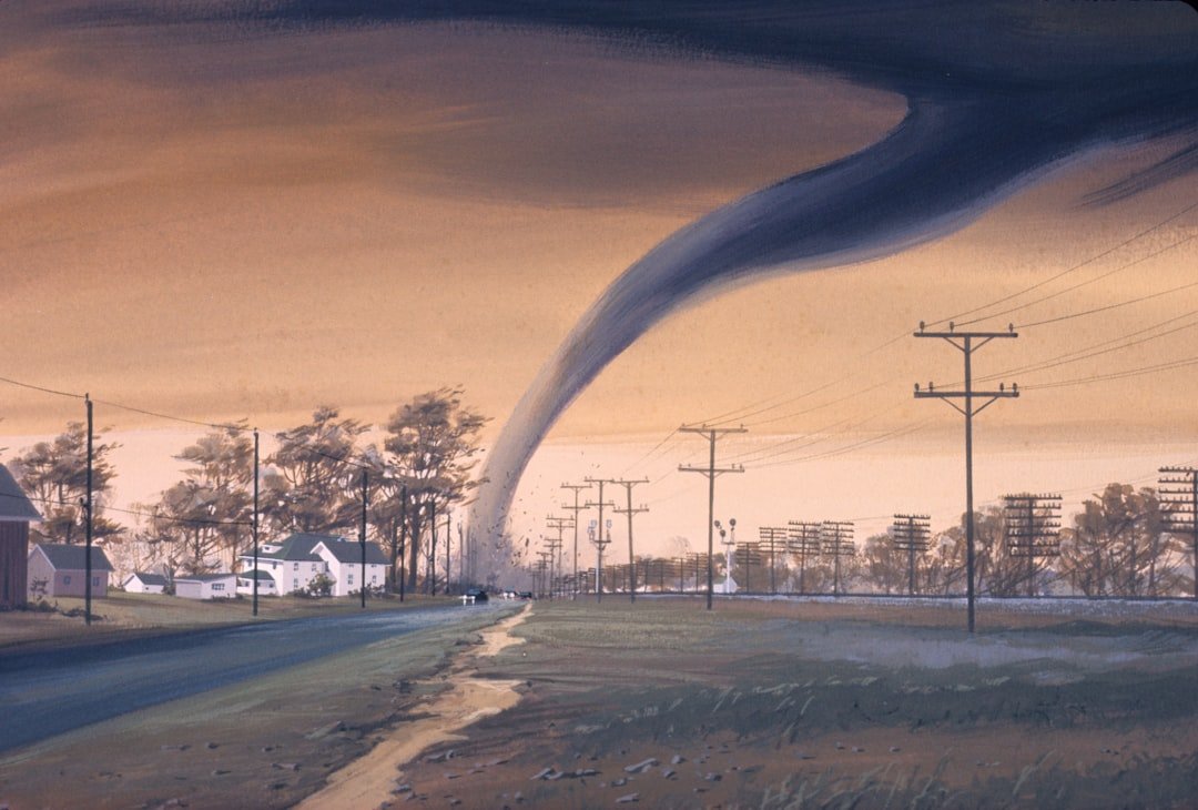
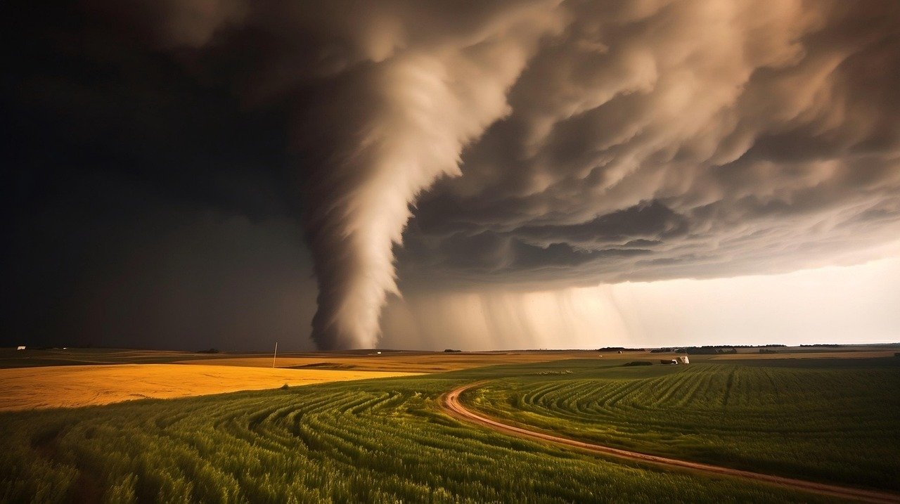
Supercells: The Elite Forces of Storm World
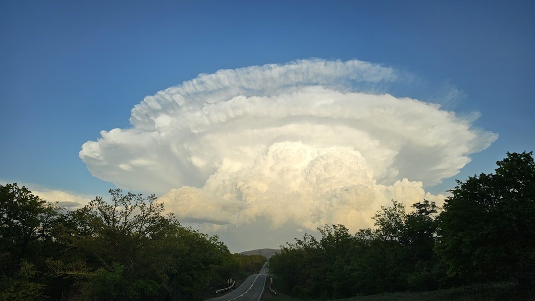
Supercells (severe thunderstorms with intense, rotating updrafts) are largely responsible for significant tornado (EF2+) formation in the continental U.S. Supercells are associated with the most extreme storm impacts, including nearly all fatal tornadoes. These aren’t your average thunderstorms – they’re the Navy SEALs of severe weather.
The future looks particularly concerning for supercell activity. A new study projects a 6.6% increase in supercell frequency nationwide by the end of the century as a result of climate warming. The study, published in January 2023, also projects an increase in supercell frequency in the eastern U.S. – a densely populated part of the country largely unfamiliar with the magnified danger associated with supercell-spawned tornadoes. Imagine regions completely unprepared for the fury these storms can unleash.
Europe’s Alpine Thunderstorm Hotspot Emerges
The Alps have become an unexpected center stage for some of Europe’s most dramatic weather performances. The new modelling identified the Alps as a hotspot for supercell thunderstorms. The region experiences around 38 of these power storms per season on the northern side of the mountain range and 61 on its southern slopes. The mountains seem to act like storm amplifiers, turning modest weather systems into meteorological monsters.
The projections for this region paint a picture that would concern any local resident. With 3°C of warming, the study predicts up to a 50 per cent increase in supercell occurrences in this mountainous region, amplifying risks for countries like Switzerland, Austria, northern Italy, and southern Germany. Overall, researchers estimate an 11 per cent increase in supercell thunderstorms across Europe.
Winter Storms Break All the Rules
Perhaps the most unsettling development is how storms are completely ignoring the calendar. The historical “tornado season” is expanding as the number of winter and early springtime tornadoes increases. From 1980–2000 to 2001–2022, the average number of wintertime (December, January, and February) tornadoes has increased 71%. Winter used to be the time when severe weather took a break – now it’s becoming another danger zone.
This seasonal shift isn’t slowing down anytime soon. Nearly 15% more supercells are expected in February, 36% more in March, and nearly 66% more in April by 2100 under a “business as usual” climate warming scenario. It’s like Mother Nature is throwing out her old playbook and writing entirely new rules for when and where dangerous storms can occur.
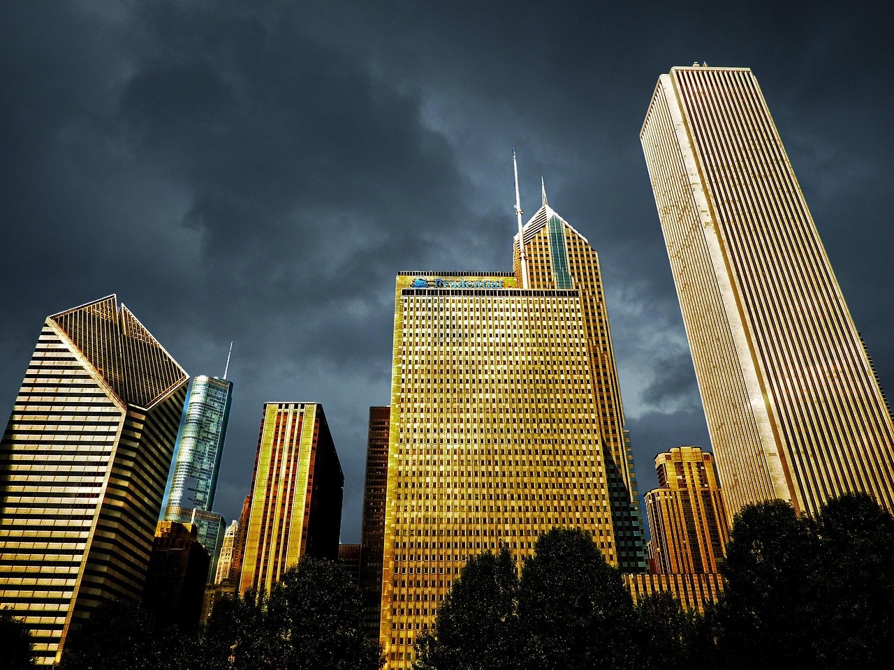
Urban Heat Islands Fuel the Fire
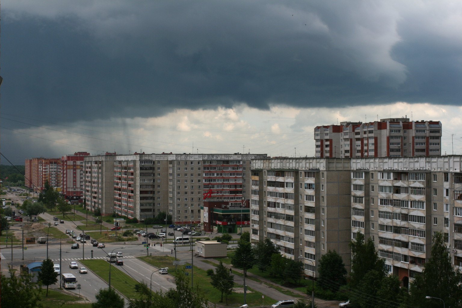
Cities are inadvertently becoming storm factories, thanks to the urban heat island effect. The extra heat provided by the UHI leads to greater upward motion, which can induce additional shower and thunderstorm activity. In addition, the UHI creates during the day a local low pressure area where relatively moist air from its rural surroundings converges, possibly leading to more favorable conditions for cloud formation.
The numbers are staggering when you look at how cities boost precipitation. Rainfall rates downwind of cities are increased between 48% and 116%. Partly as a result of this warming, monthly rainfall is about 28% greater between 20 and 40 miles (32 and 64 km) downwind of cities, compared with upwind. Your city isn’t just experiencing these storms – it’s actively creating them.
Flash Floods Become the New Normal
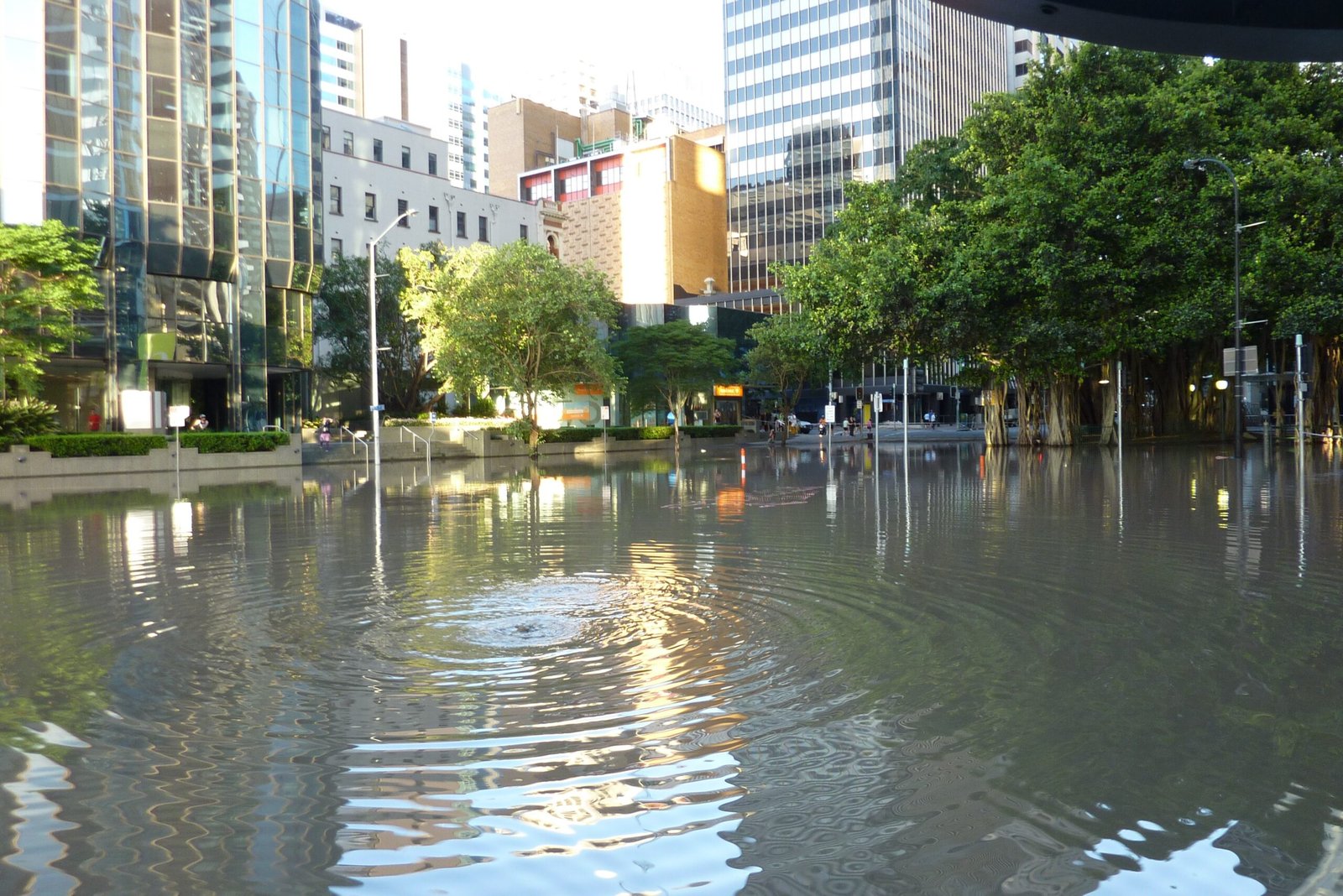
Flash flooding is the process where a landscape, most notably an urban environment, is subjected to rapid floods. These rapid floods occur more quickly and are more localized than seasonal river flooding or areal flooding and are frequently (though not always) associated with intense rainfall. What used to be once-in-a-generation flooding events are becoming disturbingly routine.
The vulnerability isn’t evenly distributed, which makes the situation even more concerning. Flash flooding can frequently occur in slow-moving thunderstorms and is usually caused by the heavy liquid precipitation that accompanies it. Flash floods are most common in arid regions as well as densely populated urban environments, where few plants, and bodies of water are present to absorb and contain the extra water.
The Tornado Alley Migration Pattern
One of the most dramatic changes happening is the geographic shift of where the most dangerous storms occur. The results indicate that supercells are projected to become more numerous in regions of the eastern U.S. while decreasing in frequency in portions of the Great Plains, traditionally known as “Tornado Alley.” This isn’t just a minor relocation – we’re watching an entire weather pattern pack up and move house.
The implications of this shift are enormous. However even a slight geographic shift could have major consequences if storms become more common in more densely populated parts of the country. A tornado striking a cornfield is less dangerous than one tearing through a subdivision. Areas that never had to worry about severe storms are suddenly finding themselves in the crosshairs.
Storm Intensity Reaches Record-Breaking Levels

The raw power being unleashed by modern thunderstorms would humble the storms of previous decades. Under both future trajectories, the number of annual supercell storms becomes more frequent and intense, with the mean U.S. supercell activity increasing by 7% (intermediate) to 15% (pessimistic). These aren’t just more storms – they’re storms with significantly more destructive potential.
In 2023 alone, a new record hail size of 19 cm was set for Europe (ESSL, 2023c), while in North America, the insured loss from severe convective storms reached around USD 60 billion, thereby also setting a new record and dominating the total loss from natural catastrophes. We’re witnessing weather that’s literally breaking the measuring sticks we use to categorize storm damage.
The Perfect Storm of Future Conditions
Looking ahead, the conditions that create these monster storms are only getting more favorable. Driving the more frequent events is what Pershing describes as a “thirstier” atmosphere, one that is hotter and thus capable of holding more moisture. “We have a supercharged water cycle and that means that when you get a rain event it has a better chance of being a bigger event than it used to be,” says Pershing.
The scientific community is clear about what’s coming. These results suggest the potential by the century’s end for more significant tornadoes, hail and extreme rainfall that, when combined with an increasingly vulnerable society, might produce disastrous consequences. We’re not just dealing with weather anymore – we’re facing a fundamental transformation in how our atmosphere behaves during storms.
Conclusion: A New Era of Extreme Weather

The evidence is overwhelming: our thunderstorms are entering uncharted territory. From the moisture-laden air that feeds them to the urban heat islands that nurture them, every aspect of storm formation is being supercharged by our changing climate. We’re witnessing the birth of a new era where yesterday’s “once-in-a-lifetime” storms become tomorrow’s typical Tuesday afternoon weather.
The transformation isn’t subtle – it’s dramatic, measurable, and accelerating. Whether it’s the record-breaking hail in Europe, the massive insurance payouts in North America, or the expanding tornado seasons that ignore our traditional calendars, the signs are everywhere. Our thunderstorms have evolved, and we’re still catching up to understanding just how powerful they’ve become. What do you think about this dramatic shift in our weather patterns? Tell us in the comments.

Hi, I’m Andrew, and I come from India. Experienced content specialist with a passion for writing. My forte includes health and wellness, Travel, Animals, and Nature. A nature nomad, I am obsessed with mountains and love high-altitude trekking. I have been on several Himalayan treks in India including the Everest Base Camp in Nepal, a profound experience.