On a spring afternoon in the American Great Plains, the world can change from calm blue to eerie green in a matter of minutes – and for people on the ground, that strange light can feel like nature’s own siren. For decades, storm chasers, farmers, and small-town residents have whispered that a green sky means a tornado is coming, while scientists have quietly debated what the color really tells us. Today, radar networks and satellites do most of the heavy lifting in tornado forecasting, yet those unsettling colors and animal reactions still shape how people respond. What if the sky’s color is not a mystical omen, but a subtle clue about the storm’s inner structure? And how do animals and modern instruments together create a richer warning system than either ever could alone?
The Hidden Clues in a Green Sky
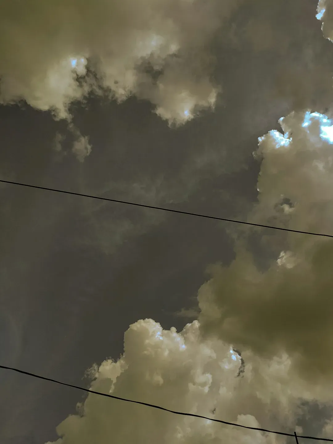
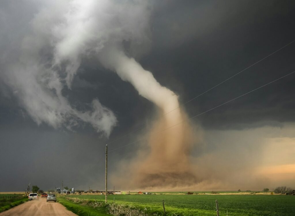
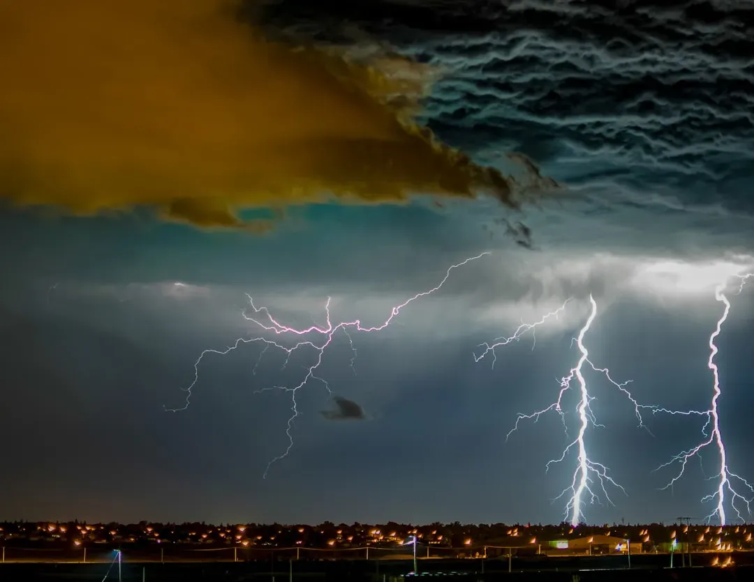
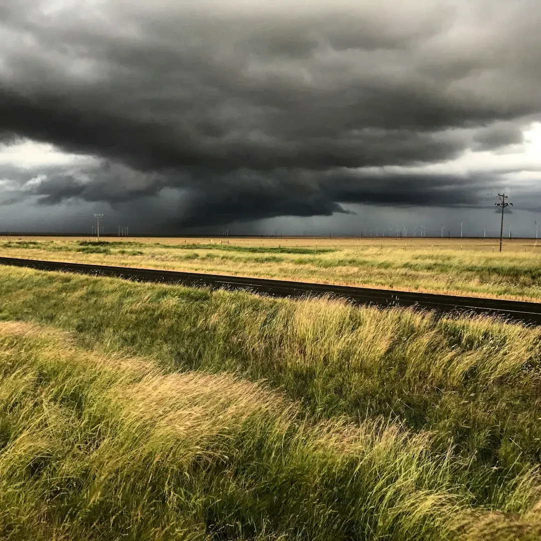
That sickly, theatrical green you sometimes see before a violent storm is one of the most haunting sights in nature, and it has fueled tornado myths for generations. Meteorologists now think this color has less to do with tornados themselves and more to do with how sunlight filters through towering thunderclouds loaded with hail and water. When late-day sunlight, already tinged with orange or red, passes through thick columns of ice and rain, certain wavelengths are scattered and absorbed in a way that can shift the overall hue toward green. In other words, your eyes are reading a kind of atmospheric cocktail: low sun, deep clouds, massive moisture, and ice aloft. A storm like that has all the ingredients for severe weather, including damaging hail and strong winds, and sometimes it also supports tornado formation. But the key is nuance – the green is a clue to an intense storm, not a guarantee of a funnel touching down nearby.
Still, stories from storm-prone regions show how deeply people trust what they see in the sky. In parts of Kansas, Oklahoma, and Texas, older residents often recall racing to basements the moment the light outside turned green, long before weather apps ever sent an alert. That instinct is not entirely misplaced, because a storm tall enough and icy enough to shift the sky’s color often overlaps with the kind of supercell that can spin up tornados. Yet, scientists emphasize that people have also seen green skies with no tornados and severe tornados under dull gray clouds. The emotional punch of that color can be lifesaving if it pushes someone to take shelter a little earlier, but it can also lull others into danger if they wait for green skies that never come. The real challenge is helping the public see the green as one piece of a larger warning puzzle, not as the whole story.
Inside a Supercell: The Physics Behind the Fear
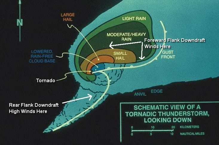
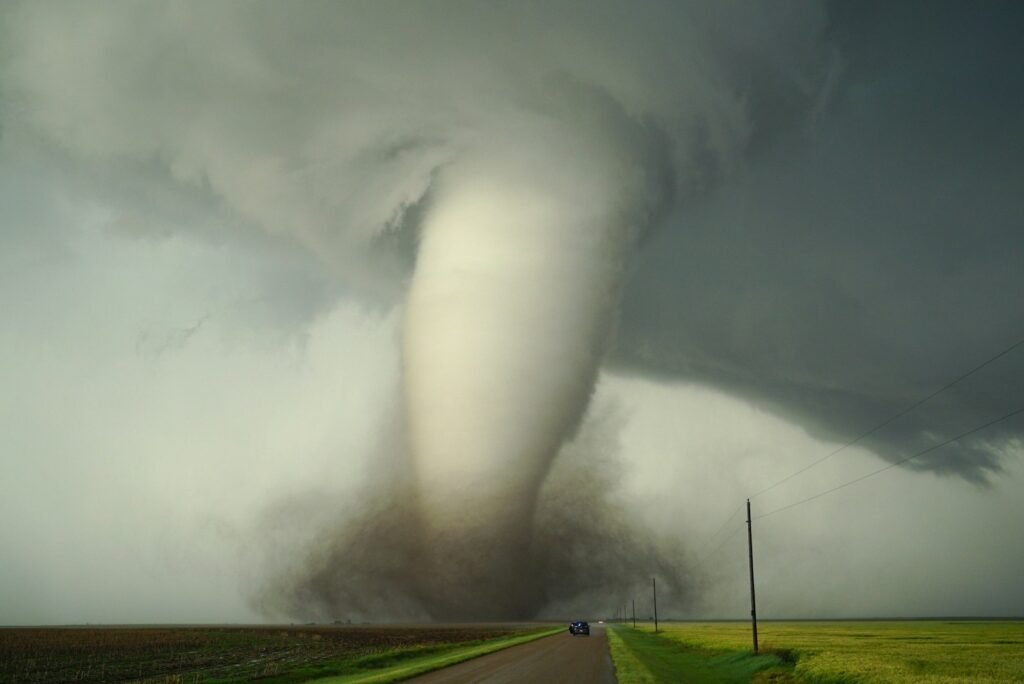
To understand why a green sky sometimes pairs with tornados, you have to step inside the anatomy of a supercell thunderstorm. Supercells are the giants of the storm world, built around a rotating updraft called a mesocyclone that can tower more than ten miles high. In these storms, warm, humid air near the ground rises violently, cools, and condenses into massive clouds; at the same time, wind speeds and directions change with height, imparting a twist that can be stretched into a spinning column. High in the storm, powerful updrafts keep hailstones suspended, layering ice like rings on a tree. That thick canopy of water and ice above, combined with the late-afternoon angle of the sun, sets up the conditions for that unsettling green tint. The visual drama is a signal that the storm has enormous vertical depth and energy, the same properties that can nurture a tornado.
But the tornado itself depends on a precise choreography inside the storm that the human eye cannot see. Subtle shifts in wind shear, the balance between inflow and outflow, and the shape of the updraft determine whether rotation tightens into a narrow funnel or remains a broad, swirling column of air. Two storms can look similar from the outside and produce very different outcomes, which is why relying solely on the sky’s appearance is risky. Modern radar can scan the interior of these storms, revealing patterns of rotation and debris that no human observer could ever detect from the ground. That combination of visible drama and invisible dynamics is what makes tornados both mesmerizing and maddeningly hard to predict. The green sky might be the trailer, but the real story is unfolding in frequencies and flows we cannot see.
Silent Superpowers: How Animals Sense the Storm
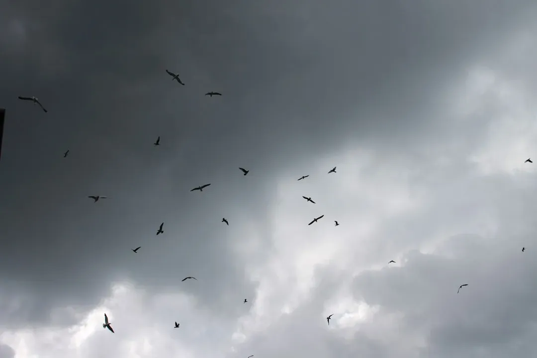
Long before radar domes dotted the landscape, people watched animals to guess what the weather would do next, and some of those observations still hold surprising value. In many tornado-prone communities, residents swear that birds fall suddenly quiet, dogs become restless, and insects seem to vanish just before a violent storm strikes. While it sounds like folklore, there is a scientific basis for at least part of this: many animals can sense changes in air pressure, humidity, and even low-frequency vibrations far better than humans can. A rapidly dropping barometer or approaching thunder can trigger instinctive behavior, from birds seeking low shelter to cattle bunching together. These responses work like a living alarm system, broadcasting that something unusual is happening in the atmosphere.
Researchers studying animal behavior around earthquakes and storms have found patterns suggesting that some species are exquisitely sensitive to infrasound – sound waves at frequencies too low for humans to hear. Tornados and powerful thunderstorms generate strong infrasound, which can travel long distances and through solid structures. To a dog or a herd animal, that might feel like a deep, uneasy rumble that demands attention and movement, well before the storm arrives overhead. Pet owners in tornado alley often note that their animals pace, whine, or hide under furniture during severe weather watches, even before any thunder is audible. While scientists are cautious about promoting animals as precise forecasting tools, there is growing interest in using networks of sensors inspired by animal senses to complement traditional weather instruments. In a way, the natural world has been “listening” to the atmosphere far longer than we have had radar screens.
From Folklore to Doppler Radar: How Warnings Evolved
For most of human history, tornado warnings were essentially stories passed down, mixed with observations of odd lights, roaring sounds, and, yes, strange colors in the sky. People learned to associate a still, heavy atmosphere and greenish clouds with danger because those patterns had preceded catastrophe before. However, this knowledge was highly local, and misinterpretations were common; many deadly storms struck with little advance notice. The modern era of tornado warning began when meteorologists started systematically tracking storms by telegraph, then by early radar in the mid-twentieth century. Over time, Doppler radar allowed scientists to see not just rain, but rotation within storms, revolutionizing how quickly and accurately they could issue alerts.
Today in the United States, a typical severe weather day is a complex dance between satellites, ground-based radar, storm spotters, and computer models. When forecasters see a supercell with strong rotation on radar, they might issue a tornado warning even before a funnel is visible, giving people valuable minutes to act. That system has saved countless lives, especially when combined with sirens, smartphone alerts, and television broadcasts. Yet, even with all that technology, local knowledge and sensory cues still matter. People may respond faster when what they see out the window – or feel in the air – matches what they hear from official sources. The evolution from folklore to formal science has not erased the old clues; it has put them in context, giving us a richer, more layered understanding of what a dangerous sky looks and feels like.
Why It Matters: Seconds, Survival, and Trust
Understanding what a green sky does and does not mean is more than a curiosity; it can literally shape who lives through the next big storm. In many tornado outbreaks, the difference between safety and tragedy comes down to a few minutes of warning and whether people choose to believe and act on that warning. If someone has grown up hearing that the sky must turn green before a tornado can hit, they might ignore a phone alert under boring gray clouds and lose precious time. On the other hand, someone who panics at every hint of green may take shelter repeatedly and eventually tune out alerts altogether. The science behind these cues helps us recalibrate our instincts so they work with modern warnings, not against them.
This is also a question of equity and access. Some rural or lower-income communities still rely heavily on sirens, local news, and what they can see outside because high-speed internet or real-time radar apps are less accessible. For them, clear communication about what visual signs to respect – and which to treat with skepticism – can be crucial. Meteorologists increasingly stress simple, behavior-focused guidance: if a trusted source issues a tornado warning for your location, get to a safe place, no matter what the sky looks like. By demystifying the green sky and other storm folklore, scientists aim to build trust rather than scold communities for their traditions. When people understand the why behind a warning, they are far more likely to take it seriously when it arrives.
Global Perspectives: Different Skies, Different Signals
Although the classic image of a green tornado sky comes from the central United States, violent storms with dramatic colors occur in many parts of the world. In Bangladesh, India, and parts of China, intense pre-monsoon thunderstorms can turn the sky an uncanny yellow-green before unleashing high winds and hail. In central Europe and Australia, severe hailstorms and rotating thunderstorms sometimes paint similar scenes, even if tornados are less frequent. The local stories that grow up around these skies vary – some tie them to spiritual warnings, others to agricultural wisdom – but they all reflect people trying to decode the atmosphere with the tools they have. As climate patterns shift, many regions that once saw only occasional severe storms are now experiencing them more often, which means more people are confronting these unsettling colors and sounds for the first time.
Scientists are beginning to compare how communities in different countries interpret atmospheric clues and how that shapes their response to official warnings. In some places, people may trust traditional knowledge more than government alerts, especially if past forecasts have been inaccurate or poorly communicated. Bridging that gap requires respecting local experience while gently challenging myths that could prove dangerous. The physics of light scattering and storm structure are the same everywhere, but the social meaning of a green or yellow sky depends on history, culture, and experience. Understanding those differences helps meteorologists and emergency planners design messages that resonate, instead of assuming that one style of warning will work worldwide. In a warming world, where extreme weather is likely to become more frequent, these cross-cultural lessons are increasingly important.
The Future Landscape: Smarter Skies and Living Sensors
The next generation of tornado warnings is taking shape at the intersection of advanced technology and insights borrowed from nature’s own super-sensing abilities. New radar systems scan storms in finer detail and at higher speeds, allowing forecasters to see rotation develop earlier and track it more precisely. Machine learning models are being trained on vast archives of radar, satellite, and surface data to spot subtle patterns that humans might miss, potentially extending lead times for tornado warnings by crucial minutes. At the same time, experimental networks of low-cost sensors are being tested to detect changes in pressure, infrasound, and electromagnetic fields, mirroring the sensitivities that animals seem to possess. The idea is not to replace radar, but to surround it with a web of additional eyes and ears on the atmosphere.
There is also growing interest in using citizen science and everyday devices as part of this living warning system. Smartphones, smart home weather stations, and even car sensors could, in theory, feed real-time environmental data into forecasting models, filling in gaps between official observation sites. Social media posts and crowd-sourced pictures of strange skies already give forecasters qualitative hints about what storms look like on the ground. The big challenge will be separating useful signals from noise without overwhelming meteorologists or confusing the public. If done well, the future could bring more personalized, street-level tornado warnings that account for both the storm’s physics and the community’s behavior. In that world, a green sky might still catch your breath, but your phone, your local forecaster, and maybe even your dog would already be several steps ahead.
What You Can Do: Reading the Sky, Respecting the Science
While none of us can control when the sky turns green, we can decide how prepared we’ll be when it happens. One of the simplest steps is to learn the basic difference between a tornado watch and a tornado warning in your region, and to decide in advance where you and your family will shelter if a warning is issued. Keeping a small emergency kit – flashlight, sturdy shoes, a battery-powered radio, and copies of essential documents – within easy reach can make those frantic few minutes far less chaotic. It also helps to sign up for multiple alert systems, such as smartphone notifications, local weather apps, and community sirens where available. Relying on the sky alone, no matter how eerie or dramatic it looks, is a gamble that severe weather does not justify.
You can also play a role in strengthening the science and communication behind tornado warnings. Supporting public funding for weather satellites, radar upgrades, and research programs helps maintain and improve the systems that keep communities safe. Participating in citizen science projects, such as reporting hail sizes or storm damage through official platforms, gives meteorologists valuable data to refine their models. Talking with family, friends, and neighbors about storm myths – like the idea that a green sky always means a tornado – and gently sharing what you have learned can shift community behavior over time. Paying attention to how animals act and how the air feels is still worthwhile, as long as it is paired with respect for official forecasts. In the end, the most powerful tornado warning system is a partnership between human curiosity, animal instincts, and the best technology we can build.

Suhail Ahmed is a passionate digital professional and nature enthusiast with over 8 years of experience in content strategy, SEO, web development, and digital operations. Alongside his freelance journey, Suhail actively contributes to nature and wildlife platforms like Discover Wildlife, where he channels his curiosity for the planet into engaging, educational storytelling.
With a strong background in managing digital ecosystems — from ecommerce stores and WordPress websites to social media and automation — Suhail merges technical precision with creative insight. His content reflects a rare balance: SEO-friendly yet deeply human, data-informed yet emotionally resonant.
Driven by a love for discovery and storytelling, Suhail believes in using digital platforms to amplify causes that matter — especially those protecting Earth’s biodiversity and inspiring sustainable living. Whether he’s managing online projects or crafting wildlife content, his goal remains the same: to inform, inspire, and leave a positive digital footprint.