Forecast Signals High-Impact Snowfall (Image Credits: Wtop.com)
Officials throughout the Washington, D.C., metro area activated emergency plans as forecasts pointed to a potent winter storm set to strike this weekend.
Forecast Signals High-Impact Snowfall
Forecasters predicted at least 4 to 8 inches of snow across much of the District, Maryland, and Virginia, with some areas facing even higher totals. Models suggested the storm could deliver up to 12 inches or more in parts of the DMV region, marking one of the most significant events in recent years. The system will arrive late Saturday and intensify through Sunday, blending heavy snow with possible sleet and ice. A Winter Storm Watch covered the capital and surrounding zones, underscoring the threat’s severity.
Timing remains critical, as the heaviest bands target evening commutes and overnight hours. Colder air locked in place will favor snow over rain, amplifying accumulation. The National Weather Service emphasized the setup’s potential for rapid escalation.
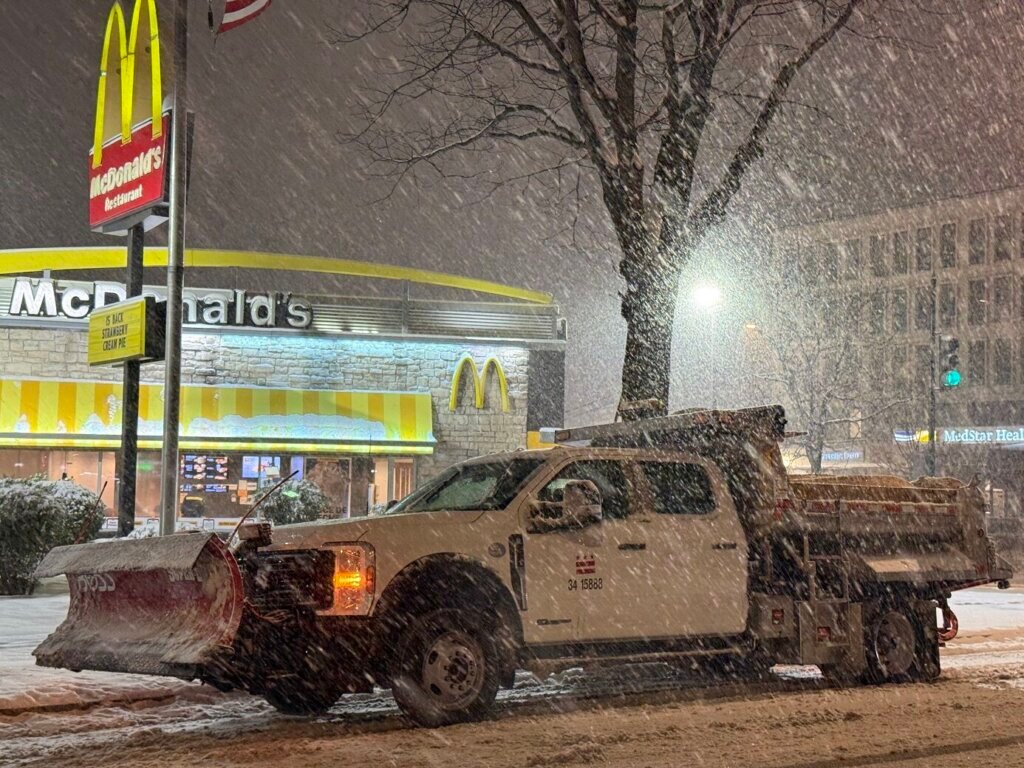
Local Governments Ramp Up Operations
Transportation departments deployed plows and salt trucks in advance, with “all hands on deck” directives echoing across agencies. Maryland and Virginia officials prepositioned equipment along major highways, while D.C. streets crews worked extended shifts. Airports, including Reagan National and Dulles, warned of flight delays and urged travelers to check updates frequently.
School districts eyed closures for Monday, drawing from past disruptions. Power companies readied crews to address outages from heavy, wet snow weighing on lines. Residents received alerts via apps and broadcasts to stock essentials early.
Impacts on Travel and Daily Life
Commuters faced the prospect of snarled roads and public transit slowdowns, prompting remote work recommendations from employers. Grocery stores reported brisk sales of milk, bread, and batteries as families prepared. Event organizers canceled outdoor activities, shifting focus indoors.
Here are key preparation steps recommended by authorities:
- Assemble an emergency kit with food, water, medications, and blankets for 72 hours.
- Charge devices and keep a full gas tank in vehicles.
- Clear gutters and secure outdoor items to prevent wind damage.
- Stay informed via local weather apps and official channels.
- Plan for power outages with alternative heating sources.
Looking Back at Past Storms
The impending system evoked memories of notable events like Snowmageddon in 2010, which paralyzed the region with over two feet in spots. Recent winters brought lighter accumulations, making this forecast stand out. Historical data from the National Weather Service ranked it among the top threats, with models hinting at 15 to 20 inches in extreme scenarios.
Lessons from prior storms shaped current strategies, emphasizing early mobilization. The blend of snow, ice, and cold amplified risks compared to isolated flurries.
Key Takeaways
- Expect 4-8 inches widely, with higher amounts possible.
- Travel disruptions likely from Saturday evening through Sunday.
- Prepare now to avoid last-minute shortages.
This storm tests the region’s resilience once more, blending modern forecasting with time-tested readiness. As flakes begin to fly, communities unite to weather the challenge – what steps have you taken? Share in the comments below.