They lie beyond the surf line, cut into the continental margins like secret scars, plunging and carrying the ocean’s wildest traffic. For decades they hid in plain sight because our eyes, cameras, and curiosity mostly stayed on land. Now, a burst of new mapping and seafloor monitoring is uncovering a global network of underwater canyons that rival Earth’s most famous gorge in scale and drama. The mystery is simple and irresistible: What carved these chasms where no rivers visibly flow, and why do some keep growing today? The answers turn out to be urgent, practical, and surprisingly human, touching everything from internet cables to fisheries to the way carbon moves through our planet.
The Hidden Clues
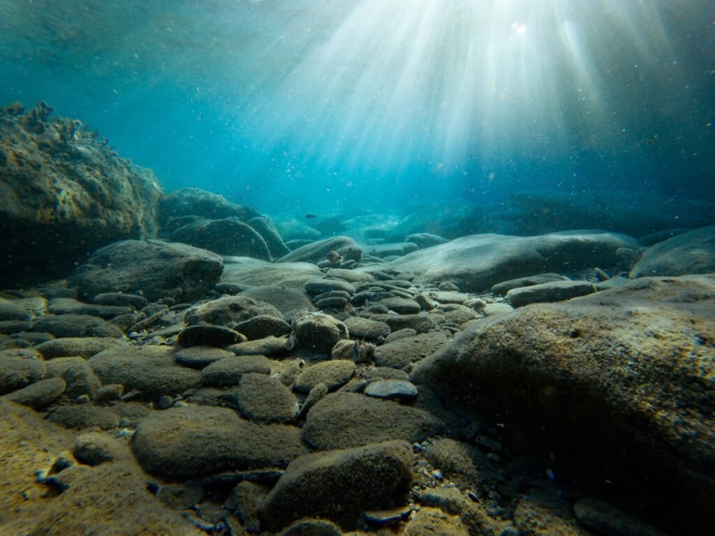
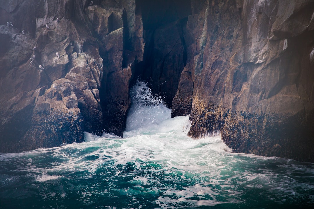
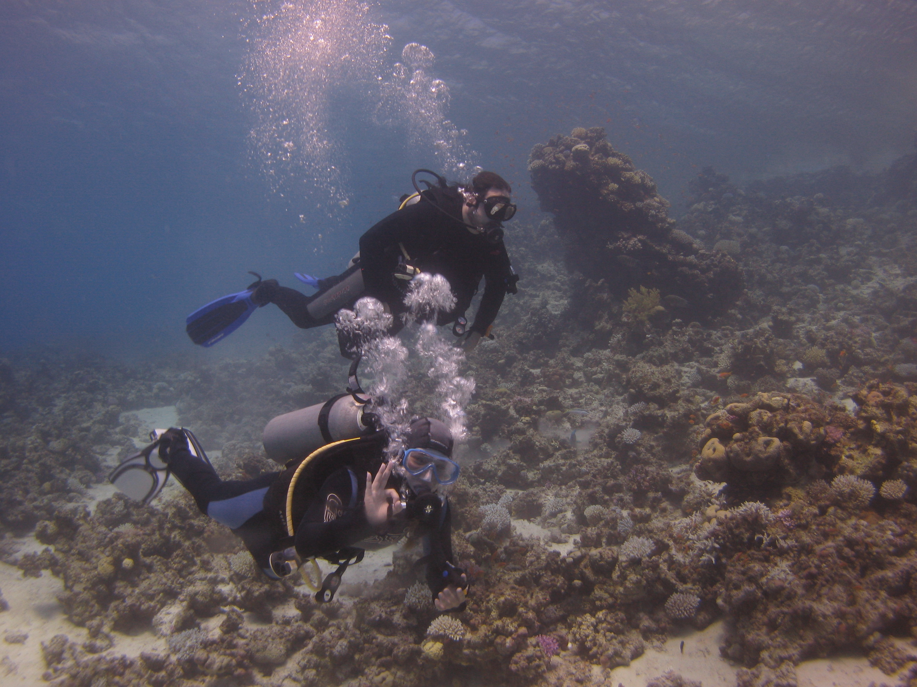
Here’s the hook: a canyon no tourist will ever see can dwarf the Grand Canyon’s relief, yet begins just offshore beneath harmless-looking waves. On a foggy morning above Monterey Bay, I once watched a research team ferry a small robot toward open water, and it felt like a launch to a parallel world; within minutes, they were dropping into a chasm that starts almost at the beach and falls toward the abyss. That’s the paradox of submarine canyons – they are both intimate and immense, forming near coastlines we think we know while plunging to depths that reset our sense of scale.
Clues pile up in patterns: steep V-shaped walls, sinuous channels, and levees built by past underwater floods. Add in fresh scars from recent sediment avalanches, and these landscapes read like crime scenes with multiple culprits. Decoding them is what turns a map into a story – and sometimes a warning.
Deeper Than the Grand Canyon: Meet the Giants
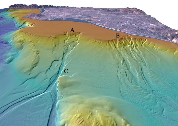
Start in the Bering Sea, where Zhemchug Canyon yawns across the shelf with vertical relief that surpasses the Grand Canyon and a footprint large enough to feel almost continental. Southwest down the Pacific margin, Monterey Canyon descends from kelp forests to deep-dark miles offshore, its head practically at a beach where surfers wait for sets. Across the Atlantic, the Congo Canyon runs from the river’s mouth to a deep-sea fan, one of the rare systems that still carries frequent, powerful sediment flows.
Then there’s Nazaré off Portugal, the canyon that turns winter storms into record-breaking surf by funneling wave energy like an acoustic horn. Around New Zealand, the Kaikōura Canyon plunges close to shore and concentrates nutrients that feed whales and fisheries. Together, these places show a simple truth: when it comes to raw depth and active processes, the sea quietly out-grands the Grand Canyon.
From Ancient Tools to Modern Science
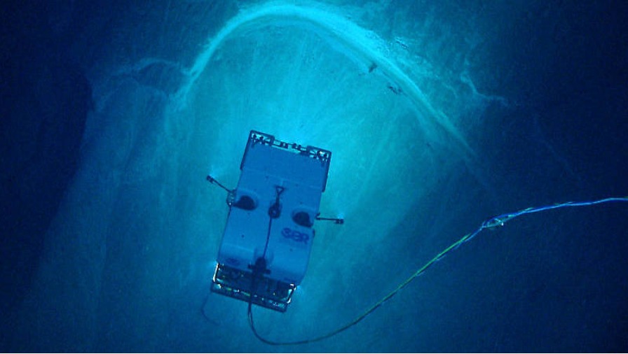
Early bathymetric contours hinted at canyons a century ago, but the details were blurry and the mechanisms were guesswork. Today, fleets of multibeam sonars stitch high-resolution seafloor mosaics, uncrewed surface vessels sweep tight grids in rough weather, and autonomous underwater vehicles fly laser-straight transects like airborne surveyors turned aquatic. Those maps get ground-truthed by cores that capture sand layers from past underwater floods and by cameras that watch pebbles shuffle in the dark.
The newest twist is listening to the ocean floor itself: fiber-optic cables can be repurposed as dense seismic arrays, detecting tremors and even the distant thrum of storms through distributed acoustic sensing. Pair that with GPS-timed cable data outages, seabed landers, and machine-learning models, and we’re finally observing canyons not as relics but as living systems. It feels like switching from a still photograph to a time-lapse film.
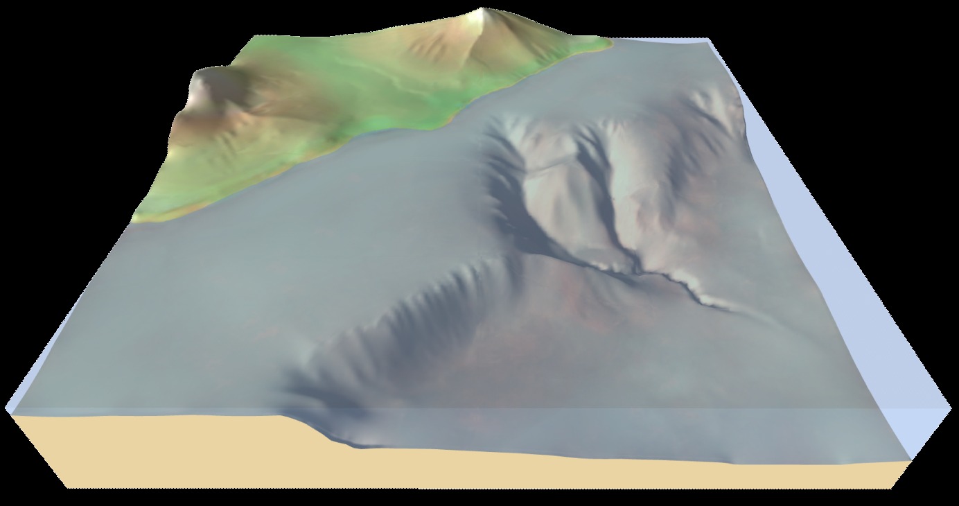
Sculpted by Gravity: The Making of a Submarine Canyon
On land, rivers carve canyons with water and time; underwater, gravity does the same job through dense, sediment-laden flows called turbidity currents. During ice ages and low sea levels, rivers often reached the shelf edge, priming canyon heads with sand and mud and setting the stage for catastrophic slumps that cut steep chutes. Earthquakes, storms, and floods still trigger those flows, sending slurry downhill at highway speeds that scour rock, snake through bends, and build levees exactly like a river – only heavier, darker, and faster.
Tectonics and currents finish the job: uplift steepens slopes, long-shore drift delivers fresh sediment, and contour currents rework the edges. In polar regions, glaciers once fed canyons with vast pulses of debris; in the tropics, coral rubble and river plumes take the lead. What emerges is a shared blueprint of incision, bypass, and deposition written by gravity and refined by climate and sea level.
River Mouth Rockets: Congo and Other Active Systems
The Congo River powers one of the few canyon systems that still runs like a conveyor, launching frequent turbidity currents that race far into the Atlantic. Recent monitoring has documented powerful turbidity currents in that canyon system that can affect seafloor infrastructure, a modern reminder that these are not quiet landscapes. Scientists traced the timing through cable telemetry and seafloor instruments, revealing a chain reaction that began near the river mouth and propagated for days.
Similar, if smaller, events pulse through canyons off California, New Zealand, and the Mediterranean after storms or earthquakes. Each flow reshapes channels, redistributes nutrients, and occasionally threatens infrastructure that sits in harm’s way. The takeaway is stark: where rivers meet steep slopes, gravity has a hair-trigger.
Why It Matters
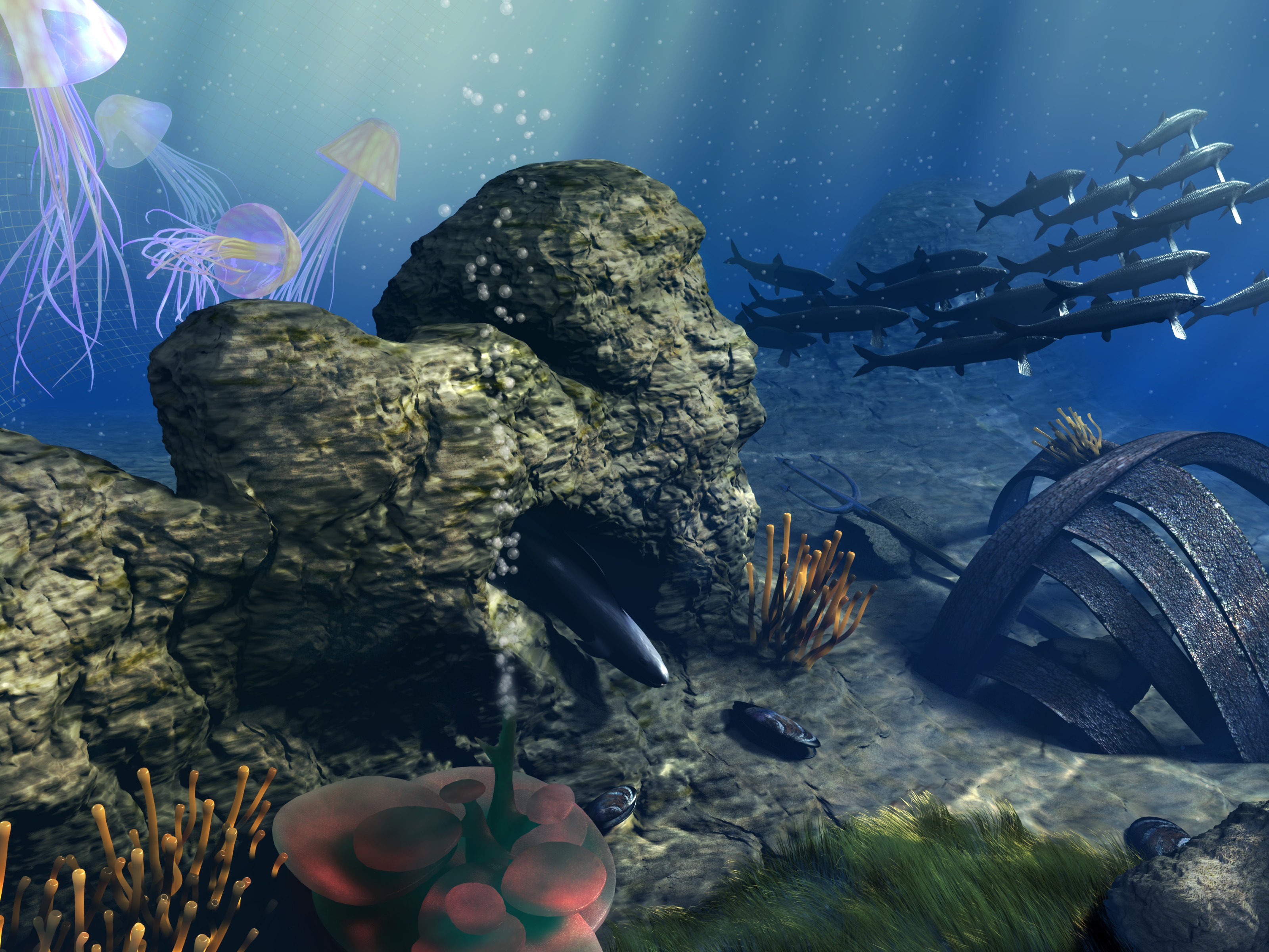
Submarine canyons act as express lanes for life and matter, concentrating nutrients, attracting fish, and providing corridors for whales and deep-sea communities. Their currents ventilate low-oxygen zones and shuttle organic carbon to the deep, tangling them in the planet’s slow, essential climate rhythms. They also intersect human lifelines: the vast majority of international data travels through seabed cables that often cross or parallel canyon systems.
Think of the trade-offs in three quick beats: – Canyons fuel productive fisheries but are sensitive to bottom trawling and sediment plumes; – They bury carbon naturally, yet large disturbances can remobilize ancient stores; – They enable science and communication while posing rare but real geohazards to cables and pipelines. Recognizing these tensions helps regulators and communities plan routing, set fishing closures, and watch the right places at the right times. In short, understanding canyons is part ecology, part engineering, and part foresight.
The Future Landscape
We’re on the cusp of a seafloor data boom as nations, companies, and nonprofits race to complete high-resolution maps and permanent observatories. Expect more uncrewed vessels to run 24/7 mapping lines, underwater gliders to patrol canyon mouths, and cabled observatories to stream real-time flow measurements and video. Machine-learning models will fuse all of it – bathymetry, sediment cores, cable strain, storm forecasts – into early warnings for turbidity currents and habitat shifts.
There are challenges: data silos, uneven access, and the risk that deep-sea mining or poorly planned infrastructure crowds critical corridors. Yet the blueprint is plausible and practical – route assets away from hot spots, protect canyon nurseries, and keep the mapping open so local fishers and global planners see the same hazards. If we get it right, the next decade turns hidden chasms into well-understood neighbors.
Take Part: A Simple Call to Action
Engagement starts close to shore, where many canyons begin and where community choices echo offshore. Support coastal projects that reduce sediment runoff after storms, back marine protected areas that include canyon heads and spillways, and ask your local representatives to prioritize open seafloor data. When you donate to ocean-science nonprofits or visit aquariums that fund deep-sea research, you help keep observatories running and mapping ships at sea.
Most of all, stay curious – follow new seafloor maps as they’re released, share them in classrooms, and remember that a seemingly quiet horizon can hide a landscape more dramatic than anything in stone. The next time you stand on a bluff and hear the surf, picture a river of sand rushing in the darkness below. Did you expect that?

Suhail Ahmed is a passionate digital professional and nature enthusiast with over 8 years of experience in content strategy, SEO, web development, and digital operations. Alongside his freelance journey, Suhail actively contributes to nature and wildlife platforms like Discover Wildlife, where he channels his curiosity for the planet into engaging, educational storytelling.
With a strong background in managing digital ecosystems — from ecommerce stores and WordPress websites to social media and automation — Suhail merges technical precision with creative insight. His content reflects a rare balance: SEO-friendly yet deeply human, data-informed yet emotionally resonant.
Driven by a love for discovery and storytelling, Suhail believes in using digital platforms to amplify causes that matter — especially those protecting Earth’s biodiversity and inspiring sustainable living. Whether he’s managing online projects or crafting wildlife content, his goal remains the same: to inform, inspire, and leave a positive digital footprint.


