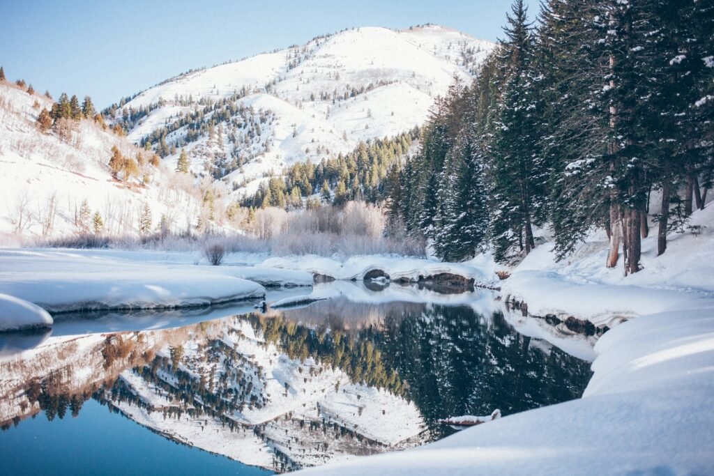
The Midwest didn’t just shiver last winter – it locked up like a seized engine. A parade of January storms shoved Arctic air into the heartland, then March roared back with a blizzard that stacked fresh drifts and snarled travel again. Power grids sputtered, highways turned to glacial ribbons, and people learned the hard way that frostbite is a countdown, not a concept. Behind the drama, scientists watched the jet stream warp, lakes steam like kettles, and the polar vortex flex just enough to remind us who’s boss. The mystery isn’t simply why it got so cold, but why these bursts arrive in clusters – and what they’re telling us about a climate system running hotter overall yet capable of brutal cold snaps.
The Hidden Clues

Step outside on a day like a day like January 21 and the cold could hit with texture – gritty, immediate, almost loud. Chicago’s wind chills bottomed out near the minus-thirties during a multi-day cold spell, a shock made stranger by the lack of deep snow on the ground at first. That detail matters: bare soil usually radiates heat differently than a bright snowpack, yet this outbreak plunged well below zero anyway. The atmosphere was signaling an efficient Arctic delivery, the kind that sprints across prairies and bites through layers. It looked simple on a map; it came down to geometry in the air.
I still remember a field trip winter in Duluth when the wind felt like it was sanding my cheeks; last January carried that same abrasive edge. Scientists call out the pattern more than the place: a buckling jet stream that opens the freezer door just wide enough and just long enough to matter.
The Lake-Effect Machine, Recharged

When frigid air tears across relatively warm water, the Great Lakes turn into five oversized snow guns. Early in the season, low ice coverage can supercharge lake-effect bursts, feeding narrow but intense snow bands that park over towns and bury them. Later, as winter progresses, even a near-average ice season modulates the heat and moisture source – and the frequency of those intense squalls. In January, parts of northern Michigan piled up far more snow than usual as cold air raked across mostly open lakes. That setup made plow schedules look futile and forecasts feel personal.
By late winter, GLERL’s analysis showed the 2025 ice season running slightly below average overall, a reminder that regional cold snaps can coexist with longer-term warming trends in lake ice. Those two realities – short, fierce outbreaks and modest seasonal ice – aren’t contradictions; they’re two chapters in the same book.
From Ancient Tools to Modern Science

For generations, Midwesterners measured storms in shovel heights and door drifts; now we measure them in power outages, high-resolution satellite loops, and ensemble forecasts. January’s first major system, tracked from the Rockies into the Plains, blossomed into a cross-country event that drop-kicked the Midwest before raking the East. By the time it cleared, hundreds of thousands had lost power and travel had cratered. The Weather Prediction Center’s storm summaries read like a time-lapse of converging jet streaks, deepening surface lows, and a conveyor of Gulf moisture colliding with Arctic air. It’s the same recipe our grandparents knew – just observed with better instruments and far more data.
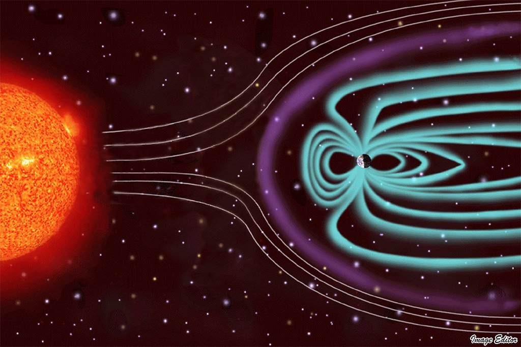
Then came the polar vortex talk. While that term gets tossed around, the science is careful: stratospheric disturbances can dislodge or elongate cold pools, and sometimes they cascade into the troposphere where we live. January lined up that cascade, and the thermometers told the tale.
Data in the Snow: What the Numbers Say

Numbers cut through the fog when everything else feels anecdotal. Consider these checkpoints from the season’s peaks:
- More than a quarter-million customers could lose power during major January storms iced wires and slammed grids across the central U.S., with outages climbing higher as the system pushed east.
- Wind chills in the Chicago metro sank to roughly the minus-thirties during the January 19–24 cold spell, despite sparse snow cover at first.
- NOAA’s winter recaps logged multiple Midwest-impact storms in early January and again into February and March, underscoring a weeks-long, multi-wave pattern.
- Great Lakes ice in 2025 ended up near to slightly below average seasonally, even after episodes of bitter cold.
Taken together, these data points show a season defined less by a single blockbuster and more by a chain of blows – each one taxing infrastructure and communities a bit more.
Why It Matters

To some, a frozen January feels like proof that global warming isn’t real; in reality, it’s what a warming, juiced-up atmosphere looks like when it flips to cold. The long-term trend lifts average temperatures, reduces typical lake ice, and loads storms with more vapor; the short-term pattern can still yank polar air south, hard. Traditional rules of thumb – like relying on deep snowpack for the coldest nights – didn’t hold in Chicago’s bare-ground deep freeze. And the economic stakes are no longer just a few lost school days: cold snaps now test grid planning, supply chains, and health systems simultaneously. The science case is blunt – variability is increasing, and costs are following.
Compared with past playbooks that focused on “average winters,” today’s risk management leans on probabilistic forecasts, stress-tested infrastructure, and rapid-response public health messaging. The tools have improved; the baseline has shifted.
Global Perspectives

Teleconnections stitched this winter together. A brief, weak La Niña emerged in early winter before fading to neutral by spring, subtly tilting the jet stream and storm tracks while other patterns, like the North Atlantic Oscillation and Pacific Decadal Oscillation, modulated the background. None of these guaranteed a Midwest deep freeze; taken together, they raised the odds for the kind of cross-country storm train we saw. Climate scientists spent the season parsing how those signals stacked, where blocking set up, and why the cold lodged where it did. The answers aren’t tidy, but they’re getting sharper every year.
Meanwhile, Europe and parts of Asia wrestled with their own cold blasts during stratospheric wobbles, underscoring that polar dynamics don’t respect borders. What happens over the Arctic ripples globally, one jet meander at a time.
The Future Landscape

Forecasting tomorrow’s Midwest winter is becoming less about picking a number and more about bounding a range. Expect more investment in subseasonal-to-seasonal prediction – models that aim to see three to six weeks ahead by tracking stratospheric signals, tropical waves, and ocean heat content. Expect, too, expanded Great Lakes ice and temperature monitoring, because lake-effect snow depends on that delicate ice-water balance. Grid operators and cities are already pivoting: hardening substations, insulating sensors, and pre-positioning mobile generation during high-risk windows. It’s quieter work than storm footage, but it’s the difference between a bad day and a cascading outage.
On the horizon, better ensemble guidance may let schools, hospitals, and logistics hubs make earlier, smarter calls. Paired with updated building codes and heating assistance, that’s where science turns into fewer headlines – and safer winters.
Conclusion

There’s a practical playbook for readers. Check your home’s weak links – attic insulation, window sealing, and the humble pipe wrap – before the first advisory, not during. Build a small, boring kit: battery lantern, hand warmers, spare phone battery, nonperishable food, and any essential meds for at least three days. Follow your local National Weather Service office and utility on whichever platform you actually open; alerts beat rumors every time. If you can, support community warming centers and donate winter gear through local groups – boots and mittens matter on the coldest mornings.
Finally, back the science that keeps you warm: vote for resilient infrastructure, encourage your school board to use weather-responsive schedules, and champion data transparency from utilities and city agencies. Winters are changing; our readiness has to change faster.

Suhail Ahmed is a passionate digital professional and nature enthusiast with over 8 years of experience in content strategy, SEO, web development, and digital operations. Alongside his freelance journey, Suhail actively contributes to nature and wildlife platforms like Discover Wildlife, where he channels his curiosity for the planet into engaging, educational storytelling.
With a strong background in managing digital ecosystems — from ecommerce stores and WordPress websites to social media and automation — Suhail merges technical precision with creative insight. His content reflects a rare balance: SEO-friendly yet deeply human, data-informed yet emotionally resonant.
Driven by a love for discovery and storytelling, Suhail believes in using digital platforms to amplify causes that matter — especially those protecting Earth’s biodiversity and inspiring sustainable living. Whether he’s managing online projects or crafting wildlife content, his goal remains the same: to inform, inspire, and leave a positive digital footprint.