The Great Plains stretch across the heart of America like a massive weather laboratory, producing some of the most mind-bending meteorological phenomena on Earth. This vast expanse of land holds secrets that would make even seasoned meteorologists gasp in amazement.
From tornadoes that can toss houses like toys to hailstones bigger than volleyballs, the Great Plains region defies what most people consider normal weather. Every year, this incredible landscape serves up atmospheric surprises that challenge our understanding of nature’s raw power and leave scientists scratching their heads in wonder.
Snow Can Fall After 70-Degree Days
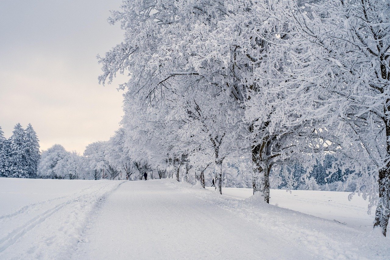
Picture this: you’re lounging in shorts enjoying a beautiful spring afternoon when suddenly, winter comes roaring back with a vengeance. Much of the Great Plains region averages well over a foot of snow – after the first day 70-degree day of the year! This isn’t just a fluke occurrence; it’s actually a common weather pattern that catches visitors completely off guard.
Swings like this aren’t unusual in the central United States, where weather can quickly shift from one extreme to another. That’s especially true in the springtime, when conditions turn into a roller coaster, with balmy spring days followed by abrupt returns to winter. Think of the Great Plains as nature’s mood swing capital, where Mother Nature can’t quite decide if she wants to wear a bikini or a parka.
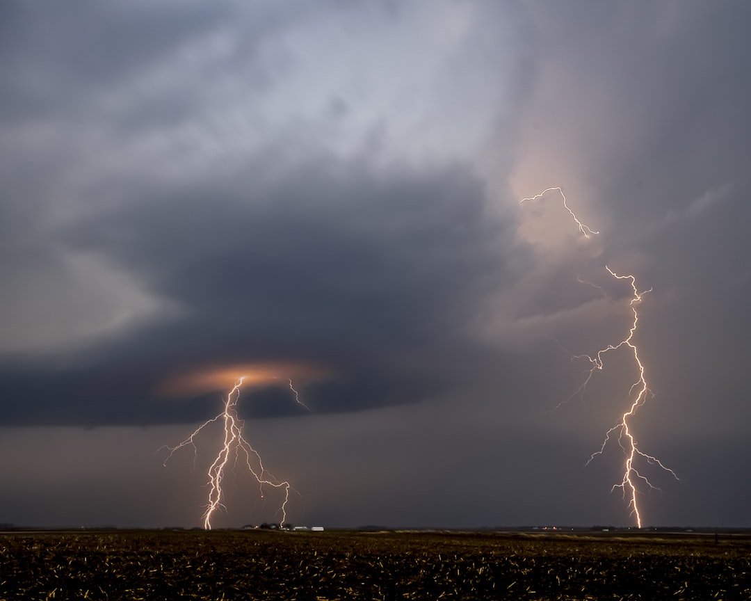
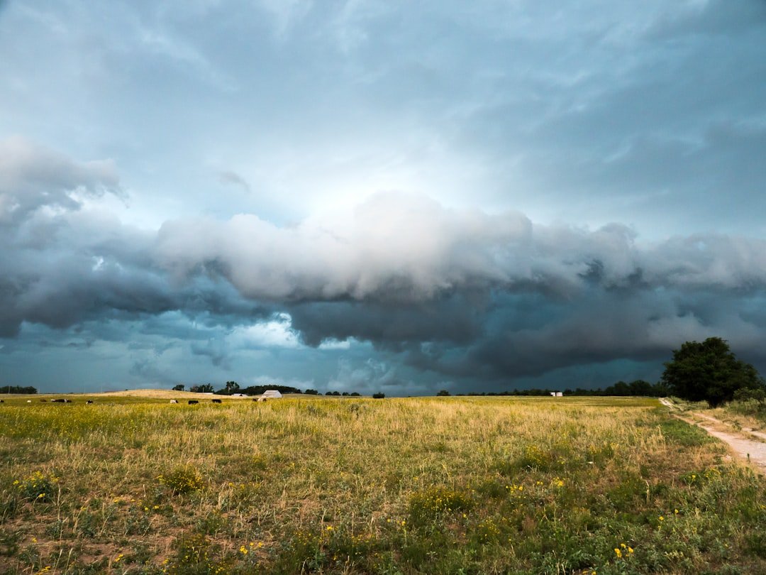
You Can Get Tornado, Blizzard, and Wildfire Warnings Simultaneously
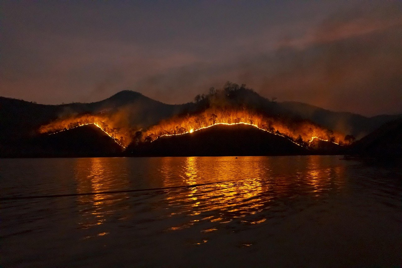
Visitors in eastern Colorado are often surprised to hear warnings for wildfires, tornadoes and a blizzard at the same time. Imagine checking your weather app and seeing three completely different disasters all threatening your area within hours of each other. This isn’t science fiction – it’s just another Tuesday on the Great Plains.
When these cyclones develop in the fall and spring, they can generate many forms of unusual and hazardous weather, sometimes just a few counties apart. It’s like having three different climates duke it out in your backyard, each bringing its own brand of chaos and confusion to anyone trying to plan their day.
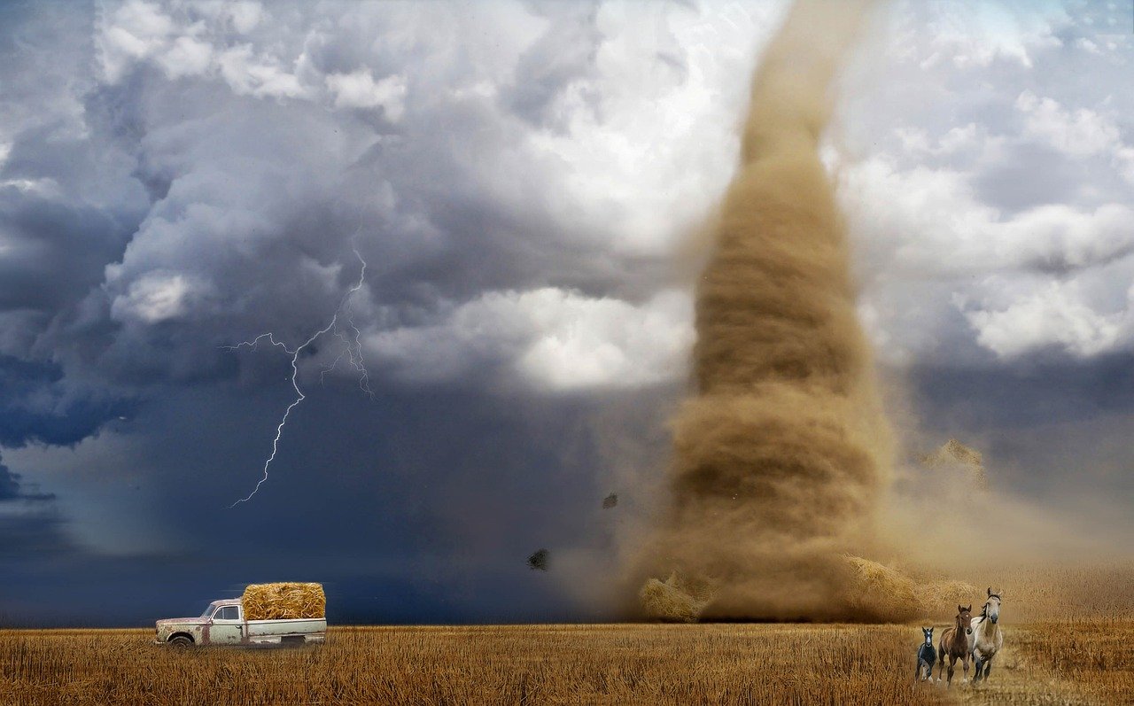
The Region Hosts Earth’s Most Tornado-Prone Area
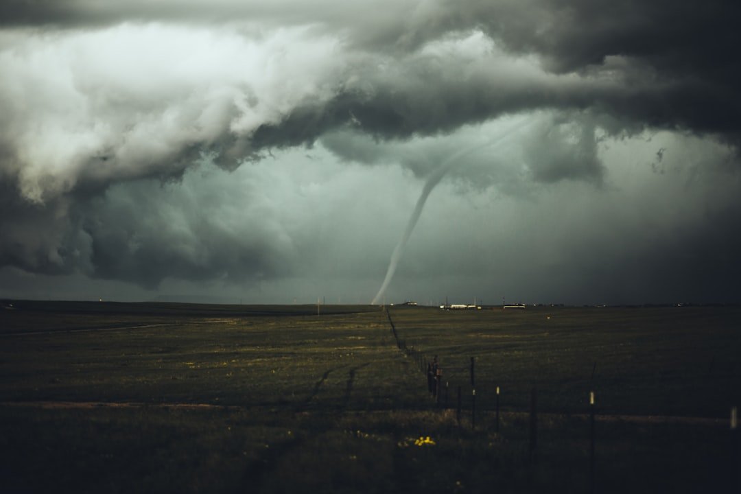
Tornadoes occur more frequently and are more intense in the Great Plains than in any other region on earth. This isn’t just a matter of bragging rights – the Great Plains have earned their reputation as the planet’s tornado capital through sheer numbers and devastating power. Texas has the most overall number of tornadoes of any state. Per data collected through 2007, Kansas and Oklahoma ranked first and second respectively in the number of tornadoes per area.
Plains geography, with fringing mountain ranges running predominantly north to south, allows cold dry air from the north to collide with warm moist tropical air from the south. The jet stream, which seasonally migrates south across the Great Plains, is another essential ingredient in the creation of tornadoes. It’s like nature created the perfect recipe for atmospheric chaos and decided to serve it up on a regular basis.
Most Tornadoes Are Wimpy, But the Violent Ones Are Killers
F0 and F1 tornadoes are weak tornadoes, with top wind speeds reaching 112 miles per hour, a typical width of 50 to 100 feet, and a typical life span of only a few minutes. They account for 68 percent of all Great Plains tornadoes. These are like nature’s tantrums – loud and dramatic but relatively harmless in the grand scheme of things.
But here’s where things get terrifying: F4 and F5 violent tornadoes are the strongest, with wind speeds that can exceed 300 miles per hour, a funnel as wide as a mile, and a duration of several hours. Violent tornadoes represent only 2 percent of all tornadoes in the Great Plains, but they account for more than 90 percent of tornado-caused deaths. That tiny percentage of monster storms carries the power to reshape entire communities in minutes.
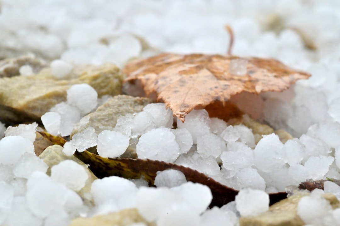
Hailstones Can Grow to Volleyball Size

The largest officially recognized hailstone on record to have been “captured” in the U.S. was that which fell near Vivian, South Dakota on July 23, 2010. It measured 8.0″ in diameter, 18.62″ in circumference, and weighed in at 1.9375 pounds. Imagine playing catch with a nearly two-pound chunk of ice falling from the sky at highway speeds – that’s exactly what Lee Scott discovered in his yard that day.
For small hailstones (<1-inch in diameter), the expected fall speed is between 9 and 25 mph. For hailstones that one would typically see in a severe thunderstorm (1-inch to 1.75-inch in diameter), the expected fall speed is between 25 and 40 mph. In the strongest supercells that produce some of the largest hail one might expect to see (2-inches to 4-inches in diameter), the expected fall speed is between 44 and 72 mph. Those record-breaking giants? They can slam into the ground at over 100 mph.
Kansas Had 18 Inches of Hail Piled on Level Ground
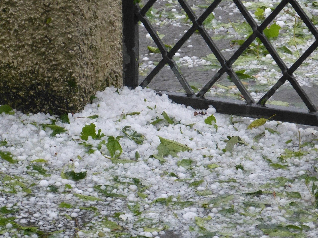
Hail accumulated 18″ deep on level in Seldon, Kansas on June 3, 1959, perhaps the greatest on-level hail accumulation on record in the U.S. Picture stepping outside after a storm and finding your entire yard buried under a foot and a half of ice balls. It wasn’t a freak accident or a pile-up in a ditch – this was legitimate, level-ground accumulation that turned summer into an instant winter wonderland.
Heavy rainfall during or following a hailstorm can cause hail accumulations to wash into ditches, creek beds, or other low-lying areas resulting in enormous piles of hail often several feet deep. Sometimes the aftermath looks more like someone dumped a mountain of ice cubes in the middle of farm country, creating bizarre landscapes that wouldn’t look out of place on an alien planet.
Temperature Swings Can Exceed 50 Degrees Daily
The Great Plains, therefore, has a large range in both annual and daily temperatures. This gives the region a much larger range in annual temperature than is found elsewhere in North America. For example, the range in mean monthly temperature between January and July in Omaha, Nebraska, is approximately 56ºF, while in Philadelphia, Pennsylvania, and San Francisco, California (each at a similar latitude), the ranges are 46ºF and 14ºF respectively.
But that’s just the annual range – daily temperature swings can be equally dramatic. So the day or two before the cyclone develops, temperatures are often well above average, only to quickly plummet as the strong cold front associated with the cyclone blasts through. You might wake up reaching for sunscreen and go to bed scraping ice off your windshield, all within the span of 24 hours.
North Dakota’s Temperatures Are Rising Faster Than Anywhere Else
North Dakota’s average temperature has increased faster than any other state in the contiguous United States, and the number of days with temperatures over 100°F is projected to double in the Northern Plains by 2050. This northern state is experiencing climate change at warp speed, transforming from a land known for brutal winters into something resembling a desert climate.
The Southern Plains are projected to experience more extreme heat, with four times the number of days over 100°F than is currently experienced in the area. The entire Great Plains region is essentially turning into a massive heat dome, where temperatures that once seemed extreme are becoming the new normal. Future summers might make today’s heat waves look like pleasant spring days.
Billion-Dollar Hailstorms Are Becoming Common
The costliest year to date was 2017, when insurers reported $22 billion in hail damage. Phoenix experienced the single most damaging hailstorm in U.S. history on October 5, 2010, with a tab of $3.2 billion (adjusted to 2018 dollars). These aren’t just weather events anymore – they’re economic disasters that can cripple entire metropolitan areas in a matter of minutes.
A coherent conception considers that there is a single Tornado Alley in the United States and Canada, and that this can simply be subdivided into smaller areas based on regional attributes. San Antonio, Texas experienced a hailstorm on April 16, 2016 that resulted in $1.4 billion in damage, with hailstones the size of grapefruits. When chunks of ice the size of citrus fruits start falling from the sky at highway speeds, insurance companies start having nightmares.
The Plains Experience Weather from Four Different Air Masses
Air masses that form over the Gulf of Mexico and the Caribbean often move northward into the Plains with warm, very moist air. Occasionally, very warm, dry air will enter the Plains with air masses that originate in the desert areas of the southwestern United States and northern Mexico. Finally, air that originates over the Pacific Ocean will often move east, crossing the mountainous region of the western third of the United States into the Great Plains.
The transport of this air up the windward side of a mountain barrier and then down the leeward side results in significant warming and drying. Depending on the time of year, one or a combination of these air masses typically dominate much of the Great Plains region. It’s like having four different weather personalities fighting for control over the same piece of land, creating an atmospheric battleground that produces some of Earth’s most spectacular and dangerous weather phenomena.
Conclusion
The Great Plains don’t just experience weather – they manufacture it on an industrial scale. From record-breaking hailstones that could dent a car to tornadoes that rewrite the landscape, this region serves up meteorological marvels that challenge everything we think we know about Earth’s atmosphere. The temperature swings alone would give most climates whiplash, while the air mass collisions create a natural laboratory where the impossible becomes routine.
These wild weather facts reveal a landscape where nature flexes its muscles daily, reminding us that the Great Plains aren’t just America’s breadbasket – they’re also the planet’s most dramatic weather theater. Next time you hear someone complain about unpredictable weather, just remember: they probably don’t live where tornadoes, blizzards, and wildfires can all threaten the same county on the same day. Makes your local weather forecast seem pretty tame by comparison, doesn’t it?

Jan loves Wildlife and Animals and is one of the founders of Animals Around The Globe. He holds an MSc in Finance & Economics and is a passionate PADI Open Water Diver. His favorite animals are Mountain Gorillas, Tigers, and Great White Sharks. He lived in South Africa, Germany, the USA, Ireland, Italy, China, and Australia. Before AATG, Jan worked for Google, Axel Springer, BMW and others.