The Sonoran Desert looks empty at noon, all shimmer and silence, yet as dusk falls its sand turns into a moving script of paw prints. For years, the question has lingered: which wild cats still share this fierce landscape with growing cities and busier roads? A wave of new fieldwork is pulling back the veil, revealing a cast of elusive hunters threading between saguaros, culverts, and backyard washes. Scientists are now comparing decades of sightings with camera-trap networks and genetic clues to map how these cats survive the heat, the drought, and the human footprint. The findings carry a jolt of hope – and a sober reminder that survival here is a narrow ridge, not a plateau.
The Hidden Clues
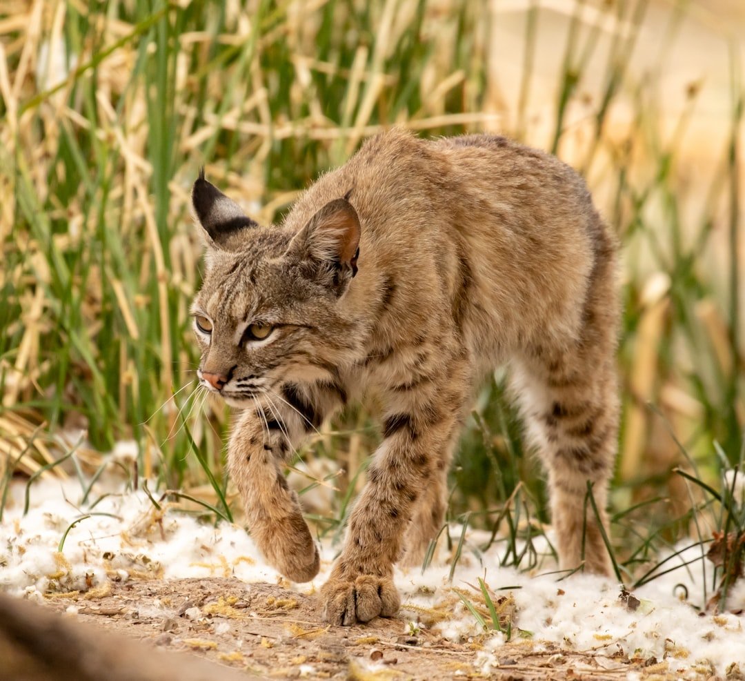
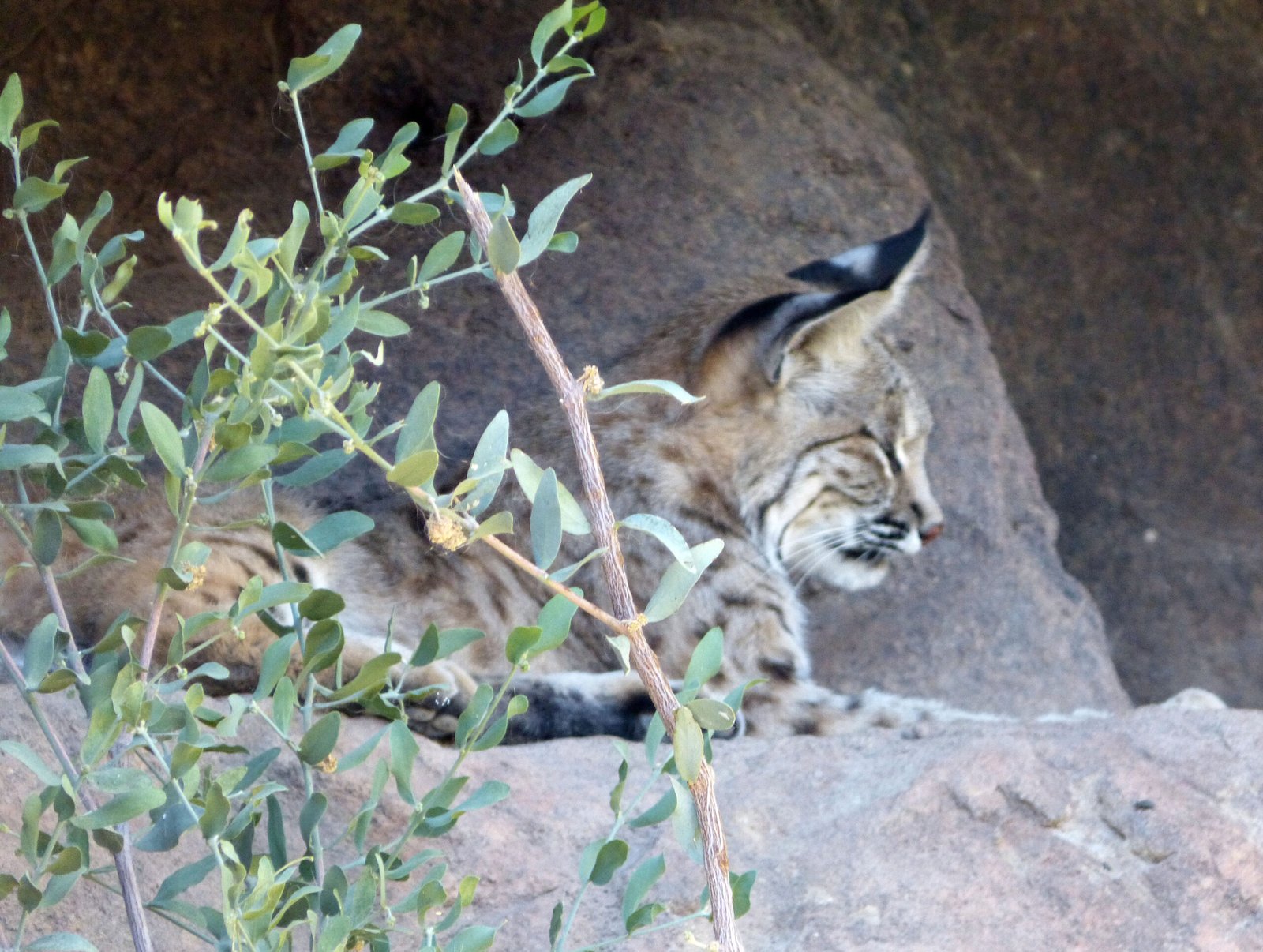
The desert rarely shows its secrets; it hints at them. Fresh scrapes beneath a mesquite, the musky twist of scat on a trail, and faint tracks stitched across a dry wash tell a story of night work and careful routes. I once paused at dusk near the Tucson Mountains and watched a bobcat glide past a driveway, so quiet that only the bobbing tail betrayed the movement.
Field biologists read these clues like weather, noting which washes carry the most traffic and which culverts funnel animals under busy roads. They cross-check prints with camera images and time stamps, building timelines of who passed where and when. The pattern that emerges is unmistakable: the cats are still here, but they move like ghosts until you learn how to see them.
The Cast of Cats
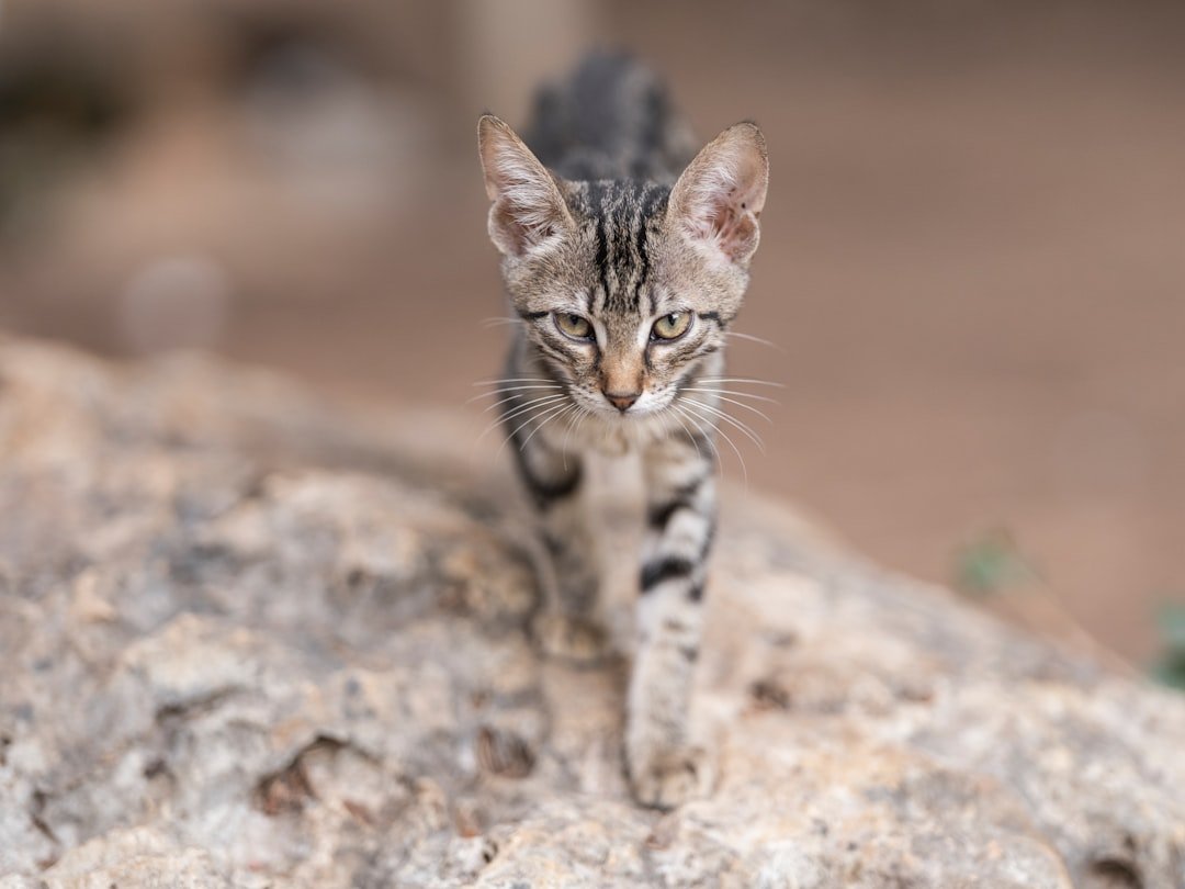
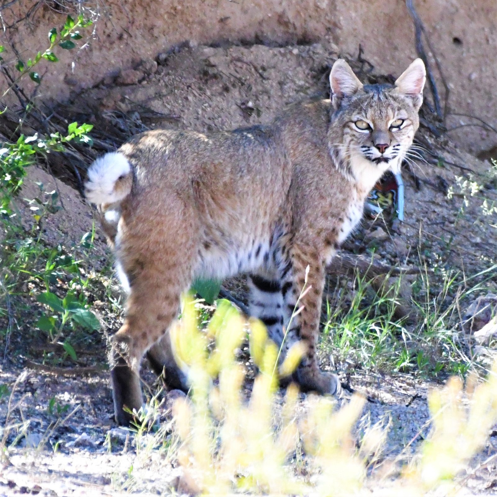
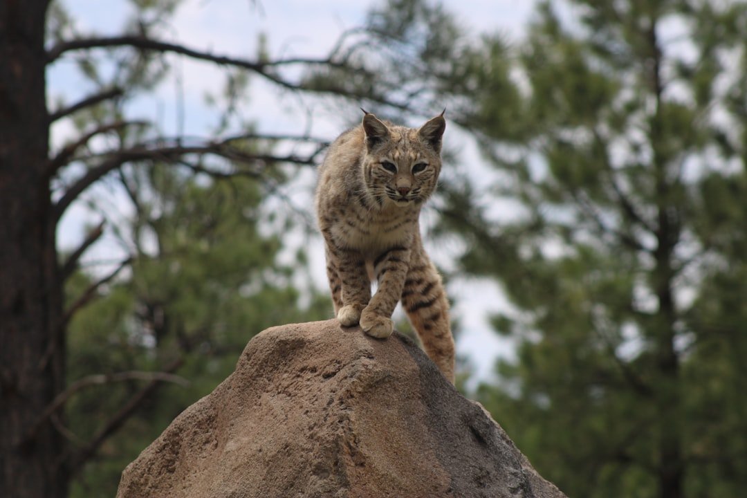
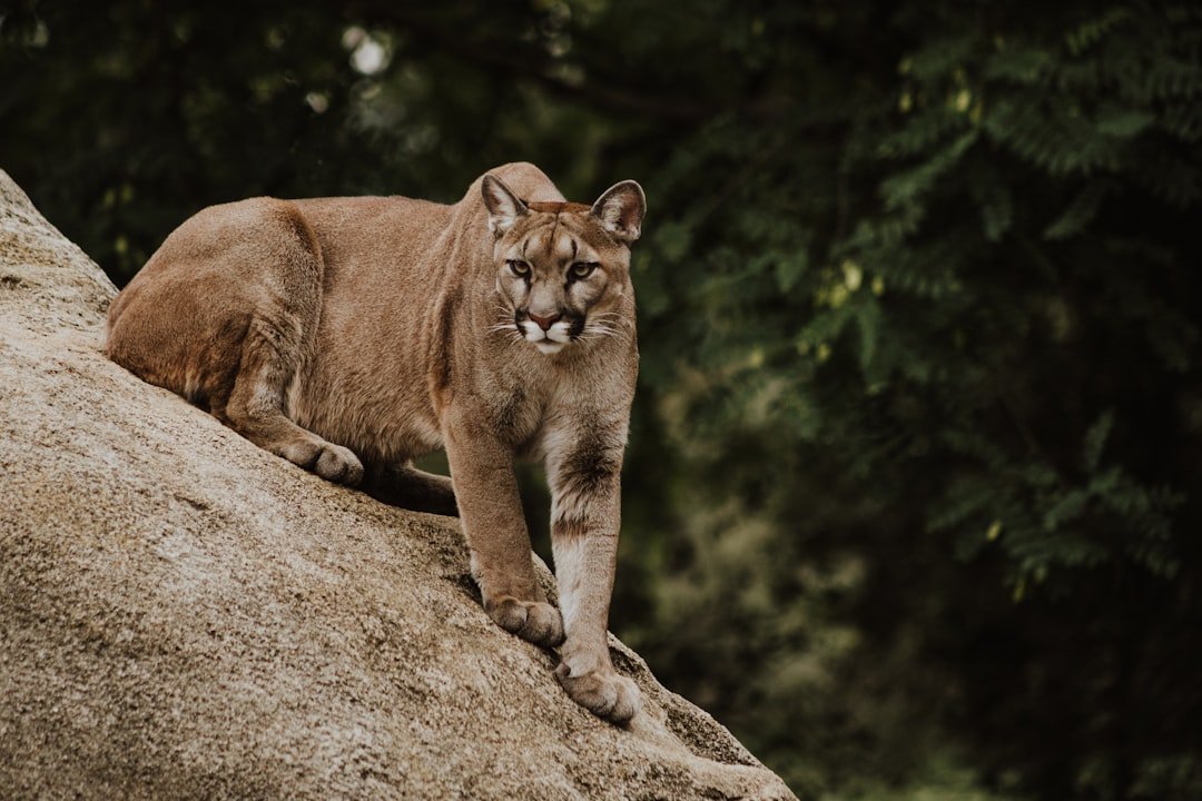
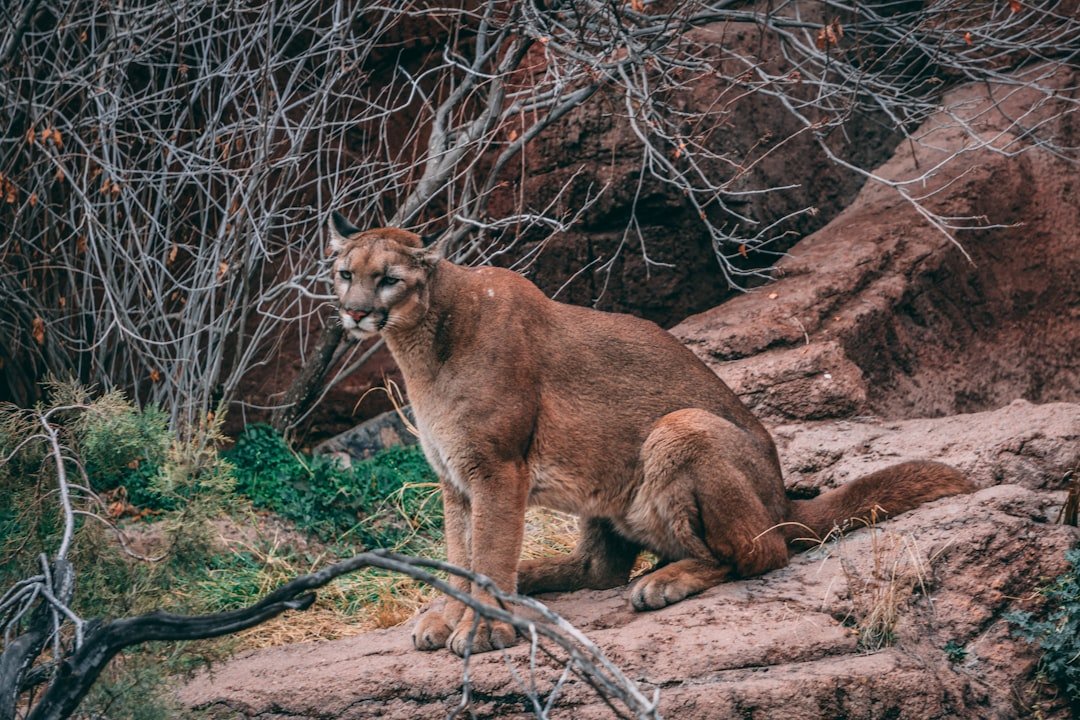
Four native felids figure in Arizona’s desert story: the bobcat, the mountain lion, the ocelot, and the jaguar. Bobcats, compact and adaptable, frequent arroyos and neighborhood edges, hunting rabbits and quail with equal confidence. Mountain lions, larger and rangier, shadow deer across canyons and foothills, sometimes skirting the lights of Tucson and Phoenix after midnight.
Ocelots, spotted and secretive, appear only rarely in southern Arizona, almost always as solitary males dispersing from strongholds in Sonora. Jaguars surface even more rarely, with several males documented over the past few decades roaming the state’s southern “sky island” ranges. Together, these species sketch a gradient – from common backyard visitor to rare borderlands wanderer – that defines the region’s feline mosaic.
From Ancient Tracks to Modern Science
Tracking in the desert begins with knowledge as old as footprints and as sharp as a new moon. Researchers still crouch over sand to read heel pads and toe drag, but they also grid canyons with motion-triggered cameras that operate night after night. GPS collars on a few study animals trace looping paths through cross-border ranges, showing how often cats hug washes and ridgelines to stay cool and invisible.
Scat, once bagged and ignored, is now a trove of DNA and diet data, revealing individual identities and the mix of rabbits, rodents, and deer that fuels them. Even whiskers and hair can carry chemical signatures of water sources and prey, adding layers to the map. Stitch those lines together and you get a living atlas – one that refreshes with every monsoon and every new camera deployment.
Water, Heat, and Survival
Life here is a negotiation with heat, and wild cats are skilled negotiators. They rest through the oven-hot hours and turn crepuscular, moving at dawn and dusk when air and sand release their grip on the thermometer. Washes become highways of cool air, and the shade of a boulder can be the difference between hunting and hunkering down.
Water shapes everything: tinajas tucked in slickrock, seep springs, and ranch stock tanks dot the routes like lifelines. Prey follows water, and predators follow prey; the cats’ territories stretch or compress with the rains. In dry years, those ranges can balloon, turning survival into a longer, riskier commute.
Borderlands on the Move
Arizona’s southern mountains are stepping-stones between the Sierra Madre in Mexico and the Mogollon Rim to the north. Bobcats and mountain lions cross these steps routinely, and on rare occasions so do ocelots and jaguars, linking populations that would otherwise be isolated. Camera traps in these “sky islands” record these crossings the way airport scanners log arrivals and departures.
Where the landscape narrows, roads and border infrastructure can pinch movement into dangerous chokepoints. Wildlife underpasses and overpasses – from the foothills near Tucson to highway projects across the state – have already logged bobcats and lions using safe passages. In a region defined by movement, every open corridor is a bet on continuity rather than cutoff.
Why It Matters
Predators are not just dramatic; they are functional, shaping ecosystems from the top down. Where mountain lions keep deer wary and moving, riverbank vegetation often rebounds, stabilizing soils and cooling streams. Bobcats suppress rabbit and rodent numbers, indirectly buffering gardens and crops at the urban fringe.
The presence of ocelots and jaguars – however rare – signals that the borderlands still link to a larger biological engine in Mexico. For science, these cats are indicators of connectivity, measuring whether our fragmented landscapes can still conduct life. For people, they anchor a sense of place, reminding a fast-growing region that wildness is not a museum piece but a neighbor.
The Hidden Clues, Revisited: Urban Edges
Suburbs built into desert foothills create a patchwork where wild and domestic lives overlap. Garbage, outdoor pet food, and backyard poultry can draw bobcats and even lions into risky proximity with people. The vast majority of encounters end with a fleeting glimpse, but a small fraction escalate when animals find easy meals or lose their fear.
Managers respond with education, hazing, and – only when necessary – relocations or removals, trying to reset boundaries before habits form. Neighborhoods that trim ground cover, secure attractants, and protect small pets at night see fewer conflicts. The lesson is simple and practical: behavior at the backyard scale ripples across the entire urban-wildlife interface.
Global Perspectives
Arizona’s story mirrors borderlands around the world where cats roam against the grain of development. Ocelots thrive in South Texas thornscrub where wildlife corridors and private ranches link habitat patches, offering a useful contrast to Arizona’s rarer visitors. Jaguars in northern Sonora rely on intact ranchlands and riparian corridors, a reminder that conservation can live alongside working landscapes.
Mountain lions stretch from Canada to Patagonia, adapting to deserts, forests, and mountains with a resilience few large mammals match. Protect the connective tissue – riparian ribbons, ridge routes, and safe road crossings – and you protect a continental traveler. The desert becomes not a barrier but a bridge, one that other species use as surely as the cats do.
The Future Landscape
Climate projections point to hotter summers, longer dry spells, and more erratic monsoons, all of which reshuffle prey and water. Fires that once crept now race, stripping shade from hillsides and changing where cats can hunt and rest. Renewable energy buildouts and new roads will need smarter siting to avoid severing the few corridors that still function.
On the tech side, AI now flags cat images from millions of camera-trap photos, and portable genetics kits push analyses from lab benches to field trucks. Satellite data can track vegetation pulses after rain, letting researchers predict where cats will move next. The challenge is coordination: agencies, tribes, ranchers, and researchers aligning data and decisions at the pace of change.
How to Help Right Now
At the household scale, keep pet food indoors, secure poultry, and bring small pets inside from dusk to dawn. Trim brush near fences to reduce ambush cover, and pack out food scraps on desert hikes. If you see a cat, give it space, note the location, and share the sighting with local wildlife managers or community science platforms.
At the civic scale, support road projects that include wildlife crossings and speak up for riparian protection in city plans. Back organizations that maintain camera networks and restore desert water sources, especially during prolonged droughts. Small steps, multiplied across neighborhoods and seasons, keep the desert’s quiet traffic flowing.

Suhail Ahmed is a passionate digital professional and nature enthusiast with over 8 years of experience in content strategy, SEO, web development, and digital operations. Alongside his freelance journey, Suhail actively contributes to nature and wildlife platforms like Discover Wildlife, where he channels his curiosity for the planet into engaging, educational storytelling.
With a strong background in managing digital ecosystems — from ecommerce stores and WordPress websites to social media and automation — Suhail merges technical precision with creative insight. His content reflects a rare balance: SEO-friendly yet deeply human, data-informed yet emotionally resonant.
Driven by a love for discovery and storytelling, Suhail believes in using digital platforms to amplify causes that matter — especially those protecting Earth’s biodiversity and inspiring sustainable living. Whether he’s managing online projects or crafting wildlife content, his goal remains the same: to inform, inspire, and leave a positive digital footprint.