For decades, oceanographers chased the drama at the surface – the gleam of swirling eddies in satellite images, the ribboning tracks of major currents, the flash of storms whipping up seas. Yet the real steering wheels were hiding in the dark: long chains of underwater mountains bending water like wind around a cliff. New high‑resolution models now reveal how those jagged ridges and seamounts quietly redirect heat, carbon, and nutrients across the Pacific. The discovery reframes old mysteries about why currents wander, where marine life clusters, and how climate patterns suddenly shift. It also hints at a future in which better maps of the seafloor could sharpen forecasts from fisheries to El Niño.
The Hidden Clues
What if the most powerful traffic signals in the Pacific are invisible from the surface? Sailors and satellite watchers have long noticed persistent streaks of life and temperature gradients that don’t line up neatly with the wind. The new modeling shows that these hidden corridors often sit downstream of seamounts and ridges, where the flow is nudged, squeezed, and spun into jets that can persist for months.
The physics are simple but relentless: water tends to conserve a property called potential vorticity, so when it crosses rough terrain it twists and slides along contours like a skateboarder tracing a half‑pipe. Mountains transfer momentum back to the ocean through a mechanism known as form stress, subtly braking some currents while accelerating others. Over thousands of miles, those tiny pushes add up to reshaped highways of water.
From Ancient Tools to Modern Science
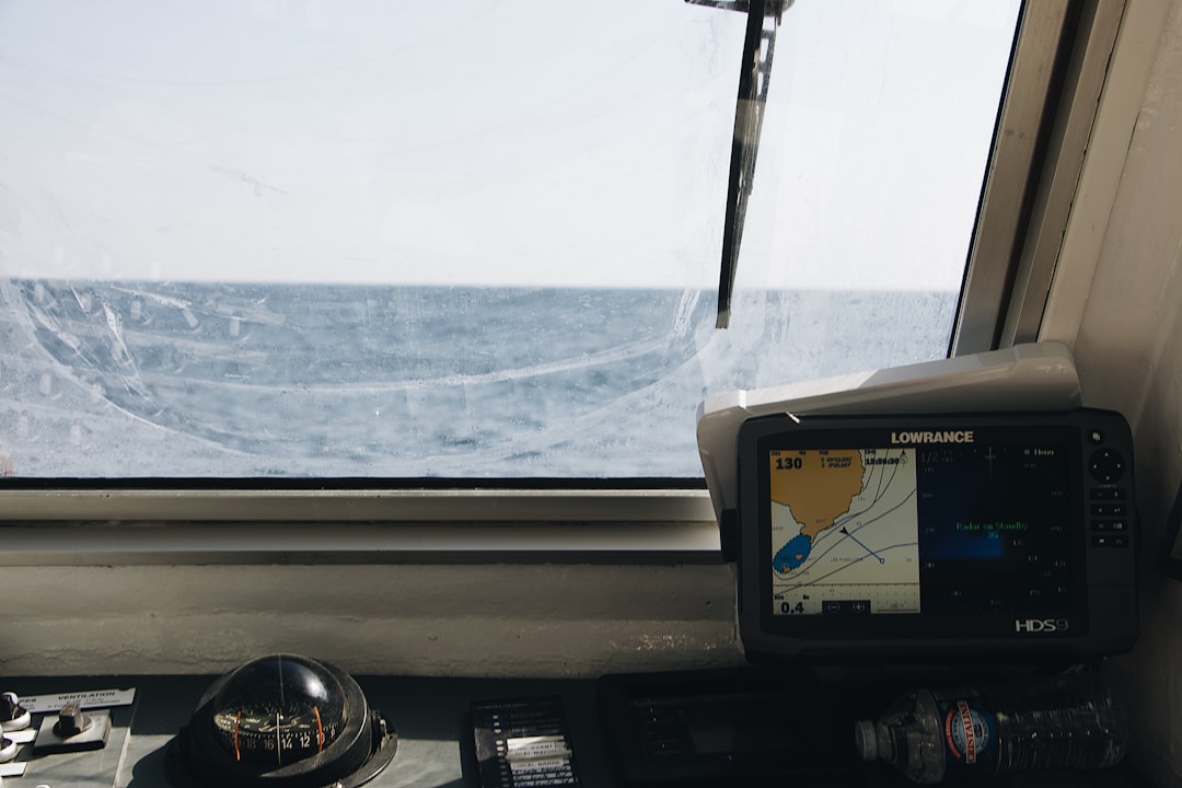
Early ocean mappers dropped lead lines and hoped for the best, sketching a world of broad plains with only the tallest peaks. Echo sounders improved the picture, but vast tracts of the Pacific remained cartoonish in detail. Today, multibeam sonars, autonomous gliders, and deep‑diving floats are filling in the fine print, while new satellite missions sharpen our view of the surface ripples caused by currents below.
Feed those observations into kilometer‑scale ocean models and the seafloor stops being a static backdrop; it becomes an active driver. What once looked like numerical noise reveals organized jets, eddies, and internal waves locked to ridgelines, finally matching patterns mariners and fishers have sensed for generations.
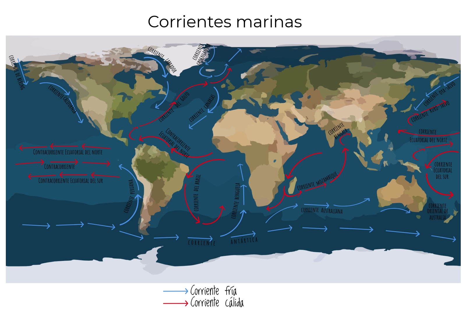
Mountains Beneath the Waves
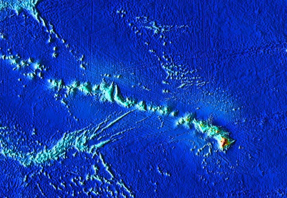
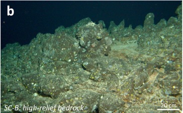
The Pacific’s bed is not a gentle bowl but a tectonic quilt stitched with volcanic arcs, fracture zones, and sprawling seamount chains. When strong currents ram these features, they generate internal tides and lee waves that break like underwater surf, mixing cold, nutrient‑rich water upward. That vertical stirring helps fertilize the sunlit layer, fueling blooms that can feed migrating predators and, eventually, us.
These same topographic interactions create hotspots of turbulence that connect deep basins, acting like stairwells in a skyscraper for heat and carbon. Instead of a smooth conveyor belt, the abyss looks more like a series of escalators and moving walkways, their speeds set by the slope and shape of the seafloor.
Rerouting the Pacific Highways
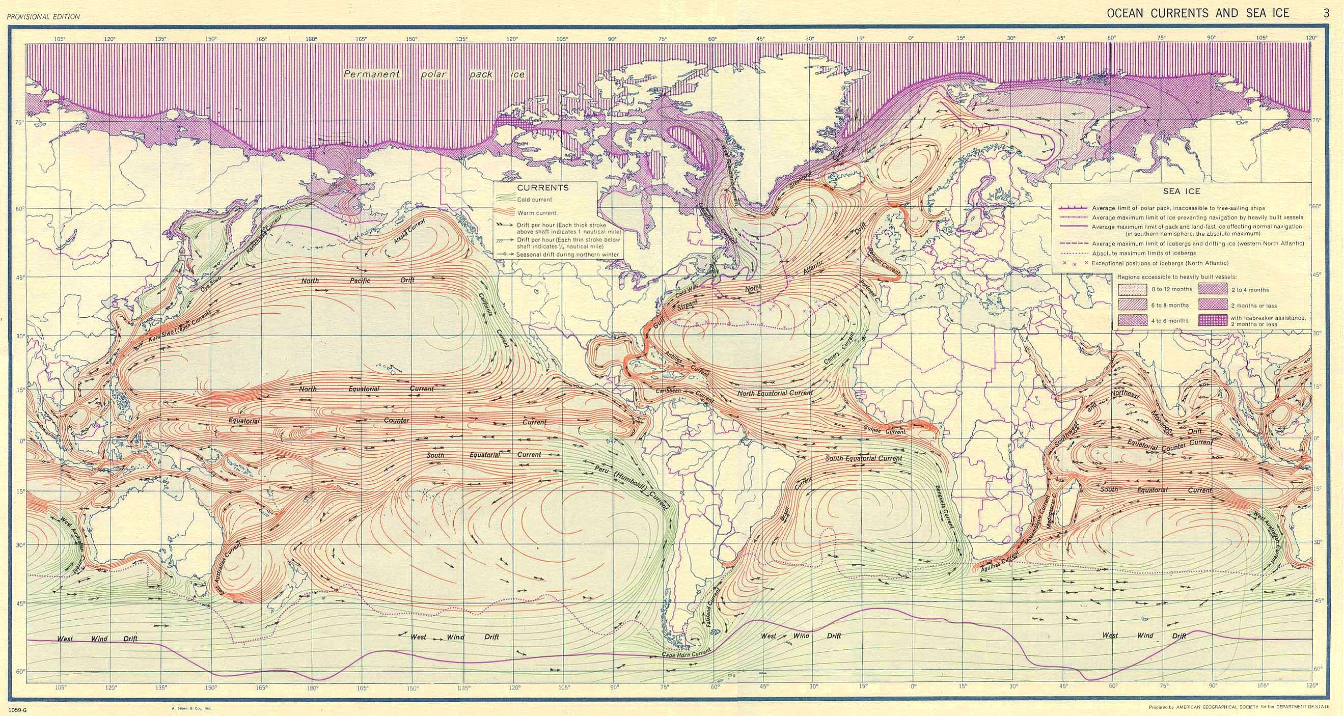
Picture the great currents as interstates: the Equatorial Undercurrent barreling east, the Kuroshio Extension veering into the open ocean, and the North Equatorial Countercurrent snaking west to east. As these flows encounter ridges and seamounts, they split, merge, or meander, creating detours that carry warm water into cool latitudes and return colder waters toward the tropics. In some places, passes between islands act like tollgates, determining how much water moves from one gyre to another.
The models show that even modest bumps can trigger persistent jets and eddy trains, steering energy across the basin like a baton relay. Over years, those reroutes change where heat builds up, where oxygen thins, and where nutrient plumes rise – quiet shifts that set the stage for future extremes.
Why It Matters
We often blame the atmosphere for the ocean’s mood swings, but the seafloor is the choreography underneath the music. Traditional climate models smoothed over many of these bottom details, which helped computations run fast but left stubborn errors, from a too‑cold equatorial tongue to misplaced rain belts. By resolving seamount‑scale features or teaching models how to mimic their effects, scientists are narrowing those biases and clarifying the pathways that deliver heat to coastlines.
The stakes are tangible. Better maps of topographic steering could refine seasonal forecasts that guide fisheries, inform marine protected areas, and prepare communities for marine heatwaves. They can also sharpen estimates of how much carbon the deep ocean can store, a critical piece of the climate puzzle. In short, getting the bottom right helps us get the future less wrong.
Signals for El Niño and Beyond
El Niño begins with subtle ripples – Kelvin and Rossby waves sliding along the equator – yet those signals don’t travel in a vacuum. Ridges and seamount chains can scatter, delay, or amplify them, changing when and where warm anomalies surface in the eastern Pacific. The new modeling suggests that small differences in underwater topography can tip the timing of events that later dominate the headlines.
That ripple effect extends to decadal modes like the Pacific Decadal Oscillation, which rearranges marine ecosystems over years rather than months. By modulating the deep routes of heat and nutrients, seafloor features can stack the deck for a warmer or cooler phase, long before we see the outcome at the surface.
Global Perspectives
Topographic steering is not a Pacific‑only story, but the scale of the basin makes its lessons unavoidable everywhere else. What happens as currents thread the Hawaiian‑Emperor chain or squeeze through island arcs has echoes in the Indian Ocean’s ridges and the Atlantic’s fracture zones. When the Pacific rearranges its heat, weather patterns far afield adjust in step, tugging on monsoons, storm tracks, and drought risk.
That means the Pacific’s hidden mountains influence harvests, insurance decisions, and even energy demand continents away. In a connected climate, ignoring the basement level of the ocean is like designing a city while skipping its foundations – and hoping the elevators still line up.
The Future Landscape

What comes next is a synthesis: exascale computing to run global models at kilometer scale, AI‑assisted emulators to capture fine turbulence, and fleets of smart gliders to patrol the gaps. Microstructure sensors are poised to map where internal tides actually dissipate, turning guesses into measurements. With every improvement, the models become less like cartoons and more like living atlases of water and rock.
Challenges remain, from the cost of sustained observing to the difficulty of representing complex mixing in ways models can handle. There’s also the urgent need to complete high‑resolution seafloor maps in areas still sketched in broad strokes. The payoff is practical: cleaner forecasts for coasts, clearer guidance for fisheries, and a sturdier foundation for climate risk planning.
Take Action: A Closing Note

You don’t need a research vessel to help. Support ocean mapping and observing programs through nonprofits that equip floats and gliders, and champion open data so local communities can use the results. Follow responsible seafood guides, back marine protected areas that shelter hotspots of productivity, and encourage leaders to fund long‑term ocean monitoring – the backbone of every forecast we rely on.
Small acts add up, just as tiny pushes from underwater mountains redirect entire currents. The seafloor is writing tomorrow’s ocean story right now; our job is to read it clearly and plan accordingly. Will we choose to see the steering wheels beneath the waves before the next turn surprises us?

Suhail Ahmed is a passionate digital professional and nature enthusiast with over 8 years of experience in content strategy, SEO, web development, and digital operations. Alongside his freelance journey, Suhail actively contributes to nature and wildlife platforms like Discover Wildlife, where he channels his curiosity for the planet into engaging, educational storytelling.
With a strong background in managing digital ecosystems — from ecommerce stores and WordPress websites to social media and automation — Suhail merges technical precision with creative insight. His content reflects a rare balance: SEO-friendly yet deeply human, data-informed yet emotionally resonant.
Driven by a love for discovery and storytelling, Suhail believes in using digital platforms to amplify causes that matter — especially those protecting Earth’s biodiversity and inspiring sustainable living. Whether he’s managing online projects or crafting wildlife content, his goal remains the same: to inform, inspire, and leave a positive digital footprint.