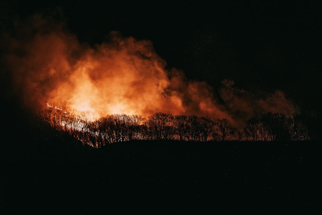
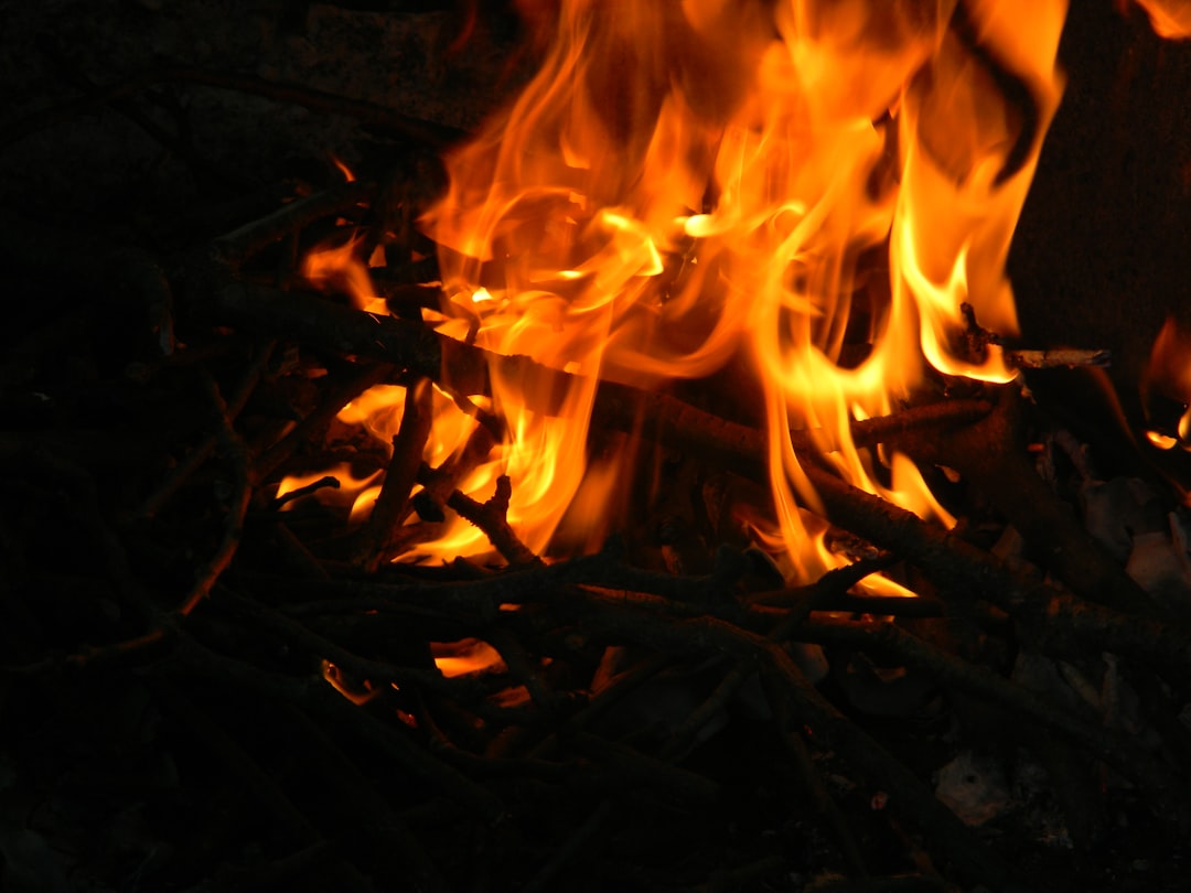
Smoke without flame. Streets that buckle in winter like rising bread. In Pennsylvania’s old coal belt, underground fires smolder so quietly that a passerby might miss them – until a whiff of sulfur or a patch of snow that melts in a perfect oval gives the secret away. These coal-seam fires, some older than many of the houses they thread beneath, are more than relics; they’re active geological engines reshaping towns from below. The mystery is how such hidden blazes persist for so long, and the challenge is how to track, tame, and ultimately prevent them without tearing apart the communities above.
The Hidden Clues
Step onto a hillside near a vent and the ground can feel like a radiator slipped under the soil, warm even in January. Vegetation fades in strange patterns, leaving scorched mosaics where roots meet hot, oxygen-starved earth. Asphalt buckles; basements grow sour; and a sulfurous haze lingers in low pockets after calm nights, a warning that gases are pooling where they shouldn’t. In some places, tree trunks char from the inside out, hollowing like burned candles while the canopy still looks oddly intact. The clues are subtle at first, but once you learn the signs, it’s hard not to see them everywhere in coal country.
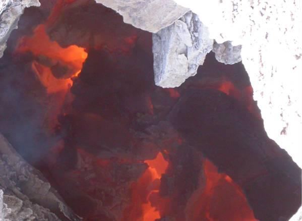
These fires spread along fractured seams, following old mine entries and hidden voids like a thief moving through unlocked doors. Oxygen leaks in from cracks and collapsed rooms, feeding combustion as the seam slowly advances. The result is a moving front that can creep a few feet a month or, under the right conditions, surge more quickly through loosened coal and waste rock. The surface expressions lag behind the fire, appearing where heat finally reaches shallow layers. That delay complicates response, turning a local nuisance into a mapmaker’s nightmare.
A Town Above a Furnace: Centralia’s Long Shadow
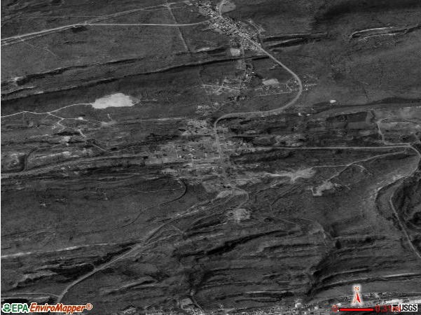
Centralia, Pennsylvania, is the name that still haunts every conversation about mine fires, and for good reason. A blaze that began in 1962 never truly let go, despite trenching, sealing, and relentless monitoring. Over time, most residents accepted buyouts and moved on, leaving a patchwork of streets, foundations, and a cautionary narrative that refuses to fade. The story is not just about one town’s loss; it’s about what happens when human infrastructure meets geological persistence. Heat, gas, and subsidence don’t follow property lines, and Centralia became a lesson written in lifted roadbeds and evacuated homes.
Nearby communities have watched warily as smaller fires flicker or rekindle in waste piles and old gangways. Local officials now plan with the mine fire in mind – routing utilities differently, testing basements for carbon monoxide, and weighing the cost of excavation against the risk of waiting. Families who stayed adapted with monitors on kitchen counters and a shared vocabulary for what smoke and steam can mean on a cold morning. The town’s long shadow is a set of habits and hard-earned caution rather than a single dot on a map. In that sense, Centralia is both place and paradigm.
From Ancient Tools to Modern Science

Early mine-fire responses were blunt instruments: dig it out, drown it, or wall it off with trenches. Those tactics worked only if crews could chase the seam faster than it burned, which rarely happened once fires penetrated the labyrinth of abandoned workings. Today, the toolkit looks different. Thermal infrared sensors on satellites and drones detect subtle heat contrasts across large areas, even through patchy vegetation. Fixed ground sensors sample gases like carbon monoxide, carbon dioxide, and methane, flagging shifts that hint at changing fire fronts underground.
Geophysical methods add the X-ray vision that old-timers wished they had. Electrical resistivity can outline hot, dry zones; passive seismic noise helps detect voids and collapsing rooms; and fiber-optic cables buried in shallow trenches read temperature along their entire length like continuous thermometers. Engineers also inject grout or fly-ash slurries to seal air pathways, starving fires of oxygen. None of these approaches is magic, but together they replace guesswork with evidence, turning a hidden process into something that can be tracked, tested, and sometimes nudged toward an end.
The Chemistry of a Slow Burn
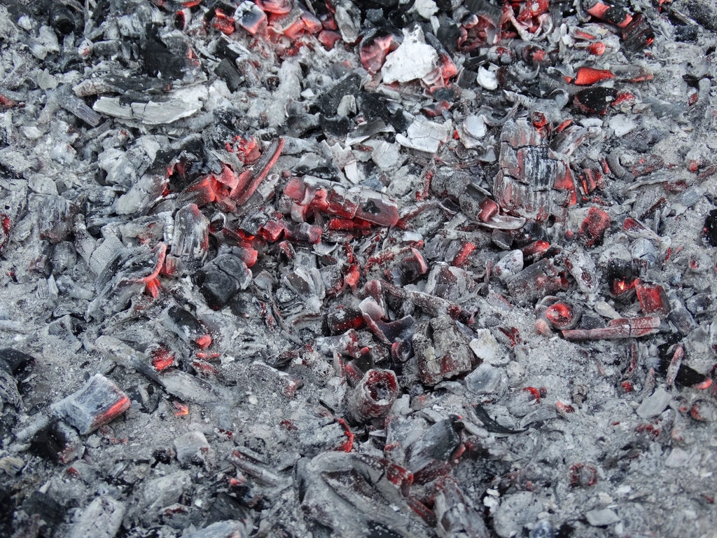
Coal-seam fires are stubborn because they exploit a simple recipe: fuel-rich rock, fractured pathways, and just enough oxygen to keep oxidation alive. As coal heats, it releases gases and tars that further feed combustion, while surrounding rock dries and fractures, enhancing airflow. Temperatures can climb high enough to bake clays into bricklike bands and drive off moisture that would otherwise dampen the reaction. Overlying soils act like a blanket, trapping heat and allowing hot zones to persist through seasons and storms. Once ignition occurs, the subsurface becomes a self-sustaining heat reservoir with its own momentum.
What rises to the surface is a chemically complex breath. Carbon monoxide and carbon dioxide dominate, but sulfur compounds, trace metals, and fine particulates can hitch a ride as the plume moves through rock. The chemistry shifts with coal rank, moisture, and oxygen supply, which is why vents may alternate between smoky, visible emissions and nearly invisible, gas-rich streams. Monitoring that blend is critical for safety decisions, from evacuations to when to dig and when to seal. The science is not only about temperature; it’s about the evolving fingerprint of a fire as conditions change.
Living With the Heat: Human and Ecological Impacts
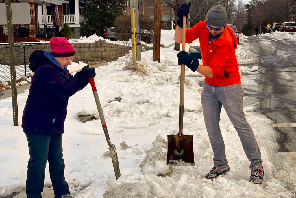
For families, the impacts land in small, relentless ways: carbon monoxide alarms at 3 a.m., a garden that won’t take root near a warm patch, or a hairline crack in a driveway that widens each freeze-thaw cycle. Schools and clinics learn to recognize symptoms of low-level exposure and to separate them from winter colds and allergies. Even when risks are managed, the ambient anxiety can be draining, a reminder that home sits above a problem measured in decades. Property values wobble; insurance questions multiply; and a sense of place gets tangled with a sense of hazard. Living with a mine fire is part science and part stamina.
Ecosystems also respond in uneven ways. Some heat-tolerant plants colonize disturbed soils, while others vanish, leaving bare mineral crusts and steam-slick openings. Amphibians and small mammals avoid the hottest ground, rearranging local food webs. Streams intersecting warm zones may lose dissolved oxygen, stressing fish during low-flow months. The patchwork of warmth and gas acts like an unplanned experiment, revealing which species bend and which break. Over years, that mosaic becomes its own habitat – novel, precarious, and decidedly human-made.
Global Perspectives
Pennsylvania’s story echoes across coal regions worldwide. In India’s Jharia field, long-burning seams have forced relocations and reshaped landscapes, while parts of northern China have invested heavily in detection and firebreaks to slow losses in remote basins. Australia’s Burning Mountain has smoldered for an astonishing span, a natural analogue that helps scientists study very long-term behavior without the overlay of mining. Each region wrestles with different balances of accessibility, fuel geometry, and moisture, which is why treatment successes rarely copy-paste from one site to another. The global view clarifies that this is a class of problems, not a single anomaly.
International collaborations now swap methods and data rather than recipes. Remote sensing teams compare algorithms across dry and humid climates to sharpen thresholds for detection. Engineers test grout formulas that resist cracking during thermal cycling, a recurring failure mode in freeze-prone zones. Public health experts share strategies for home monitoring and community alerts that reduce panic while improving response times. The more widely these fires are studied, the more precise – and realistic – the playbooks become.
Why It Matters
Underground fires rarely make headlines unless a road collapses or a dramatic evacuation unfolds, but slow disasters are still disasters. Long-lived fires represent persistent emissions, chronic infrastructure stress, and a recurring drain on local budgets that can least afford it. Traditional remediation focused on single bursts of action, yet these systems behave like marathoners, not sprinters, requiring monitoring and staged interventions over years rather than weeks. Comparing that old approach to today’s data-driven strategy is like comparing a snapshot to a time-lapse: one misses the motion that defines the threat. When communities grasp that shift, expectations and funding structures can finally align with reality.
The scientific stakes are larger than one state. These fires offer rare, real-world laboratories for studying porous flow, heat transfer, and feedbacks in fractured rock – knowledge relevant to geothermal energy, carbon storage, and subsurface hydrogen projects. By learning how heat and gases move through messy geology, we become better at predicting where problems will bloom and where they will fade. That cross-pollination of ideas turns a local hazard into a wider scientific resource. In the end, relevance is the difference between a curiosity and a priority.
The Future Landscape
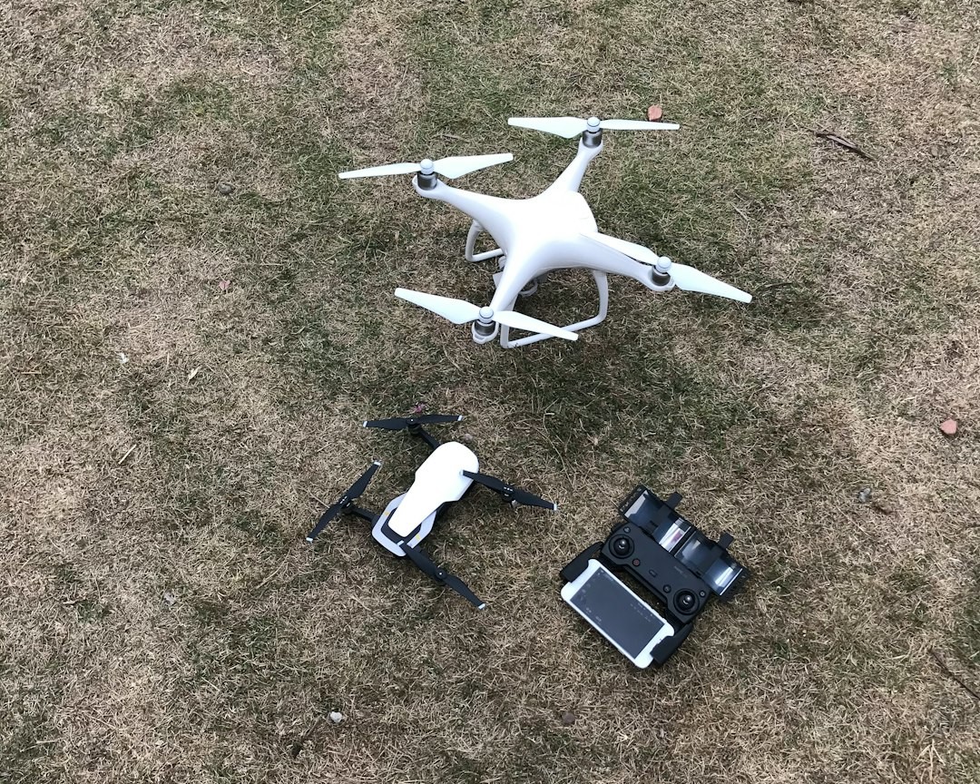
What’s next looks smarter, smaller, and more integrated. Low-cost thermal cameras on fixed poles can watch known hot spots in real time, sending alerts when temperatures deviate from seasonal norms. Fiber-optic sensing, paired with machine learning, can flag anomalies along buried lines, catching subtle shifts before surface cracks appear. Small drones can skim treelines and steep culm banks, scanning vents that would be dangerous to reach on foot. When those data streams merge into shared dashboards, decision-makers finally operate from the same picture.
On the remediation front, oxygen-starvation strategies are advancing beyond simple sealing. Inert gas injections and engineered barriers are being designed to flex with seasonal expansion and contraction, reducing the risk of fissures reopening after a deep freeze. Where excavation is feasible, selective digging guided by high-resolution subsurface imaging can limit disturbance and cost. Long-term, the most cost-effective move is prevention: proper waste-pile design, post-closure sealing, and routine inspections that catch warm spots before they become wildfires beneath our feet. The path forward is not one big fix but many small, disciplined ones.
Conclusion
Readers can help by turning awareness into practical steps close to home. If you live or work in historic coal areas, learn the signs of subsurface heating and report suspicious vents or winter steam to local authorities rather than exploring them. Support community air-monitoring programs and school-based sensor kits that demystify air quality while adding valuable data points. Encourage town councils to apply for state and federal mine-land reclamation funds and to prioritize long-term monitoring in budgets, not just one-time projects. When neighbors understand why steady measurement matters, it becomes easier to back the quiet investments that prevent loud emergencies.
Those outside coal country have a role, too. Advocate for research funding that advances remote sensing, geophysics, and safer remediation materials – tools that apply well beyond mine fires. Follow public updates from environmental agencies to see how data informs decision-making and to hold programs accountable for progress. Share clear, evidence-based information rather than myths that either exaggerate or dismiss the risk. In a problem measured in decades, steady attention is the most powerful force we can provide.

Suhail Ahmed is a passionate digital professional and nature enthusiast with over 8 years of experience in content strategy, SEO, web development, and digital operations. Alongside his freelance journey, Suhail actively contributes to nature and wildlife platforms like Discover Wildlife, where he channels his curiosity for the planet into engaging, educational storytelling.
With a strong background in managing digital ecosystems — from ecommerce stores and WordPress websites to social media and automation — Suhail merges technical precision with creative insight. His content reflects a rare balance: SEO-friendly yet deeply human, data-informed yet emotionally resonant.
Driven by a love for discovery and storytelling, Suhail believes in using digital platforms to amplify causes that matter — especially those protecting Earth’s biodiversity and inspiring sustainable living. Whether he’s managing online projects or crafting wildlife content, his goal remains the same: to inform, inspire, and leave a positive digital footprint.