You’ve probably heard of Tornado Alley. It’s that strip of land across the middle of America where the sky can turn from blue to black in minutes, where sirens wail every spring, and where families have storm cellars built right into their backyards. Let’s be real, this place is nature’s fury at its finest.
What makes this region such a tornado magnet? The answer isn’t some random twist of fate. It’s actually a fascinating collision of geography, atmospheric physics, and timing that creates the perfect recipe for these violent storms. Once you understand the science, you’ll see why nowhere else on Earth matches the Great Plains for sheer tornado intensity and frequency. Ready to dive into what makes this region tick? Let’s get started.
Where Air Masses Collide: The Perfect Recipe for Chaos
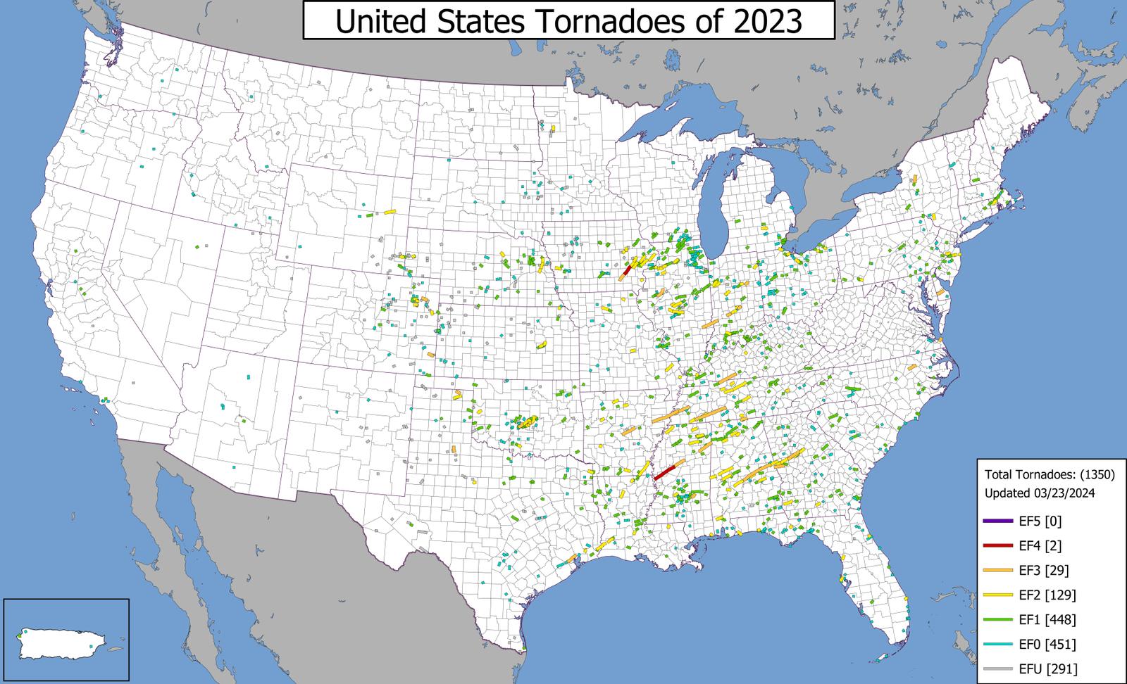
You’ve got roughly twelve hundred tornadoes striking the United States each year, and that’s far more than anywhere else in the world because its geography sets up the perfect conditions. Think about what’s happening here. Westerly winds from the Pacific Ocean drop their moisture when they push up over the Rocky Mountains, becoming high, dry, and cool as they move farther east, sometimes descending from Canada, while low, warm, humid air streams northward from the Gulf of Mexico.
When cold, dry air from Canada collides with warm, moist air from the Gulf of Mexico, this clash of air masses creates unstable atmospheric conditions essential for severe thunderstorms and tornadoes. Flat terrain along these paths allows the winds to move relatively uninterrupted, at contrasting altitudes, until they run into one another, and the angles at which they collide tend to create unstable air and wind shear, two big factors that favor tornado formation. It’s this battle between polar air and tropical moisture that transforms the Great Plains into a natural thunderstorm factory.
Geography as Destiny: Why the Great Plains Are Built for Tornadoes
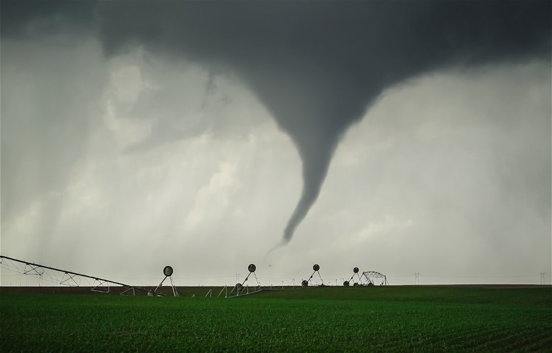
Tornadoes occur more frequently and are more intense in the Great Plains than in any other region on earth, with plains geography and fringing mountain ranges running predominantly north to south allowing cold dry air from the north to collide with warm moist tropical air from the south. Honestly, you couldn’t design a better tornado laboratory if you tried.
The Rocky Mountains act like a massive wall on the western edge, forcing air to rise and cool, stripping out moisture. The further west you travel, the higher the elevation becomes, eventually leading to the Rocky Mountains, and this steep incline in elevation helps contribute to severe storms and tornadoes, as low-pressure systems are stretched when traveling west to east into the Great Plains, turning into potentially violent cyclones. Meanwhile, there’s nothing blocking the flow from the south. The Gulf of Mexico sits wide open, pumping warm, humid air northward like a furnace.
The flat land of the Great Plains allows the air masses to meet with little obstruction, and there are few natural barriers like mountains, which means that these differing air masses can interact more directly and intensely. I know it sounds crazy, but that flatness is actually what makes things so dangerous.
The Jet Stream: Nature’s High-Speed Highway for Storms
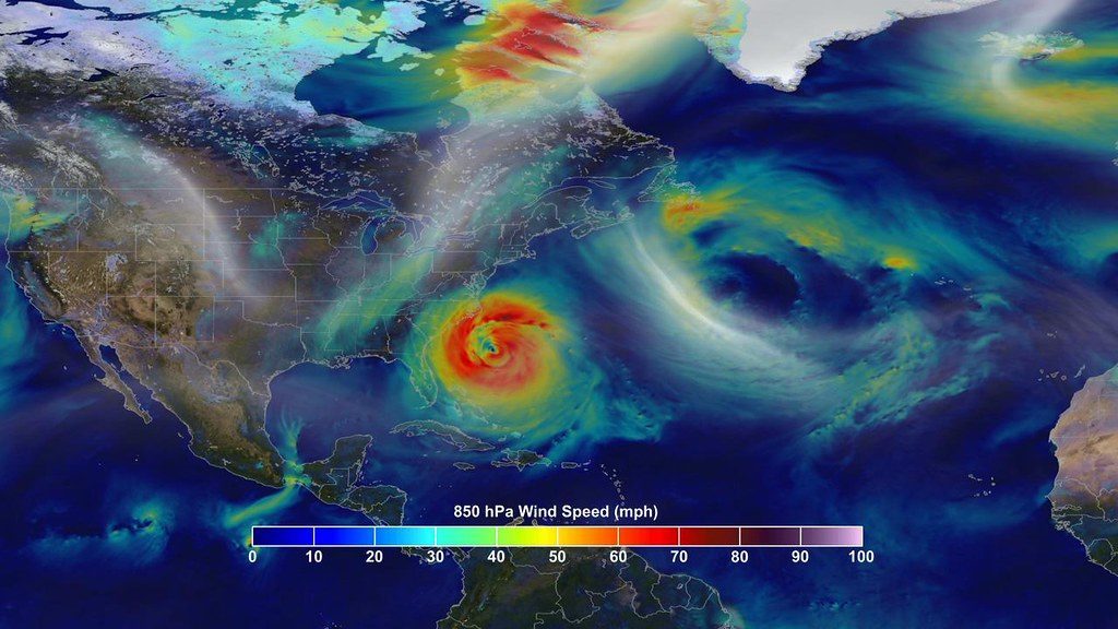
The jet stream plays a starring role in this atmospheric drama. Storms tend to follow the edge of the jet stream, where the difference between cool and warm air creates the turbulent conditions for storms, and that makes for more thunder, lightning, and more tornadoes. This high-altitude river of air, racing along at speeds that can exceed a hundred miles per hour, essentially guides weather systems across the continent.
The northward migration of tornadoes reflects the northward migration of the jet stream, and since the jet stream is tied to the southern edge of the cold air centered on the Pole, as the seasons change from late winter to late summer, the polar cold air retreats to the north dragging the jet stream and the tornado season with it. Spring is when things get particularly dicey because the jet stream is positioned right over the Great Plains.
The direction of movement is often guided by high winds such as jet streams, and many fronts cause weather events such as rain, thunderstorms, gusty winds, and tornadoes. That positioning matters more than you might think. The jet stream doesn’t just move storms around; it actively helps create the wind shear that’s essential for tornado development.
Wind Shear: The Invisible Force That Spins Up Destruction
Wind shear might sound technical, but it’s really just winds blowing at different speeds or directions at different heights. Vertical wind shear, which is the change in wind speed and direction with height, causes the updrafts in thunderstorms to rotate, and in the Great Plains, strong vertical wind shear can enhance the rotation of air, which is essential for the development of tornadoes.
Picture it like this: near the ground, you’ve got slower-moving winds from one direction. Higher up, faster winds are blowing from another direction. Wind shear sets air spinning, the updraft tips the spinning air upright, and the updraft then starts rotating. That horizontal spinning gets tilted vertically by powerful updrafts in thunderstorms, creating a rotating column of air that can eventually reach down to the ground.
Strong jet streams help provide the wind shear needed for tornado formation, and this shearing action of the three air masses colliding forms the tornado in the part of the storm known as the mesocyclone. It’s hard to say for sure, but without wind shear, you simply don’t get the rotation necessary for tornadoes to form, no matter how unstable the atmosphere becomes.
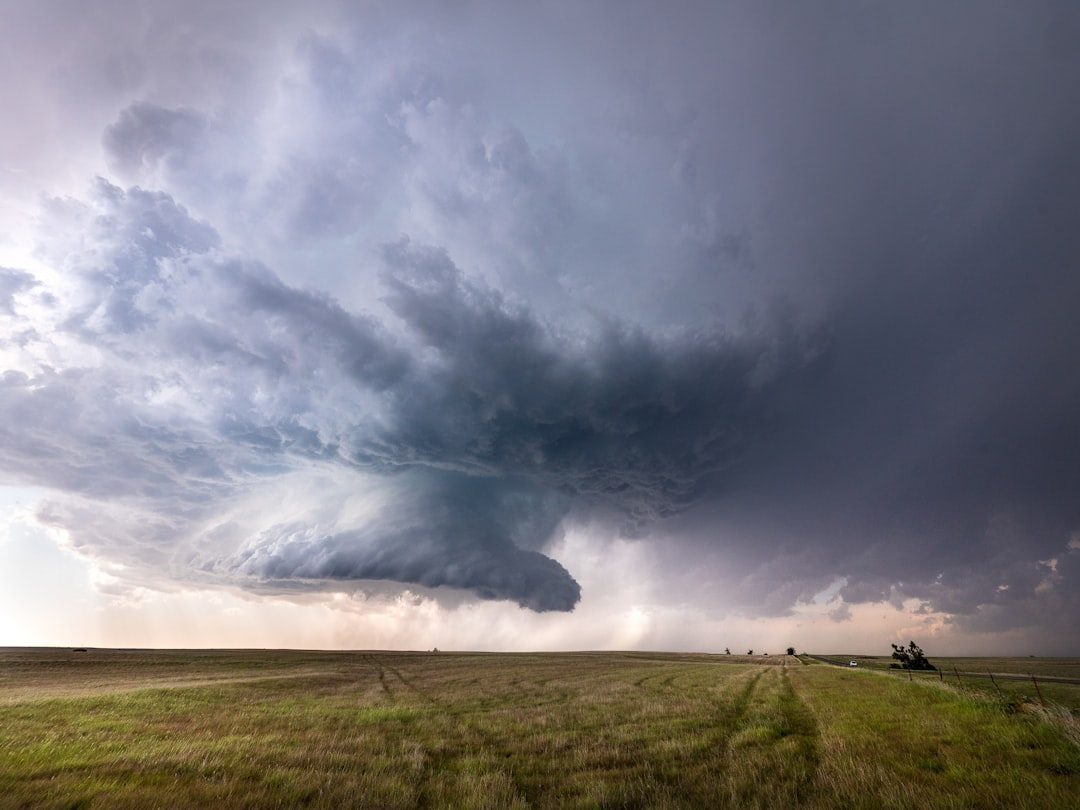
Supercells and Mesocyclones: The Tornado Production Machine
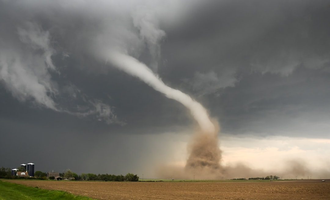
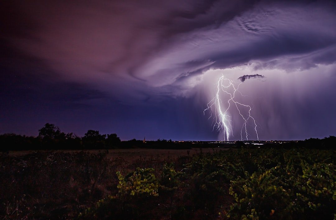
A supercell is a thunderstorm characterized by the presence of a mesocyclone, a deep, persistently rotating updraft, and due to this, these storms are sometimes referred to as rotating thunderstorms. These aren’t your average summer rainstorms. Supercells are nature’s most violent and sophisticated weather systems.
Supercells derive their rotation through the tilting of horizontal vorticity, which is caused by wind shear imparting rotation upon a rising air parcel by differential forces, and strong updrafts lift the air turning about a horizontal axis and cause this air to turn about a vertical axis. Supercells are one of the few types of clouds that typically spawn tornadoes within the mesocyclone, although only 30 percent or fewer do so.
Here’s the thing: even though most supercells don’t produce tornadoes, when they do, the results can be catastrophic. Most tornadoes are spawned from supercell thunderstorms, which are characterized by a persistent rotating updraft and form in environments of strong vertical wind shear. The rotating updraft, typically spanning a few miles wide, becomes the birthplace for some of the most intense tornadoes on the planet.
Seasonal Timing: When Tornado Alley Becomes Most Dangerous
The peak tornado season for the southern Plains, including Texas, Oklahoma, and Kansas, is from May into early June. That’s when everything comes together just right, or just wrong, depending on your perspective. The jet stream sits perfectly positioned, cold air still pushes down from the north, and the Gulf of Mexico is pumping out maximum moisture and heat.
Great Plains tornadoes commonly occur in late afternoon, when surface temperatures are the highest, providing the daily maximum uplift to the moist air near the ground. In the northern Plains and upper Midwest, including North and South Dakota, Nebraska, Iowa, and Minnesota, tornado season is in June or July, but tornadoes can happen at any time of year.
Spring is particularly dangerous because that’s when temperature contrasts are most dramatic. Cold fronts sweeping down from Canada still pack a punch, while the sun is heating up the southern air masses. During winter months, tornadoes are usually spotted in the southern area of the country and states near the Gulf of Mexico, and as spring comes, this pushes the mass of colder air forward out of the Gulf States and into the Southeastern states, where tornado frequency is highest in April.
The Atmospheric Ingredients: Moisture, Instability, and Lift
Meteorologists talk about three essential ingredients for severe thunderstorms and tornadoes: moisture, instability, and a lifting mechanism. All thunderstorms require three ingredients for their formation: moisture, instability, and a lifting mechanism, and the main source of moisture for much of the region is the Gulf of Mexico. Without all three working together, you might get a regular thunderstorm, but you won’t get a tornado.
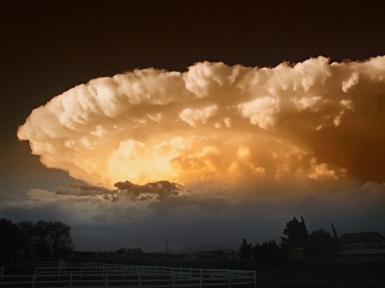
Instability is created when you’ve got warm air at the surface and much colder air aloft. That temperature difference makes the atmosphere want to overturn, like water boiling in a pot. The warm air desperately wants to rise, and when it does, it rises explosively. Another factor on the Great Plains is something called a cap, which only lets the strongest storms develop so that they don’t have to compete with weaker storms for energy, allowing them to grow even stronger.
The lifting mechanism can be a cold front, a dry line where dry air meets moist air, or even just daytime heating. Once that lifting starts, if the other ingredients are present, you can get towering thunderstorms that reach heights of fifty thousand feet or more. Those are the storms that have the potential to spawn tornadoes.
The Shifting Alley: Climate Change and Tornado Migration
Drier conditions in the Great Plains, coupled with increased moisture in the Southeast, is shifting tornado activity away from states like Texas, Oklahoma, and Kansas, and some scientists have linked this shift to climate change. This isn’t just an academic curiosity. It’s a real shift with real consequences for communities that haven’t historically dealt with tornadoes.
The tornado focus has shifted eastward by 400 to 500 miles, and in the past decade or so tornadoes have become prevalent in eastern Missouri and Arkansas, western Tennessee and Kentucky, and northern Mississippi and Alabama, creating a new region of concentrated storms. The jet stream, a strong current of frigid Arctic air, is dipping further south into the Mississippi delta region because of Southwestern drought, and water temperature in the Gulf has also increased on average by one or two degrees, creating the moist, humid air needed for tornadoes.
Traditional Tornado Alley isn’t going away because the ingredients that make severe weather tornadoes, including the Rocky Mountains and the Gulf of Mexico, are critical for that, and those geographic features aren’t going anywhere. Still, the eastward expansion means more people are now at risk in areas where tornado preparedness hasn’t been as ingrained in the culture.
Living With the Monster: Understanding the Unpredictable Power
Understanding the science behind Tornado Alley doesn’t make tornadoes any less terrifying, but it does reveal why this particular stretch of America experiences these violent storms more than anywhere else on Earth. The collision of geography, atmospheric physics, and seasonal timing creates a perfect storm factory that operates year after year.
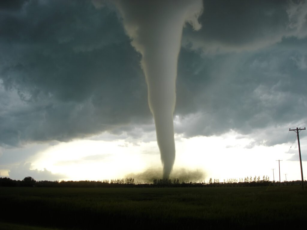
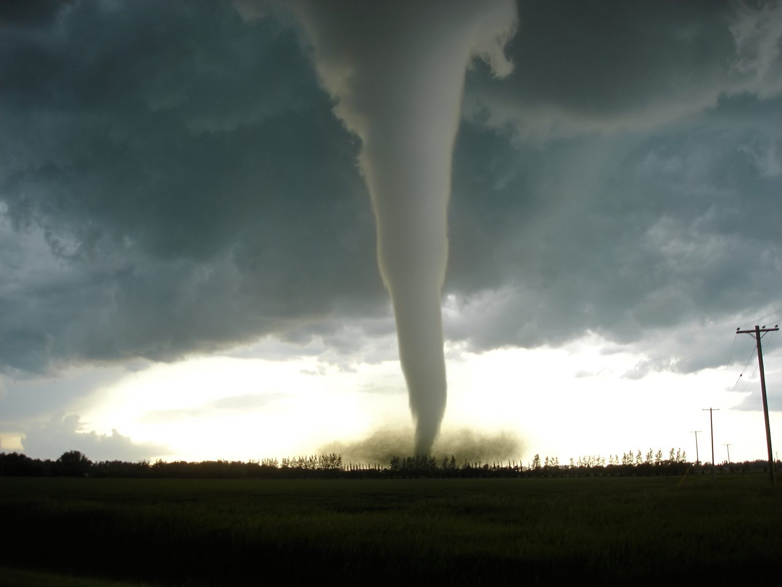
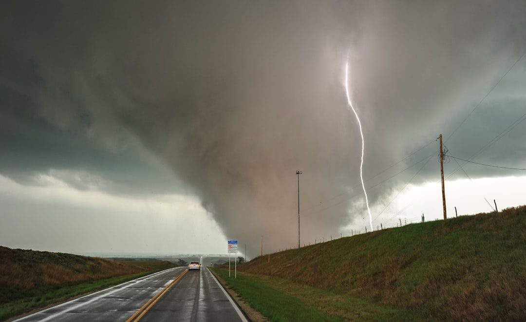
Tornadoes are composed of a column of air rotating up to 300 mph and traveling across the landscape at speeds up to 70 mph along unpredictable paths, and they flip cars and trucks, rip trees out of the ground, tear buildings apart, and turn loose debris into deadly projectiles. The science tells us where and when they’re most likely to occur, but predicting exactly which storm will drop a funnel remains one of meteorology’s toughest challenges.
For the people living in Tornado Alley, this science translates into a way of life. Storm cellars, weather radios, and an eye on the sky become second nature. The knowledge that warm Gulf air meeting cold Canadian air over flat terrain creates these monsters doesn’t make them easier to face, but it does explain why this region will always be a storm magnet. What do you think about living in a place where the weather can turn deadly in minutes? Would you be prepared?

Jan loves Wildlife and Animals and is one of the founders of Animals Around The Globe. He holds an MSc in Finance & Economics and is a passionate PADI Open Water Diver. His favorite animals are Mountain Gorillas, Tigers, and Great White Sharks. He lived in South Africa, Germany, the USA, Ireland, Italy, China, and Australia. Before AATG, Jan worked for Google, Axel Springer, BMW and others.


