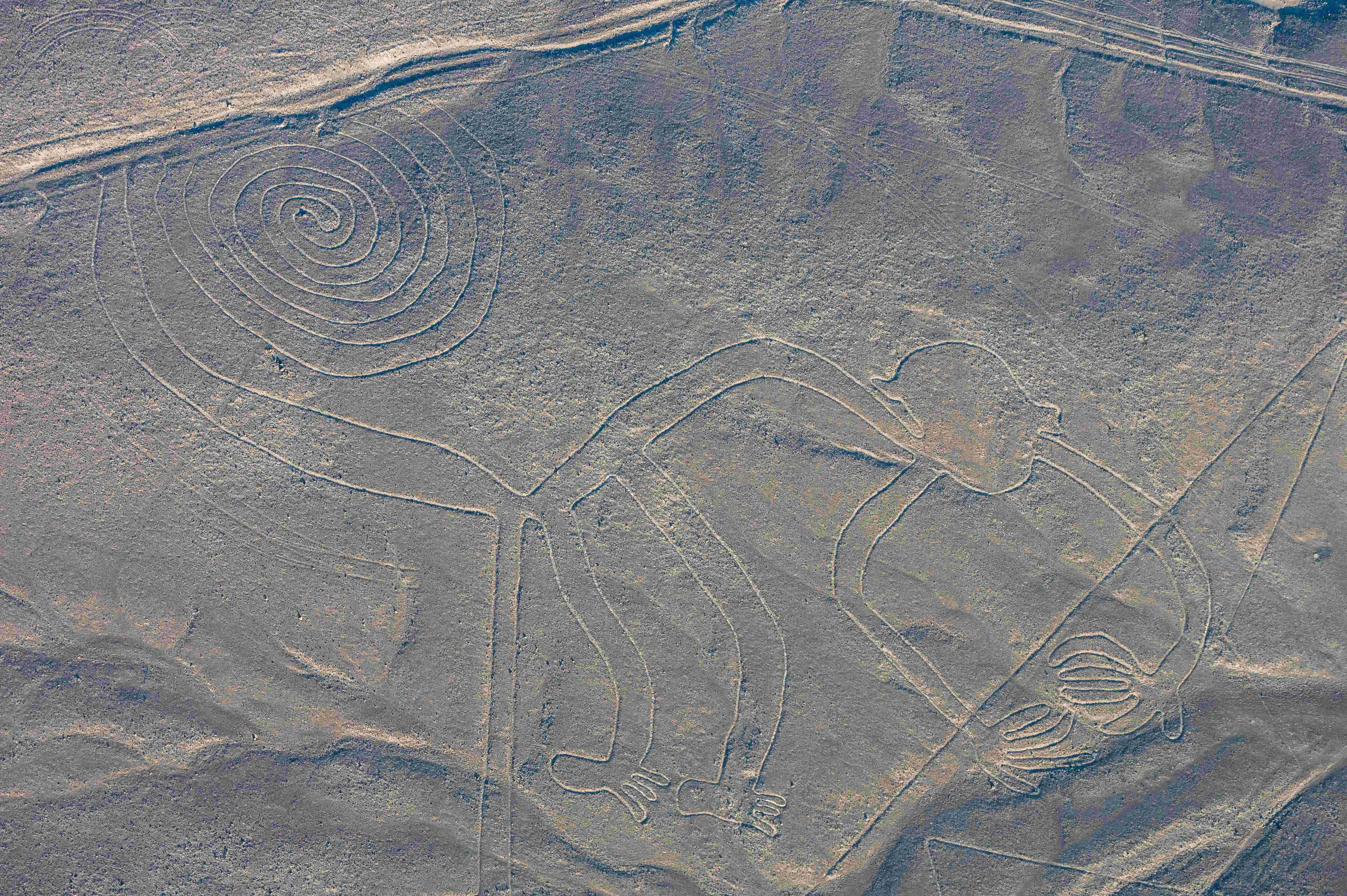
High on Peru’s coastal desert, a web of pale strokes runs straight to the horizon, shapes so vast they only fully snap into focus from the air. For more than a century, the Nazca Lines have sparked arguments, from sober archaeology to wild conjectures, because they pose a simple, stubborn mystery: Why would a society carve pictures you can barely read from the ground? Now, drones, satellite imaging, and pattern-finding algorithms are bringing the plateau into unprecedented detail, revealing new figures and restoring context that wind and time tried to erase. The story emerging is less about extraterrestrial fantasies and more about human ingenuity, ritual, and water in a harsh landscape. And it’s a race, because the same forces that preserved these marks for up to two millennia face new pressures that could undo them in a season.
The Hidden Clues
Look closely – some figures are unmistakable animals: a hummingbird with a needle-fine beak, a long-limbed monkey, a poised spider, a curious dog. Others are geometric: endless ruler-straight lines, wide trapezoids that funnel toward vanishing points, and spirals that evoke whirlpools or winds. Their makers simply scraped away dark, iron-oxide pebbles to expose the lighter soil beneath, a low-tech trick that turned the desert’s surface into a reversible canvas.
From the ground, many lines look like paths; from nearby hills, pieces coalesce into forms; from above, the full choreography appears. The desert’s hyperarid climate, minimal rain, and low winds acted like a vault, keeping the pale underlayer intact. That stability made the Nazca plateau one of the world’s most improbable archives of landscape-scale design.
From Ancient Tools to Modern Science
There’s no need to imagine exotic technology to explain straight lines stretching miles: stakes, cords, and sighting poles are enough to survey big spaces with surprising accuracy. Experimental archaeologists have replicated long, true lines and clean curves in hours using nothing more than rope, pegs, and a patient eye. The same everyday toolkit – scaled up and repeated – could have guided entire crews across the open pampa.
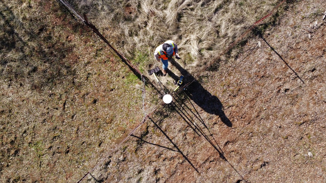
Today, the toolkit is different: high-resolution satellite mosaics, low-flying drones, and photogrammetry stitch the surface into centimeter-level models. Machine-learning systems flagged new outlines that field teams then confirmed on foot, showing how algorithms and archaeology can work in tandem rather than competition. Together, they’re recovering faint, eroded figures and the subtle relationships among lines, hills, and ancient routes.
Reading the Desert: Competing Theories
Several ideas vie for attention, and the strongest are grounded in the realities of life without steady rivers. Many researchers see the lines as ceremonial pathways or open-air stages for processions tied to water rituals, fertility, and seasonal cycles. The plateau’s geometry would then be the infrastructure of belief, a landscape meant to be walked, not merely seen.
Others have probed astronomical alignments, and while isolated correlations exist, the pattern as a whole doesn’t behave like a precise sky map. A further view links some lines to nearby springs, ancient canals, and spiral wells, suggesting signals that point toward or celebrate precious groundwater. The likeliest picture blends these strands: a society inscribing devotion, memory, and navigation into a single, walkable canvas.
Fragility in Plain Sight
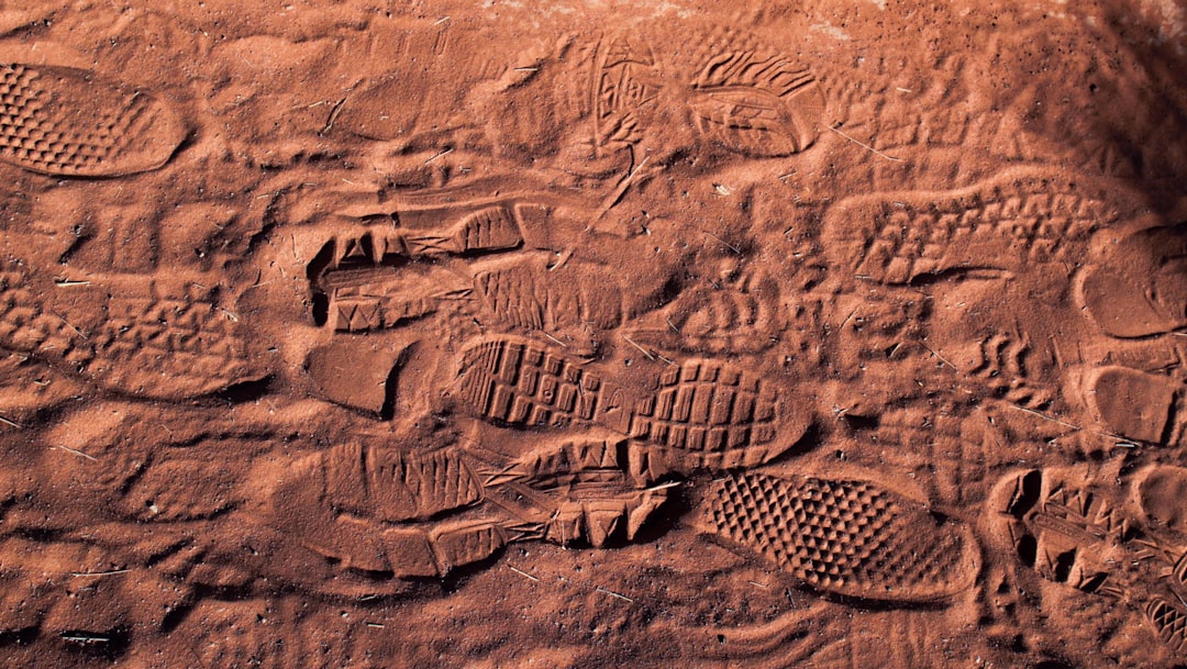
Paradoxically, what preserved the Nazca Lines for centuries now makes them vulnerable to a single careless tread. A truck tire, a motorcycle track, or even a misjudged footstep can bruise the pale substrate and linger for decades.
- The grooves are shallow – often just a few centimeters deep – so modern tracks can overprint them instantly.
- Unusual rains linked to strong climate swings can carve new gullies that slice through figures in one season.
Recent years have brought protective patrols, signage, and more careful visitor routes, yet the sheer size of the area makes surveillance difficult. Monitoring is improving, but prevention still depends on awareness and restraint as much as technology.
Why It Matters
The Nazca Lines are a masterclass in large-scale coordination without stone walls or royal inscriptions to narrate it. They show a community able to design, organize, and maintain projects across miles of open ground, all to serve shared meaning rather than immediate utility. In that sense, they expand our understanding of what counts as infrastructure – ritual architecture etched into earth instead of built above it.
They also remind us how culture and environment braid together: where rivers fail, societies often write their hopes into the terrain. Studying the lines with modern sensors sharpens methods used in disaster mapping, agriculture, and climate science, proving that heritage research can be a testbed for tools with wider impact. And by confronting pseudoarchaeology with careful evidence, the site strengthens public trust in how science corrects and refines itself.
Global Perspectives
The Nazca plateau is singular, but it isn’t alone: the Atacama Desert hosts vast geoglyphs, and chalk figures like the Uffington White Horse in England carve meaning into hillsides. Each tradition chooses a different medium – dark varnish, light chalk, contrasting stone – yet all tap into the same impulse to scale symbols to the land itself. Comparing them shows how diverse cultures used open ground as a stage for identity, myth, and orientation.
These parallels also underscore caution in interpretation; not every geoglyph system served the same purpose, even when forms look similar. By building a comparative dataset, researchers can separate local quirks from universal tendencies, such as the draw of prominent viewpoints or routes that stitch communities together. The Nazca Lines belong to this global conversation, a benchmark for how people imprint meaning on vast, shared spaces.
The Future Landscape
Next-generation satellites with sharper optics and hyperspectral sensors can detect subtle differences in surface varnish, helping spot faint or damaged figures. Low-cost drones piloted by local teams will map change after storms, roadwork, or new footpaths, turning monitoring into a routine rather than a rescue. Open, well-curated image archives could invite citizen scientists to help classify shapes while preserving sensitive coordinates.
The biggest challenges aren’t only technical: funding consistent stewardship, coordinating agencies across a huge area, and balancing tourism with protection. Smart visitor corridors, better signage, and real-time alerts can reduce accidental harm, while clear legal consequences deter intentional damage. A future where AI flags risks and communities respond quickly is within reach if policy keeps pace with the tools.
Conclusion
If you visit, stay on marked routes, follow local guidance, and resist the temptation to step onto the pale ground for a better photo. Support organizations that fund site monitoring, conservation training, and scholarships for Peruvian researchers working on heritage science.
From home, explore reputable museum and university datasets, and consider participating in vetted image-labeling projects that help researchers triage new finds. Share accurate information that pushes back on sensational claims, and encourage schools to use the Nazca Lines to teach both cultural history and the scientific method. Small, consistent choices – attention, patience, and respect – are the easiest tools to keep a giant drawing intact.

Suhail Ahmed is a passionate digital professional and nature enthusiast with over 8 years of experience in content strategy, SEO, web development, and digital operations. Alongside his freelance journey, Suhail actively contributes to nature and wildlife platforms like Discover Wildlife, where he channels his curiosity for the planet into engaging, educational storytelling.
With a strong background in managing digital ecosystems — from ecommerce stores and WordPress websites to social media and automation — Suhail merges technical precision with creative insight. His content reflects a rare balance: SEO-friendly yet deeply human, data-informed yet emotionally resonant.
Driven by a love for discovery and storytelling, Suhail believes in using digital platforms to amplify causes that matter — especially those protecting Earth’s biodiversity and inspiring sustainable living. Whether he’s managing online projects or crafting wildlife content, his goal remains the same: to inform, inspire, and leave a positive digital footprint.