Deep ‘s iconic desert landscape, a hidden network of volcanic vents tells one of the most fascinating geological stories in North America. Most people think of Arizona as a land of cacti and copper mines. They’re missing something incredible that lies just below the surface.
Imagine walking across what appears to be ordinary high desert terrain, never realizing you’re standing atop one of the continent’s most extensive volcanic networks. This isn’t science fiction or some distant geological theory. It’s happening right now in northern Arizona, where scientists have mapped an astonishing underground maze of dormant volcanic systems.
The discovery reveals something remarkable about our planet’s restless interior. These aren’t just random scattered vents, but part of interconnected volcanic fields that stretch for thousands of square miles. So let’s dive into this hidden world and uncover the secrets lying ‘s surface.
The San Francisco Volcanic Field: A Giant’s Footprint
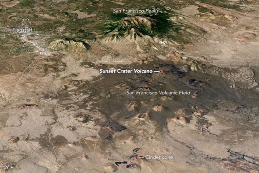
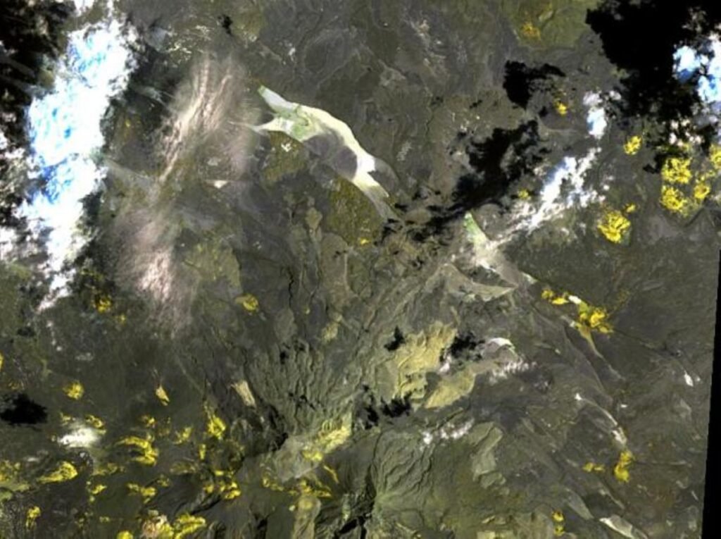
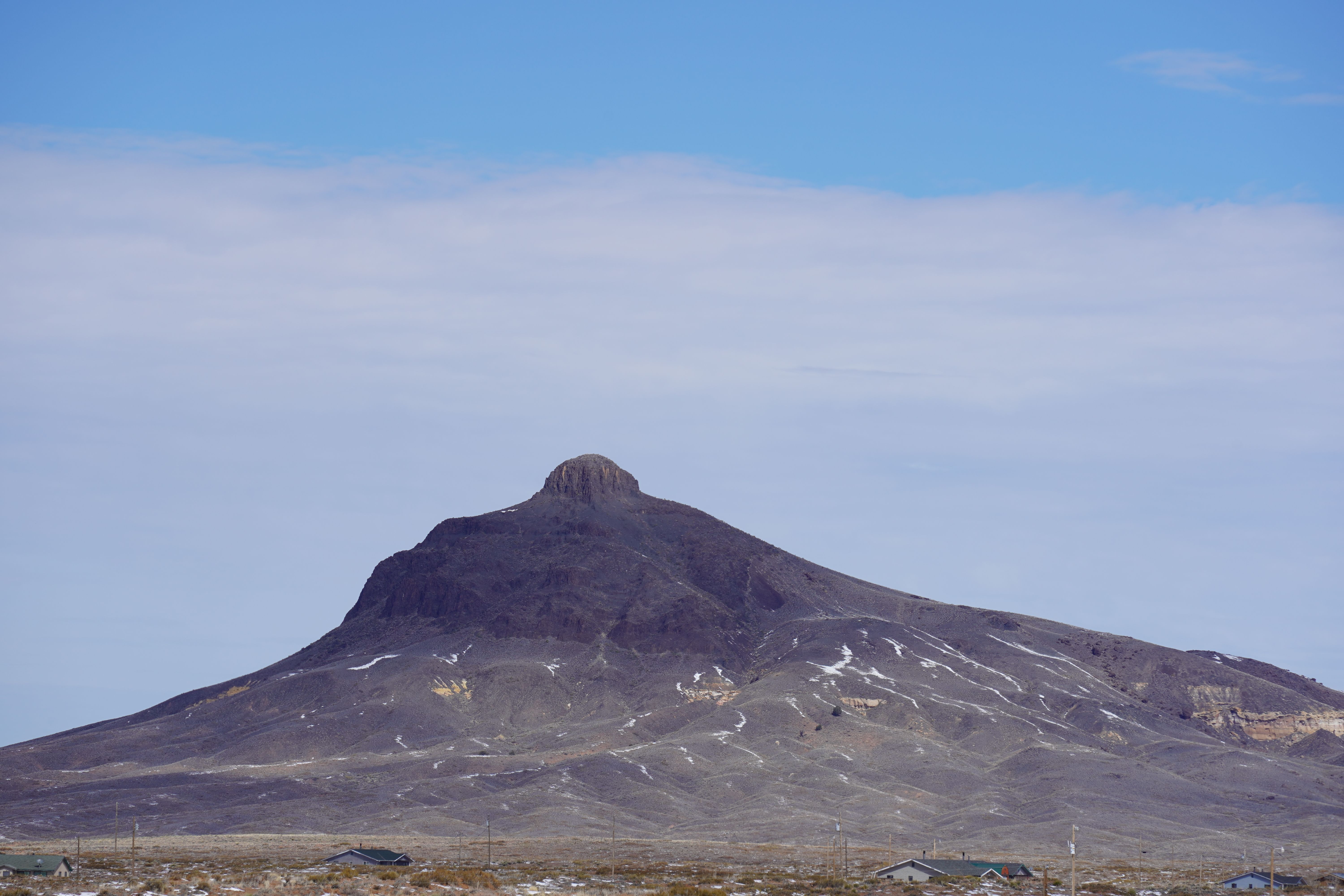
The San Francisco Volcanic Field covers about 1,800 square miles and contains almost all hills and mountains between Flagstaff and the Grand Canyon that are geologically young but extinct volcanoes. This massive volcanic system represents one of the most impressive geological features in the American Southwest.
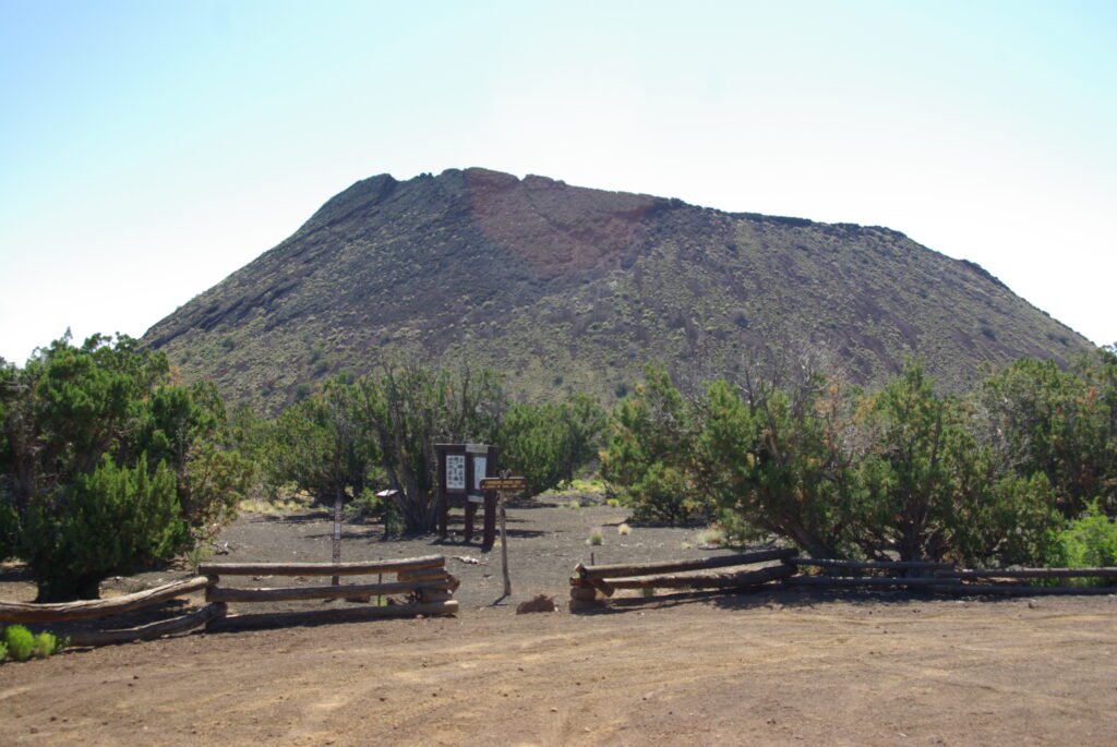
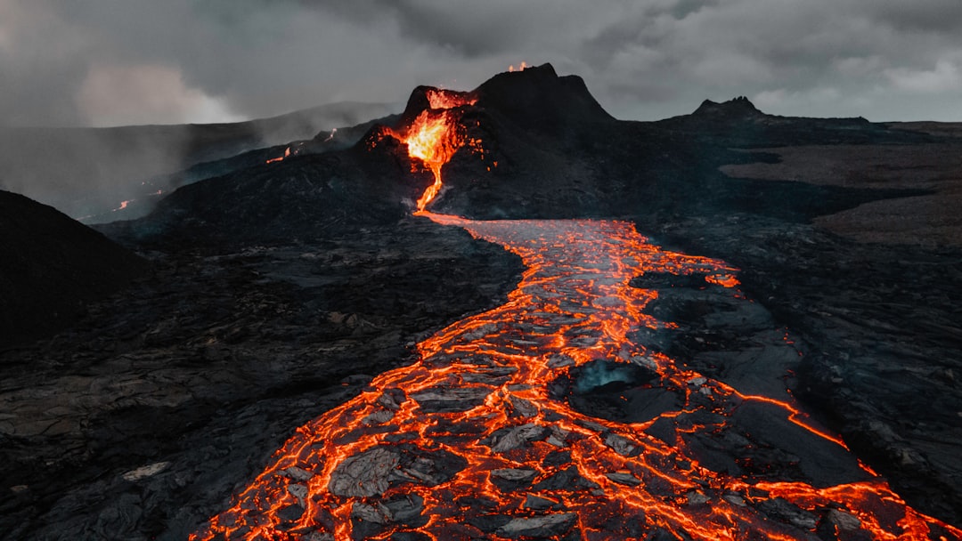
More than 600 volcanoes exist within this single field, with most being basalt cinder cones, and Sunset Crater being just one of more than 550 vents. What makes this discovery truly extraordinary is the sheer density of volcanic vents packed into this region. Each one represents a separate pathway where molten rock once found its way to the surface.
The first volcanoes began erupting about 6 million years ago near present-day Williams, with subsequent eruptions migrating eastward in a belt toward the Little Colorado River. This pattern reveals something fascinating about how volcanic systems evolve over geological time.
The Underground Plumbing System
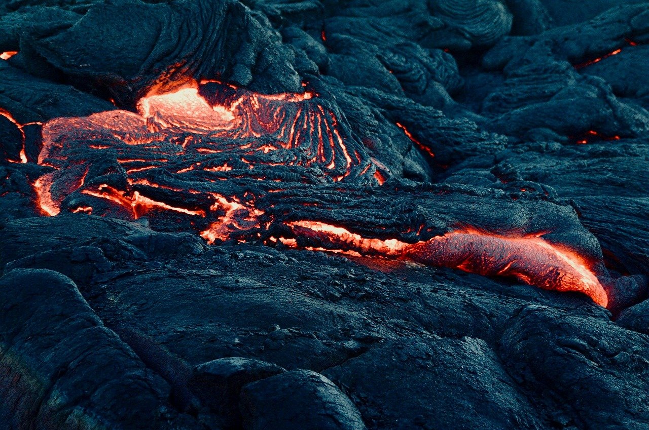
Some geologists suggest there’s a site of localized melting, or hot spot, fixed deep within the Earth’s mantle beneath northern Arizona, with the North American Plate moving slowly westward over this stationary source of molten rock. This creates what scientists call the “plumbing system” of Arizona’s volcanic network.
Think of it like an enormous underground heating system with pipes and chambers spreading out in all directions. The molten rock doesn’t just sit there waiting. It finds every possible crack, fissure, and weakness in the rock above, creating pathways that connect deep underground chambers to surface vents.
The volcanic activity has left behind a fascinating legacy underground: lava tubes, which are hidden wonders and testament to the powerful forces shaping the landscape. These underground tunnels form an intricate network that most visitors never see.
Arizona’s Three Active Volcanic Fields
Arizona’s three youngest volcanic fields are the San Francisco, Uinkaret, and Pinacate fields, with the former two residing on the Colorado Plateau of northern Arizona and the Pinacate field situated about 40 miles south-southwest of Ajo. Each field represents a different chapter in Arizona’s volcanic story.
The San Francisco field near Flagstaff was active as recently as 1085 CE with the Sunset Crater eruption, while the Uinkaret field perched on the north rim of Grand Canyon also shows evidence of volcanic activity about 1,000 years ago. These aren’t ancient history but relatively recent events in geological terms.
The Uinkaret field contains 213 volcanoes or vents and is more than 3.5 million years old, with some volcanoes possibly having erupted as recently as 500 years ago. This field sits right on the edge of one of America’s most famous natural landmarks.
The Springerville Surprise: Arizona’s Third Largest Field

The Springerville volcanic field is located in east-central Arizona between Springerville and Show Low, consisting of 405 discrete vents covering approximately 3,000 square kilometers and ranking as the third-largest such field in the continental United States. Many people have never heard of this massive volcanic complex.
The total erupted volume is estimated at 90 cubic kilometers. To put that in perspective, that’s enough volcanic material to bury the entire state of Rhode Island under several feet of rock. This field alone demonstrates the incredible scale of Arizona’s hidden volcanic network.
The Springerville field sits quietly in the White Mountains region, where pine forests and recreational areas hide one of the continent’s largest concentrations of volcanic vents. Visitors hiking through these mountains rarely realize they’re walking across the remnants of one of North America’s most significant volcanic systems.
Hidden Connections: The Underground Network
What scientists have discovered through advanced geological mapping techniques is that these volcanic fields aren’t isolated systems. Underground, they’re connected through a vast network of magma chambers, conduits, and fractured rock that extends far beyond what we see on the surface.
The volcanic vents cover different pathways from which magma could erupt, with magma stirring beneath the earth’s crust and using the vents to release lava or gases. This creates an interconnected system that resembles a massive underground highway network for molten rock.
Advanced seismic studies reveal that many of these connections run much deeper than previously thought. The network extends down into the Earth’s mantle, creating pathways that could potentially become active again under the right conditions.
Strange Volcanic Features: Kimberlite Pipes and Mystery Vents
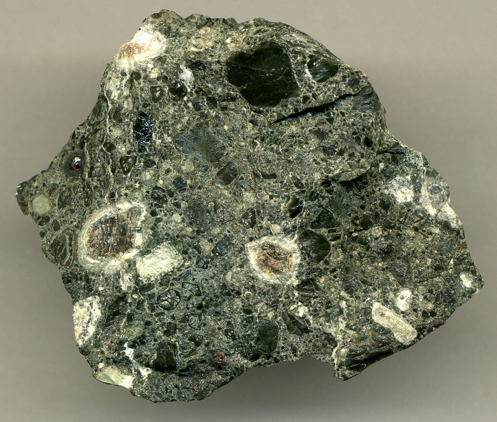
The strangest volcano-type vent in Arizona is Buell Park, north of Window Rock on the Navajo Reservation, which is a kimberlite pipe that blows out busted-up and ground-up mantle rock material at extreme high-speed. This represents one of the most unusual volcanic features in North America.
Kimberlite pipes are famous worldwide as the sole source of diamonds, though Arizona’s pipe lacks such treasures while similar pipes in Wyoming and Arkansas contain them. This demonstrates the incredible diversity of volcanic features hidden ‘s surface.
These mystery vents operate completely differently from typical volcanoes. Instead of the steady flow of lava we might expect, they explode material from deep within the Earth’s mantle with tremendous force, creating unique geological formations that scientists are still studying.
Lava Tubes: The Hidden Highway System
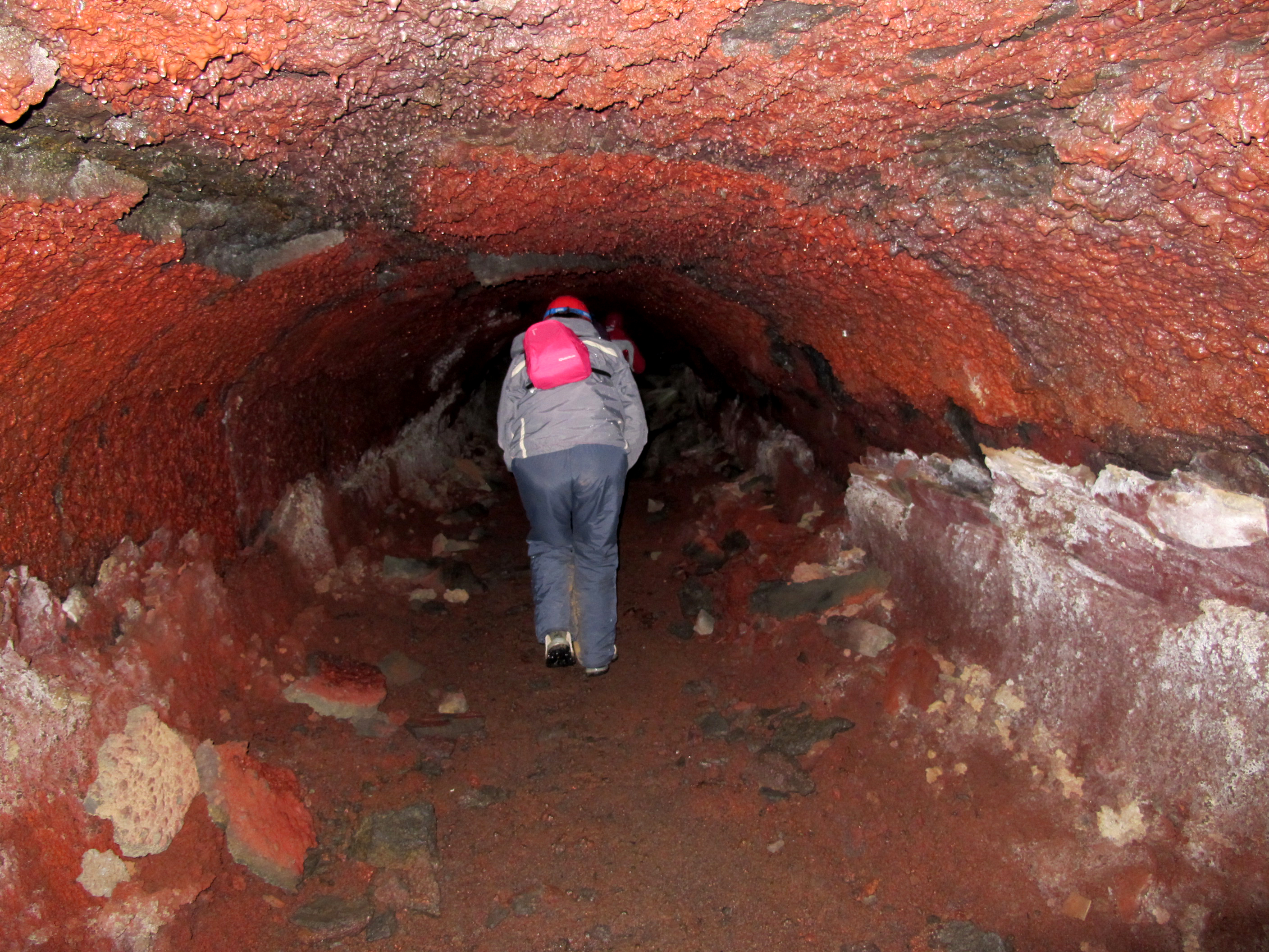
As lava cools down and becomes solid, it leaves behind underground tunnels beneath the Earth’s surface, creating tunnels known as lava tubes that form a fascinating maze of formations underground. These represent some of Arizona’s most accessible hidden volcanic features.
One notable formation is the Lava River Cave in Coconino National Forest, which promises an exciting adventure for those brave enough to explore. Visitors can actually walk through these ancient lava highways, experiencing firsthand the pathways that once carried molten rock.
These tubes stretch for miles underground, connecting different volcanic vents and creating a network that resembles a subway system built by geological forces. Some tubes are large enough to drive trucks through, while others are barely wide enough for a single person to crawl through.
Future Volcanic Activity: What Scientists Expect
There is good reason to anticipate additional eruptions in all three volcanic fields, with future eruptions likely occurring in the San Francisco Volcanic Field despite no eruption for nearly 1,000 years. Scientists aren’t just studying the past but preparing for future volcanic activity.
With an average interval of several thousand years between past periods of volcanic activity, it’s impossible to forecast when the next eruption will occur, though scientists believe the most probable sites are in the eastern part of the field with likely small eruptions. This uncertainty makes monitoring these systems crucial.
Volcanic activity occurs on geological timescales with intervals of hundreds or thousands of years between eruptions, with Arizona’s most recent volcanic eruption occurring around 1,000 years ago at Sunset Crater. While this might seem like a long time to us, it’s just a moment in geological time.
Economic Impact: The Copper Connection
Arizona’s nickname ‘the Copper State’ stems from large porphyry copper deposits that accompany multiple caldera formation events from about 75 to 60 million years ago, with copper from these deposits fueling Arizona’s mining industry and economy since the 1870s. The hidden volcanic network has shaped more than just the landscape.
Copper production still contributes more than $5 billion annually to the Arizona economy. This massive economic impact comes directly from the volcanic processes that created Arizona’s hidden underground network. The same forces that built the volcanic fields also concentrated valuable minerals in economically important deposits.
The volcanic activity didn’t just create spectacular geological features. It fundamentally transformed the chemistry of the region’s rocks, concentrating metals and minerals that continue to drive Arizona’s economy today. This connection between ancient volcanic activity and modern economic prosperity demonstrates how geological processes continue influencing our lives.
Conclusion
Arizona’s hidden volcanic network represents one of North America’s most remarkable geological discoveries. From the massive San Francisco Volcanic Field to the mysterious kimberlite pipes and extensive underground lava tube systems, this hidden world challenges everything we thought we knew about volcanic activity in the American Southwest.
These discoveries remind us that our planet’s surface tells only part of the story. Beneath the familiar desert landscapes of Arizona lies an intricate network of volcanic features that continues to shape the region’s geology, economy, and future. The next time you visit Arizona, remember that you’re not just walking across desert terrain but standing atop one of the continent’s most complex and fascinating volcanic systems.
What do you think about Arizona’s hidden volcanic secrets? Tell us in the comments.

Hi, I’m Andrew, and I come from India. Experienced content specialist with a passion for writing. My forte includes health and wellness, Travel, Animals, and Nature. A nature nomad, I am obsessed with mountains and love high-altitude trekking. I have been on several Himalayan treks in India including the Everest Base Camp in Nepal, a profound experience.