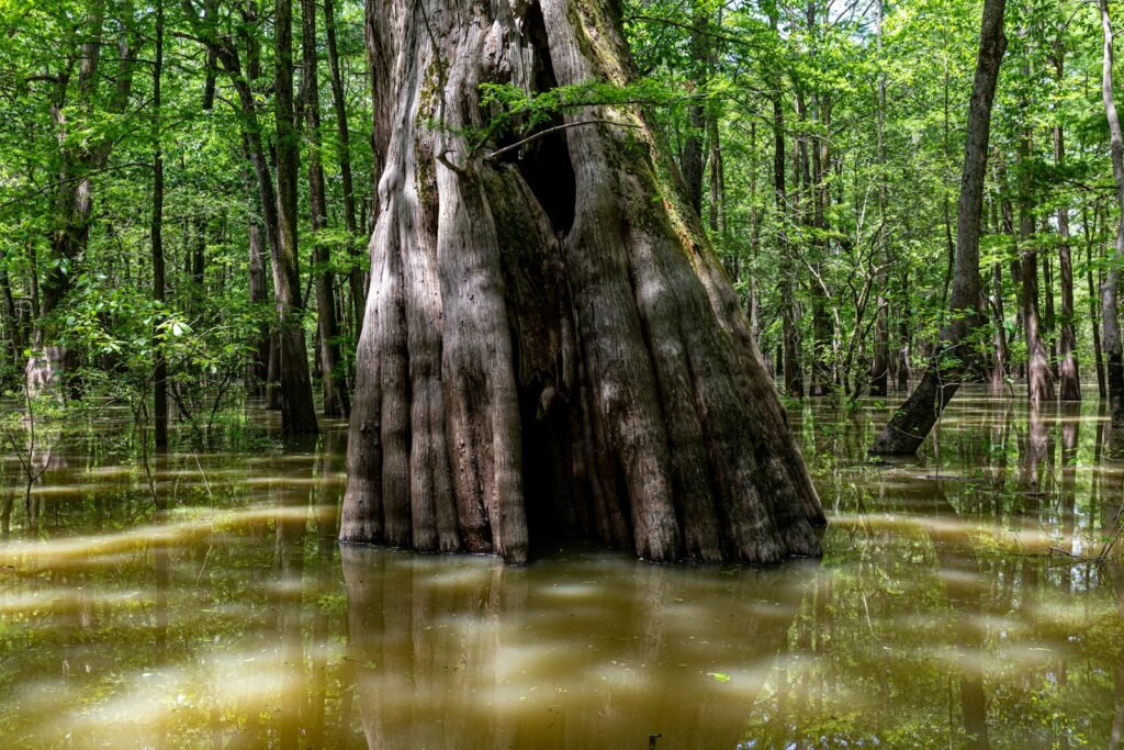
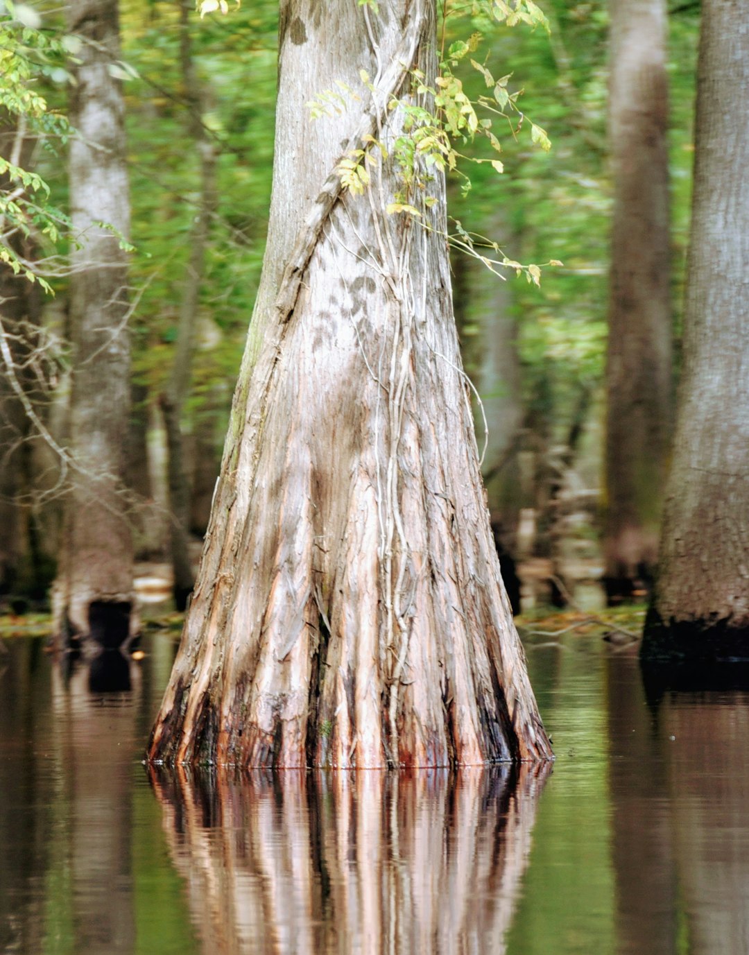
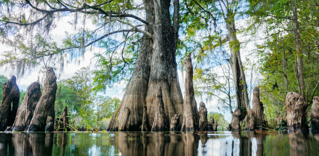
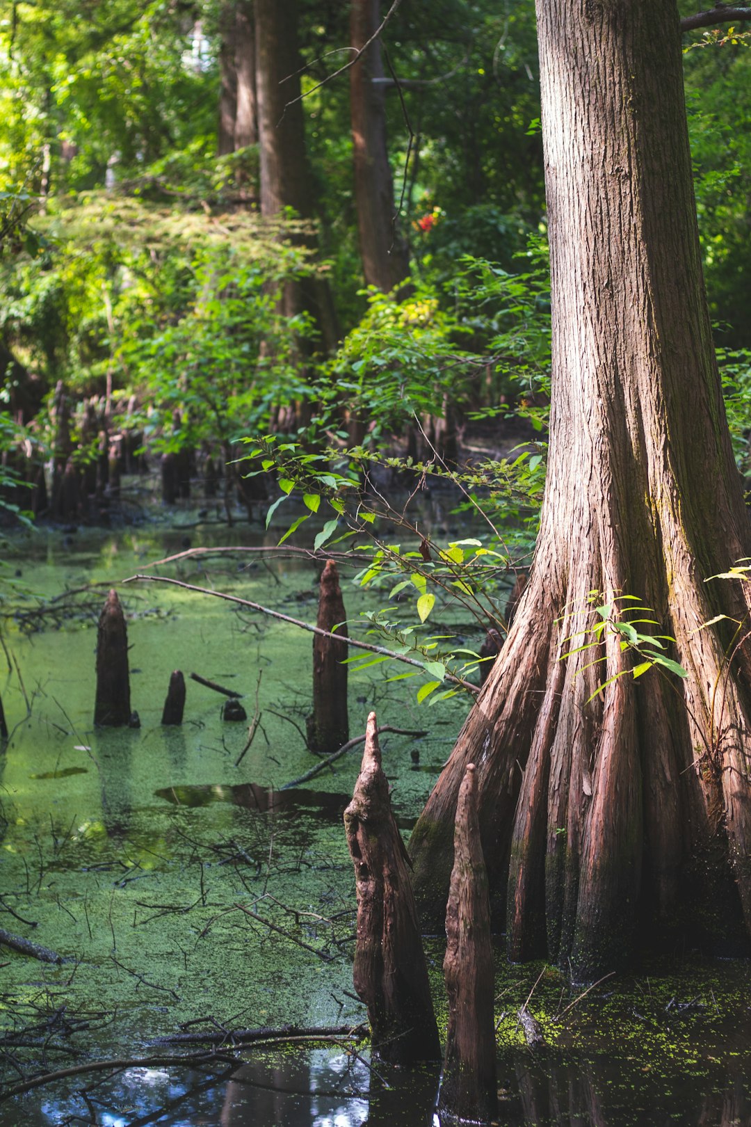
They look like ribs of a giant creature rising from green water, but the ghost trees of Louisiana are really time capsules – submerged trunks and root flares from cypress and tupelo that died as salt crept inland and water levels rose. Their story is equal parts mystery and warning: how did thriving forests drown, and what do the remains still whisper about the past? Scientists are fusing old-school natural history with high-tech tools to decode those whispers, turning dark water into an archive. The result is a portrait of a coast changing faster than memory, yet leaving fingerprints sturdy enough to study. In a region where every inch of elevation can mean survival, these underwater forests are becoming unlikely guides for what to protect, where to rebuild, and how to buy time.
The Hidden Clues
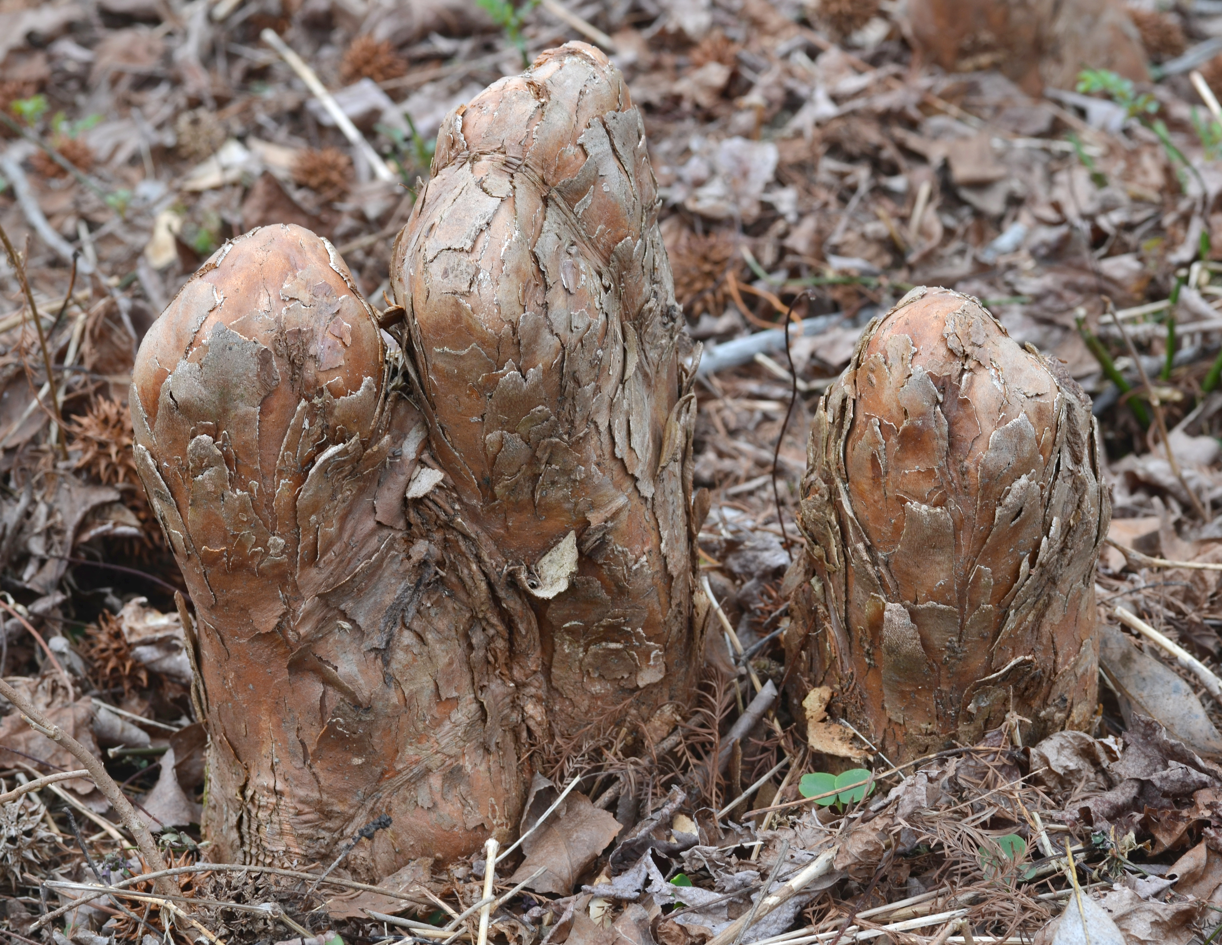
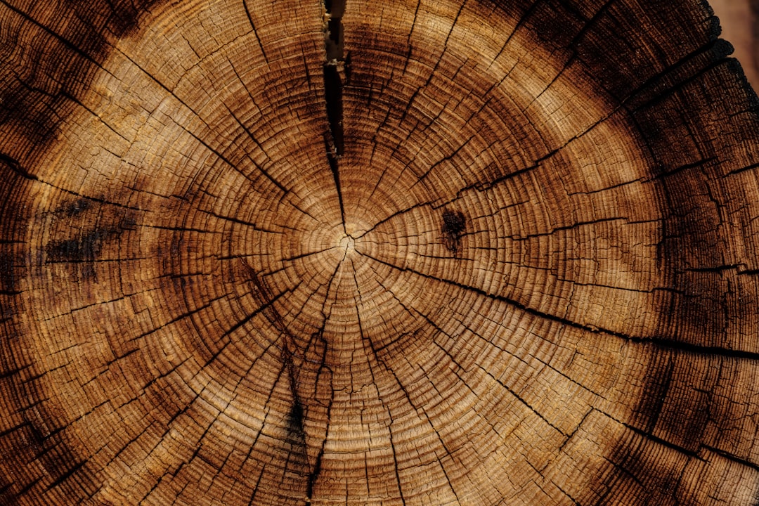
What looks like a desolate graveyard is actually a library, with stumps and snagged knees stacked like shelves in the mud. Each preserved trunk carries clues that survived precisely because oxygen is scarce in swamp bottoms and lake beds, slowing decay to a crawl. Run a hand along a cypress knee at low tide and you’re touching wood that may have stood in sunlight when parts of the modern coast were still dry ground.
These ghost trees map the retreat of freshwater forests as the balance tips toward brackish and open water. Their positions trace old shorelines, long-lost flow paths, and the boundary between resilience and collapse. When researchers chart where the dead still stand, they can see how ecosystems fell – and sometimes, where they can still rise again.
From Ancient Tools to Modern Science
Early swamp researchers relied on canoes, compasses, and patience, sketching tree islands and dredging up stumps by hand. Today, side‑scan sonar paints the bottom in grayscale mosaics, while bathymetric lidar and drones stitch together elevations millimeter by millimeter. Divers and coring teams extract pencil-thin cylinders from submerged trunks, capturing rings and chemistry without ripping apart the archive.
Back in the lab, microscopes meet mass spectrometers as wood anatomy teams with isotope analysis to reconstruct growing seasons and stress. Computer models then fuse these histories with tidal records and storm tracks to test competing explanations for the die‑off. The tools changed, but the aim stayed simple: read the trees, learn the truth.
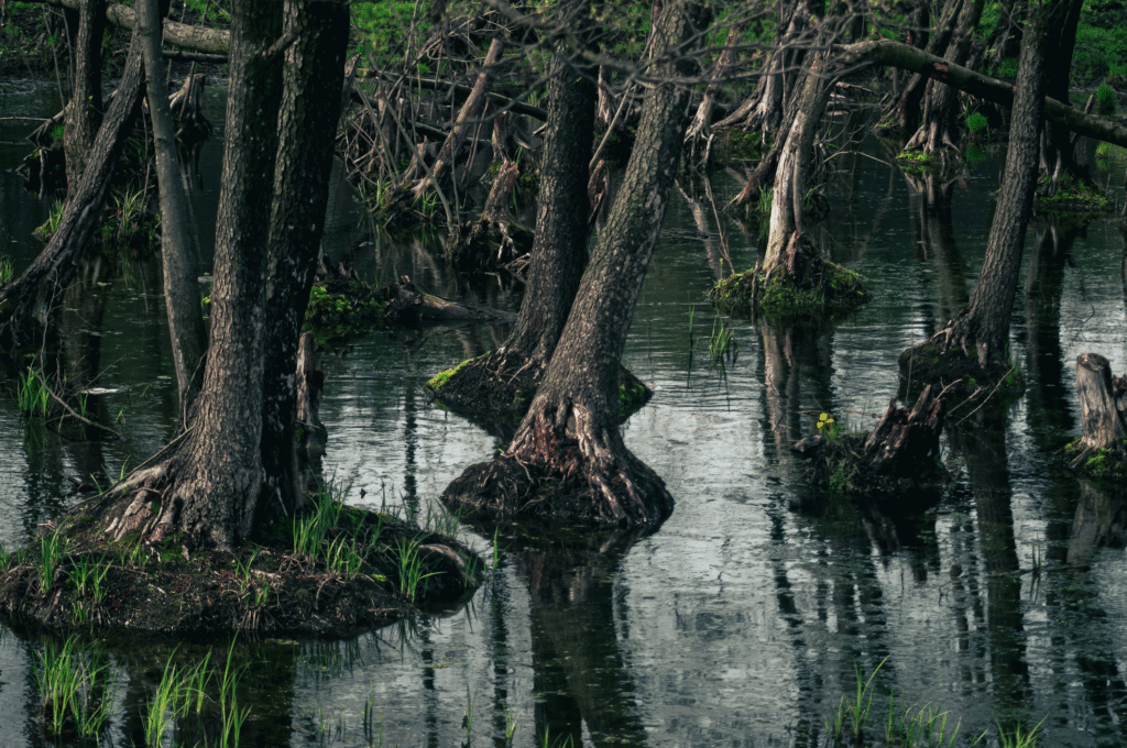
The Salty Creep: How Water Turned Deadly
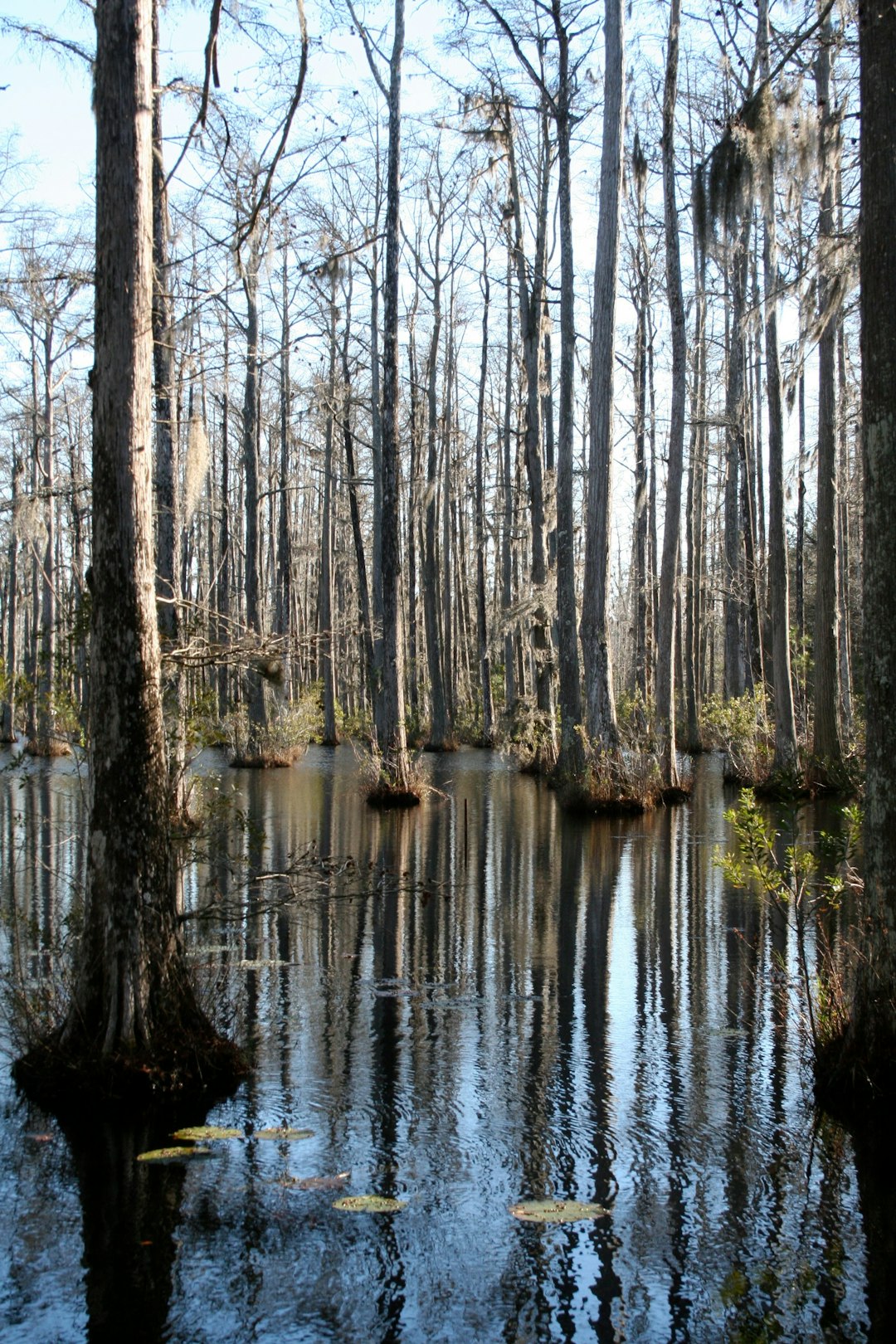
Bottomland forests thrive on a delicate recipe – flooded enough to stay wet, fresh enough to drink. Canal cuts, storms that shove brine inland, and levees that starve swamps of new sediment all tilt this recipe toward failure. When salt lingers and water sits too deep for too long, cypress seedlings never get a foothold, and mature trees slowly starve.
What begins as thinning crowns ends as pale trunks without leaves, then silent rows of stumps as the forest floor unravels into open water. It’s a slow-motion transformation, but once roots rot and peat slumps, it accelerates. The ghost trees mark the moment the living forest couldn’t keep pace.
Signatures in Wood and Water
Tree rings widen in wet, mild years and tighten under stress, writing a ledger of feast and famine. Chemical ratios in cellulose and trapped minerals can flag episodes of salinity spikes or droughts that choked freshwater input. Even microbes leave hints, with certain decay patterns pointing to oxygen‑poor conditions that lock wood in place for centuries.
Nearby sediments complete the picture by holding pollen, charcoal, and tiny shells that speak to water chemistry and fire history. Radiocarbon ages from stumps and mud layers anchor the timeline so scientists can line up die‑offs with storms, river shifts, or infrastructure changes. In the end, the story is not just that forests died, but precisely how and when they crossed the line.
Why It Matters
Ghost trees are not just curiosities; they are yardsticks for risk. Satellite images show where land vanished, but drowned forests reveal the process from inside the ecosystem, capturing thresholds that pixels can miss. Against tide gauges and model projections, these wooden markers provide ground truth where roads don’t go and instruments fail.
The stakes are human and immediate: swamps that once blunted storm surge and buffered drinking water now fracture into shallow lakes. Lose the trees and you lose drag on wind and waves, nursery grounds for fish and crawfish, and carbon tucked into saturated soils. The dead remind us what the living still provide – and what it costs when that service ends.
Global Perspectives
Louisiana’s ghost trees belong to a wider family of drowned forests scattered from the Atlantic seaboard to the North Sea shelf. As coasts subside or seas rise, ancient stands slip underwater, where cold, dark, and low‑oxygen conditions can preserve wood for astonishing lengths of time. Each site is a case study in different drivers – glacial legacies, tectonics, river engineering, or rapid urbanization.
Comparing these archives lets scientists separate local quirks from universal patterns. If similar salinity thresholds and recovery windows appear across continents, managers can borrow solutions rather than start from scratch. In that sense, a cypress stump in Louisiana can teach a lesson to a drowned oak in Europe.
The Future Landscape
New tools are arriving fast: environmental DNA pulled from sediments to list vanished species, machine learning to spot stress in canopy spectra, and portable sensors that log salinity in real time beneath the duckweed. Hydro‑ecological models now couple tides, storms, and tree growth to test whether diverting river water or blocking canals can flip a swamp back to fresh. Pilot projects are using elevated ridges of dredged sediment as nursery beds, planting cypress behind protective fencing to outpace herbivores.
Yet hard choices loom because restoration takes years while relative sea levels climb year by year. Some basins can be rescued with freshwater and sediment; others may be triaged into marsh or open water as living shorelines replace lost trunks. The map of tomorrow’s forests is being drafted today, with ghost trees as red‑ink warnings along the margins.
Conclusion
Start local and practical: reduce household fertilizer runoff, support community tree‑plantings in coastal parishes, and back groups maintaining freshwater flow into swamps. Visit refuges and state parks with care, share observations of stressed trees through citizen‑science apps, and learn how restoration dollars are being prioritized in your region. Small acts add up, especially when they help buy time for bigger fixes to take root.
If you live far from the Gulf, your voice still matters in research funding, disaster resilience policies, and climate choices that influence every tidal forest. The ghost trees can’t speak, but the record they keep is loud enough for all of us to hear. The question is whether we’ll answer before more forests fall – what will you choose to do next?

Suhail Ahmed is a passionate digital professional and nature enthusiast with over 8 years of experience in content strategy, SEO, web development, and digital operations. Alongside his freelance journey, Suhail actively contributes to nature and wildlife platforms like Discover Wildlife, where he channels his curiosity for the planet into engaging, educational storytelling.
With a strong background in managing digital ecosystems — from ecommerce stores and WordPress websites to social media and automation — Suhail merges technical precision with creative insight. His content reflects a rare balance: SEO-friendly yet deeply human, data-informed yet emotionally resonant.
Driven by a love for discovery and storytelling, Suhail believes in using digital platforms to amplify causes that matter — especially those protecting Earth’s biodiversity and inspiring sustainable living. Whether he’s managing online projects or crafting wildlife content, his goal remains the same: to inform, inspire, and leave a positive digital footprint.