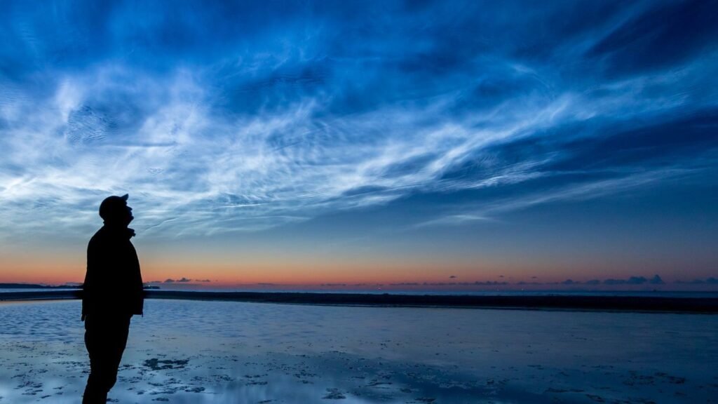
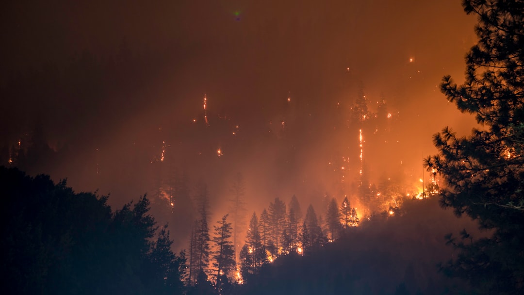
The ground looked ordinary until the wind shifted and a thin ribbon of heat shimmered above the leaf litter. That is the unnerving reality of underground coal s across parts of the United States, where seams of buried carbon smolder for years and send up ghostly breath like hidden volcanoes. The science community has been closing in on these hotspots with new tools, even as communities wrestle with subsidence, fumes, and the cost of digging out of rock. The puzzle is equal parts geology and detective work, and the stakes reach far beyond smoky hillsides. Solving it means seeing beneath our feet without lifting a shovel.
The Hidden Clues
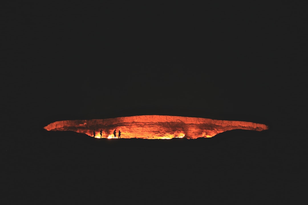
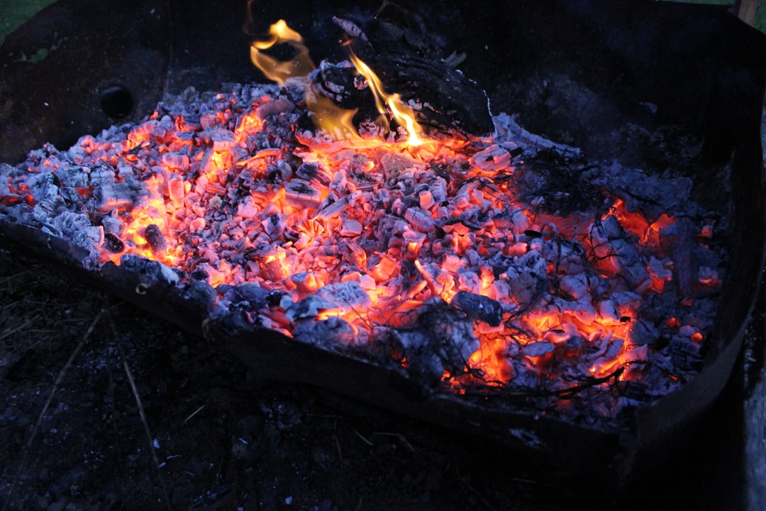
What if a forest could burn without a single flame? Hikers report warm soil in winter, snow melting in odd patches, and trees that mysteriously die from the roots upward. Surface cracks exhale wisps of steam that smell faintly metallic, and patches of ground bake into brick-red rock. These are the signatures of a coal seam fire, which can creep along a vein for decades, ignoring seasons and firefighting calendars. From the surface, it mimics volcanic ground, replacing lava and ash with heat, gases, and altered minerals.
In some valleys, the land itself sags as underground pillars crumble, leaving sinkholes that appear after heavy rain. Elsewhere, long-healed mine entries act like chimneys, channeling hot air and signaling a fire’s migration. I once pressed my boot to a warm patch in the high plains and felt a subtle pulse of heat, as if the earth were quietly breathing. It was impossible to un-feel after that day.
From Ancient Tools to Modern Science
Early miners judged a seam’s temperature by the color of clinker, the baked rock that forms when overlying sediments fuse in the heat. Today, geologists add drones, satellite thermal bands, and laser-based gas analyzers to the field kit, but the aim is the same: find the fire’s edge and the path it is likely to take. Ground crews still carry probes that read temperatures a few feet down, building a crude but vital thermal map. The work has a tactile feel because instruments, like people, are easily fooled by wind, shade, and topography. A single cloudy day can hide a fire the size of a small town.
Laboratories extend the hunt with mineral fingerprints that form only under sustained heat, confirming whether a hillside cooked from within. Radar satellites track millimeter-scale ground movement, revealing slump zones that line up with known seams. The old and new methods dovetail, each compensating for the other’s blind spots. Together, they turn guesswork into something closer to evidence.
Underfoot Chemistry
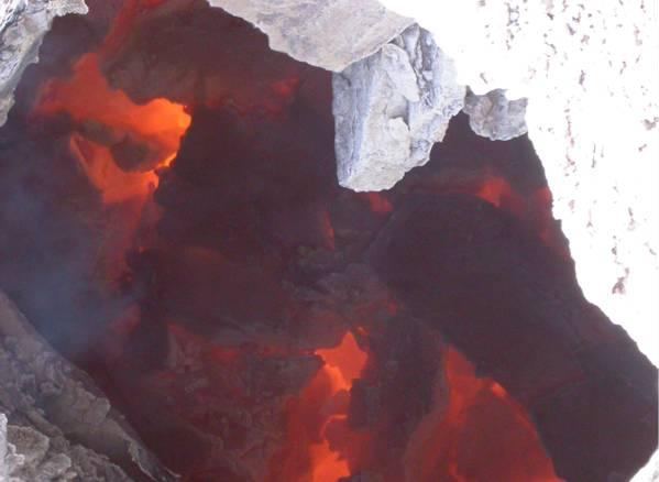
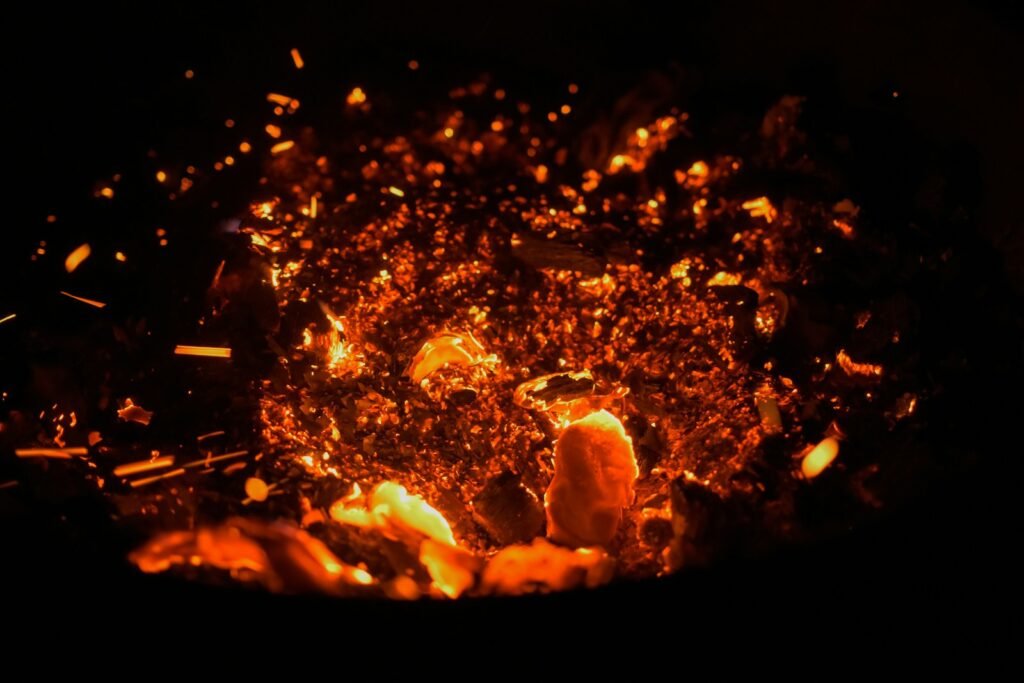
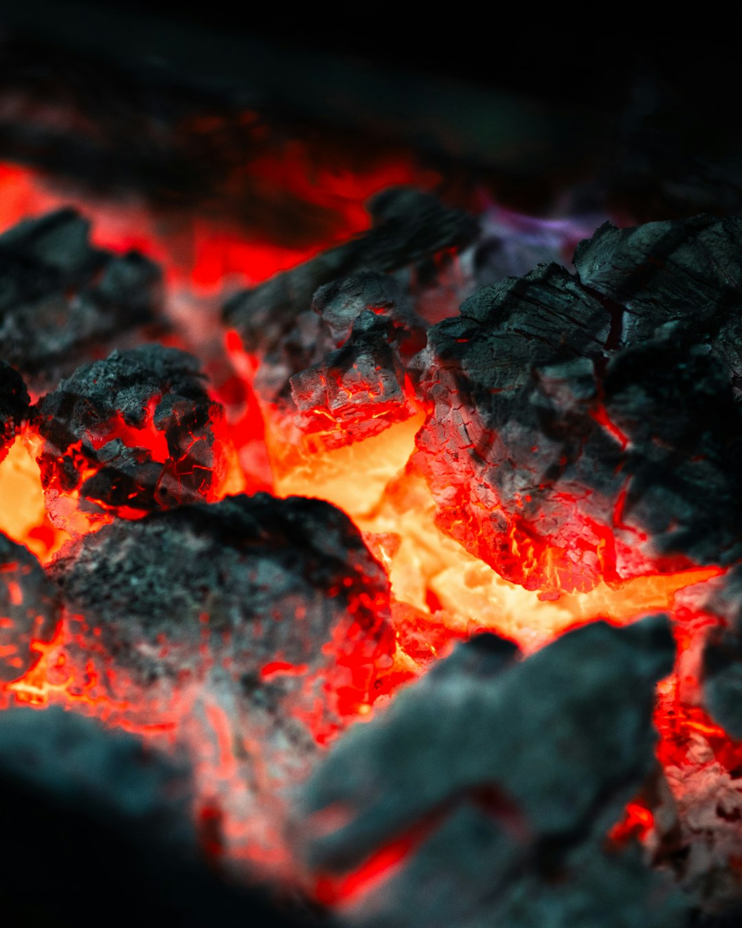
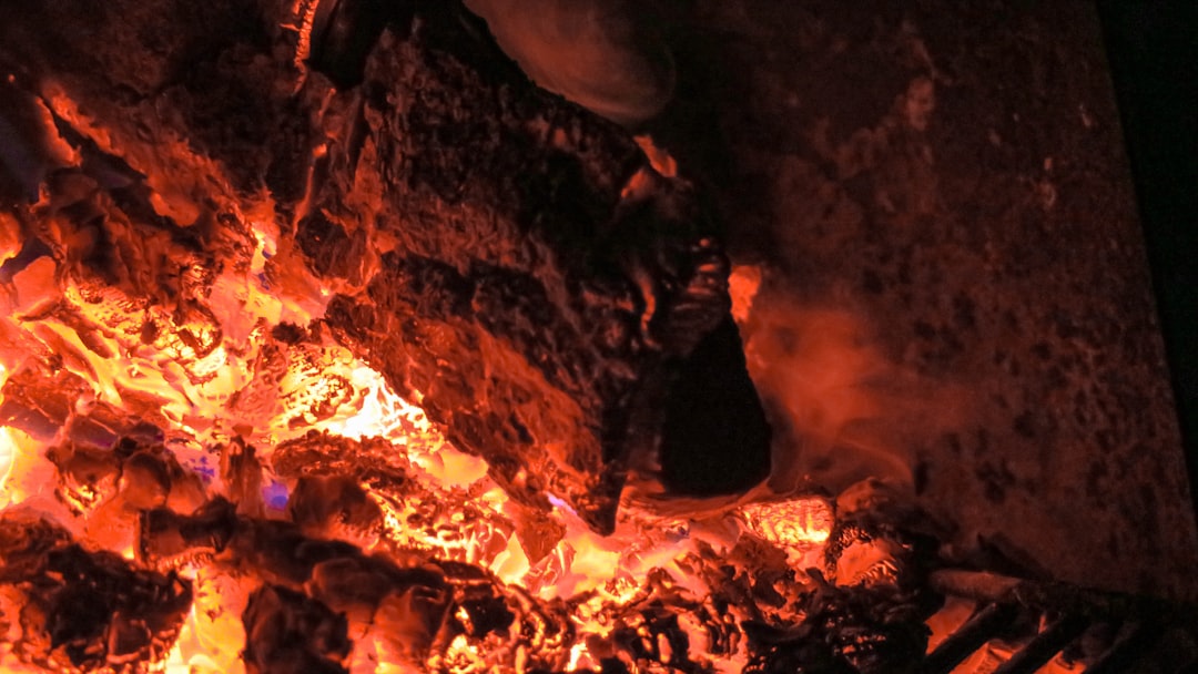
A coal seam fire is chemistry with a long fuse. Oxygen seeps through fractures and old mine works, feeding a slow burn that can exceed the temperature of a home oven by several times. The reaction releases carbon dioxide, carbon monoxide, methane, and sulfur compounds, and it alters the surrounding rock in ways that last for centuries. Clay minerals dehydrate and reorganize, iron oxides redden, and tar-like residues can migrate through pores before hardening. The result is a landscape quietly rewritten by heat.
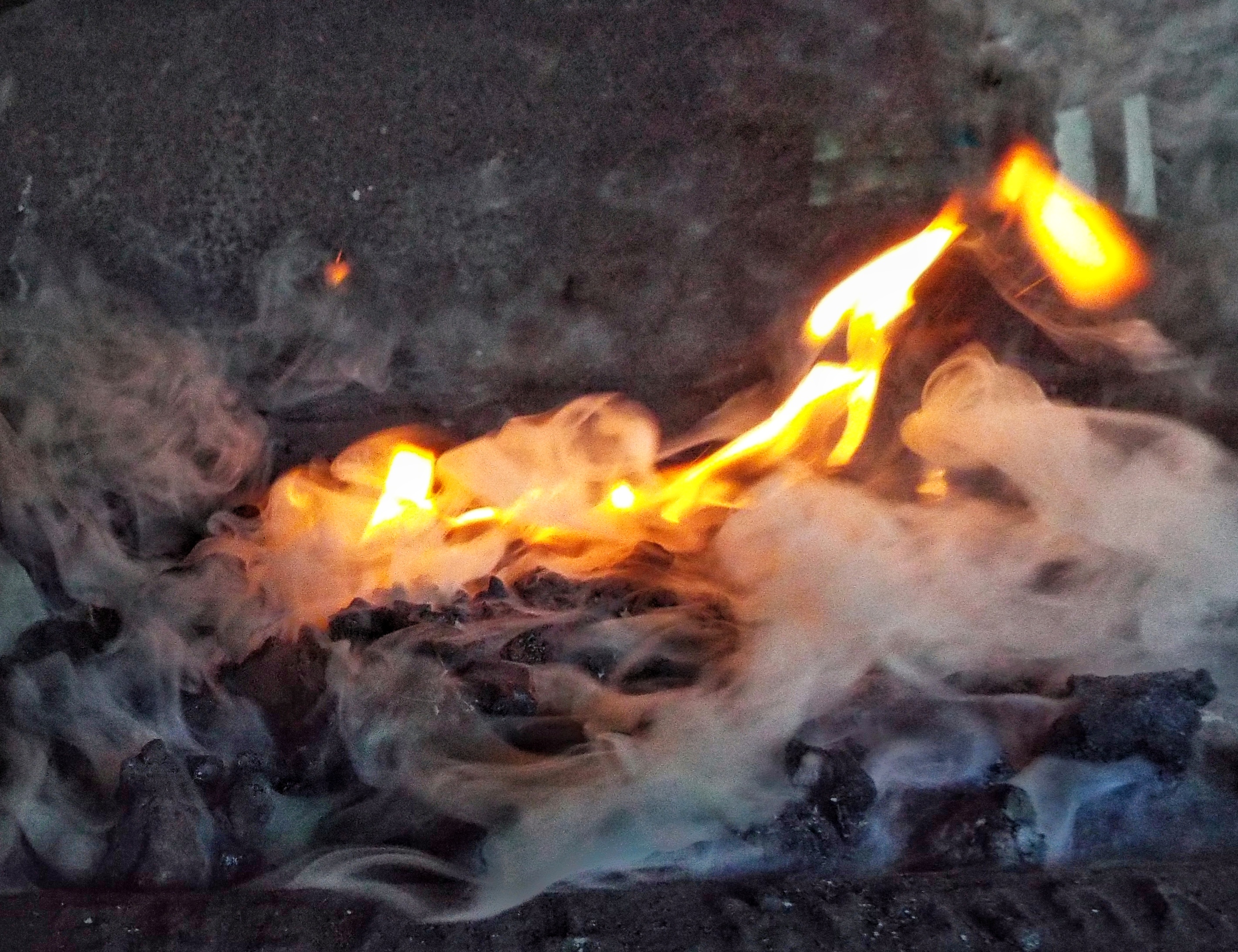
Moisture complicates everything by ferrying heat through steam and carrying soluble salts to the surface, where they crystallize into brittle crusts. That crust can trap gases until a cold snap or pressure change cracks it open, sending a new puff into the air. It is not the dramatic burst of a geyser, but it belongs to the same family of hidden plumbing. The chemistry speaks if you know how to listen.
Mapping the Unseen
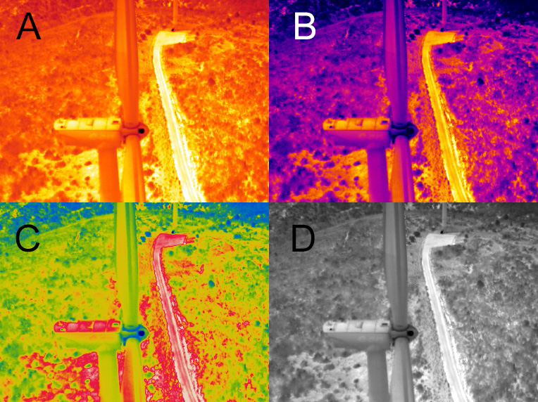
Thermal satellites pick up nighttime hot spots that linger after the sun’s warmth drains away, a helpful filter to separate geology from weather. Drones then fly low and slow with infrared cameras, tracing temperature gradients across hummocks and old roadbeds. Add radar interferometry, and subtle subsidence outlines voids where pillars of coal have been eaten away. The composite map looks like layers of tracing paper, each one adding confidence to the picture beneath. That evidence helps officials decide where to fence, where to vent, and where to dig.
In places with dense vegetation, airborne LiDAR peels away the canopy to reveal linear mounds and fissures that betray mined seams. Field crews ground-truth the maps with gas flux measurements, cross-checking instruments the way a pilot trusts but verifies a cockpit full of gauges. When the datasets agree, a once-invisible fire becomes a charted hazard. When they do not, investigators start over and look harder.
Fighting a Fire You Can’t See
Putting out an underground coal fire is less like hosing a campfire and more like sealing a leaking pipeline that runs through a maze. Teams starve the reaction by cutting off air with clay caps, grout injections, and trench barriers. In colder months, excavators sometimes dig out the burning seam and cool it in controlled cells, a noisy, costly operation that trades one scar for another. Vent pipes release hazardous gases so the work site stays survivable for people and wildlife. None of it is simple, fast, or cheap.
The key is containment rather than conquest. If the fire is boxed in and monitored, it can be shepherded away from homes, forests, and infrastructure. Old mine maps, when they exist, are priceless; when they do not, every shovelful is a guess. Patience is as essential as diesel fuel.
Measuring the Breath
Emissions from coal fires are hyperlocal troublemakers and a wider climate concern. The hot vents can concentrate carbon monoxide and sulfur gases, irritating lungs and browning nearby leaves in mid-summer. Smoke brings fine particles that settle on snowpack, darkening it and quickening melt where winter water supplies depend on slow release. Over months and years, the steady release of carbon dioxide and methane adds a persistent tail to regional inventories. The numbers are modest compared with power plants, but they are not zero and they are preventable.
Scientists parse the signature of these gases with stable isotopes to distinguish a burning seam from a passing vehicle plume. That distinction matters when agencies tally emissions and decide where limited dollars will do the most good. It is the quiet accounting behind every fence line, warning sign, and work order. Invisible breath, counted carefully.
Global Perspectives
The United States has numerous coal seam fires domestically, but the phenomenon is global wherever coal and oxygen meet. Australia’s outcrops host natural burn zones that have altered landscapes for generations, while parts of Asia face fires tied to both natural exposures and long histories of mining. In arid regions, the red clinker caps create strange mesas that look volcanic from afar, tempting travelers to mistake cause for effect. Each region’s geology shapes the tactics, from trenching through soft sediments to sealing fractures in hard, brittle rock. The vocabulary changes, but the physics stays stubbornly the same.
International collaborations now trade playbooks, aligning remote-sensing protocols and post-fire reclamation standards. Shared data makes it easier to test new techniques in one country and deploy them in another without reinventing the wheel. The global view keeps local teams from working in isolation. It also raises the bar for what success looks like.
Why It Matters
This story is not just about odd smells in the woods; it is about safety, budgets, and the long tail of industrial history. Unlike surface wildfires, which crews can flank and smother, underground fires move along tunnels and fractures that may be older than anyone on site. Traditional wildfire tools rarely apply because there is no visible flame front to chase, only a thermal ghost advancing through rock. Communities sit above that ghost on roads, water lines, and schoolyards that were never designed for shifting ground. The risk is slow-moving but deeply personal when a backyard buckles.
There is also a moral thread here. If we accept the legacy costs of past extraction, we should fund the science and work to clean it up with the same seriousness we bring to other infrastructure. The payoff is fewer evacuations, fewer emergency closures, and less pollution wafting from cracks we could have sealed. Prevention beats panic every time. That is why evidence and planning matter.
The Future Landscape

The next wave of detection will stitch together satellite constellations, low-cost sensors, and machine learning models that flag anomalies before a hiker smells them. Fiber optic cables buried along old mine corridors can function as miles-long thermometers, turning every meter into a watch post. New grouts that swell and self-seal promise tighter oxygen cutoffs without repeated injections, and hybrid trenches can double as wildlife corridors once the heavy machines leave. Insurance models are being rewritten to factor underground heat into land-use planning, nudging development away from trouble. The tools are catching up to the problem.
Still, hard questions remain about who pays, who decides, and how to prioritize sites when budgets will never match the need. Climate change complicates forecasts by drying soils and shifting freeze–thaw cycles that open new pathways for air. The best outcomes will likely blend state monitoring with community-led reporting and academic partnerships. In other words, a coalition, not a hero.
Conclusion
You do not need a PhD or a hard hat to help. Learn the signs of underground heat and report steaming ground, persistent dead vegetation in narrow stripes, or mid-winter snow melt patches to your state geological survey or land manager. Support abandoned mine land programs and local reclamation bonds when they appear on ballots, because every funded fence, vent, and trench prevents panic later. If you live near old workings, ask officials about monitoring plans and keep heavy construction off suspect zones until a geologist clears them. Small steps, taken early, are the cheapest kind of courage.
Most of all, stay curious and pay attention to what the land is trying to tell you. is not a myth; it is a slow headline written in heat. Will we read it in time?

Suhail Ahmed is a passionate digital professional and nature enthusiast with over 8 years of experience in content strategy, SEO, web development, and digital operations. Alongside his freelance journey, Suhail actively contributes to nature and wildlife platforms like Discover Wildlife, where he channels his curiosity for the planet into engaging, educational storytelling.
With a strong background in managing digital ecosystems — from ecommerce stores and WordPress websites to social media and automation — Suhail merges technical precision with creative insight. His content reflects a rare balance: SEO-friendly yet deeply human, data-informed yet emotionally resonant.
Driven by a love for discovery and storytelling, Suhail believes in using digital platforms to amplify causes that matter — especially those protecting Earth’s biodiversity and inspiring sustainable living. Whether he’s managing online projects or crafting wildlife content, his goal remains the same: to inform, inspire, and leave a positive digital footprint.