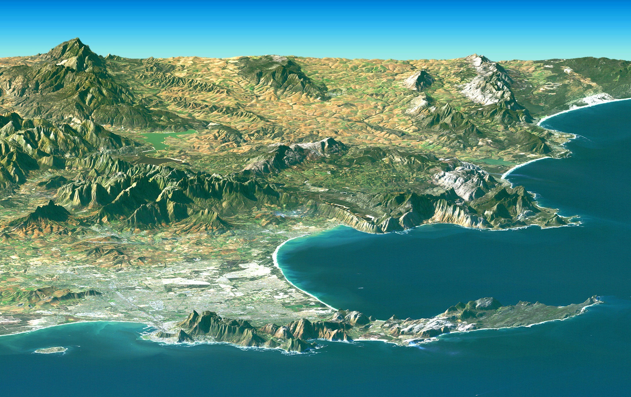
Out on the sunburned horizon, a ridge that looks immovable is, in truth, drifting grain by grain. The mountain’s profile doesn’t change overnight, yet instruments whisper that it creeps downslope every year, like a glacier made of dust and stone. That quiet motion has turned into a scientific riddle with high‑stakes consequences for people living below and for the roads and pipelines threading the basin. New satellite eyes and ground sensors now reveal a pattern of subtle shifts tied to heat, water, and deep geology, reshaping how we think about “solid” ground. The mystery is giving way to a story more intricate – and more urgent – than anyone expected.
The Hidden Clues
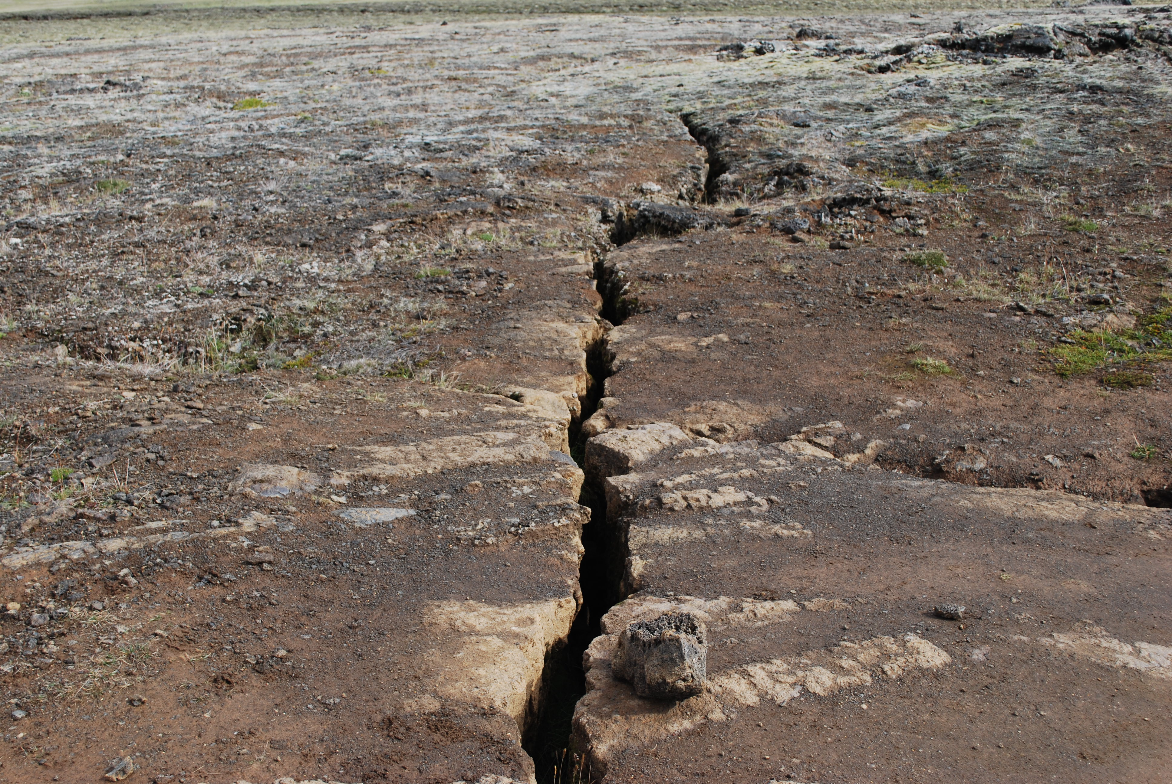
The first hints rarely announce themselves as drama; they arrive as hairline cracks marching across a dirt road or a fence that refuses to stay straight. On a still morning, you might notice a tilted Joshua tree or a boulder with a crescent of new soil on its downslope side, the telltale mustache of slow motion. Survey stakes set years apart don’t quite line up, and seasonal ruts reappear in the same place, as if the land is breathing. Each sign is minor, but together they sketch a moving landscape that ignores our calendars.
Scientists call this long, steady migration “creep” and “earthflow,” a spectrum of slow landslides that can run from barely a few millimeters to several centimeters per year. The desert’s deceptive calm actually helps: with thin soils and sparse plants, the ground wears its subtle movements openly. What seems like an optical illusion becomes measurable when compared across seasons and storms, revealing a mountain that isn’t frozen in place at all. Once you see these clues, you can’t unsee them.
From Ancient Tools to Modern Science
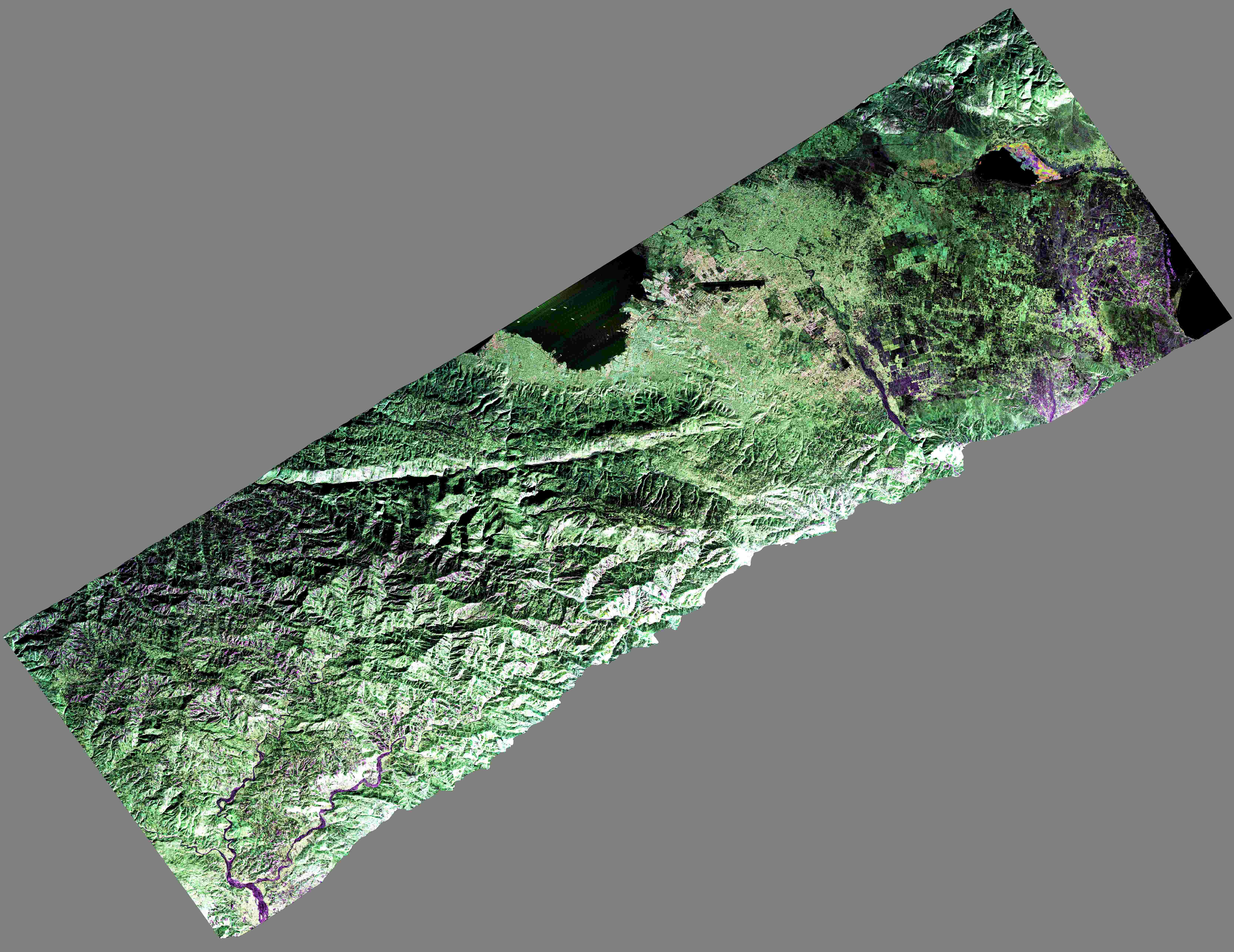
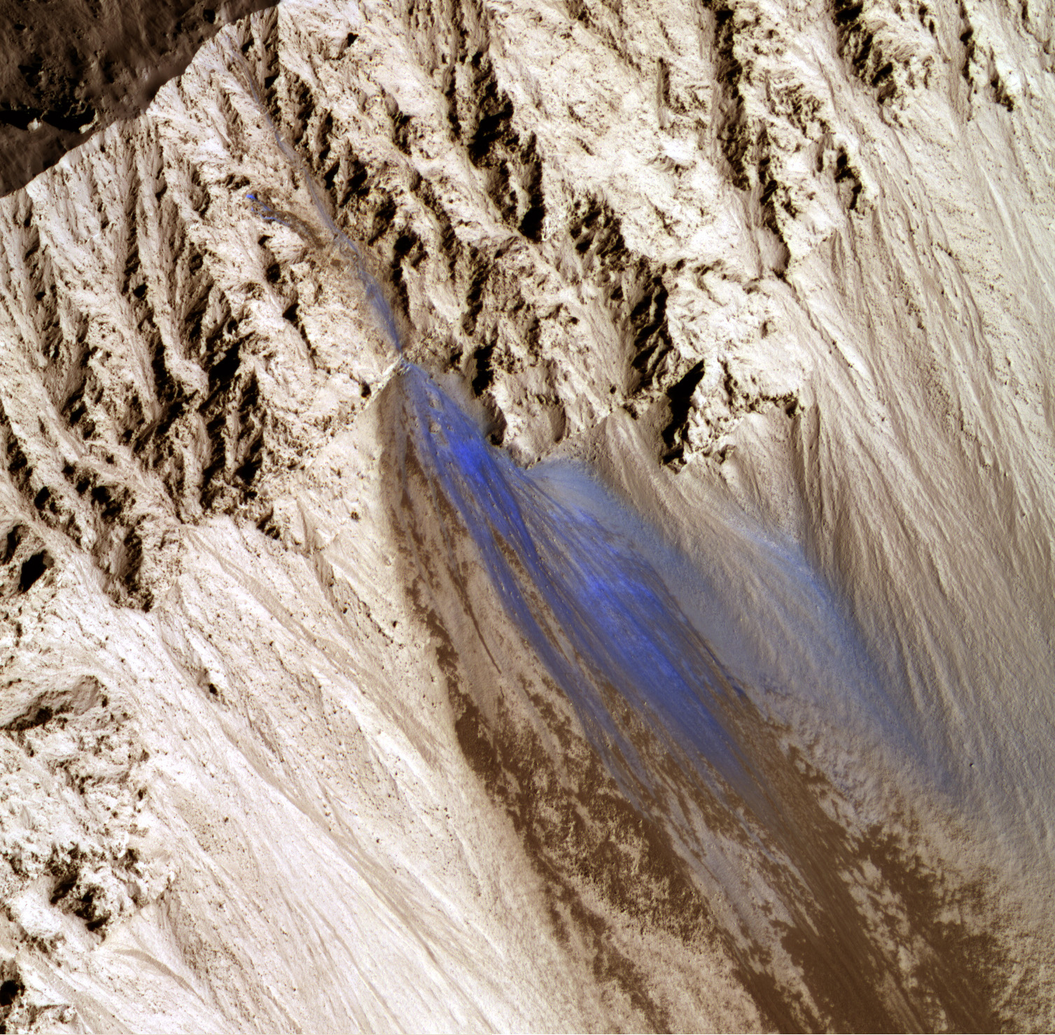
For decades, geologists relied on remeasured benchmarks, tape measures, and patient field notes to catch motion that a human eye could miss. Those classical tools built the first timelines, but they struggled to keep up with vast, roadless ridges and movements too small to justify frequent trips. The revolution came from the sky: radar satellites like Sentinel‑1 and airborne systems such as interferometric synthetic aperture radar, or InSAR, compare repeat images to detect motion far thinner than a thumbnail. Suddenly, entire ranges could be watched week after week, storm after storm.
Ground‑based GPS receivers add the local heartbeat, capturing how particular points drift through heat waves and winter rains. Laser scanning and drone photogrammetry stitch in the fine texture, revealing where blocks hinge, gullies open, and micro‑scarps propagate. When you layer these techniques, patterns emerge – zones that accelerate after rare downpours, slopes that pulse with summer heat, and deep‑seated slides that soldier on regardless. What once felt like guesswork becomes a time‑lapse of the mountain’s quiet journey.
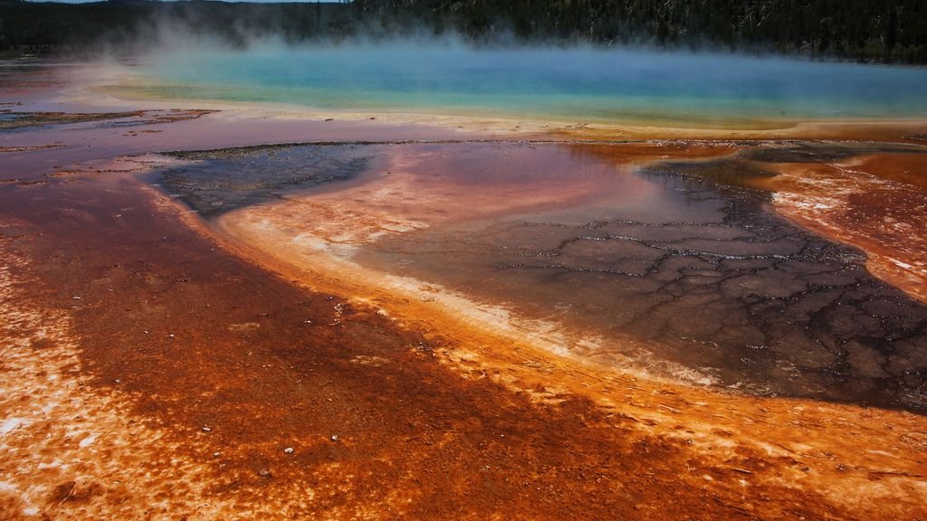
What the Rocks Are Telling Us
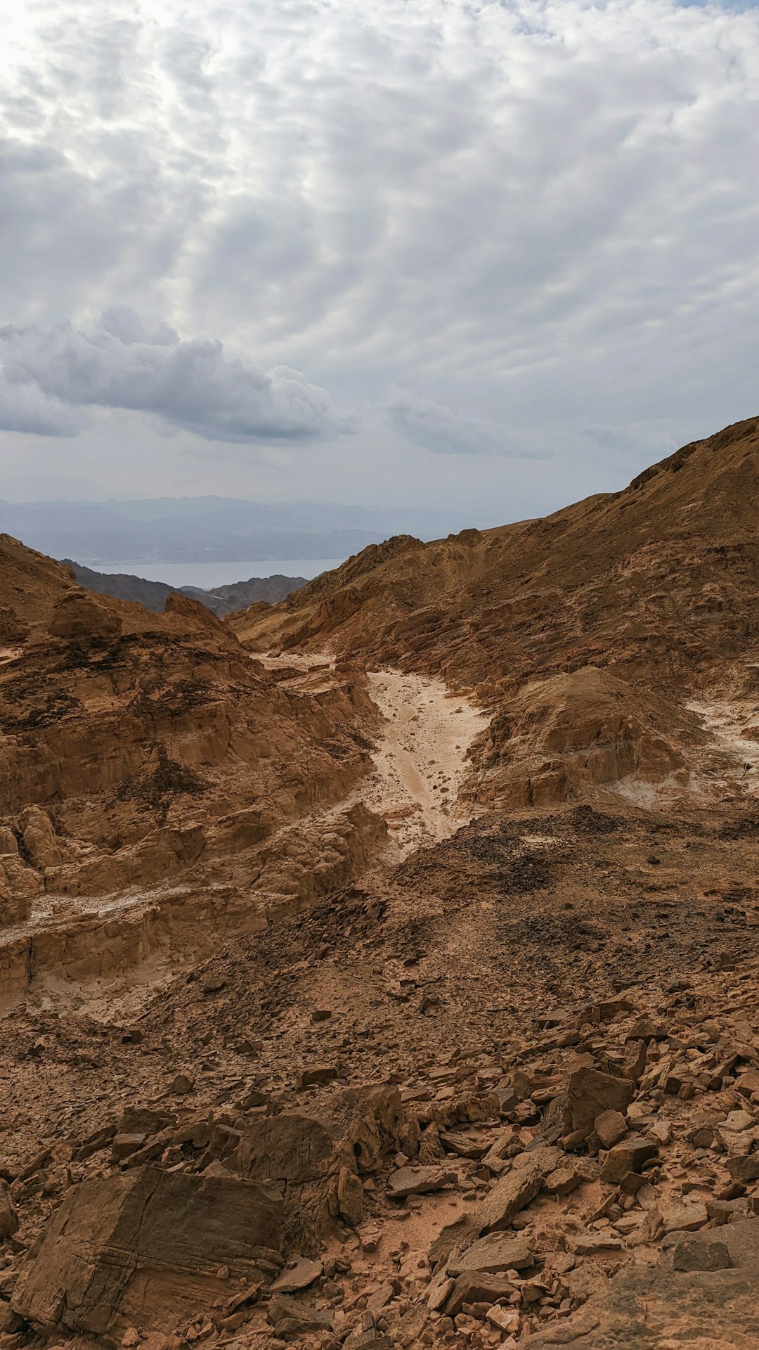
Desert mountains are not monoliths; they’re mosaics. Many host ancient lakebed clays tucked beneath harder volcanic or sedimentary caps, creating a geological sandwich with a slippery filling. Clays such as smectite swell when they soak up water and contract as they dry, ratcheting grains downhill over thousands of cycles. Gypsum and other evaporite minerals can dissolve along fractures, further weakening the foundation.
Even without heavy rains, sparse moisture moves through the ground via dew, rare storms, and capillary flow, nudging those reactive layers. Add gravity, and you get a long, slow release, like a heavy book ever so slightly sliding on a dusty shelf. Where bedrock is intensely fractured, entire blocks can behave as a coherent unit, creeping downslope along planes tilted just enough to matter. The rocks aren’t resisting; they’re negotiating.
Water and Heat: A Subtle Engine
It feels paradoxical that water drives motion in a place defined by dryness, but deserts are tuned to extremes. Intense bursts of rain can spike pore pressures in soils and weathered rock, temporarily lifting grains from each other and lowering friction. After storms, instruments often see short‑lived accelerations that fade as the ground dries and stiffens. Even trace snowmelt on high crests can seep downward days later, quietly lubricating deeper layers.
Heat is the co‑conspirator. Rocks expand in blistering afternoons and contract as temperatures crash at night, a daily flexing that loosens joints like a door worked back and forth. Over years, this thermal fatigue opens pathways for water and pries blocks free, increasing the landscape’s sensitivity to the next rare cloudburst. In this dance of heat and moisture, the mountain never truly rests.
Shaken, Not Broken: Quakes and Human Footprints
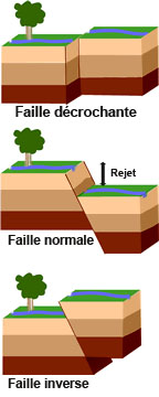
Earthquakes don’t need to shatter a ridge to set it moving; even moderate shaking can jostle grains past their friction thresholds, priming slopes for months. After regional tremors, researchers sometimes watch baseline speeds tick upward before settling into a new normal, as if the mountain re‑set its internal clock. Faults threading desert basins also act as subterranean plumbing, channeling fluids that alter slide behavior long after the shaking stops. The result is a compound story where tectonics and climate overlap.
Human activity can join the plot. Groundwater pumping lowers water tables and can rearrange stress within slopes, while road cuts and quarries remove the natural buttresses that once held colluvium in place. Even changes in vegetation from wildfire or invasive grasses can tweak how fast soils wet and dry. None of these drivers acts alone; together they tune the mountain’s pace, sometimes doubling or halving its annual creep.
Why It Matters
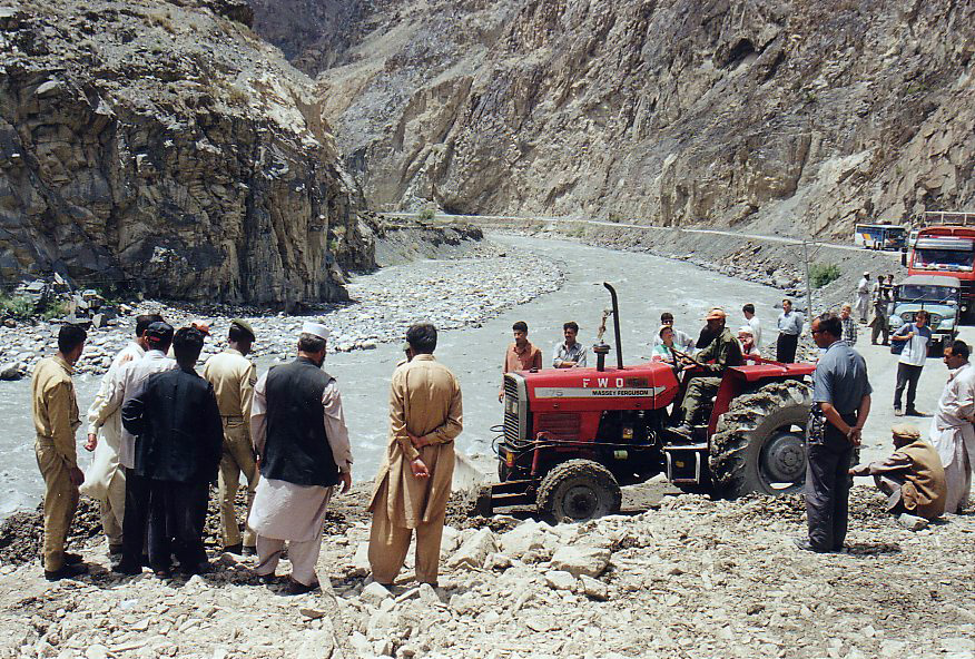
This isn’t just an academic puzzle; slow motion still breaks things. A creeping ridge can tug apart buried pipelines, buckle asphalt, and twist rail beds with damage that accumulates quietly until a maintenance crew meets a surprise. Emergency managers care because slow slides can transition to faster failures when thresholds are crossed, especially after back‑to‑back storms. For communities downstream, better maps mean better planning – rerouted roads, redesigned culverts, and smarter building codes.
Consider a few hard realities that make vigilance worthwhile:
– Even millimeter‑scale motion, integrated over years, can shift infrastructure by hand‑widths.
– A small number of intense storms often accounts for most of the annual acceleration.
– Monitoring costs have fallen sharply as open radar data and low‑cost GPS proliferate.
With targeted surveillance, agencies can prioritize repairs before they become crises and set trigger levels that prompt inspections after big weather or shaking.
Global Perspectives
Although this story plays out vividly in the American Southwest, similar slow movers dot the Atacama, North Africa’s Atlas foothills, Australia’s interior, and the rain‑shadowed flanks of Central Asia. Each region offers a variant on the theme – different rock recipes, different storm rhythms, the same gravitational negotiation. What unites them is the value of consistent measurement and shared methods, from open satellite archives to standardized field protocols. The more landscapes that are watched, the clearer the common rules become.
Climate shifts complicate the picture. Longer dry spells punctuated by heavier bursts of rain can amplify the very cycles that ease grains past each other. In some basins, warming elevates the snow line, altering when and where water infiltrates fractured crests. Comparing sites across continents helps researchers separate what is local idiosyncrasy from global signal, sharpening forecasts where people live with the slope.
The Future Landscape
What comes next isn’t guesswork; it’s instrumentation scaling up. Constellations of radar satellites are increasing revisit rates from weeks to days, while small solar‑powered beacons on ridgelines stream motion data in real time. Machine‑learning tools now flag subtle accelerations within noisy signals, giving managers early nudges instead of late alarms. Drones can return to the same flight lines season after season, stacking high‑resolution models that reveal tiny scarps before they grow teeth.
Challenges remain. Translating motion into risk still hinges on local geology that satellites can’t see alone, and funding cycles rarely match the slow timelines of creeping slopes. Data sharing across jurisdictions can lag, and rugged terrain still eats batteries and boots. But the trajectory is clear: more eyes, better models, and practical thresholds that tie numbers to action. The mountain will keep sliding; the question is whether we keep pace.
How You Can Help
Report what you notice: recurring cracks in roads, leaning fence posts, or warping foundations along the same stretch of slope are valuable clues. Support local land‑use plans that account for landslide mapping, and ask utilities how they monitor long‑term ground motion along pipelines and power corridors. If you hike these ridges, photograph the same landmarks each season from the same spot; paired images can expose change that memory smooths away.
For those in classrooms or clubs, adopt‑a‑slope projects using open satellite dashboards and low‑cost GPS can turn curiosity into community data. Back regional science initiatives that maintain sensors and publish accessible maps, because consistent observing beats heroic response every time. Awareness builds resilience, and in landscapes that move slowly, time is the ally of anyone paying attention.

Suhail Ahmed is a passionate digital professional and nature enthusiast with over 8 years of experience in content strategy, SEO, web development, and digital operations. Alongside his freelance journey, Suhail actively contributes to nature and wildlife platforms like Discover Wildlife, where he channels his curiosity for the planet into engaging, educational storytelling.
With a strong background in managing digital ecosystems — from ecommerce stores and WordPress websites to social media and automation — Suhail merges technical precision with creative insight. His content reflects a rare balance: SEO-friendly yet deeply human, data-informed yet emotionally resonant.
Driven by a love for discovery and storytelling, Suhail believes in using digital platforms to amplify causes that matter — especially those protecting Earth’s biodiversity and inspiring sustainable living. Whether he’s managing online projects or crafting wildlife content, his goal remains the same: to inform, inspire, and leave a positive digital footprint.