In the world’s driest basins, a lake can bloom like a mirage, hold its breath for a few days, and then vanish as if closing a door. Scientists call these water bodies ephemeral, but in person they feel dramatic, even unruly. The real mystery isn’t just that they come and go – it’s how quickly they reorganize the landscape, biology, and even the air above them. Recent storms across the American Southwest and beyond have turned salt flats into shallow mirrors, then back into cracked polygons in a blink. That whiplash is turning a once-rare curiosity into a living laboratory for some of the most urgent questions in modern hydrology.
The Hidden Clues
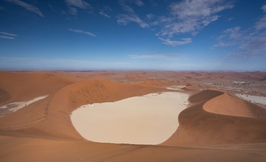
Stand at dawn on a dry playa and you’ll notice clues that foretell a sudden lake: faint bathtub rings of salt, ripple marks like fingerprints, and tiny channels braided into the clay. Those features record past floods the way tree rings hold storms, and they hint at how the next sheet of water will behave. When rain or distant mountain runoff finally arrives, the playa’s ultra-fine clays swell, sealing the surface like a lid and trapping water on top. That creates a shallow lens that can spread for miles yet remain only ankle to knee deep. Because the basin is closed – no rivers flow out – the lake’s lifespan is set by a tight contest between evaporation, infiltration, and wind.
The Fast Physics of a Vanishing Lake
Ephemeral lakes disappear fast because the desert stacks the deck: blazing sun, bone-dry air, and frequent gusts rip moisture from the surface. Wind matters more than most people think, pushing water across the pan so it puddles in one corner while exposing salty mud elsewhere. As the sheet thins, a tiny change in depth can double the surface area, which in turn accelerates evaporation again. Meanwhile, capillary action draws brines upward, building a glittering crust that later fractures into the classic hexagons. Once the heat turns up, the last puddles fade rapidly, leaving a reflective salt skin where you swear you were wading days earlier.
From Ancient Tools to Modern Science
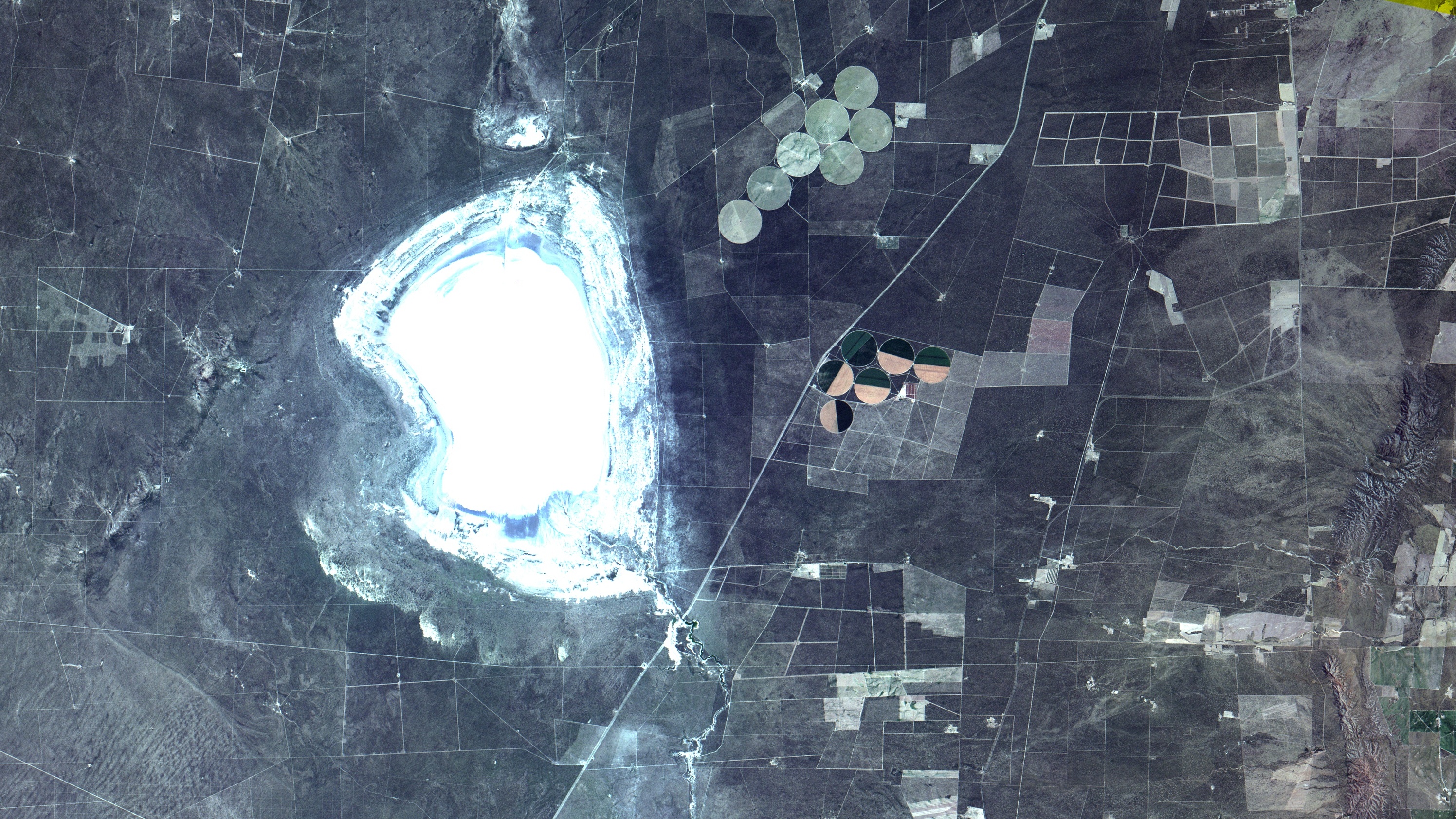
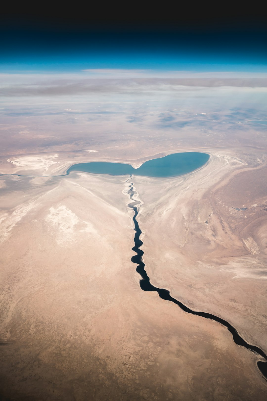
For decades, scientists tracked playa floods with boots, staff gauges, and hand levels – simple tools that taught us plenty but missed the blink-and-you-miss-it drama. Now aircraft lidar, weather radar, and a new breed of satellites measure millimeter-scale changes in water level and map the lake’s shape in near-real time. In late 2023, a temporary lake in Death Valley became a testbed, its depth mapped over successive orbits by a radar altimeter mission designed to monitor global water bodies.
Paired with high-resolution elevation models from the ground, those measurements revealed how the lake thinned and sloshed under passing storms and bursts of wind. It’s a leap from clipboards to constellations, and it’s rewriting what we know about short-lived waters.
The People Who Read the Land
Local rangers, field hydrologists, and desert residents are the first to read the subtle signs – darkened mud that means saturated clays, fresh debris fans where channels spilled, a misty sheen that telegraphs an overnight flood. I remember stepping onto a salt pan after a winter storm and hearing the crust snap like thin glass, the mud below still cool and slick; it was a tactile reminder that the surface is a story in progress.
Field reports like these shape science campaigns, helping researchers decide where to place sensors and when to fly a drone or schedule a satellite overpass. They also protect fragile surfaces: one careless trek or boat drag can scar a playa for years, etched into crust that heals painfully slowly. Human judgment on the ground makes the data smarter – and keeps the landscape intact for the next rare flood.
Global Perspectives
While North America’s deserts grab headlines, these blink-and-gone lakes are a global language spoken across salt pans and clay basins on every continent. In southern Africa, Australia, and parts of Central Asia, similar basins fill during brief wet pulses, transforming dust-prone flats into short-lived oases for birds and brine-loving microbes. Each basin has its quirks – different geology, salt composition, and wind regimes – but the core physics of thin water, big surface area, and ruthless evaporation repeats.
Climate variability is the conductor here, stringing together tropical remnants, atmospheric rivers, and snowmelt bursts into sudden floods. That shared pattern lets researchers compare basins and refine models that can hopscotch across regions without starting from scratch.
Why It Matters
An overnight lake can shape dust, ecosystems, safety, and even regional climate feedbacks, and that makes its on–off switch everyone’s business. Wet playas temporarily suppress dust emissions that otherwise carry salts and fine particles into towns and croplands; when they dry, those same surfaces can become major dust sources. Thin sheets of water also wake up seed banks and microbial mats, jump-starting food webs that feed insects and migratory birds for a brief but critical window. For managers, hours matter: closing a road before a flood or pausing recreation while surfaces are vulnerable can prevent lasting scars. Consider these quick facts that drive decisions in the field:
– Shallow desert lakes can shift position by miles under sustained winds, dramatically changing depth and evaporation.
– A sealed clay surface can trap water despite porous sediments below, delaying infiltration and prolonging wet conditions.
– Once the surface fractures and roughens, evaporation speeds up and the last puddles vanish far more quickly.
Maps That Move and Models That Learn
To forecast a lake that morphs in days, scientists now blend moving maps with machine learning that ingests weather, wind, and topography. Radar satellites sketch the water’s outline through haze and twilight, while optical sensors capture color changes as mud and salts mix. Add in meteorological forecasts and you get a nowcast that says not just if a lake exists, but where, how deep, and for how long it will be safe to approach.
The payoff is practical: park alerts that reflect real conditions, targeted dust advisories, and protection plans for microhabitats that bloom and fade with each flood. The more we teach the models about these short-lived pulses, the fewer surprises we’ll have when the sky suddenly turns silver over a white pan.
The Future Landscape
Looking ahead, new satellites will pass more often and see smaller features, shrinking the blind spots between storms and overpasses. Ground teams are testing low-cost sensors – salt-safe pressure loggers, time-lapse cameras, and crust-strength probes – that can ride out floods and phone home when conditions change. The hardest problem is still timing, because extreme precipitation is becoming more erratic in many drylands, stacking years of silence beside single, walloping events.
That swing challenges infrastructure, wildlife, and visitors who arrive to find either a glassy mirror or a blistering salt flat, with little in between. Expect more rapid-response science: flexible permits, preplanned flight lines, and open data that flows as quickly as the lakes themselves.
Conclusion
If you visit a playa, treat it like wet paint: stay on durable surfaces, follow local guidance, and skip boating or biking when mud is soft and tracks will fossilize. Support open hydrology data and park science funds that keep instruments running and maps current between storms. Share conditions responsibly – note dates, locations, and photos – so researchers and managers can stitch together better timelines of each flood.
If you live downwind of dry lakes, pay attention to dust alerts and pitch in on community monitoring that tracks air quality before and after wet pulses. Small choices add up, and in places where a lake can appear and disappear overnight, timing and care are everything.

Suhail Ahmed is a passionate digital professional and nature enthusiast with over 8 years of experience in content strategy, SEO, web development, and digital operations. Alongside his freelance journey, Suhail actively contributes to nature and wildlife platforms like Discover Wildlife, where he channels his curiosity for the planet into engaging, educational storytelling.
With a strong background in managing digital ecosystems — from ecommerce stores and WordPress websites to social media and automation — Suhail merges technical precision with creative insight. His content reflects a rare balance: SEO-friendly yet deeply human, data-informed yet emotionally resonant.
Driven by a love for discovery and storytelling, Suhail believes in using digital platforms to amplify causes that matter — especially those protecting Earth’s biodiversity and inspiring sustainable living. Whether he’s managing online projects or crafting wildlife content, his goal remains the same: to inform, inspire, and leave a positive digital footprint.