Imagine a massive stretch of land, roughly the size of Australia, sitting where icy ocean water flows today. No boats. No borders. Just open terrain connecting two of the world’s great continents. That was Beringia – and what happened across it over tens of thousands of years quietly wrote the biological story of an entire hemisphere.
Most people think of the Bering Land Bridge as a narrow frozen corridor. Honestly, that image couldn’t be further from the truth. You’re actually looking at one of the most consequential geographic features in Earth’s history, and its influence on is still visible in every forest, meadow, and mountain range across the continent today. Let’s dive in.
A Landmass That Dwarfed Our Imagination
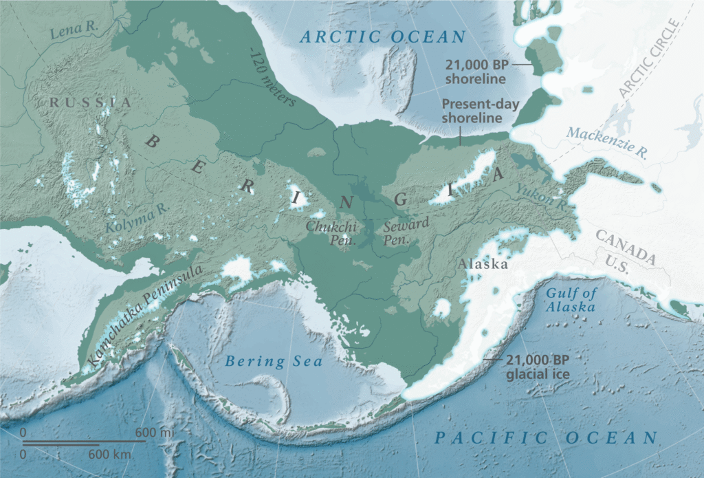
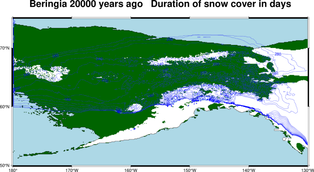
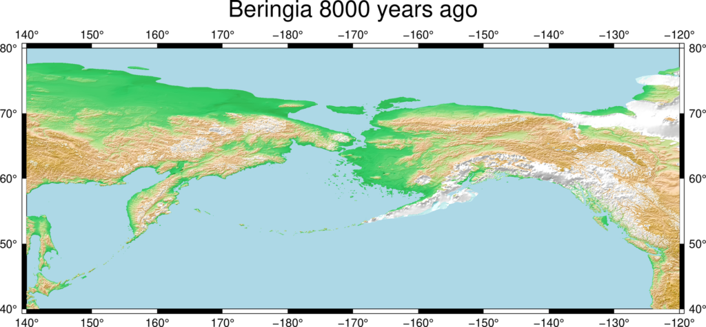
Here’s the thing – when you picture the Bering Land Bridge, you probably imagine something narrow and icy. Forget it. At its greatest extent, it was a landmass roughly as large as Australia, stretching 1,600 kilometers north to south and 4,800 kilometers east to west, from Canada’s Mackenzie River to Russia’s Verkhoyansk Mountains. That’s not a bridge. That’s a continent within a continent.
The Bering Land Bridge emerged as a result of dramatic climatic and geological changes during the Ice Age, particularly in the Pleistocene Epoch. During this time, glaciers trapped vast amounts of the Earth’s water, causing sea levels to drop by as much as 400 feet, which exposed the Bering Land Bridge. Think of it like draining a bathtub – except the bathtub is the Arctic Ocean, and what’s revealed underneath reshapes life on Earth.
For interchange between Eurasian and North American biotas, the Bering land bridge acted as a bottleneck, and it has been considered one of the most significant regions on Earth for paleogeographic and biogeographic studies. Geological records suggest that the Bering land bridge connected northeastern Asia and northwestern North America for much of the time since the Cretaceous. We’re not talking about a brief episode here. This connection defined biological movement for millions of years.
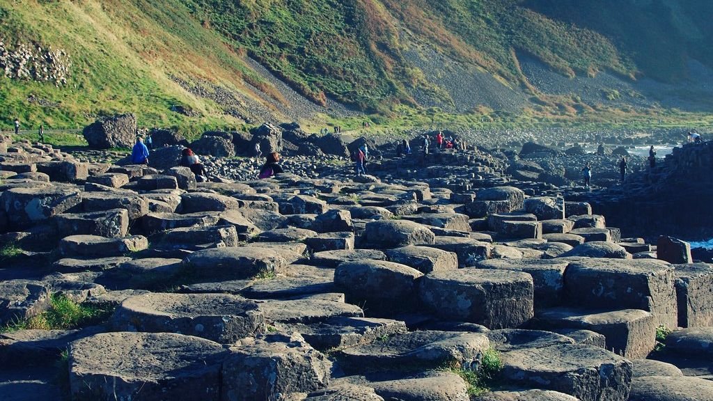
A Living, Breathing Ecosystem – Not a Frozen Wasteland
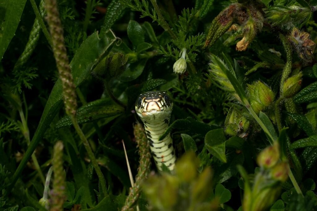
Flora as diverse as shrub willows, flowering plants, grasses, and sphagnum moss all flourished, and fossil studies point to a wealth of fauna, from beetles, lemmings, and ptarmigan to moose and grizzly bears. Scientists initially assumed the bridge was a bleak, windswept passage. The fossil record proved them wrong in the most spectacular fashion.
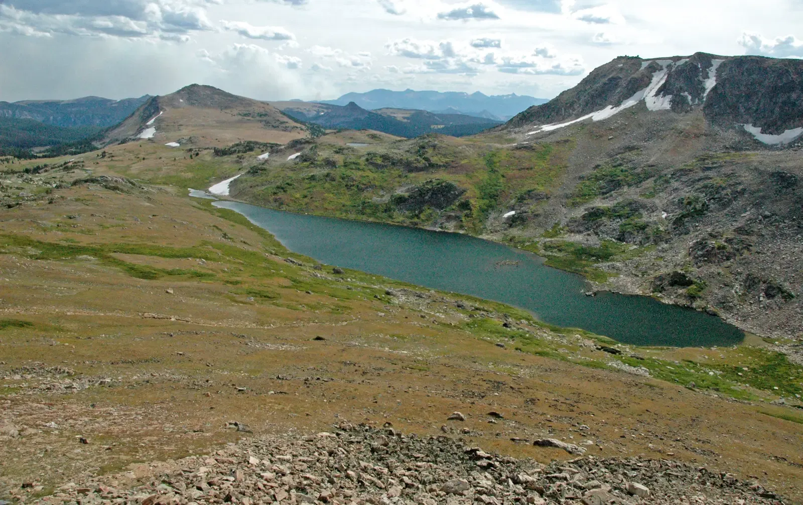
In the Late Pleistocene, Beringia was a mosaic of biological communities. Commencing from approximately 57,000 years before present, steppe-tundra vegetation dominated large parts of Beringia with a rich diversity of grasses and herbs. There were patches of shrub tundra with isolated refugia of larch and spruce forests with birch and alder trees. It was a patchwork of habitats, almost like a living experiment in ecological variety.
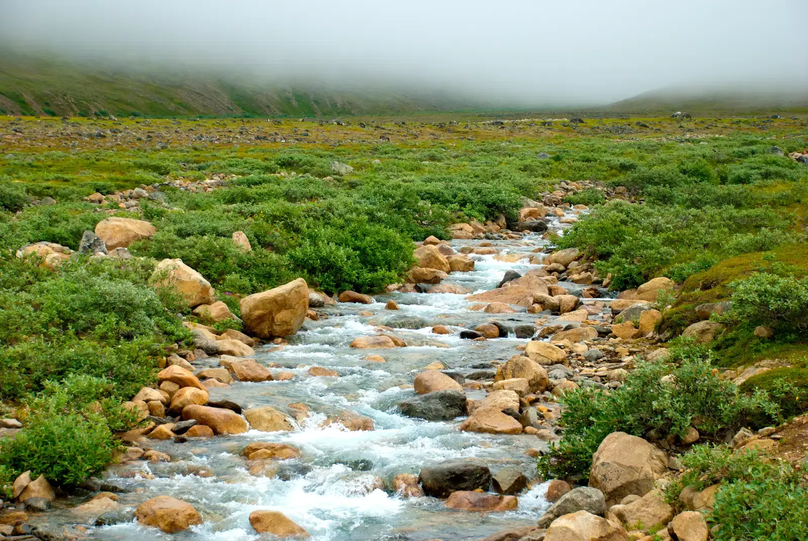
Beringia received more moisture and intermittent maritime cloud cover from the north Pacific Ocean than the rest of the mammoth steppe, including the dry environments on either side of it. This moisture supported a shrub-tundra habitat that provided an ecological refugium for plants and animals. A refugium – meaning it was actually a shelter, a safe haven, where life could survive and persist across harsh glacial cycles.
The Great Animal Migration: Who Crossed and Who Stayed Behind
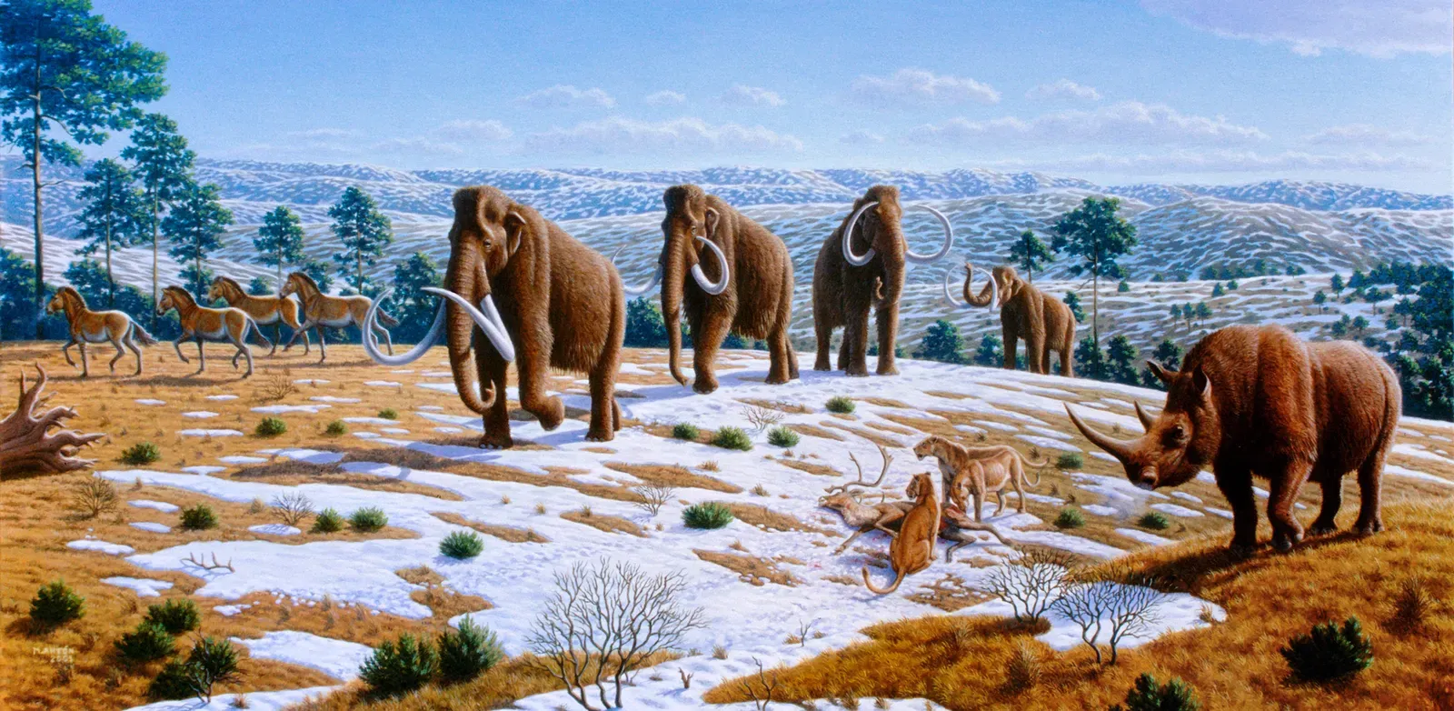
The Bering Land Bridge was episodically open throughout the Pleistocene until about 13,000 years ago. A corridor was created by falling sea levels that provided an opportunity for Asian species including mammoths, bison, muskoxen, caribou, lions, brown bears, and wolves to move into North America. One American species, the horse, dispersed westward across the land bridge to Asia. Horses, in fact, originated in North America. That detail alone is enough to completely rearrange how you think about wildlife origins on this continent.
The existence of fauna endemic to the respective Siberian and North American portions of Beringia has led to the “Beringian Gap” hypothesis, wherein an unconfirmed geographic factor blocked migration across the land bridge when it emerged. Beringia did not block the movement of most dry steppe-adapted large species such as saiga antelope, woolly mammoth, and caballid horses. Notable restricted fauna include the woolly rhino in Siberia, and Arctodus simus, American badger, American kiang-like equids, Bootherium and Camelops in North America. So it wasn’t an open highway for everyone. Some species were stopped cold, for reasons scientists are still working to understand.
Interestingly, DNA evidence suggests that despite its vast area, the land bridge was not a busy highway with populations moving back and forth between the continents. While the distribution of woolly mammoths extended from Europe, across Siberia into North America, the genetic evidence suggests after colonizing North America, there was minimal gene flow. Once they crossed, many populations simply stayed put and evolved independently. Nature’s doors, it turns out, don’t always swing both ways.
Plants, Fungi, and the Asymmetry of Life’s Exchange
The pattern of bidirectional flow of biota has been asymmetric, with more plants, animals, and fungi generally migrating from Asia to North America than vice versa throughout the Cenozoic. Let’s be real – this is one of the most quietly astonishing facts in all of biogeography. Asia was, in a very real sense, the dominant exporter of life to North America across geological time.
The major contribution of Asian tundra plants arrived in Alaska throughout the Quaternary, via the land bridge while it was exposed. Successive changes directly related to the waxing and waning of glaciers and consequent rising and falling of sea level caused the repeated appearance and disappearance of the Bering Land Bridge. These dynamics have together created conditions for plant dispersal and also diversification. Every time the bridge emerged, it was like a new green corridor opening up, each time slightly different, each time carrying different travelers.
The distribution of plants in the genera Erythranthe and Pinus are good examples of this, as very similar genera members are found in Asia and the Americas. You might never guess while walking through a North American pine forest that you’re actually looking at descendants of Asian ancestors. The Bering Land Bridge has been a major highway for Asian plants into North America, but also a barrier to some and a filter for others. It was never a simple open door – it was more like a selective sieve, deciding which life forms could pass and which could not.
When the Bridge Closed: Isolation and the Acceleration of Evolution
Deglaciation commenced in the Northern Hemisphere approximately 19,000 years before present, and the bridge was finally inundated around 11,000 years before present. Rising seas reclaimed Beringia slowly, over thousands of years. What had been continuous terrain became islands, then open water. Populations that once shared territory were now permanently separated by ocean.
The disappearance of the Bering Land Bridge around 11,000 years ago led to the isolation of plant and animal populations, driving distinct evolutionary pathways. The earlier exchange of species had enriched the genetic pool and fostered ecological resilience on both continents. Isolation, as evolutionary biologists will tell you, is one of the most powerful forces in creating new species. The bridge’s closure essentially locked in the biodiversity that had accumulated and pressed the fast-forward button on divergence.
As the land bridge flooded, the entire Beringian region grew more warm and moist, and the shrub tundra vegetation spread rapidly, out-competing the steppe-tundra plants that had dominated the interior lowlands of Beringia. While this spelled the end of the woolly mammoths and other large grazing animals, it probably also provided the impetus for human migration. A cascade of ecological change, all triggered by rising water. In some ways, the flooding was just as transformative as the bridge itself.
The Ongoing Science: What We Still Don’t Know About Beringia
Everything we currently know about the Bering Land Bridge, we know from studies in present-day Alaska or Russia or from small islands in the Bering Sea. This research is providing novel insight into what the environment of the low-lying, and now submerged, central Bering Land Bridge was like. It’s a sobering thought. The central and most crucial portion of the bridge is still sitting under ocean water, largely unstudied. Scientists are essentially reading a book with many pages still soaking wet.
The Bering Land Bridge was an important biotic corridor and climatic modifier during the Pleistocene. Understanding when the land bridge was most recently exposed reveals insights into past climate, the modern distribution of plants and animals, and potential human migration into the Americas. The stakes of understanding Beringia couldn’t be higher – it touches everything from conservation biology to the origins of Indigenous peoples across an entire hemisphere.
Combined analyses will allow researchers to identify plants and animals that were present on the low-lying Bering Land Bridge as well as to identify what types of wetlands were present. This will help better understand what conditions were like, particularly for animals, that migrated between Asia and North America thousands of years ago. Understanding what this ecosystem looked like will help us understand why some organisms crossed the land bridge and others stayed on one side or another. It’s hard to say for sure what future discoveries will reveal, but every sediment core pulled from the Bering Sea floor brings us closer to a fuller picture of this world-changing corridor.
Conclusion: A Sunken Bridge With a Living Legacy
The Bering Land Bridge is gone now. It has been for roughly 11,000 years, resting somewhere beneath the cold waters of the Bering Strait. Yet its fingerprints are absolutely everywhere – in the genetics of North American wolves, in the pine trees lining Alaskan ridges, in the bison herds of the Great Plains, and in the deep ancestry of every Indigenous community across the Americas.
What strikes me most about this story is its sheer scale. We’re talking about a process stretching back millions of years, involving thousands of species, reshaping two entire continents – and yet the bridge itself was temporary. It appeared and disappeared repeatedly with the rhythms of ice ages, each time reshuffling the deck of life in the Western Hemisphere. It was never permanent. It was always changing. And perhaps that’s the deepest lesson it leaves us with: biodiversity is never a fixed state. It is always in motion, shaped by the slow forces of geology and climate in ways we are only beginning to fully grasp.
What would North America look like today if that land bridge had never existed? It’s one of those questions that keeps scientists up at night – and honestly, it should fascinate the rest of us too.