Across North America, rumors whisper of underground passageways that seem to trace secret routes beneath cities, deserts, and mountains. Some are clearly natural – carved by lava, water, or ice – while others hint at human hands, from Indigenous refuge caves to mining adits and Prohibition-era corridors. Yet every time archaeologists and geologists illuminate one piece, new questions appear at the edges of the map. The mystery is not about a single vast tunnel, but about how countless subterranean systems overlap in ways we still don’t fully grasp. The result is a patchwork puzzle where science, history, and folklore meet in the dark.
The Hidden Clues
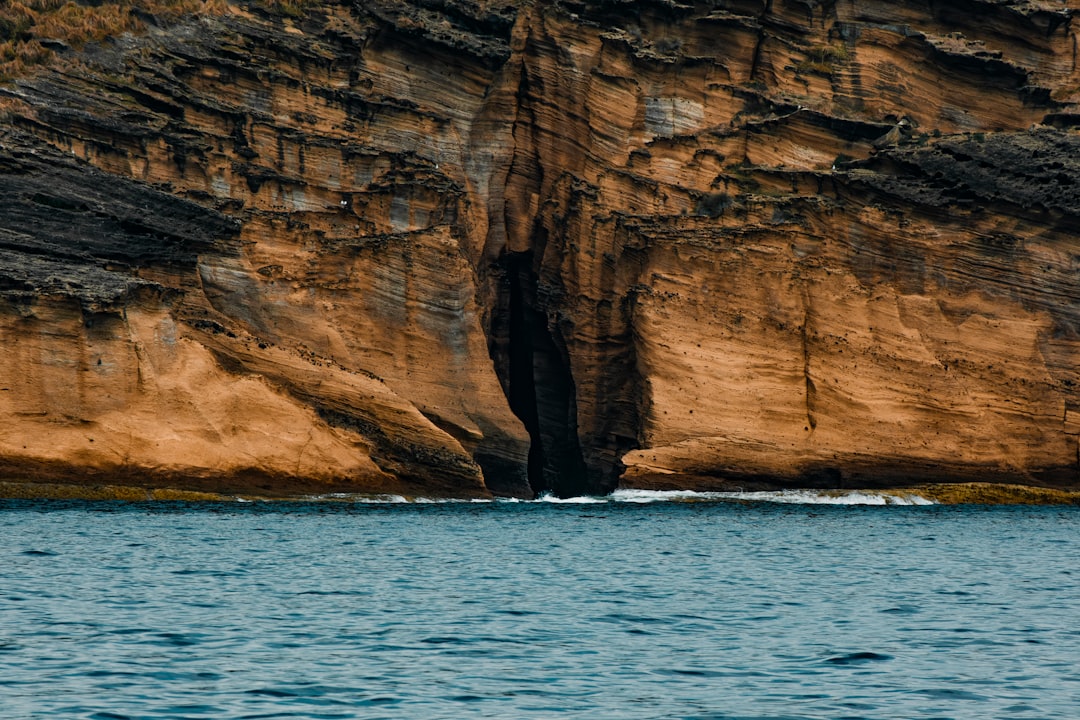
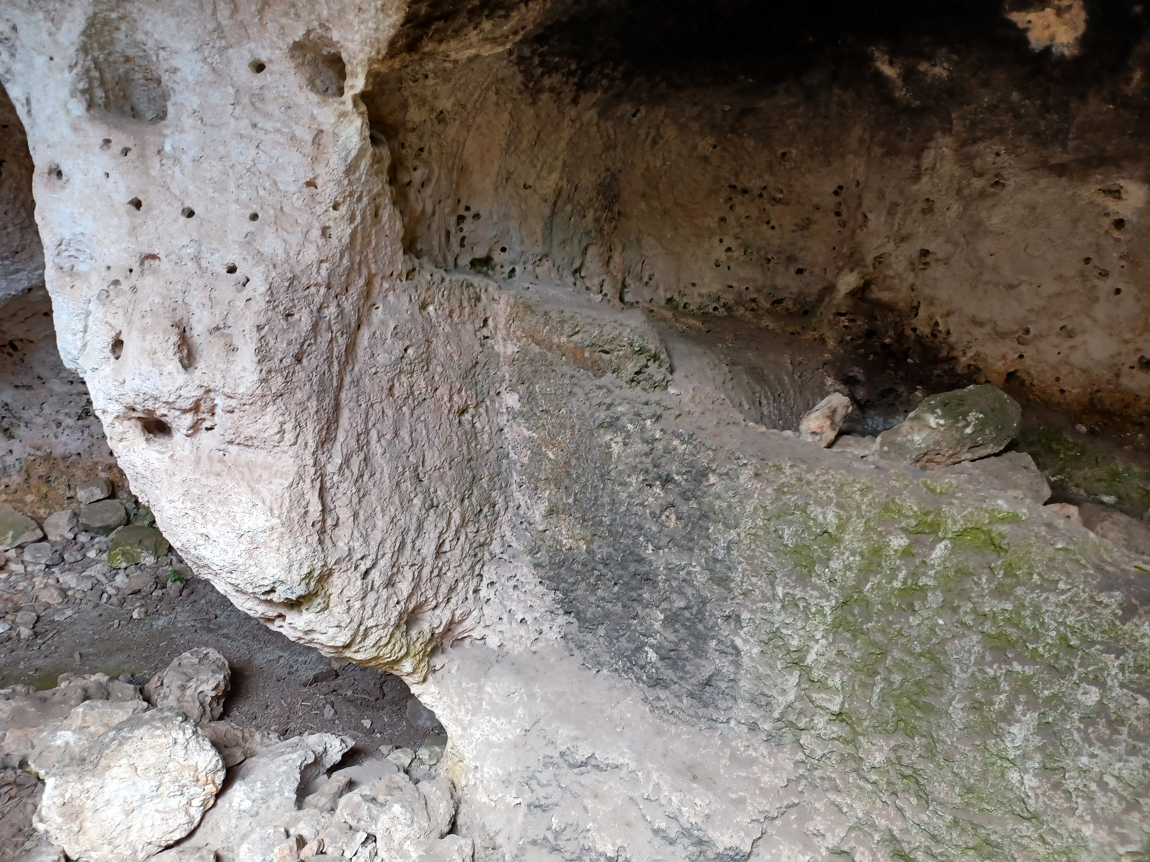
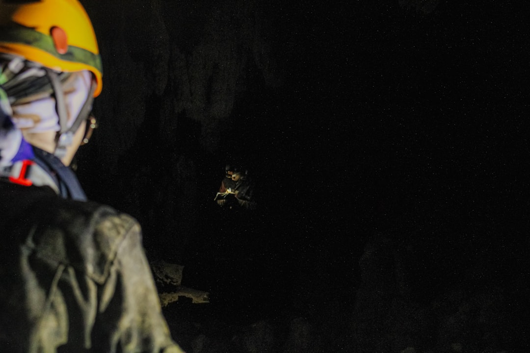
Start with what we can touch: scattered openings in sagebrush flats, limestone sinkholes that breathe in winter, and lava tubes that march like black arteries beneath the West. In dry seasons, cavers find cool drafts flowing from basalt cracks, as if the earth were quietly exhaling. In Kentucky’s karst, a stream might vanish mid-valley, then reappear miles away as if it commuted through another world. On a summer field trip in my early career, I felt that same ghostly airflow on my wrist and realized the hill beneath us wasn’t solid at all.
These clues aren’t proof of a continent-spanning tunnel, but they do map a hidden reality: the subsurface is more connected than our surface roads suggest. A shallow cave can link to deeper passage through joints and bedding planes, while lava tubes fork and rejoin like a subway designed by heat. When locals talk about animals or cold air emerging from odd places, they’re sometimes pointing to genuine subterranean highways. And when ranchers report sinkholes swallowing fences, it’s another reminder that the roof of this buried world can be thin.
From Ancient Tools to Modern Science
Archaeologists approach the underground with ground-penetrating radar, magnetometry, and careful excavation, often revealing short, purposeful passages cut into soft rock or soil. These features tend to be practical: storage pits, ritual chambers, or defensive shelters clustered near settlements rather than long-distance corridors. Meanwhile, geologists map natural systems with dye tracing, lidar-derived sinkhole inventories, and 3D cave scans, translating rumors into measurable flow paths. Satellite-based elevation models can hint at collapsed tunnel segments the way a scar hints at an old wound.
That convergence of methods matters. When indigenous oral histories describe places of emergence or hidden refuges, researchers now pair those accounts with survey data and hydrology. The result is a clearer sense of where natural voids likely intersect with cultural landscapes. Modern science doesn’t erase the mystery; it reframes it, showing how many different processes can produce similar-looking corridors.
Unraveling the Myths
Stories of a single colossal tunnel under North America tend to morph as they travel, borrowing details from real caves and old service tunnels. The appeal is obvious: a tidy narrative is more thrilling than a messy, multi-source reality. But when investigators retrace these claims, they usually find braided histories – lava tubes in one region, mining galleries in another, and dry conduits in karst tying them together only in imagination. The truth is broader and, frankly, more interesting than any one legend.
That doesn’t mean the rumors are useless; they can be starting points. A tale about a secret passage beneath a border town might lead to a collapsed cellar that once linked basements for commerce or smuggling. A story about hand-hewn corridors under a mesa might reveal short tunnels used for storage or ceremonies beside natural fissures. The myths endure because they carry a grain of reality wrapped in narrative sugar.
Natural Architects Underground
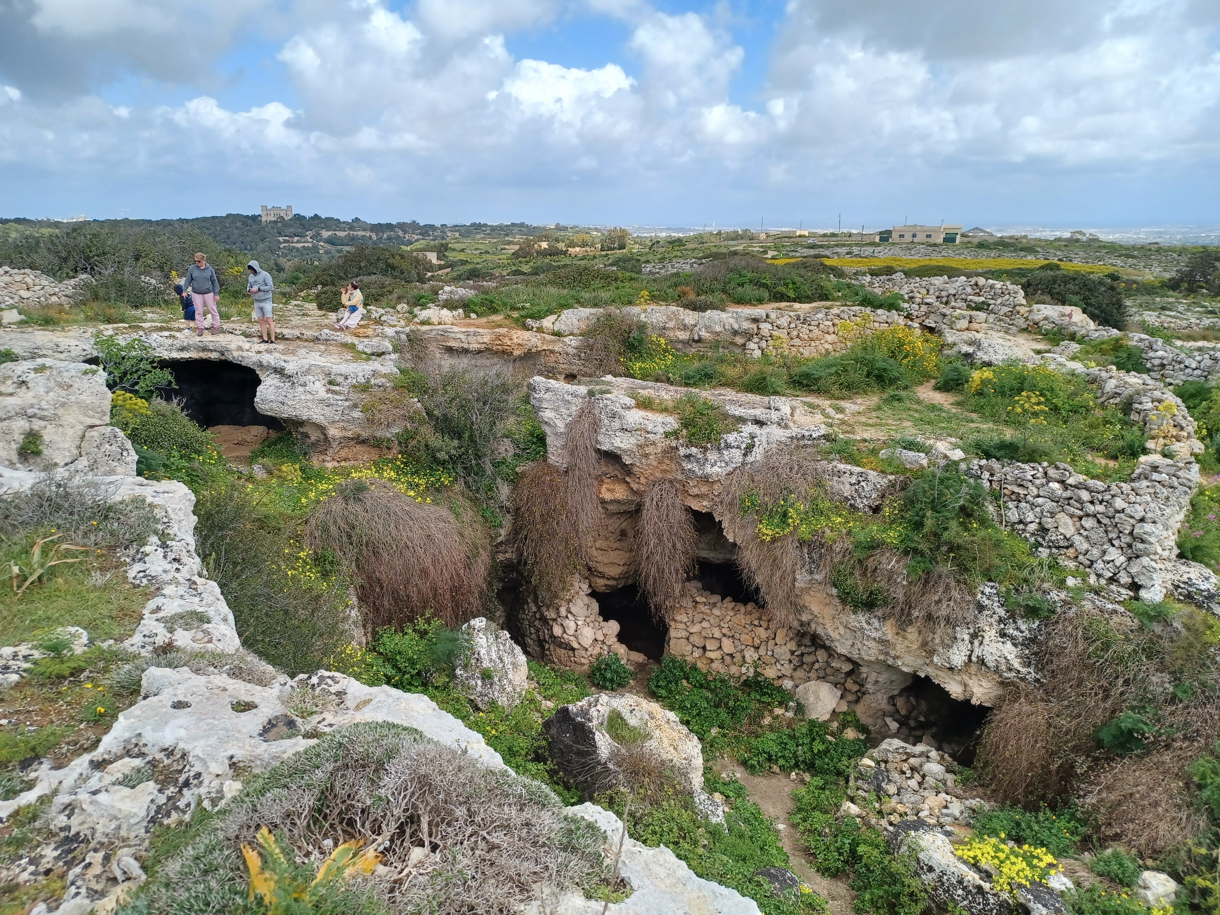
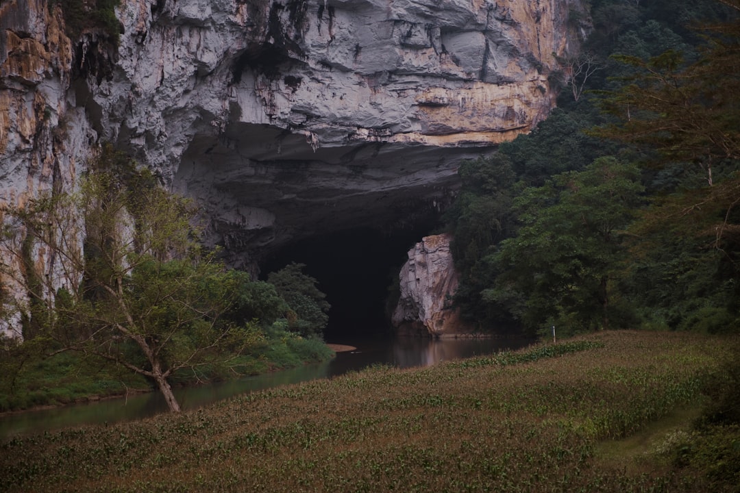
America’s hidden routes begin with geology. Karst landscapes dissolve like sugar cubes in coffee, leaving chambers and sinuous water-carved conduits. Basaltic terrains host lava tubes formed when the crust of a flow hardens and molten rock drains away, leaving clean boots-on-the-ground passage. In alpine or formerly glaciated regions, meltwater once tunneled through ice and sediment, sculpting conduits that later became dry or seasonally active.
These systems braid and stack. A lava tube can intersect a fault-fractured limestone shelf; a karst stream can undercut old mining stopes; a talus cave can plug into a jointed sandstone seam. Each piece is “local,” but the cumulative effect can feel continental when you follow airflow, water chemistry, and animal movement across distances. Nature is the master engineer here, and time is the only contractor patient enough to finish the job.
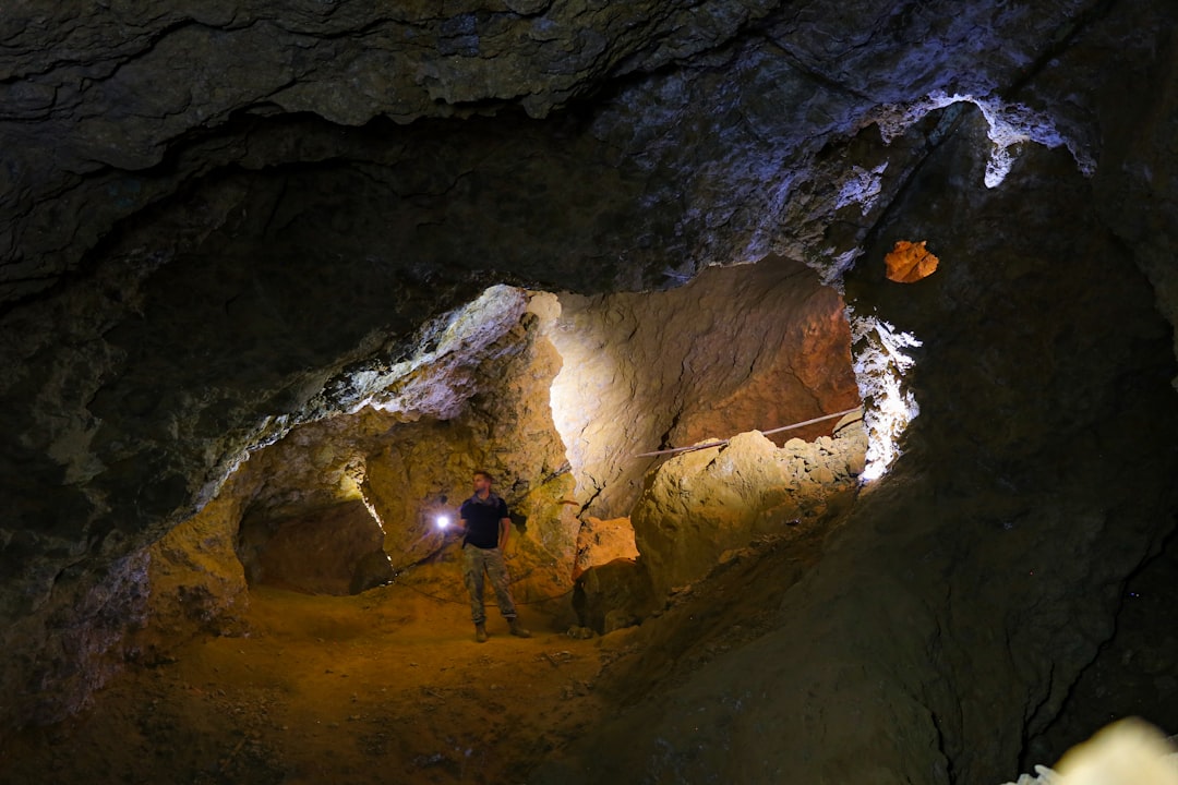
The Human Footprint, Old and New
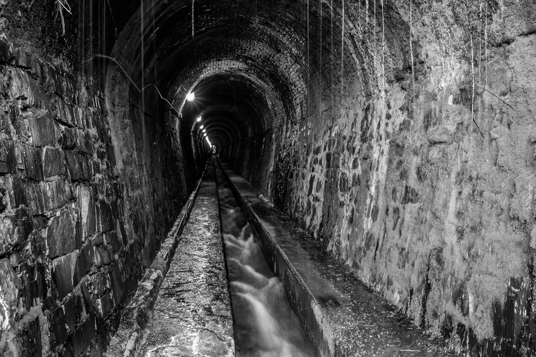
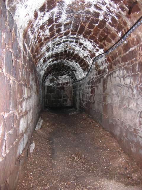
Human-made passages add their own layers: Indigenous storage chambers, colonial cellars, Civil War-era mines, railroad tunnels, Prohibition hideaways, Cold War infrastructure, and modern utility corridors. In city cores, entire blocks can sit atop quilted basements and retired service tunnels that now function like accidental caves. Along the coasts and borderlands, short illicit passages appear and disappear with law enforcement pressure and shifting soils. The archaeological challenge is sorting durable, intentional works from temporary or repurposed spaces.
Consider a few recurring patterns that muddy the map:
– Older mining districts often contain miles of adits and stopes, many undocumented by modern standards.
– Urban redevelopment routinely redistributes voids, sealing some while leaving others semi-connected through forgotten access points.
– Agricultural irrigation and storm drains can capture natural springs, quietly rerouting underground flow. These layers give rumors oxygen, because real connections do exist – just not in the singular, cinematic way many imagine.
Why It Matters
The stakes extend far beyond curiosity. Subsurface networks govern groundwater quality and speed, turning a small spill at one sinkhole into a basin-wide problem in short order. In drought-prone regions, understanding underground routes helps water managers protect springs that communities and wildlife depend on. Emergency planners need accurate void maps to anticipate sinkhole hazards, mine collapses, or gas migration beneath neighborhoods.
Scientifically, these networks are living laboratories. They preserve paleoclimate records in mineral layers, archive extinct fauna in protected pockets, and support microbes that metabolize rocks and gases in ways useful to biotechnology. Compared with traditional above-ground surveys, subsurface mapping reveals the hidden half of landscape evolution. When we ignore these corridors, we’re reading only the surface notes of a much deeper score.
The Future Landscape
New tools are reshaping the hunt. Drone-sized robots and rope-free climbing devices can scout dangerous passages, while compact spectrometers sniff out subtle changes in air chemistry that betray hidden openings. Satellite interferometry measures millimeter-scale ground motion to flag collapsing voids, and machine learning stitches disparate datasets into probabilistic maps of where tunnels are most likely. Low-frequency geophysics can now image deeper than many older surveys without trenching.
But challenges remain. Access is ethically complex around sacred sites and privately owned land; safety is unforgiving; and data standards vary between agencies and volunteer cavers. Climate extremes also stress underground systems by swinging water levels harder and faster than in the past. If we get the governance and technology right, North America could soon have an integrated subsurface atlas that makes today’s rumors either evaporate – or crystallize into evidence.
Global Perspectives
While America’s underground patchwork feels unique, it fits a global pattern: landscapes with karst, basalt, or heavy mining inherit labyrinths. Iceland’s tidy lava tubes, Europe’s sprawling karst caves, and Asia’s ancient quarry tunnels all show how different geologies produce similar forms. What varies most is how societies record, regulate, and respect them. Countries with long cave traditions often maintain national inventories and strict access protocols, which reduce accidents and preserve science value.
North America is catching up through state cave surveys, tribal heritage programs, and university partnerships. The most promising advances come when local knowledge, Indigenous stewardship, and technical mapping align. That model emphasizes listening first and measuring second, so discoveries serve communities as well as curiosity. It’s slower, but it builds trust – and better maps.
What You Can Do
If this underground world pulls at your imagination, there are safe, practical ways to help. Support local cave conservancies and land trusts that protect entrances and recharge zones, because clean water starts where it sinks. If you live in karst country, maintain septic systems, minimize chemical use outdoors, and report new sinkholes to your county or state survey. In cities, back redevelopment projects that catalog and stabilize old tunnels rather than bury them in paperwork.
For the adventurous, join a reputable caving club to learn safety, conservation ethics, and survey methods before stepping underground. Respect closures designed to protect bat colonies and cultural sites, and never enter off-limits areas or suspected illicit tunnels. Share family stories about old cellars, springs, and mine openings with local historians – they’re often the breadcrumbs that lead to real discoveries. The mystery doesn’t need embellishment; it needs careful eyes and steady hands. What might be waiting beneath your feet?

Suhail Ahmed is a passionate digital professional and nature enthusiast with over 8 years of experience in content strategy, SEO, web development, and digital operations. Alongside his freelance journey, Suhail actively contributes to nature and wildlife platforms like Discover Wildlife, where he channels his curiosity for the planet into engaging, educational storytelling.
With a strong background in managing digital ecosystems — from ecommerce stores and WordPress websites to social media and automation — Suhail merges technical precision with creative insight. His content reflects a rare balance: SEO-friendly yet deeply human, data-informed yet emotionally resonant.
Driven by a love for discovery and storytelling, Suhail believes in using digital platforms to amplify causes that matter — especially those protecting Earth’s biodiversity and inspiring sustainable living. Whether he’s managing online projects or crafting wildlife content, his goal remains the same: to inform, inspire, and leave a positive digital footprint.