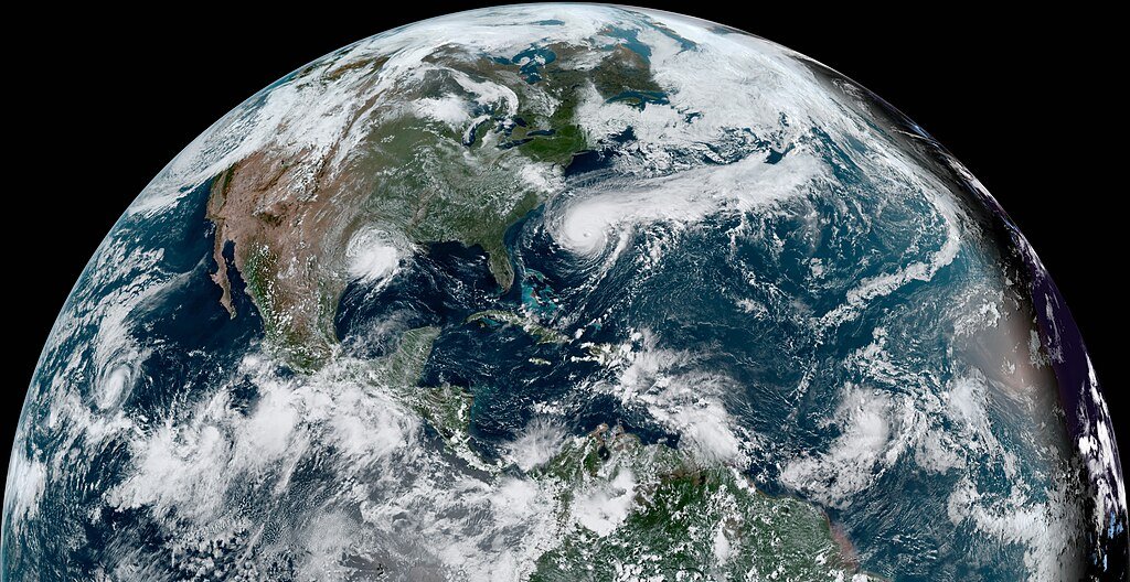
The 2025 Atlantic hurricane season proved to be a gauntlet of storms for the U.S. East Coast—one that left meteorologists uneasy, coastal communities on edge, and scientists scrambling to understand the shifting rules of the storm game. Though not all made landfall, the atmospheric slugs that clawed at the Eastern Seaboard inflicted damage through waves, flooding, erosion, and psychological threat. Below, we chronicle the five worst hurricanes that tested the East Coast’s resilience, dig into the science behind their ferocity, and peer ahead to a future where such storms may no longer be “exceptional.”
A Reckoning Begins: Erin’s Atlantic Fury

Hurricane Erin was the season’s first major proving ground. Developing as a Cape Verde–type hurricane, Erin underwent explosive intensification, cresting before arching parallel to the U.S. coast. While Erin never struck land directly, its offshore path still inflicted havoc: lifeguards rescued dozens from treacherous rip currents, storm surges lapped at piers, and beaches from the Carolinas to New England closed under threat of life-threatening waves. In sheer size, Erin rivaled Sandy in footprint—its winds extended some 230 miles from the eye, rendering it one of the largest storms ever tracked in the Atlantic. For many coastal residents, Erin was a terrifying reminder: you don’t have to have landfall to suffer.
Gabrielle’s Swells: A Distant Threat That Hit Home

A few weeks after Erin, Hurricane Gabrielle formed in the central Atlantic and rapidly intensified. Although Gabrielle remained mostly offshore, it sent powerful swells westward that battered beaches and stirred high surf along the Eastern Seaboard. In places like Long Island and Cape Cod, the shoreline experienced elevated wave action that eroded dunes and damaged breakwaters. Local officials issued warnings for beachgoers to stay clear. The curious paradox here: a storm thousands of miles offshore could still force evacuations, road closures, and lost beachfront property—proof that impact lines on maps don’t always tell the full story.
Imelda’s Push: A Storm of Rain and Rip Currents

Hurricane Imelda formed in the Bahamas and carved a path northward—growth aided by warm sea-surface temperatures and moderate shear. It reached hurricane strength before veering away from a direct landfall, though not before sending torrents of rain into the Carolinas and generating dangerous coastal flooding.Rainfall projections of 2 to 4 inches (with local maxima of 6 inches) threatened flash flooding inland, while inundated roads and saturated soils added to the chaos. Axios Off the shore, Imelda’s strong wind field and interaction with nearby Hurricane Humberto created enormous swells and rip currents that imperiled swimmers for days. In a rare meteorological dance known as the Fujiwhara effect, Imelda and Humberto spun around each other—forcing delicate shifts in trajectory that kept the East Coast guessing.
Humberto’s Shadow: Torqued and Transformed

Humberto arrived as a formidable presence, reaching intensity at peak. Its initial trajectory threatened the southeastern U.S., but a mid-latitude trough tugged Humberto northeastward, causing it to transition into a potent extratropical cyclone. Yet even in this state shift, Humberto’s legacy lingered: six homes along the Outer Banks of North Carolina collapsed into the ocean under wave assault and erosion pressure. Axios+1 In Florida, a drowning was reported in part due to persistent, storm-driven surf and rip currents linked to Humberto’s outer wave field. Through its life cycle, Humberto exemplified the dynamic complexity of these systems—their capacity to shift form, path, and danger zone unpredictably.
Erin Revisited: Lingering Surge and Coastal Fatigue

Though Erin has already taken its place in the season’s reckoning, its aftershocks persisted. Beaches that had lost dunes during Erin’s onslaught remained vulnerable. In many places, subsequent tides surged higher than expected because sediment buffers had been stripped. Coastal managers note that the storm laid bare the fragility of “soft” infrastructure—sand dunes, waterfront boardwalks, jetties, and barrier islands. Locals speak now in terms of coastal fatigue, the slow erosion and stress of one storm weakening defenses before the next arrives. In the season’s later weeks, that fatigue meant that even moderate storms and high tides caused outsized damage in areas already battered by Erin.
Why It Matters: Storms as Signals, Not Anomalies

This line of five storms is more than a catalog of catastrophe; it marks a turning point in how scientists and policymakers view hurricane risk. In a climate-warmed world, hurricanes are more likely to:
- Intensify faster (rapid intensification events are more common)
- Maintain or expand their wind fields
- Produce heavier rainfall in shorter periods
- Remain potent farther offshore while still inflicting damage
The traditional coastal defense paradigm—seawalls, levees, zoning based on historical records—is being challenged. These storms stress-test our models, revealing gaps in forecasting for storm surge and rainfall coupling. They also serve as signals: climate change is altering baseline conditions, and scientists must adapt faster. Compared to past eras, the 2025 storms underscore that even “near-miss” tracks no longer guarantee safety.
The Future Landscape: Forecasting, Resiliency, and Global Patterns

Looking ahead, researchers are pushing toward next-generation forecasting tools. High-resolution coupling of ocean-atmosphere models, machine learning–aided intensity forecasts, and drone/swarm-based in situ observations are all being trialed. But they face hurdles: computing power limits, data sparsity over the ocean, and unpredictability of storm–jet stream interactions (as seen in Humberto’s transformation). Globally, analog storms may shift westward in latitude or connect with mid-latitude systems more often, altering patterns of risk. Regions like the U.S. East Coast could see an increase not only in storm frequency but also in the class of “offshore impact” hurricanes—storms that never technically make landfall yet impose devastating secondary effects. The 2025 season may well be a harbinger of what’s to come.
Conclusion: From Citizen to Coastal Advocate

You don’t have to be a meteorologist to engage meaningfully. Here are accessible ways to help strengthen resilience:
- Support local coastal-restoration projects — dune planting, marsh buffers, and living shorelines absorb storm energy more flexibly than rigid walls.
- Donate to science agencies and community preparedness funds — accuracy and readiness depend on resources.
- Stay informed and prepared — follow National Hurricane Center alerts, heed evacuation orders, and understand your local flood maps.
- Engage legislators on climate policy — advocate for emissions reduction, coastal resilience funding, and infrastructure designed for future bound outcomes.
- Participate in citizen science — volunteer for storm-surge measurement networks or community flood-monitor programs.
As storms like Erin, Gabrielle, Imelda, and Humberto remind us, resilience is not passive. It’s a collective, anticipatory act.

Suhail Ahmed is a passionate digital professional and nature enthusiast with over 8 years of experience in content strategy, SEO, web development, and digital operations. Alongside his freelance journey, Suhail actively contributes to nature and wildlife platforms like Discover Wildlife, where he channels his curiosity for the planet into engaging, educational storytelling.
With a strong background in managing digital ecosystems — from ecommerce stores and WordPress websites to social media and automation — Suhail merges technical precision with creative insight. His content reflects a rare balance: SEO-friendly yet deeply human, data-informed yet emotionally resonant.
Driven by a love for discovery and storytelling, Suhail believes in using digital platforms to amplify causes that matter — especially those protecting Earth’s biodiversity and inspiring sustainable living. Whether he’s managing online projects or crafting wildlife content, his goal remains the same: to inform, inspire, and leave a positive digital footprint.