
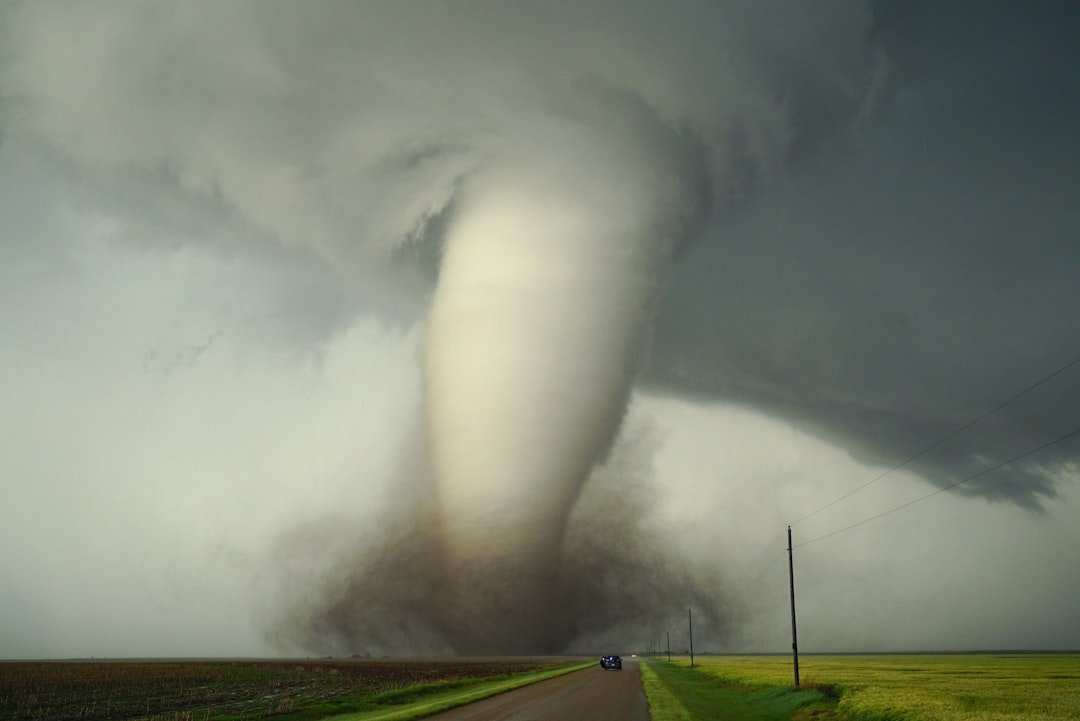
Tornado Watch Lifted Amid Fading Immediate Threat (Image Credits: Unsplash)
North Texas – The Tornado Watch that blanketed much of the region Friday was canceled early in the evening, but forecasters warned of persistent storm threats including heavy rain, flooding, high winds, large hail, and isolated tornadoes heading into the weekend.[1]
Tornado Watch Lifted Amid Fading Immediate Threat
The National Weather Service issued the Tornado Watch around 2:45 p.m. Friday for counties including Dallas, Tarrant, Denton, Collin, and others north and east of the Metroplex.[1] It covered areas from Parker County to Red River County and remained in effect until 10 p.m. before officials canceled it prematurely around 6:30 p.m.[1] Meteorologists noted that while severe potential diminished, scattered storms continued to pose risks.
Highest concerns Friday centered north of Dallas-Fort Worth, particularly near Sherman, where hail up to two inches and damaging wind gusts up to 75 mph threatened.[1] The overall tornado probability stayed low, yet residents monitored updates closely as cells developed late afternoon.
Friday Storms Usher in Active Pattern
Storms fired up Friday afternoon as a cold front approached, delivering the first wave of this multi-day event.[2] Heavy downpours led to initial flooding reports, with wind gusts and hail reports trickling in across North Texas.
The primary activity window spanned 3 p.m. to 10 p.m., though isolated cells lingered overnight.[1] FOX 4 forecasters emphasized preparation despite the marginal severe risk, urging umbrellas at the ready for the stretch ahead.[2]
Saturday Brings Heightened Flood and Hail Concerns
Today, Saturday, March 7, showers and thunderstorms spread eastward with a stalled front fueling repeated rounds.[3] Large hail emerges as the top severe hazard, alongside heavy rain capable of sparking flash flooding.
Expected rainfall totals range from one to three inches regionwide, with isolated spots south of Dallas possibly seeing four to five inches.[1] Highs hover near 67 to 70 degrees Fahrenheit under overcast skies, cooler than recent days.[4] Central Texas holds the greatest severe odds, but North Texans should brace similarly.
Extended Outlook Signals Ongoing Vigilance
Rain chances persist Sunday before an upper-level system prolongs unsettled conditions into next week.[1] Strong to severe storms could rebound Tuesday and Wednesday, maintaining threats of hail, winds, and heavy precipitation.
Temperatures stabilize in the 70s and 80s amid daily shower risks through mid-week, with drier air arriving later.[3] Daylight saving time begins early Sunday, requiring clock adjustments at 2 a.m.[1]
Key Takeaways
North Texas transitions from tornado worries to broader storm readiness, underscoring spring’s unpredictable fury. Stay informed via National Weather Service updates and local radars – what precautions are you taking this weekend? Tell us in the comments.