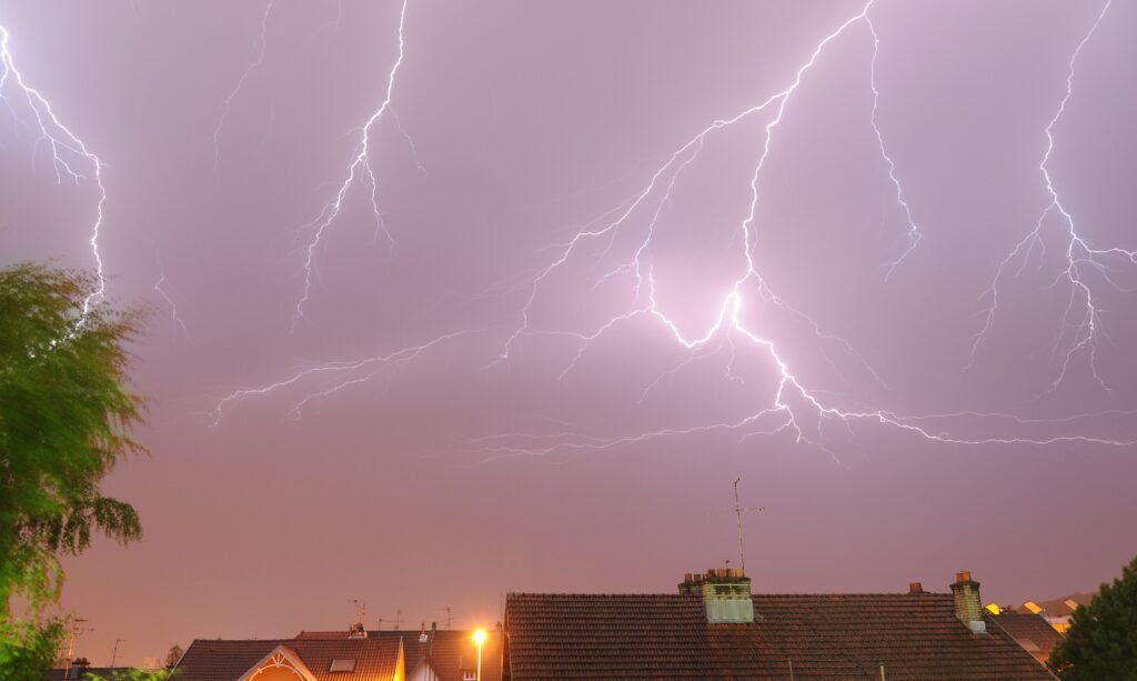

Hail Up to 2 Inches Possible Friday Evening (Image Credits: Upload.wikimedia.org)
Powerful thunderstorms will target North Texas starting Friday afternoon, packing heavy rain, large hail, damaging winds, and isolated tornado risks through the weekend.[1][2]
Hail Up to 2 Inches Possible Friday Evening
Forecasters highlighted the potential for golf ball-sized hail as storms intensify across the Dallas-Fort Worth area late Friday.[3] The National Weather Service in Fort Worth noted strong to severe thunderstorms developing mainly during the afternoon and evening hours.[2] Recent storms already delivered flash flooding and power outages earlier this week, setting the stage for renewed activity.[1]
Enhanced risks from the Storm Prediction Center cover much of North and Central Texas, with the highest threats concentrated near major metro areas.[4] Residents reported highway flooding from record rainfall on Thursday, underscoring the region’s vulnerability.[4] Conditions remain primed for rapid escalation as warm, moist air clashes with an incoming front.
Primary Dangers from the Incoming Storms
Severe weather outlooks pinpoint several core hazards for the multi-day event. Large hail leads the concerns, followed closely by gusts exceeding 75 mph.[3] A few tornadoes cannot be ruled out, particularly during the overnight hours Friday.[5]
- Heavy rainfall sparking flash floods in low-lying areas
- Hail diameters reaching 2 inches, capable of vehicle damage
- Damaging wind gusts up to 75 mph, downing trees and power lines
- Isolated tornadoes, with potential for strong rotation
- Localized power outages from storm impacts
These threats mirror patterns seen in recent North Texas outbreaks, where similar setups produced widespread disruptions.[6] Officials urged vigilance as activity pulses through Saturday.
Flooding Emerges as Weekend Wildcard
Saturday brings a shift toward heavier rainfall totals, heightening flash flood dangers across urban zones.[7] Forecasts call for showers and thunderstorms with accumulations that could overwhelm drainage systems still recovering from midweek deluges.[8] Highways and creeks near Dallas-Fort Worth face the greatest exposure.
Flash flood warnings lingered into early Thursday, a preview of persistent moisture through the weekend.[9] Cooler highs around 69 degrees Saturday will not deter the soggy pattern, with southwesterly winds fueling instability.[10] Motorists encountered stalled vehicles and submerged roads in prior events, prompting travel cautions.
Weekend Timeline at a Glance
| Day | High Temp | Main Threats |
|---|---|---|
| Friday | 80°F | Severe thunderstorms, large hail, winds, tornadoes |
| Saturday | 69°F | Heavy rain, thunderstorms, flash flooding |
| Sunday | 70°F | Scattered showers, lingering moisture |
The pattern eases slightly Sunday but maintains shower chances amid cloudy skies.[8] Multiple rounds define this outbreak, testing preparedness across the metroplex.[6]
- Monitor local alerts from the National Weather Service for real-time updates.
- Secure outdoor items and avoid flooded roads during peak threats.
- Expect disruptions to travel and power through at least Saturday night.
North Texas residents stand at the crossroads of a classic severe weather setup, where preparation spells the difference between minor inconvenience and major headache. Stay informed and safe – what precautions are you taking this weekend? Share in the comments below.