For generations, the names of lost cities like Atlantis, Thonis-Heracleion, and the fabled cities of the Amazon have hovered somewhere between legend and science. Now, an avalanche of new data is dragging these places out of myth and into the realm of measurable reality. Archaeologists armed with lasers, satellites, machine learning, and sediment cores are re-mapping the ancient world in startling detail. Entire urban networks are appearing under jungle canopies, beneath the seafloor, and even under modern cities. With every discovery, the story of how and why civilizations vanish is being rewritten – and it is turning out to be far stranger, more intricate, and more relevant to our own future than anyone expected.
The Hidden Clues Beneath Forests, Seas, and Cities
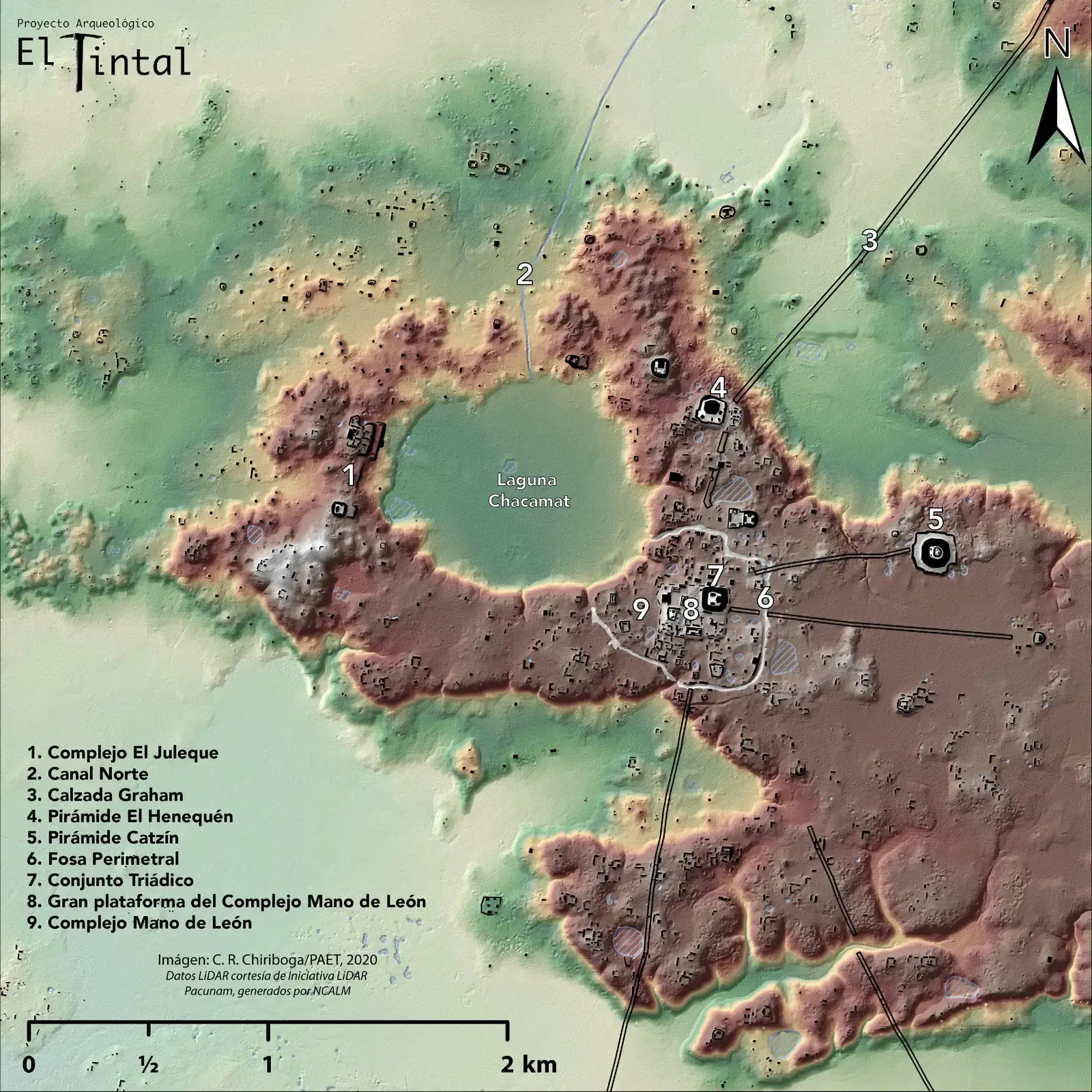
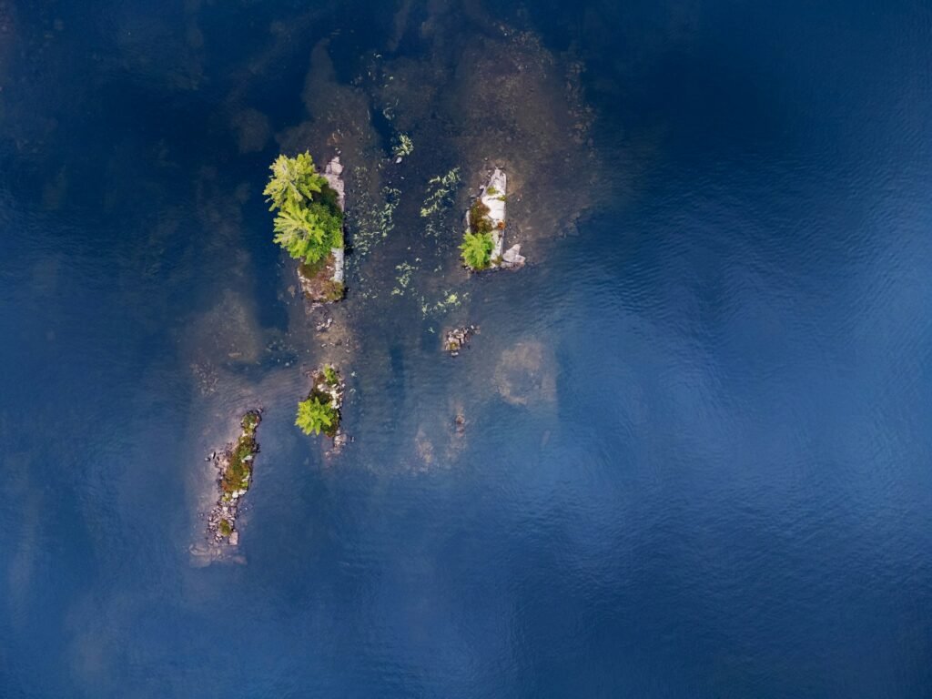
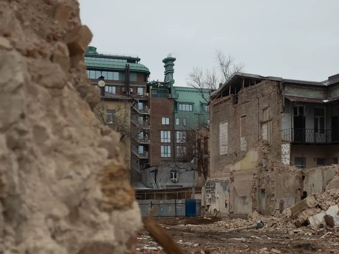
One of the most shocking realizations of the last decade is how many ancient cities still lie hidden in plain sight. In the Amazon, high-resolution satellite imagery and airborne laser scanning have revealed sprawling pre-Columbian settlements beneath what was long thought to be untouched rainforest. Similar technologies have mapped vast temple and city networks in Cambodia and Laos, showing that Angkor was part of an enormous low-density urban sprawl rather than a single isolated capital. Off the Egyptian coast, divers and marine archaeologists have pieced together the drowned port city of Thonis-Heracleion, once a bustling gateway to the Nile and now scattered across the seafloor in silt and broken statues.
These discoveries are not happening by chance; they emerge from a kind of forensic reading of landscapes and seascapes. Slight changes in vegetation patterns, anomalous bumps in the topography, or disturbances in sediment layers become the breadcrumbs leading to buried streets and temples. In some cases, what looks like random forest or seafloor on a casual map transforms into gridded avenues, canals, and engineered mounds once seen through scientific instruments. It’s like watching invisible ink develop across the surface of the planet, slowly revealing a palimpsest of lost urban worlds beneath our feet.
From Ancient Tools to Modern Science
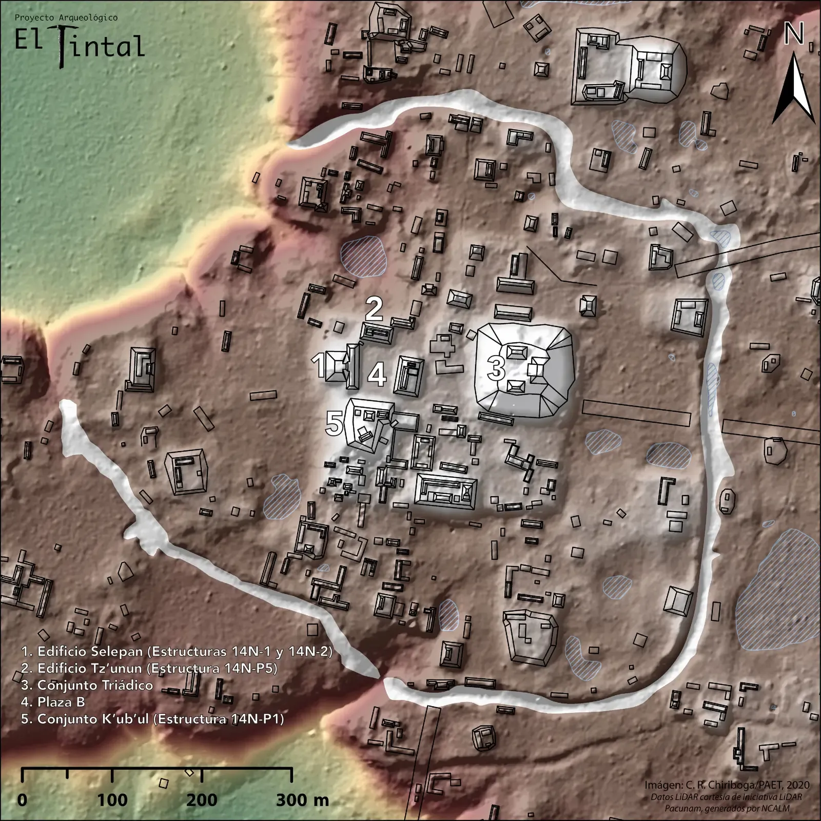
Earlier generations of explorers had to rely on chance finds, local folklore, and physically digging trial trenches – a process that could take years to produce a single major discovery. Today, airborne LiDAR (light detection and ranging) has become the workhorse of lost city research, firing laser pulses through forest canopies and measuring their reflections to build razor-sharp 3D models of the ground below. In Central America, LiDAR surveys have revealed massive Maya cities with road networks, defensive walls, and terraced agriculture that were completely invisible from the ground. Similar techniques have uncovered intricate earthworks and causeways in the Amazon Basin, challenging the long-held belief that the rainforest could not support large, complex societies.
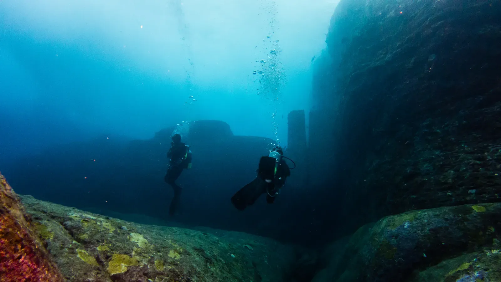
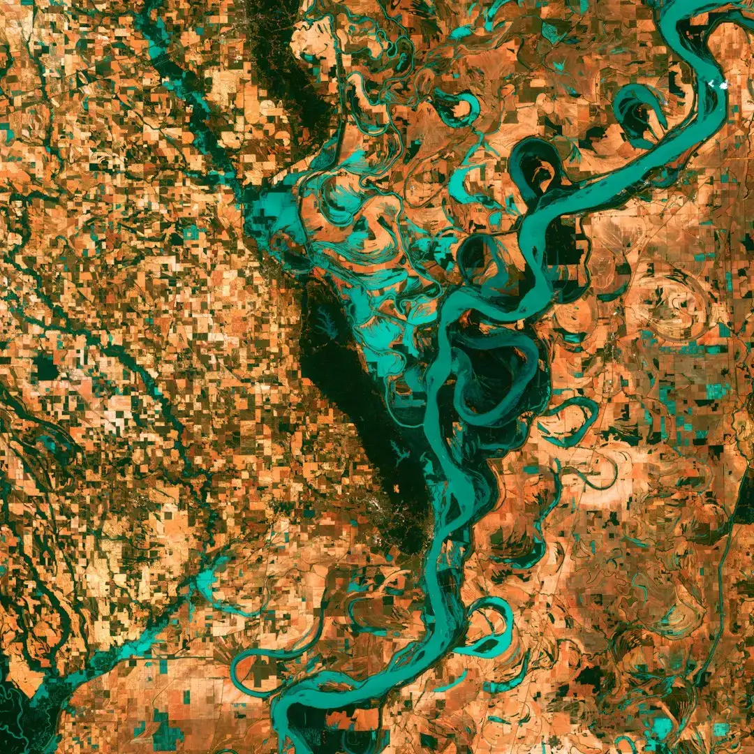
Underwater, sonar mapping and sub-bottom profiling have transformed marine archaeology. Multibeam sonar can create detailed seafloor maps around submerged harbors and rumored city sites, while sub-bottom profilers send acoustic waves into the sediments to detect buried structures. In coastal India, these methods have been used to explore possible submerged settlements near the ancient port city of Dwarka, while in the Mediterranean, they have traced the outlines of quays, streets, and warehouses drowned by land subsidence and sea-level rise. The shift from shovel and compass to lasers and sound waves has not replaced traditional excavation, but it has made it far more targeted and efficient, turning the hunt for lost cities into a data-driven enterprise.
Mysteries Reconsidered: Myths, Legends, and What the Evidence Shows
For centuries, some of the world’s most famous lost cities have existed as more story than science. Atlantis, the lost land described in ancient Greek texts, has sparked countless theories pointing to locations from the Mediterranean to the Atlantic. While no consensus “Atlantis” has been verified, the growing record of real drowned cities has made scholars more cautious about dismissing flood myths out of hand. Evidence of catastrophic coastal flooding and sudden sea-level jumps at the end of the last Ice Age suggests that dramatic drownings of settlements did occur, even if specific legendary accounts remain unproven. The line between exaggerated tale and distorted memory of real events is thinner than many once assumed.
In other cases, legends are turning out to be surprisingly accurate guides. In Cambodia, stories of hidden temples and vast forgotten complexes foreshadowed the LiDAR-based discovery of extensive urban landscapes around Angkor and in the Kulen Mountains. In the Andes, oral histories about ancient roads and terraced fields align with modern satellite mapping that reveals enormous engineered landscapes. The emerging pattern suggests that while myths often wrap history in symbolism and supernatural flourishes, they can still point to kernels of physical truth. Rather than discarding them, archaeologists increasingly treat traditional narratives as one more dataset to be tested against the physical record.
Reading the Ruins: Climate, Collapse, and Human Choices
Behind the romance of crumbling temples and sunken plazas lies a harder, more sobering story about how cities live and die. Many of the most mysterious abandoned cities share a common thread: they sit in regions that experienced major environmental shifts. Studies of sediment cores and stalagmites near former Maya cities, for example, show repeated droughts around key moments of political instability and population decline. At Angkor, evidence of extreme rainfall events and damage to its vast canal network suggests that climate volatility strained the city’s water management system, contributing to its fragmentation. These places did not simply vanish overnight; they unraveled over generations under the pressure of ecological stress and human decisions.
Yet climate is never the sole villain. In almost every case, political conflict, social inequality, and economic overreach are woven into the narrative of collapse. Archaeologists studying abandoned Amazonian settlements, for instance, are piecing together how land-use choices, soil management, and shifting trade routes may have made certain communities more or less resilient. The ruins become a kind of long-term experiment in how societies respond to shocks. Some adapted, downsized, or moved; others clung to unsustainable systems until they broke. These patterns resonate uncomfortably with modern debates about urban growth, resource extraction, and the limits of environmental buffering capacity.
Why It Matters: Lost Cities as Warnings and Blueprints
The renewed study of lost cities is not just about satisfying curiosity or solving historical puzzles; it directly informs how we think about our own urban future. When scientists reconstruct how ancient cities managed water, food, and waste over centuries, they are effectively analyzing long-term stress tests that modern cities have not yet fully lived through. The elaborate cisterns and reservoirs of desert cities, the causeways and raised fields of flood-prone regions, and the urban forests cultivated around some pre-Columbian settlements all offer clues to low-tech resilience strategies. They show that sophisticated environmental engineering does not always mean more concrete or more energy; sometimes it means aligning infrastructure more carefully with local ecosystems.
Comparing these ancient strategies with today’s approaches also highlights the costs of ignoring warning signs. In case after case, urban systems that pushed ecological boundaries without adequate buffers suffered severe, sometimes irreversible consequences. For modern coastal megacities facing sea-level rise, or expanding metropolises in drought-prone regions, the parallels with drowned ports and desiccated inland capitals are hard to miss. Lost cities effectively act as experiments that have already run their course, revealing what happens when societies misjudge environmental thresholds. Treating them as mere curiosities instead of as data-rich case studies would mean leaving some of the most relevant lessons of human history on the table.
Global Perspectives: A Planet-Wide Patchwork of Vanished Urban Worlds
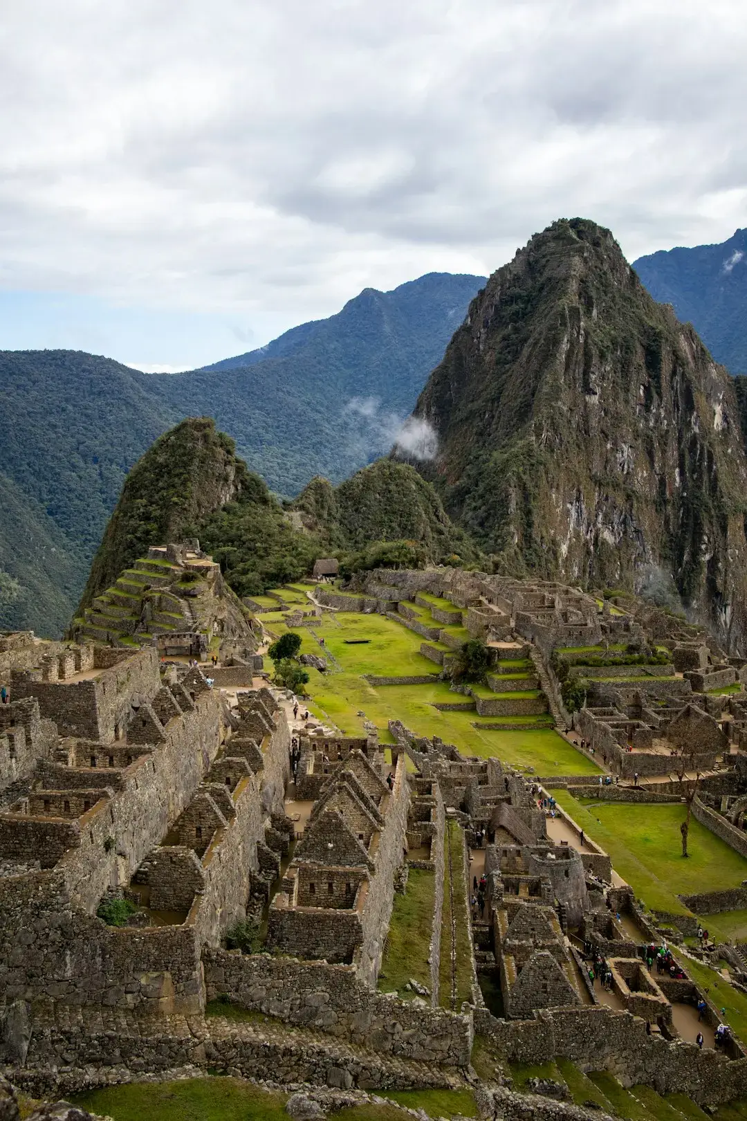
One striking outcome of recent research is how global the phenomenon of lost cities really is. From the submerged Bronze Age towns of the eastern Mediterranean, to the buried Indus settlements under modern Pakistani fields, to the forgotten earthwork complexes across the African Sahel, the pattern repeats: cities appear, flourish, transform, and sometimes disappear from view. In South America, lidar and mapping studies are revealing that the Amazon once held networks of towns connected by straight roads and surrounded by engineered soils. In Southeast Asia, low-density urban sprawl around Angkor and other centers suggests that what we think of as a distinctly modern urban form has deep ancient roots. The familiar picture of a few “cradles of civilization” is giving way to a far more diverse, decentralized story.
This global perspective helps undercut old assumptions that complex urban life depended on a handful of river valleys or imperial systems. It shows that large-scale planning, ecological engineering, and social organization emerged independently in multiple environments, from seasonally flooded forests to semi-arid plateaus. At the same time, it emphasizes that no region is immune to disappearance from the historical record. Some cities were literally buried by volcanic ash or river sediments; others were overbuilt by new towns and only survive as shards beneath streets and basements. When scientists compile this patchwork of cases, they begin to see recurring dynamics – feedback loops between environment, technology, and power – that play out again and again, even when the surface details change.
The Future Landscape: New Technologies and New Ethical Questions
The pace of discovery is unlikely to slow down any time soon. Advances in satellite constellations, hyperspectral imaging, and machine-learning pattern recognition are turning Earth’s surface into a continuously updated archaeological dataset. Algorithms trained to spot rectilinear patterns, soil disturbances, or unusual vegetation signatures can flag potential ancient settlements across vast regions faster than any human team. Underwater, autonomous vehicles equipped with improved sonar and cameras are expanding the searchable seafloor, including at depths that divers cannot safely reach. These tools are already revealing more lost structures than archaeologists can feasibly excavate, creating a new bottleneck: interpretation and preservation rather than raw discovery.
This technological leap also raises hard questions about who controls access to heritage and how it is used. The same satellite imagery that helps scientists find buried cities can be exploited by looters or developers if locations are made public too quickly. Indigenous and local communities, whose histories are often entangled with these sites, are increasingly demanding a say in how research is conducted and what stories get told. There are also debates about whether every discovered city should be physically excavated, or whether some are better preserved in situ, documented digitally rather than exposed to erosion and tourism. As our ability to find lost cities grows, so does our responsibility to decide what to do with them, and who gets to participate in that decision.
How Readers Can Engage With the New Archaeology of Lost Cities
While lidar surveys and deep-sea robots may feel remote from everyday life, there are surprisingly direct ways for the public to be part of this unfolding story. Many research teams now rely on open-access satellite imagery platforms where volunteer “citizen scientists” help flag potential features for follow-up analysis. Museum and university projects often invite the public to online talks or exhibitions that unpack the science behind recent discoveries, moving beyond the usual sensational headlines. Supporting organizations that work with local and Indigenous communities to document and protect archaeological sites helps ensure that new finds do not come at the cost of living cultures. Even small actions – choosing responsible tourism operators, avoiding the trade in antiquities, donating to heritage preservation groups – feed into the larger system that determines whether newly uncovered cities are respected or exploited.
On a more personal level, staying curious about how landscapes around you came to look the way they do can be its own form of engagement. The hillside that seems oddly terraced, the straight line of trees in a forest, the shallow rise in an otherwise flat field – all might hint at buried human histories. Reading about lost cities with an eye toward climate, resource use, and social choices turns them from distant curios into mirrors that reflect our own moment. Every time a hidden city comes into focus, it expands not just the map of the ancient world, but also the range of futures we can imagine for our own. The question is not only what else lies buried, but what we decide to learn from it.

Suhail Ahmed is a passionate digital professional and nature enthusiast with over 8 years of experience in content strategy, SEO, web development, and digital operations. Alongside his freelance journey, Suhail actively contributes to nature and wildlife platforms like Discover Wildlife, where he channels his curiosity for the planet into engaging, educational storytelling.
With a strong background in managing digital ecosystems — from ecommerce stores and WordPress websites to social media and automation — Suhail merges technical precision with creative insight. His content reflects a rare balance: SEO-friendly yet deeply human, data-informed yet emotionally resonant.
Driven by a love for discovery and storytelling, Suhail believes in using digital platforms to amplify causes that matter — especially those protecting Earth’s biodiversity and inspiring sustainable living. Whether he’s managing online projects or crafting wildlife content, his goal remains the same: to inform, inspire, and leave a positive digital footprint.