You’ve probably never questioned how many continents exist on Earth. Seven has been the standard answer for decades. Yet beneath the waves of the Pacific Ocean, something remarkable has remained hidden from view for millions of years. Scientists have finally pieced together evidence of what they’re calling an eighth continent, and it’s roughly the size of Australia. Most of it lies submerged under water, which explains why it took so long to recognize. This discovery challenges everything you thought you knew about the planet’s geography and opens up fascinating questions about what else might be lurking beneath the seas.
The Moment Geologists Realized Something Was Missing
Deep ocean basins off the coast of Australia held crucial clues that a landmass had broken away roughly 155 million years ago. Geologists had long suspected something didn’t add up when they examined the Argo Abyssal Plain. The geology of this underwater region hinted at a continental separation event, yet no one could definitively locate where that lost land had ended up. The breakup between Australia and what scientists would come to call Argoland occurred around 155 million years ago, and it took until now for researchers to actually locate where Argoland had drifted.
Imagine trying to solve a jigsaw puzzle when most of the pieces are hidden under a blanket. That’s essentially what researchers faced. They knew a continent had to exist based on tectonic evidence, but locating its remains proved nearly impossible for decades. Even though other land masses tied to the ancient supercontinent Gondwana had proven easier to locate, Argoland seemed to have disappeared entirely.
Where The Lost Land Actually Ended Up
According to research published in the journal Gondwana Research, the team believes they’ve located Argoland in Southeast Asia. Here’s where it gets interesting: the continent didn’t stay intact during its journey. The team eventually realized that Argoland was probably never one single land mass to begin with, but was likely originally an “argopelago” of microcontinental fragments separated by older oceanic basins.
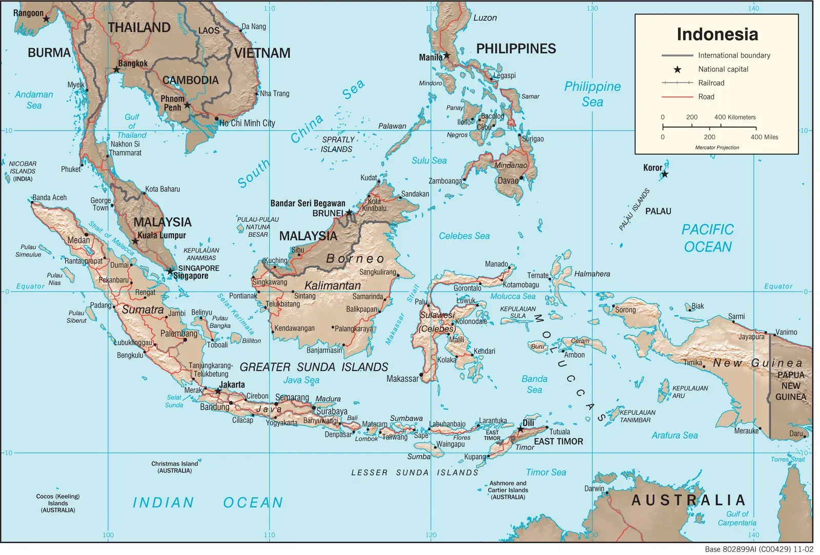
Parts of the continent, which once extended over 3,000 miles, were hidden beneath the green jungles of large parts of Indonesia and Myanmar. Think about that for a moment. An entire continent fragmented and scattered itself across Southeast Asia, disguised beneath tropical forests and ocean water. Tectonic forces stretched and fissured Argoland prior to the landmass breaking off, creating small oceans dating to roughly 200 million years ago. The continent essentially shattered before it even fully separated from Australia.
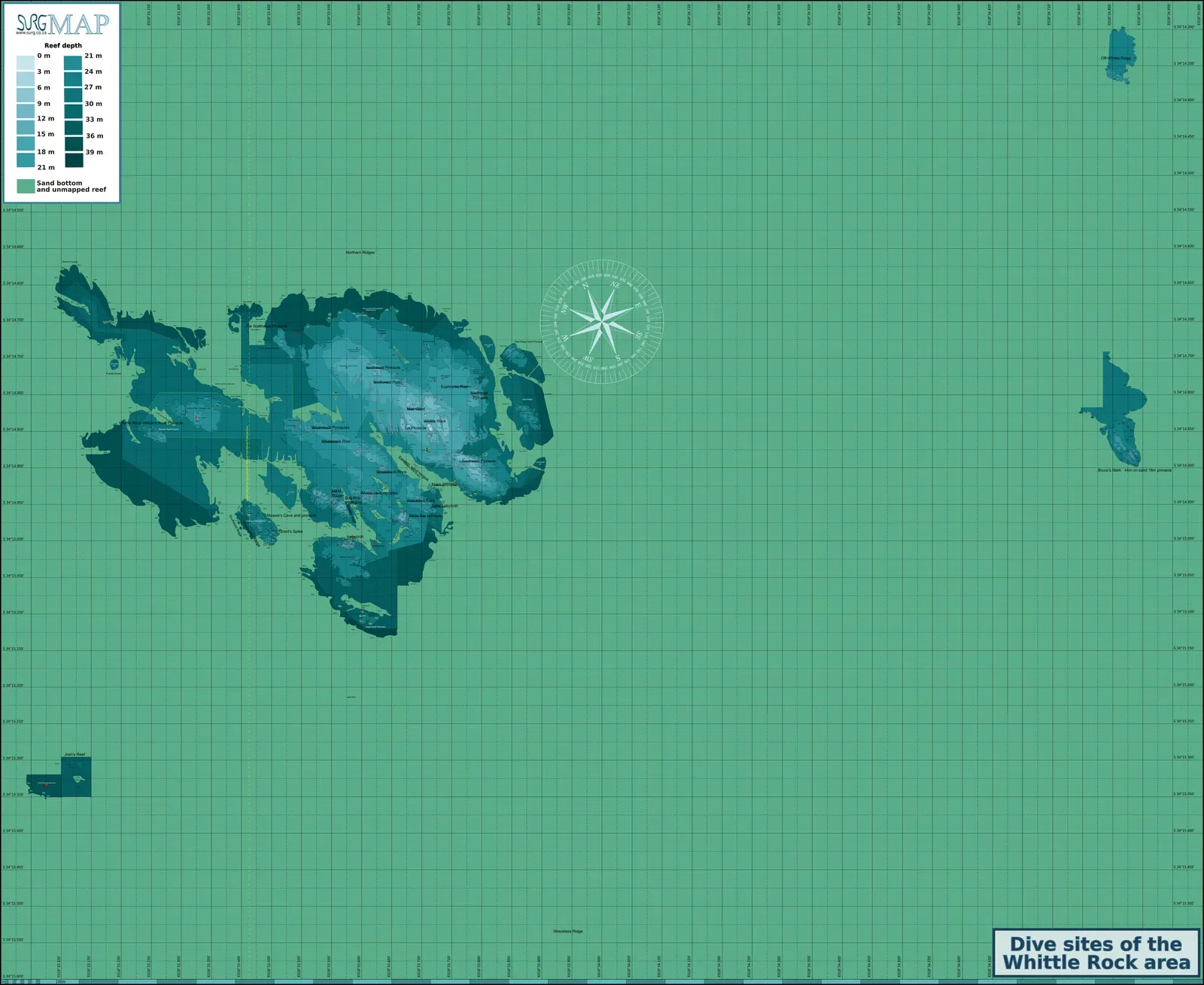
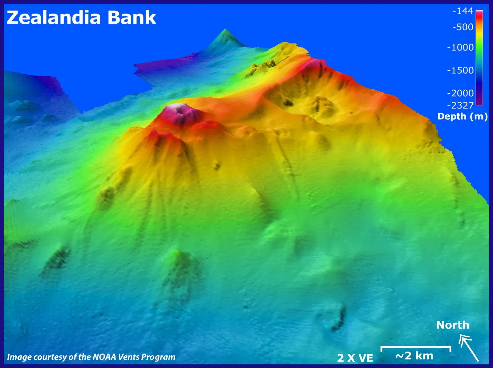
Zealandia: The Other Submerged Continent Making Headlines
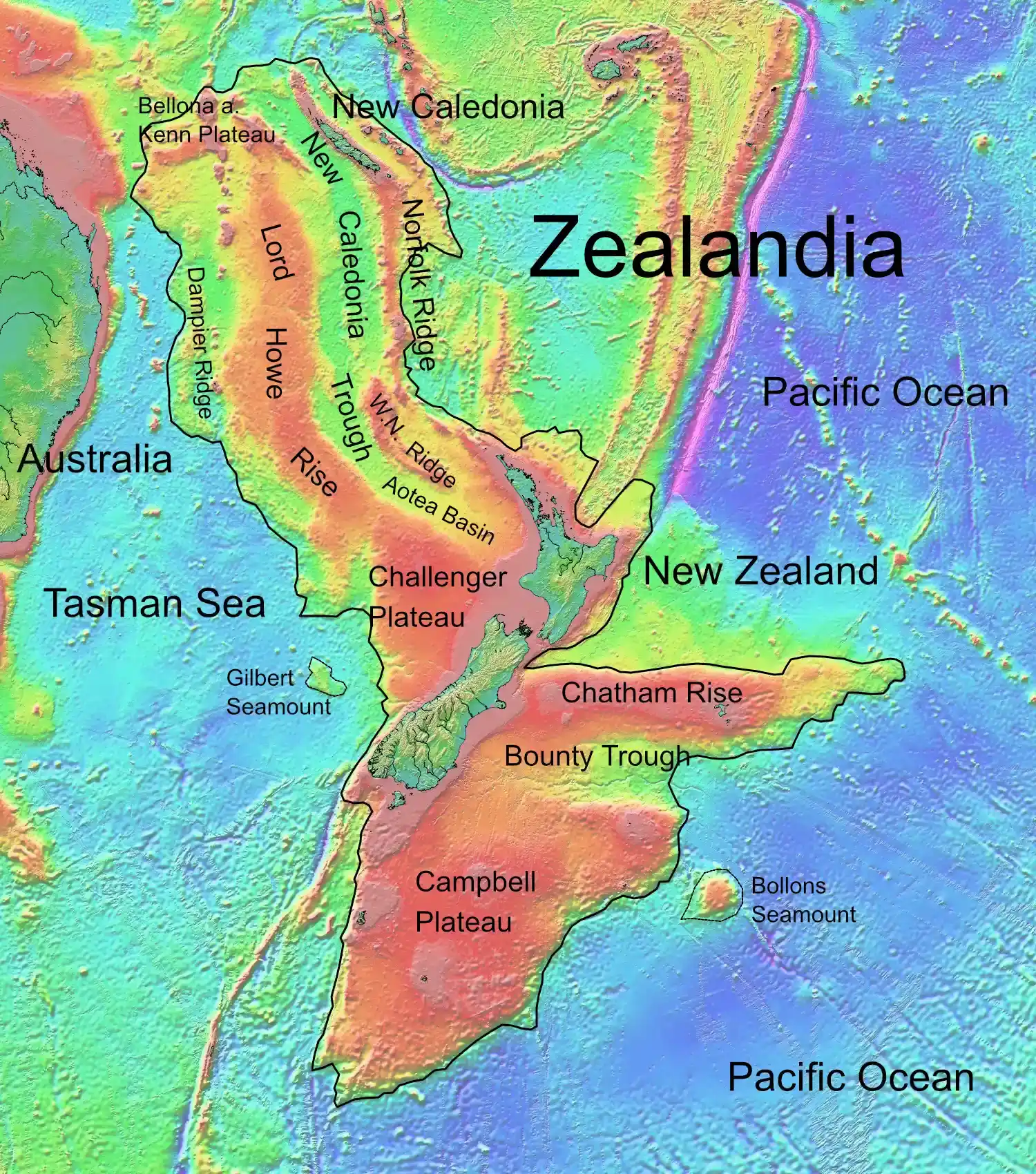
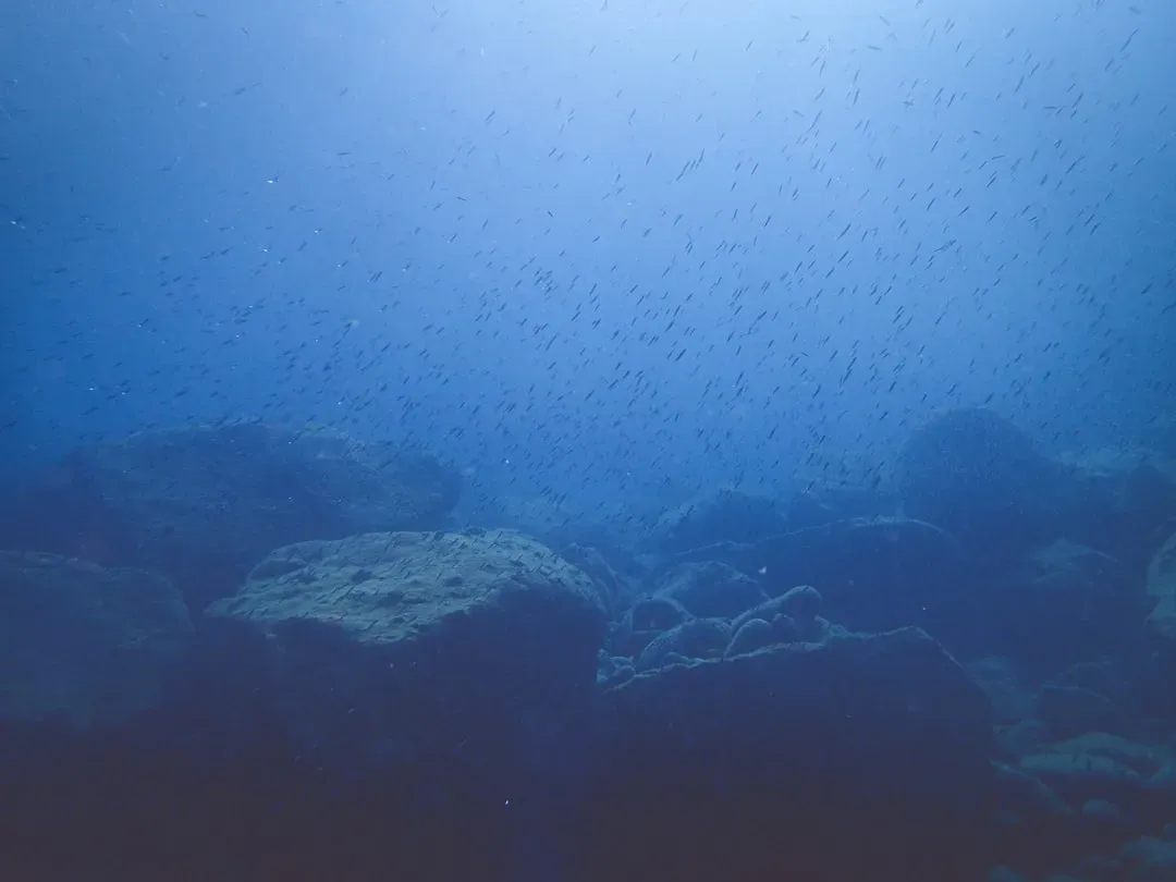
While Argoland captures attention for its fragmented journey, there’s another submerged continent that’s been generating even more buzz. In 2017, a team of eleven geologists from New Zealand, New Caledonia, and Australia concluded that Zealandia fulfills all the requirements to be considered a submerged continent, and this verdict was widely covered in the news media. About 94% of the area of Zealandia currently is submerged, which explains why it remained overlooked for centuries.
A region covering 4.9 million square kilometers of the southwest Pacific Ocean is made up of continental crust, has elevated bathymetry relative to surrounding oceanic crust, diverse and silica-rich rocks, and relatively thick and low-velocity crustal structure, supporting its definition as a continent. What you’re looking at when you see New Zealand isn’t just an island nation. It’s actually the visible tip of a massive continental landmass. Researchers have finished mapping out the northern two-thirds of Zealandia, wrapping up the documentation of the nearly two million square miles of the submerged land mass.
How Continental Crust Differs From Ocean Floor
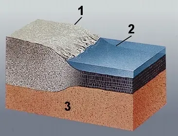
You might wonder what makes these submerged regions actual continents rather than just elevated sections of ocean floor. The distinction comes down to geology. Rocks of the modern oceanic crust typically comprise basalt and gabbro of Jurassic to Holocene age, while continents have diverse assemblages of igneous, metamorphic, and sedimentary rocks such as granite, rhyolite, limestone, quartzite, greywacke, schist, and gneiss.
The ridges of Zealandia are continental rock, but are lower in elevation than normal continents because their crust is thinner than usual, approximately 20 kilometers thick. This thinness explains why Zealandia sits mostly underwater. Continental crust typically measures between 30 and 45 kilometers thick, so Zealandia’s relatively thin crust doesn’t float as high on Earth’s mantle. The continent is 94% submerged, mainly as a result of widespread Late Cretaceous crustal thinning preceding supercontinent breakup and consequent isostatic balance. The land literally stretched and thinned until it could no longer support itself above sea level.
Ancient Supercontinents And The Breakup That Changed Everything
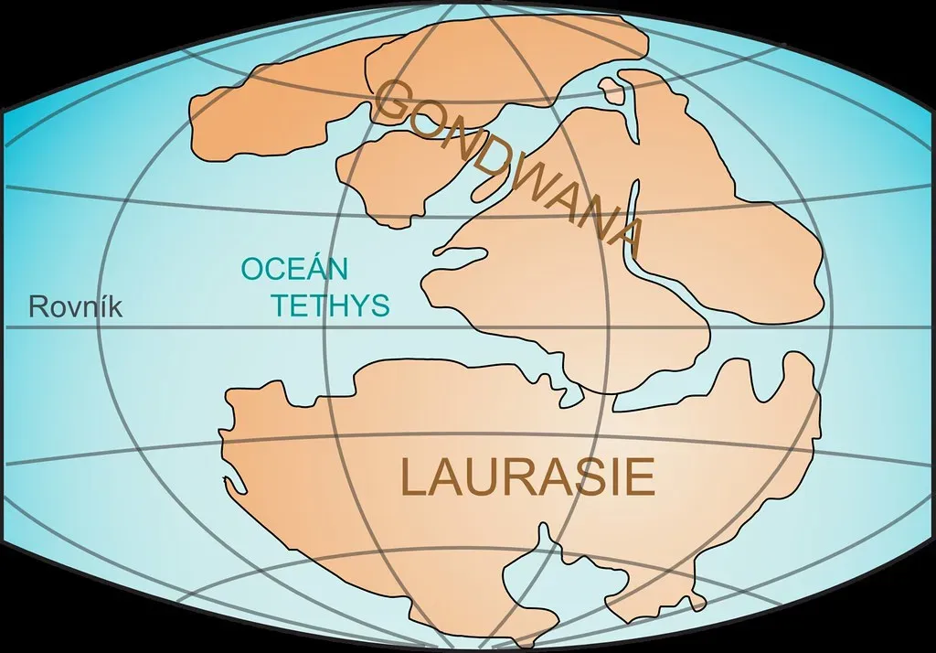
Researchers looked back over 100 million years to when Gondwana was a huge supercontinent consisting of South America, Africa, Antarctica, Australia, and parts of Asia, and pieces of Gondwana started drifting apart over time, with one section eventually evolving into Zealandia. The story of these lost continents really begins with the ancient supercontinent Gondwana. Picture a world where South America, Africa, India, Australia, Antarctica, and several smaller landmasses were all connected.
About 85 million years ago, as the seafloor spread, Zealandia broke away from Australia, and initially Zealandia was all land, but as it moved and was stretched, much of it sank beneath the sea. Tectonic forces gradually pulled these landmasses apart. Some remained buoyant and visible, like Australia. Others, like Zealandia, stretched so thin that they descended below the waves. The magnetic rocks from previously volcanic regions appear to be related to the stretching of the Gondwana crust, just before Zealandia and Antarctica and Australia broke up.
Mapping A Continent You Can’t See
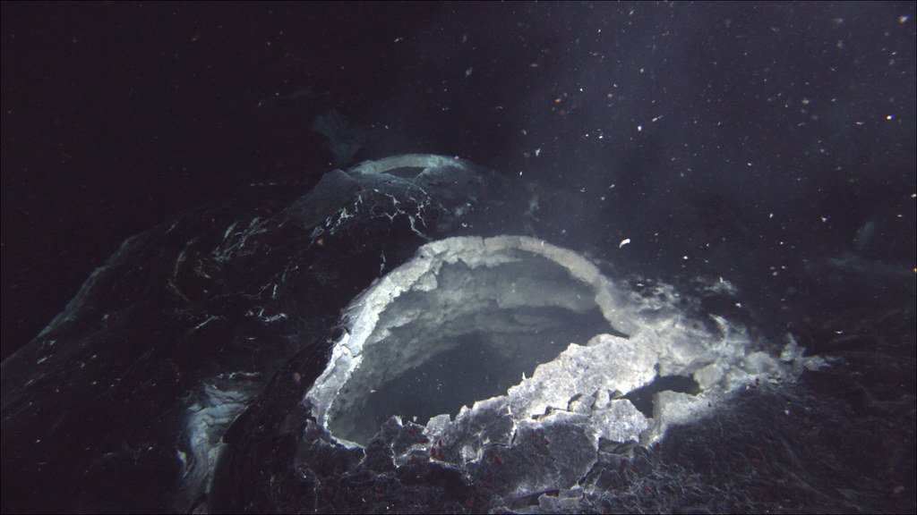
Honestly, mapping something that’s almost entirely underwater presents challenges you probably can’t even imagine. All of Earth’s continents include submarine shelves that are mostly hidden underwater, making them rather difficult to map and explore, and the geology of most continental shelves is poorly known. For Zealandia, this challenge was exponential.
Using measurements of magnetic anomalies, researchers spotted clear patterns tied to ancient volcanic activity that helped mark the continent’s boundaries, and these anomalies aligned with rock ages from dredged samples, revealing stretches of intraplate basalts formed during the Cretaceous and Eocene periods. The team also used satellite measurements, gravity data, and seafloor sediment cores to build a complete picture. As the last continent to be discovered, Zealandia is the first ever continent to have its geology, volcanoes and sedimentary basins fully mapped out to its underwater edges. It’s a remarkable achievement considering the technological limitations scientists faced even a few decades ago.
Why This Discovery Matters Beyond Geography
Piecing together the life and death of continents is vital for understanding processes like the evolution of biodiversity and climate, for finding raw materials, and at a more fundamental level for understanding how mountains are formed or for working out the driving forces behind plate tectonics. The implications extend far beyond simply adding another name to the list of continents.
The reconstruction of Argoland’s history may shed light on the region’s past climate, which would have cooled as oceans formed between the fragments, and as fragments collided with landmasses in Southeast Asia, they shaped the rich biodiversity we see today, potentially explaining the uneven distribution of species along an invisible barrier that runs through Indonesia. These lost continents hold clues to ancient climate patterns, biological evolution, and resource distribution. This discovery resolves a long-standing geological puzzle: why certain ocean islands located far from tectonic plate boundaries contain chemical signatures that look distinctly continental.
The more scientists learn about how continents break apart, drift, and sometimes disappear, the better they can predict future tectonic activity and understand Earth’s deep history. It’s hard to say for sure, but these submerged lands might hold keys to understanding earthquake patterns, volcanic activity, and even mineral resource distribution.
What This Means For Our Understanding Of Earth
Zealandia stands out for its size and completeness among several areas on the planet that exist as microcontinents or submerged fragments, and it is not only a trove of history but also a reminder that Earth still holds secrets. The discovery of these hidden continents fundamentally challenges how we categorize Earth’s landmasses. You’ve grown up learning about seven continents, yet the reality beneath the ocean’s surface tells a more complex story.
Using radiometric dating techniques, geologists discovered that Zealandia’s crust formed over 1 billion years ago, placing it in the Proterozoic Eon, which doubles earlier estimates that had placed the continent’s formation at around 500 million years ago and significantly alters understanding of the tectonic evolution of the southern hemisphere. This revised timeline changes the entire narrative of continental evolution in the Southern Hemisphere. The fact that massive landmasses can hide in plain sight for centuries really makes you wonder what else remains undiscovered.
These findings remind us that despite satellites, advanced imaging technology, and centuries of exploration, our planet still guards profound secrets. The oceans cover more than 70% of Earth’s surface, and we’ve explored less of the deep sea than we have of outer space. What do you think lies beneath the waves that we haven’t yet discovered?