If you have ever stood at the edge of the Grand Canyon or stared across the endless mesas of Arizona and Utah and thought, “There’s no way this happened slowly,” you’re not alone. A growing wave of research is now backing up that gut feeling with hard evidence: some of the most iconic landscapes in the American Southwest were likely ripped open by short-lived, unimaginably powerful mega-floods. We are not talking about the kind of flood that makes the evening news; we are talking about walls of water taller than skyscrapers, roaring across the land like liquid bulldozers, reshaping entire regions in days or weeks.
Over the past few years, scientists have pieced together clues from carved bedrock, giant boulders, and oddly shaped valleys that don’t line up with slow, gentle erosion. New dating techniques and high-resolution elevation data are pulling back the curtain on events that happened hundreds of thousands to millions of years ago but left scars we can still see from space. It’s changing how we understand the Southwest, and honestly, once you hear the story, you’ll never look at those “silent” deserts the same way again.
The Shocking Scale Of Ancient Western Mega-Floods
Imagine a flood so large that every river flood you’ve ever seen feels like a dripping faucet in comparison. That’s the scale scientists are now talking about for parts of the American Southwest: flows that may have rivaled the biggest outburst floods known on Earth, comparable to ones that once surged across the Pacific Northwest after glacial lakes burst. Researchers studying the Southwest have identified features suggesting flows racing at highway speeds, carrying more water per second than all modern rivers in North America combined.
Instead of meandering streams, these were roaring torrents unleashed when natural dams of rock, ice, or sediment catastrophically failed. Where today we see dry canyons, bare rock, and scattered scrub, at those moments there would have been chaos: entire hillsides collapsing, boulders the size of houses tumbling like gravel, and sediment-laden water grinding rock into powder. The mind-bending part is that what looks like a landscape sculpted over tens of millions of quiet years may, in key places, have been reshaped in a series of violent bursts that lasted only days or weeks.
Clues Written In Rock: Giant Ripples, Scoured Channels, And “Impossible” Valleys
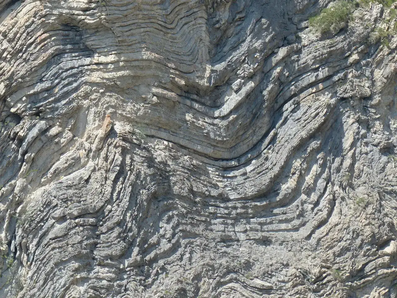
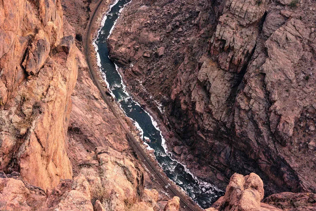
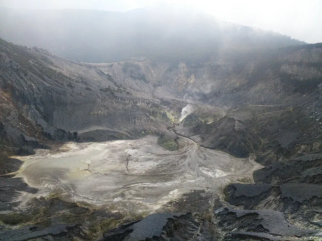
Geologists love puzzles, and the Southwest is full of them. You’ll find canyon walls where the bedrock looks smoothed and fluted as if someone took a giant sandblaster to it, and valley floors patterned with enormous gravel bars and streamlined islands that make no sense if you imagine only small, gentle rivers. Some plateaus are sliced by deep, narrow canyons that seem wildly oversized for the streams that trickle through them today, almost like using a chainsaw to cut a thread.
These shapes match the fingerprints of known mega-floods in other parts of the world. In places, researchers have mapped what look like gigantic current ripples frozen in place, with crests separated by tens or even hundreds of meters, far too big to have formed by normal flows. The pattern repeats: scoured bedrock, sudden over-deepening, and abrupt knickpoints where the landscape steps down in a sharp drop, hinting at intense, short-lived surges of water. When those telltale features line up along a path, it’s like tracing the route of an ancient, catastrophic river that no longer exists.
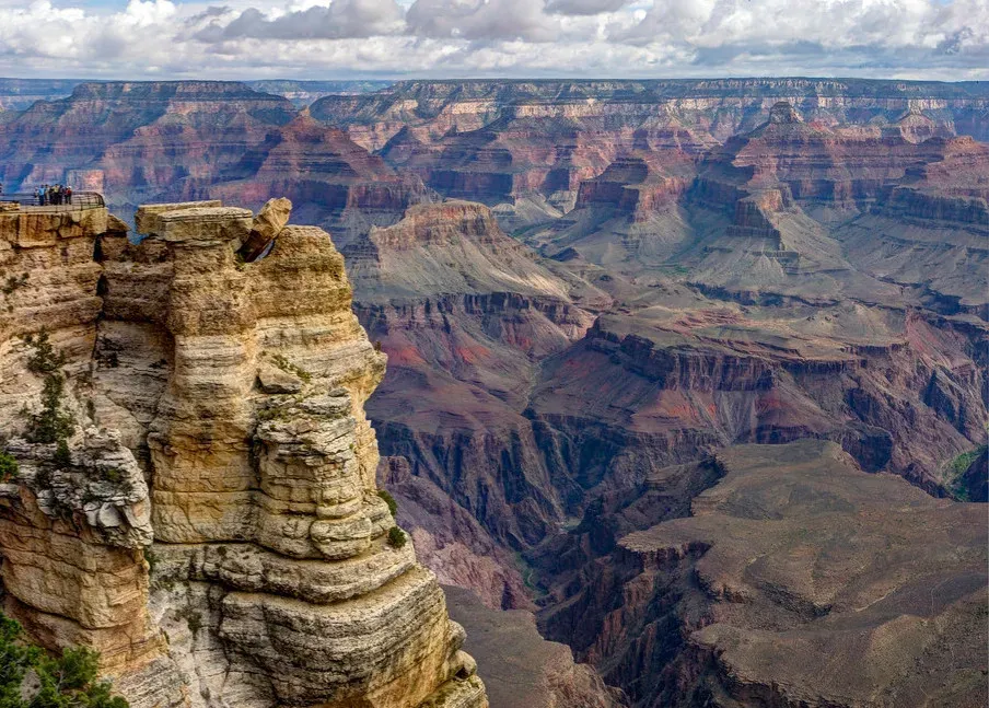
The Grand Canyon Debate: Slow Erosion Or Canyon In A Flash?
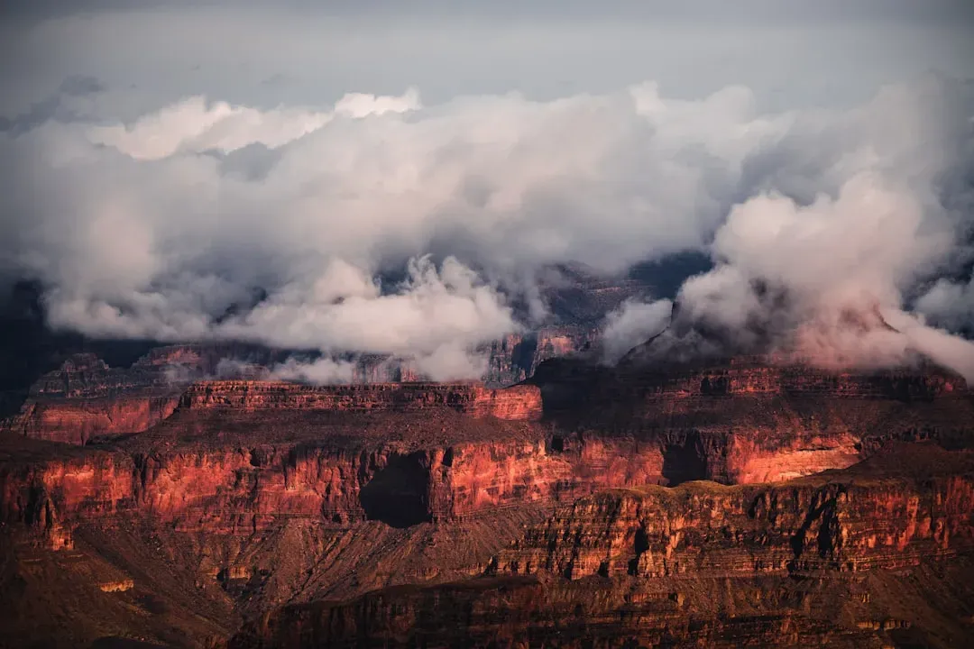
The Grand Canyon has always been the lightning rod in this conversation. For decades, the standard story has been that the Colorado River patiently carved it over millions of years, shaving away rock grain by grain in a slow, relentless process. That story is still mostly true, but new evidence suggests it might be missing some of the juiciest chapters, where the river stopped being slow and steady and briefly turned into a monster. Researchers have proposed that giant natural lakes once filled parts of the Colorado Plateau, held back by rock and sediment dams that occasionally failed in spectacular fashion.
If those proposed lakes drained suddenly, the resulting outburst floods would have roared through the region, deepening and widening canyons far faster than steady erosion alone could manage. While scientists still argue over how many such floods occurred and how much of the canyon’s depth they explain, the idea is no longer fringe. It’s becoming more plausible that the Grand Canyon’s famous steep walls, sharp bends, and abrupt side canyons reflect a history that alternated between grinding slowness and brutal, short-lived violence.
Catastrophic Lakes And Broken Dams: How Mega-Floods Begin
Ancient mega-floods do not appear out of nowhere; they build quietly behind natural barriers until something gives. In the Southwest, one of the leading ideas involves huge lakes that formed when rivers were blocked by landslides, tectonic uplift, or even old lava flows. Imagine entire valleys turned into bathtubs, filling for thousands of years behind a dam of rock and sediment, the water level creeping higher and higher, slowly straining the barrier holding it back.
Eventually, a tipping point is reached. Water begins to spill over the top, cutting a small channel that rapidly deepens, like a zipper tearing open from one end. Once that cut reaches a critical depth, the dam fails suddenly, and all the stored water rushes out in one ferocious burst. The resulting flood tears downstream, over-deepening canyons, stripping away soil, and moving enormous blocks of stone that no ordinary river could budge. In the geologic record, scientists see evidence of these potential failures in abrupt terraces, stranded shorelines, and deposits that look like chaos dumped by a single, furious event.
Reading The Past With New Tools: Satellites, Lasers, And Better Clocks
Part of why the mega-flood story is gaining traction now, rather than fifty years ago, is the explosion of new technology. High-resolution satellite imagery and laser-based elevation mapping from aircraft can pick up subtle landforms that are invisible from the ground, like faint shorelines from ancient lakes or streamlined ridges that trace old flood paths. Once those shapes are spotted, researchers can map them in detail and compare them to known mega-flood landscapes elsewhere in the world, building a case piece by piece.
At the same time, improvements in dating techniques are helping put real numbers on when certain rocks were last exposed or buried. Methods that track tiny changes caused by cosmic rays or the slow decay of radioactive elements can reveal when a boulder was dropped by a flood or when a canyon floor was last scoured clean. That timing can be compared to evidence of climate swings, glacial advances, or tectonic shifts, giving scientists a way to connect dots between big climate events and sudden pulses of water tearing across the Southwest.
Why It Matters: Rethinking “Slow And Steady” Earth Stories
For a long time, geology leaned hard on the idea that the present is the key to the past and that big landscapes are mostly carved by slow, familiar processes acting over huge spans of time. Mega-flood research does not throw that idea out, but it does force a big revision: sometimes, the past was shockingly more dramatic than what we see today. The American Southwest might be one of the clearest examples of this, where graceful, quiet vistas hide a history that includes sudden, terrifying pulses of destruction.
Recognizing these cataclysms matters because it changes how we interpret almost everything: how long landscapes take to form, how rivers respond to climate change, and how fragile natural barriers really are. It reminds us that Earth does not always play by the calm, incremental rules we prefer when we tell its story. In a way, it’s a humbling realization; the ground beneath our feet has a mood swing, and sometimes, it is far more explosive than we ever imagined.
Echoes For Today: Ancient Floods And Modern Risk
Even though these mega-floods happened long before people ever built cities in the Southwest, they are not just ancient curiosities. Understanding how natural dams fail and how water behaves when it is suddenly unleashed is painfully relevant in a world where modern reservoirs, aging infrastructure, and climate-charged storms are all part of daily life. When scientists model those past events, they learn how far water can travel, how high it can climb valley walls, and how much debris it can move, lessons that matter for mapping today’s flood hazards.
Looking at ancient landscapes that were ripped open by short-lived water surges can also shake us out of complacency. It is easy to stand in a dry canyon and assume it has always been quiet, or that big disasters are confined to human timescales and human mistakes. The rocks tell a harsher story: nature itself has triggered failures far more violent than anything we have seen with our own eyes. That knowledge carries a kind of warning, even if it is wrapped in events that happened hundreds of thousands or millions of years ago.
A Wild Past Hidden In Plain Sight
When you start to see the American Southwest as a landscape marked by ancient mega-floods, the familiar suddenly becomes strange and alive. Those serene mesas, dry washes, and dramatic cliffs begin to feel like the aftermath of a disaster movie that ended long before humans arrived, with the final scene frozen across entire states. The evidence is not in secret archives; it is etched into canyon walls, strewn in oversized boulders, and carved into valleys that are blatantly too big for the timid rivers that occupy them today.
As more research comes in, the story will keep evolving, but one thing already feels clear: the Southwest is not just a monument to slow erosion, but also to rare, brutally powerful floods that rewrote the landscape in geologic instants. That realization adds a new layer of awe, and maybe a bit of unease, to every overlook, every desert hike, every long drive past endless red rock. The quiet lands we see now were once anything but quiet, shaped partly by waters we can barely imagine. The next time you stare into a canyon and try to picture how it formed, will you still think only of patience, or will you also picture sudden, roaring chaos?