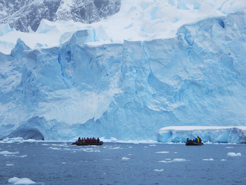
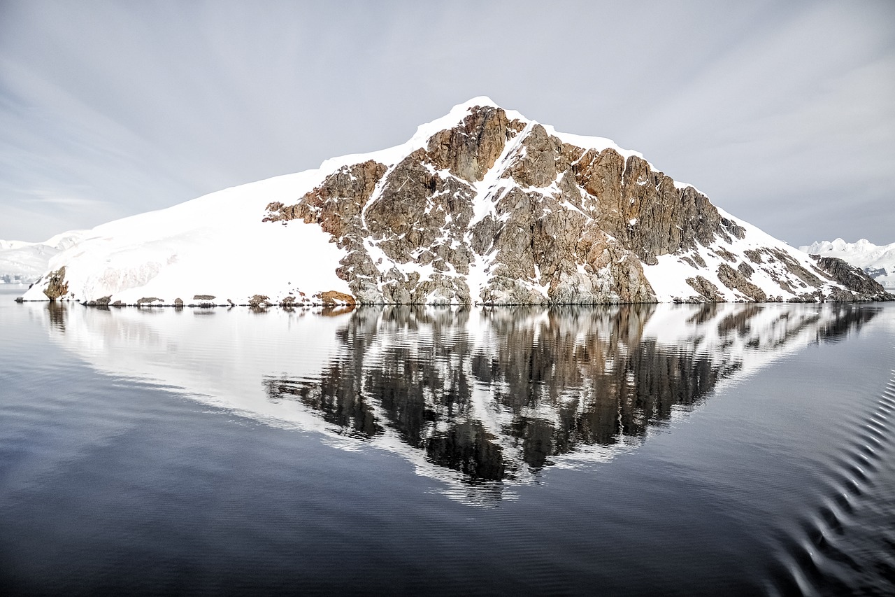
You’ve probably never imagined that beneath the frozen wasteland of Antarctica, an entire hidden world thrives with flowing rivers and dynamic waterways. Recent groundbreaking discoveries have revealed an extraordinary network of subglacial rivers that challenge everything scientists thought they knew about the icy continent.
These findings aren’t just fascinating scientific curiosities. They’re fundamentally reshaping our understanding of climate change and sea level rise predictions. Think of Antarctica as an iceberg where we’ve only seen the tip, while beneath lies a complex aquatic highway system that could dramatically alter our planet’s future.
The Revolutionary Detection Technology
Scientists use sophisticated radar altimeters that send thousands of radar pulses down to Earth per second, then record how long their echoes take to bounce back to measure large-scale ice surface changes over time. Radar interferometry, known as InSAR, precisely measures the spatial pattern of these changes. Together, they form a powerful instrument to investigate the physical causes of changes in the ice surface.
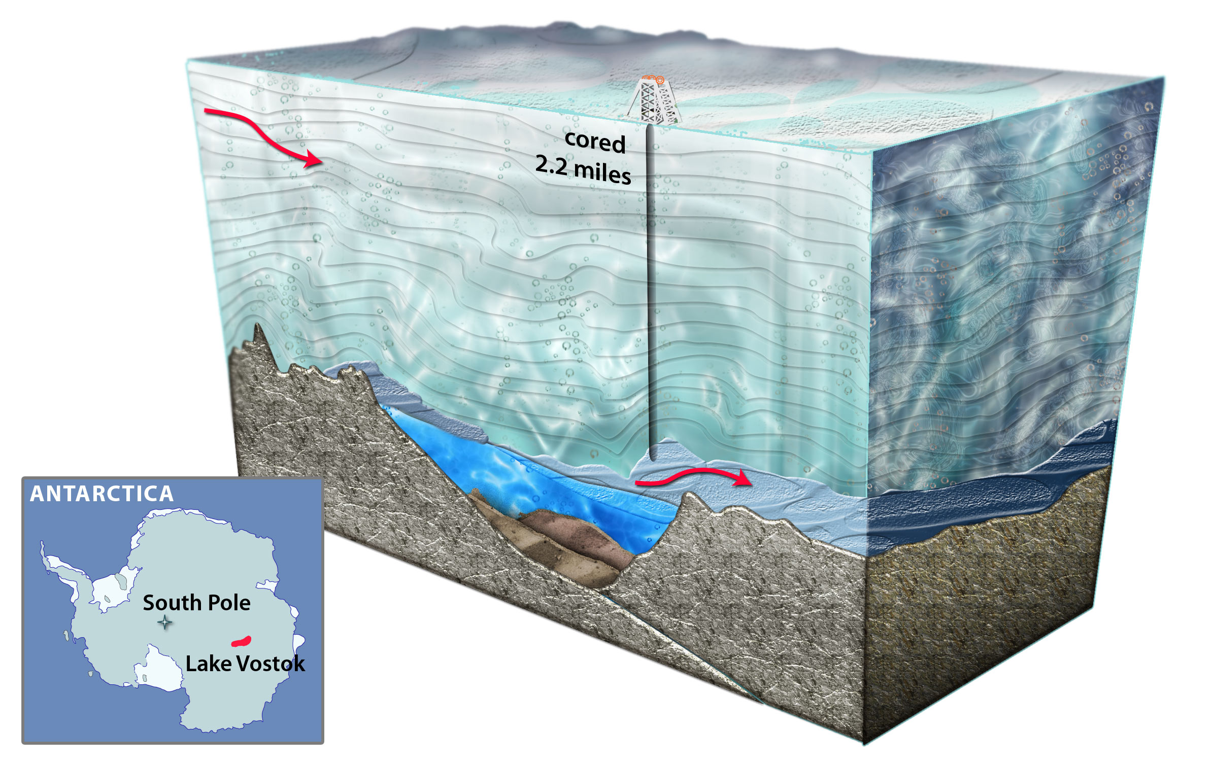
Using a decade of observations from CryoSat, researchers detected localised changes in the height of Antarctica’s icy surface, which rises and falls as the lakes fill and drain at the base of the ice sheet, allowing them to detect and map subglacial lakes and monitor their filling and draining cycles over time. Ultra-precise radar measurements revealed that ice above one lake had sunk by about three metres, while 290 kilometres away, above two different subglacial lakes, the ice had bulged upwards, with about 1.8 cubic kilometres of water racing along a tunnel carved in solid ice over 16 months.
The Shocking Scale of the Discovery

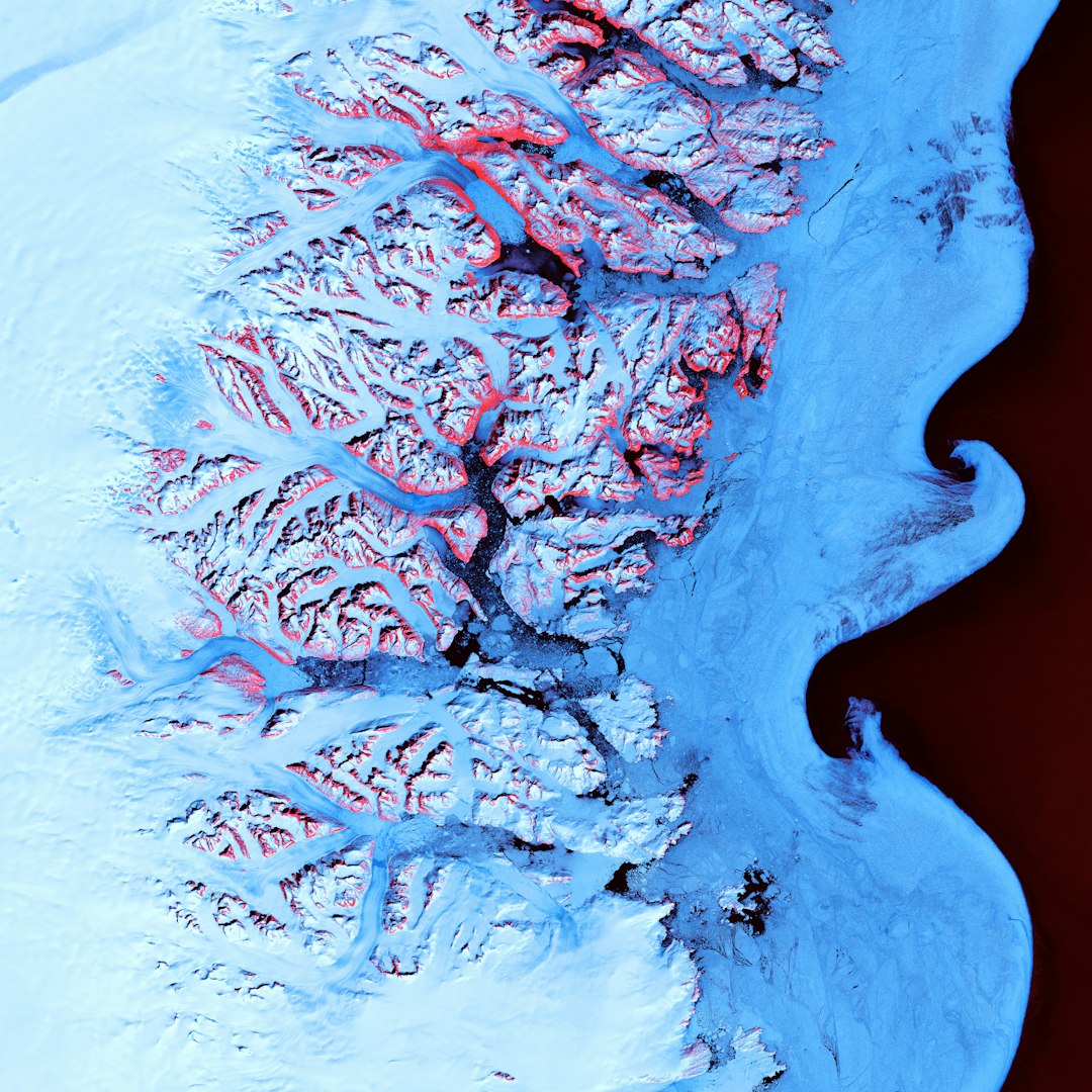
The international study used radar data to reveal previously unmapped, remarkably flat surfaces buried beneath a 3,500km stretch of the East Antarctic Ice Sheet, between Princess Elizabeth Land and George V Land. Researchers led by Durham University examined radar measurements of ice thickness and found extensive, previously unmapped, flat surfaces buried beneath a 3,500 km stretch of the East Antarctic coastline.
In a recent expedition, researchers drilled deep into the West Antarctic Ice Sheet and discovered a subglacial river flowing beneath the Ross Ice Shelf. Their cameras captured clusters of lobster-like creatures inhabiting a hidden subglacial river nearly 250 miles from the ocean’s edge. Imagine drilling through nearly a quarter mile of solid ice only to find not just water, but entire ecosystems thriving in complete darkness.
Ancient River Systems Preserved in Ice
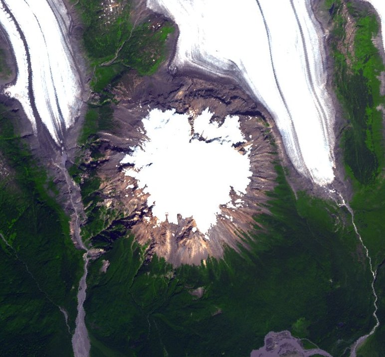
These surfaces are believed to have formed over 80 million years ago when East Antarctica and Australia were still joined, thought to have been smoothed by large rivers before the continent was engulfed by ice around 34 million years ago, and these landscapes have remained largely intact, preserved beneath the ice sheet for over 30 million years. Researchers led by Stewart Jamieson from Durham University have uncovered an ancient, river-carved landscape that has been preserved for over 34 million years, buried under nearly two kilometers of ice and remaining untouched since long before glaciation began in Antarctica.
The survey revealed valleys, ridges, and channels that point to an ancient river system, suggesting the landscape was once shaped by flowing water, not ice, providing an important clue to the climate and environmental conditions of ancient Antarctica. These discoveries reveal that what we see today as barren ice was once a lush, temperate environment with extensive river networks flowing across vast plains.
How Water Moves Beneath Miles of Ice
Subglacial meltwater forms due to geothermal heat from Earth’s bedrock surface and frictional heat as ice slides over bedrock. The water beneath the ice remains liquid because of small levels of geothermal heat from the Earth’s core coming up through bedrock, and from the insulating effect of several kilometres of ice above.
Scientists realized that subglacial rivers often flow in or out of the lakes, and these rivers can act in strange ways, since they obey not only gravity, but also the crushing pressure of the ice overhead. Previously, it was thought that water moves underneath the ice by very slow seepage, but new data shows that, every so often, the lakes beneath the ice pop off like champagne corks, releasing floods that travel very long distances.
The Dramatic Scale of Hidden Water Systems
Thanks to a decade of data from the European Space Agency’s CryoSat satellite, researchers have identified 85 previously unknown lakes several kilometres under the frozen surface surrounding the South Pole, significantly increasing the number of known active subglacial lakes below Antarctica. There are over 400 subglacial lakes known in Antarctica existing in most parts of the continent because low levels of geothermal heat from the Earth’s interior is enough to melt the base of the ice sheet, with the melted water being part of a hydrological network under the ice sheet which includes lakes, river channels and estuarine environments.
The sheer magnitude becomes even more staggering when you consider that some of these underground waterways rival major surface rivers. British scientists discovered substantial rivers flowing hundreds of miles under the Antarctica ice shelf. These aren’t tiny trickles but massive aquatic highways carrying enormous volumes of water across vast distances.
Surprising Life in Antarctica’s Hidden Rivers
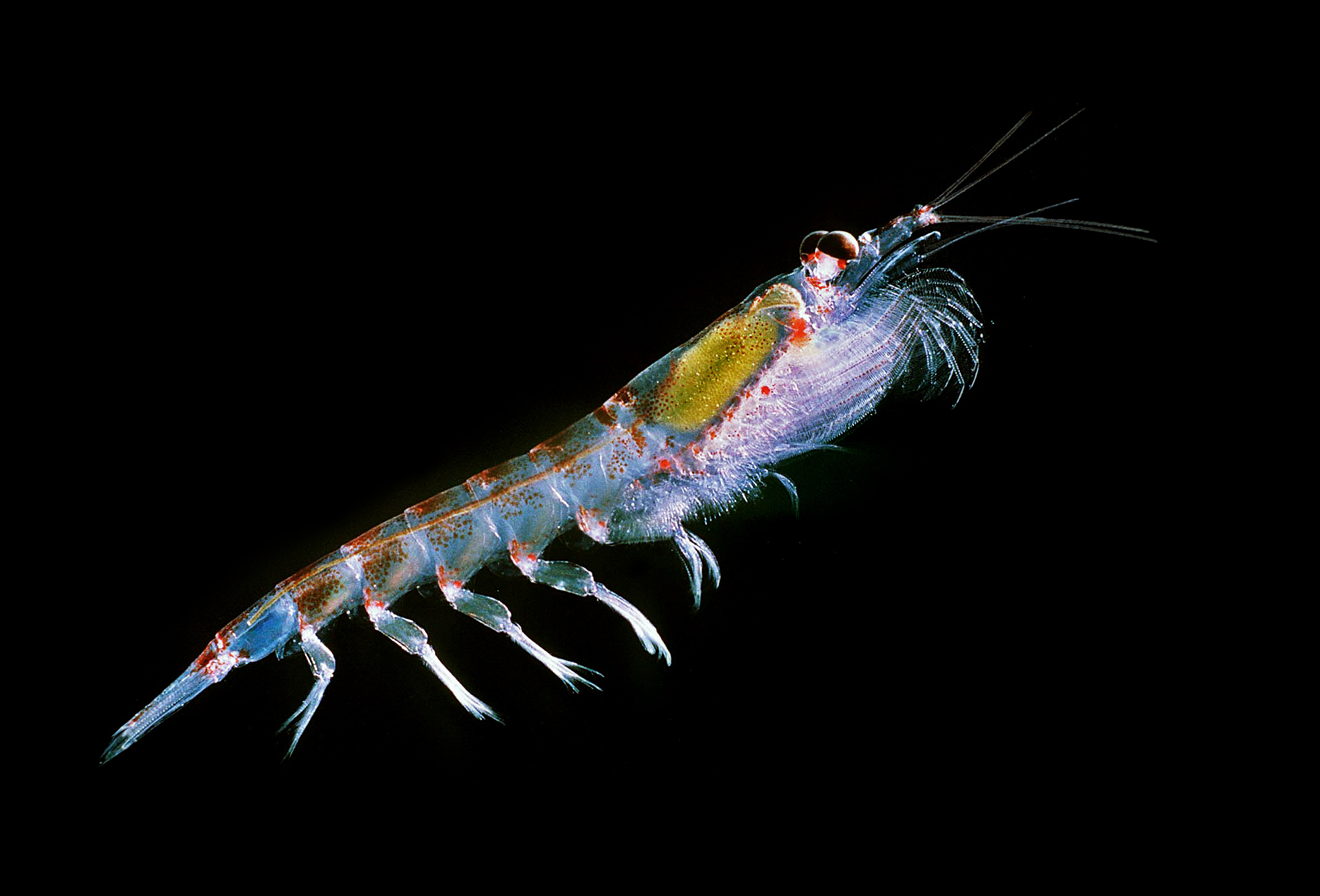
These crustaceans have adapted to survive in a harsh, lightless environment disconnected from typical marine food chains, with their existence hinting at a unique underwater ecosystem sustained by unknown energy sources, raising exciting questions about how life finds a way even in the most extreme isolation. The discovery challenges our understanding of what environments can support life.
If hardy lobster-like creatures can thrive in such a remote, frozen environment on Earth, what might this mean for life on icy moons like Europa or Enceladus? This finding opens entirely new possibilities for astrobiology research. Scientists caution that warming could accelerate subglacial river flows, disrupting the balance that sustains these unique creatures, with environmental protection agencies now considering how to shield these hidden habitats from contamination and human interference.
Climate Change Implications That Will Shock You
Incorporating subglacial water can amplify ice discharge across the Antarctic Ice Sheet by up to threefold above the standard approach, potentially contributing an additional 2.2 metres to sea-level rise by 2300. Including the effects of evolving subglacial water in ice sheet models can triple the amount of ice flowing to the ocean, adding more than two metres to global sea levels by 2300, with potentially enormous consequences for coastal communities worldwide.
In 2024, researchers reported that river-driven melting would have a major impact on East Antarctica’s Totten Glacier, which by itself holds enough ice to raise sea level by 12 feet, finding that by 2100, subglacial rivers increased the ice loss from Totten by 30 percent over standard models. These aren’t gradual changes. When rivers thin ice shelves from beneath, it makes it easier for land-based ice to slip into the ocean, speeding up sea-level rise.
Why Current Models Are Dangerously Wrong
Scientists need the effect of subglacial discharge to explain observed melt rates, but the computer models that scientists currently use to project future ice loss and sea level rise don’t include these effects. If scientists don’t consider subglacial rivers, they’re missing out on a critical part of the picture, and it’s important that scientists who model ice sheets account for hydrology because it could reduce uncertainty in estimates of sea level rise.
Many Antarctic Ice Sheet computer simulations that predict sea level rise ignore the effects of subglacial water and are probably underestimating its impact. The water layer between the ice sheet and the bedrock is either entirely ignored in projections of sea level rise or modelers have to make approximations, but now there’s no excuse for not including this really important aspect of ice behaviour. This represents a fundamental flaw in how we’ve been approaching climate predictions.
The Alarming Future We Face
If East Antarctica’s ice were to melt completely, it holds enough frozen water to raise global sea levels by approximately 50 metres or more. Aurora Subglacial Basin is grounded below sea level, a particularly unstable configuration that could lead to rapid and irreversible retreat, and an increase of four metres in the global ocean level if all the ice in the region melted.
The shape and path of these subglacial networks matter because they can channel fresh water into the sea at sensitive spots, and when cold, fresh water pours out at certain areas beneath ice shelves, it can disrupt the usual ocean patterns and speed up local ice thinning. Changes in where the river drains into the ocean can impact water circulation beneath floating ice and enhance weaknesses in vulnerable regions where ice flows from land into the ocean, potentially causing ice to break off and contribute to even faster ice flow and greater increase in ocean rise than previously suggested.
The Urgent Need for Action
It’s critical that projections of sea level rise include as much relevant information as possible so that the world can take appropriate measures to lessen the devastation to global coastal communities. Studies that include this water layer in their models of glacier flow end up predicting much higher degrees of glacier melt and mass loss by the end of the century.
These findings highlight the urgent need to incorporate evolving subglacial hydrology into ice sheet models for more accurate sea-level rise projections. More observations are needed to improve our models, particularly from remote regions such as East Antarctica, and continuing to gather information from boreholes, ice-penetrating radar and satellites will help us better understand how the underside of the ice sheet behaves, with these techniques combined with computer simulations to enable more accurate projections of future ice loss and sea-level rise.
Conclusion: A Wake-Up Call for Humanity
The discovery of vast river systems represents more than just a scientific breakthrough. It’s a fundamental game-changer that forces us to reconsider everything we thought we knew about our planet’s future. These hidden waterways could accelerate sea level rise far beyond current projections, potentially displacing millions of people and reshaping coastlines worldwide.
Yet this revelation also offers hope. By finally understanding these crucial systems, scientists can create more accurate climate models and better predict what lies ahead. The question now isn’t whether we should take action, but how quickly we can adapt our understanding and response to this hidden threat lurking beneath the ice. What surprises you most about these underwater highways that could reshape our world?

Hi, I’m Andrew, and I come from India. Experienced content specialist with a passion for writing. My forte includes health and wellness, Travel, Animals, and Nature. A nature nomad, I am obsessed with mountains and love high-altitude trekking. I have been on several Himalayan treks in India including the Everest Base Camp in Nepal, a profound experience.