A Pioneering Voyage into the Abyss (Image Credits: CEFAS)
The Caribbean – Scientists embarked on the first major expedition into the deep waters surrounding British Overseas Territories and uncovered a realm of breathtaking geological features and vibrant marine life. Researchers mapped vast swaths of the seafloor, revealing structures long absent from charts and ecosystems remarkably resilient to environmental pressures. This six-week mission highlighted how little explorers knew about these offshore expanses, even as surface-level threats loomed large.[1][2]
A Pioneering Voyage into the Abyss
Teams from the UK Centre for Environment, Fisheries and Aquaculture Science operated the research vessel RRS James Cook around the Cayman Islands, Anguilla, and Turks and Caicos. They pushed equipment to depths of 6,000 meters under relentless pressure, working around the clock. Outdated maps forced constant adjustments, with entire regions missing and errors complicating navigation.[1]
Dr. James Bell, who led the effort, described the findings as a breakthrough. “This is the first step into environments people have never seen, and in some cases didn’t know existed,” he stated. The crew captured 20,000 photographs and charted nearly 25,000 square kilometers of seafloor, documenting close to 14,000 specimens across 290 marine types.[1]
Majestic Underwater Peaks and Sinkholes
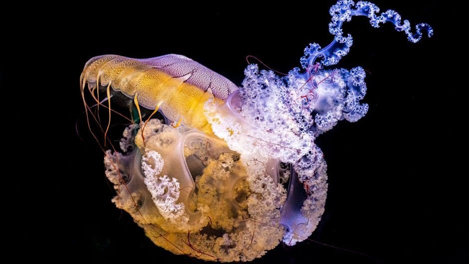
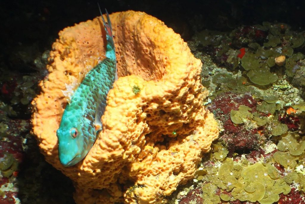
North of Little Cayman, the expedition approached Pickle Bank, an uncharted mountain rising from 2,500 meters to just 20 meters below the surface. Its slopes burst with color – bright blues, yellows, and oranges – hosting golden towers of coral alongside brain-like formations. Fish darted through gorgonian whips, while jelly-like orange sponges clung nearby.[1]
West of Turks and Caicos’ Gentry Bank stretched a 70-kilometer ridge towering 3,200 meters high, overlooked by prior surveys. Further south, near Grand Turk, lay a colossal blue hole – a collapsed cave forming a 300-meter-wide crater plunging 550 meters deep. Cameras inside revealed sponges, large spatangoid urchins, and schools of fish, suggesting it rivals Belize’s Great Blue Hole in scale.[3]
Thriving Corals and Resilient Reefs
Deep-water reefs appeared healthier than their shallow counterparts, spared from stony coral disease and warming waters that damaged 80% of global corals since 2023. Steep slopes and depths shielded these habitats, fostering black corals potentially thousands of years old. North of Anguilla, a 4-kilometer reef featured coral mosaics amid sponge gardens, confirming reports from local fishers.[1]
These structures funnel nutrient-rich currents upward, creating vital feeding zones. The discoveries underscored the Caribbean’s role as home to 146 endemic species, with potential additions from this survey. Such pristine conditions offered a stark contrast to degraded coastal areas.[4]
Encounters with the Unknown
Never-before-seen creatures populated these depths. A swimming sea cucumber baffled experts, its identity still unclear. Pelican eels wielded glowing pink tails that flashed red to attract prey, while barreleye fish peered upward through tubular eyes to spot silhouettes.[1]
- Dragonfish dangled glowing rods from their chins to lure meals.
- Enope squids and alien-like cephalopods glided in the dark.
- Lanternfish emitted eerie lights amid the sponge gardens.
- Diverse fish thrived within the blue hole’s confines.
- Orange sponges and black corals anchored bustling communities.
Bell noted the astonishing diversity during the mission.[3]
Charting a Course for Conservation
The Blue Belt Programme united island environmentalists with UK scientists to bolster management plans and sustainable fishing. Kelly Forsythe of the Cayman Islands Department of Environment remarked, “Our islands were literally born from the sea. But when it comes to our offshore environments, we really haven’t had a chance before to discover what’s out there.”[1]
| Location | Key Feature | Depth Range |
|---|---|---|
| Pickle Bank (Cayman Islands) | Mountain with golden corals | 2,500m to 20m |
| Gentry Bank (Turks & Caicos) | 70km ridge | 3,200m high |
| Grand Turk | Blue hole | 550m deep |
Findings will aid the UK’s pledge to safeguard 30% of oceans by 2030. Bell emphasized that effective protection demands precise knowledge, not arbitrary boundaries.[2]
- Over 25,000 sq km mapped, revealing missing mountains and holes.
- Healthy deep reefs resist disease and heat, hosting ancient life.
- New species sightings fuel urgency for targeted marine protections.
These revelations remind us that Earth’s oceans hold vast unknowns, even near familiar shores. As mapping continues, the focus sharpens on shielding these treasures from emerging threats. What do you think about these deep-sea wonders? Tell us in the comments.