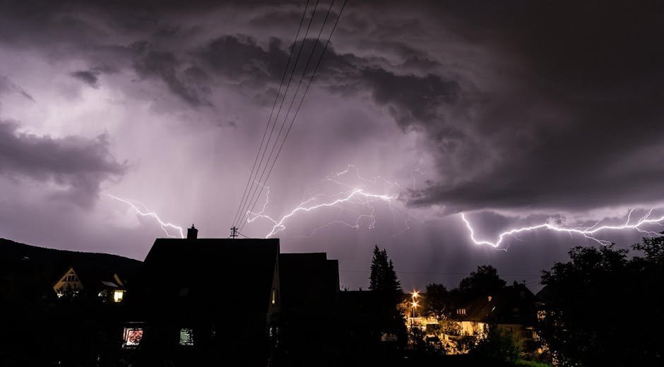
Enhanced Risk Signals Serious Threat (Image Credits: Pexels)
Central U.S. – Forecasters at the Storm Prediction Center warned that millions from Texas to the Great Lakes region confront heightened risks of severe thunderstorms on Friday, complete with heavy rain, damaging winds and large hail.[1]
Enhanced Risk Signals Serious Threat
The Storm Prediction Center escalated its Day 1 outlook to an Enhanced Risk across more than 104,000 square miles in the central and southern Plains extending into the lower Missouri Valley.[1] This category covered about 7.6 million people in areas including Kansas City, Missouri; Omaha, Nebraska; and Tulsa, Oklahoma. Scattered severe thunderstorms promised the greatest potential for very large hail and a few strong tornadoes in eastern Oklahoma, Kansas and Nebraska, as well as western Arkansas, Missouri and southern Iowa.
Strong low-level moisture surged northward ahead of a cold front, fueling instability levels of 1,000 to 1,500 J/kg amid daytime heating. Deep-layer wind shear exceeding 50 knots supported organized storm structures, from initial supercells to bowing clusters capable of widespread wind damage.[1] Forecasters noted uncertainty in storm initiation near a dryline in Oklahoma and Texas but expected development to accelerate later.
Wide Swath of States in the Path
A Slight Risk enveloped a larger zone of over 200,000 square miles, impacting roughly 24.7 million residents from parts of Texas and Oklahoma through the Ozarks and into the Midwest.[1] Cities such as Dallas, Fort Worth, Oklahoma City, Milwaukee and St. Louis fell within this area. A Marginal Risk stretched even farther, reaching into Illinois, Michigan, Indiana and Louisiana, affecting nearly 27 million more.[3]
The threat aligned with a multi-day pattern, as storms expanded eastward with a lifting warm front across the Plains.[4] Existing morning thunderstorms in north-central Oklahoma and southeast Kansas hinted at the setup’s potency, though cloud cover posed challenges for precise forecasting in eastern Kansas and northwest Missouri.
Key Hazards to Monitor Closely
Very large hail topped the concerns, with steep lapse rates and robust updrafts capable of producing stones larger than golf balls. Damaging wind gusts emerged as another primary danger, particularly from organized clusters and quasi-linear convective systems late in the day.
- Large to very large hail, potentially 2 inches or more in diameter.
- Damaging straight-line winds from bowing storm segments.
- A few strong tornadoes (EF2 or greater) tied to supercells or embedded circulations.
- Heavy rainfall raising isolated flooding risks.
Tornado potential heightened in the evening as low-level shear strengthened, creating curved hodographs favorable for rotation.[1] Storms could persist overnight into early Saturday across Wisconsin, Illinois and lower Michigan.
Timing Shapes the Response
Storms fired up around mid-afternoon, roughly 3 to 5 p.m. Central Time, in southeast Nebraska and northern Kansas before pushing into Iowa and Missouri by evening. Peak activity unfolded through Friday night, with the cold front driving more robust development south-southeastward.
Residents tracked updates as the outlook evolved, reflecting shifts in convection and frontal positioning.[3] This positioned Friday as the week’s most intense severe weather day within a broader siege of thunderstorms.
Key Takeaways
- Enhanced Risk zones prioritize very large hail and tornadoes in OK, KS, NE, AR, MO, IA.
- Slight and Marginal Risks expand threats to TX, Midwest cities like Chicago and Milwaukee.
- Monitor mid-afternoon initiation; activity peaks evening through overnight.
As the Central U.S. girds for this formidable storm push, timely alerts from the National Weather Service will prove crucial in minimizing impacts. Stay vigilant with local forecasts and have a safety plan ready – what steps are you taking to prepare? Share in the comments below.