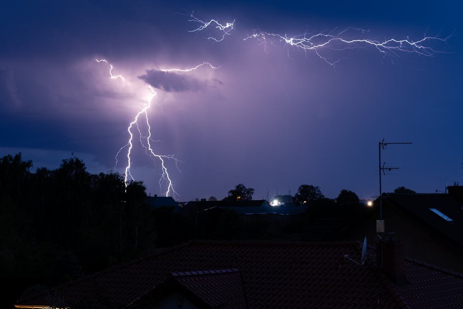
Nearly 50 Million Under Threat from Powerful Storms (Image Credits: Pexels)
Midwest – Forecasters tracked a potent weather system south of the Great Lakes, setting the stage for scattered severe thunderstorms across the region Thursday afternoon and evening. The Storm Prediction Center outlined elevated risks for large hail, damaging winds and isolated tornadoes, affecting tens of millions from Illinois to Ohio. Residents in storm-weary communities prepared for another round in what has become an active March for severe weather.
Nearly 50 Million Under Threat from Powerful Storms
The sheer scale of the forecast caught attention early Thursday. An enhanced risk area covered over 60,000 square miles, home to more than 13 million people, while broader slight and marginal risks extended the danger zone to roughly 50 million residents overall.[1][2]
Storms formed along a cold front pushing south through Illinois, Indiana, southern Michigan and Ohio. Diurnal heating combined with a narrow corridor of unstable air fueled the development, leading to organized thunderstorms capable of producing significant hazards.
Initial supercells posed the greatest danger before transitioning into linear clusters, heightening wind threats as they spread east-southeastward.
Key Hazards: From Baseball-Sized Hail to EF2 Tornadoes
Large to very large hail emerged as a primary concern, with diameters exceeding two inches possible in the most intense storms. Supercell updrafts sustained these massive ice chunks, which could damage vehicles and property.[3]
Damaging wind gusts reached potential speeds of 75 miles per hour or higher, strong enough to topple trees and disrupt power supplies. A few tornadoes, including the possibility of stronger EF2 variants, loomed especially in northern and central Indiana and Ohio, where low-level shear enhanced rotation.[2]
Heavy rainfall added flash flooding risks in areas repeatedly hit by slow-moving clusters. The combination created a multifaceted severe weather event.
- Very large hail: Up to baseball size (2+ inches).
- Damaging winds: Isolated gusts over 75 mph.
- Tornadoes: A few, potentially EF2 strength in IN/OH.
- Flash flooding: From repeated storms over the same spots.
Targeted Regions Span Major Cities
The enhanced risk focused on parts of the Midwest and Ohio Valley, including Indianapolis, Columbus, Cleveland, Toledo and Fort Wayne. These areas faced the highest odds for supercell activity and peak hazards.[2]
Slight risk enveloped Chicago, Detroit, Pittsburgh and surrounding suburbs, where storms arrived later in the afternoon. Marginal threats reached Kansas City, St. Louis and Cincinnati, with isolated severe potential farther west in Missouri and Kansas.[1]
| Risk Level | Key Areas | Population Impact |
|---|---|---|
| Enhanced (3/5) | IN/OH (Indianapolis, Columbus) | 13+ million |
| Slight (2/5) | IL/IN/MI/OH (Chicago, Detroit) | 15+ million |
| Marginal (1/5) | MO/KS/OH/PA (St. Louis, Cincinnati) | 20+ million |
Development began around 19-22Z near central Illinois, spreading eastward through the evening.
Busy March Sets Stage for Thursday’s Outbreak
March 2026 proved relentless for severe weather in the Midwest. Earlier events included deadly tornadoes in Michigan and Illinois, with EF3 twisters claiming lives in Branch County and Kankakee.[3]
Additional outbreaks struck on March 10, 15 and 22, delivering more tornadoes, hail and winds from the Plains to Pennsylvania. Record late-March warmth provided ample fuel, though a cold front introduced the latest round.[4]
Forecasters noted strong mid-level jets and sufficient instability, despite challenges like a capping layer in some spots.
Key Takeaways
- Monitor local alerts as storms evolve rapidly Thursday afternoon.
- Seek shelter indoors away from windows during peak threats.
- Stay updated via National Weather Service and Storm Prediction Center outlooks.
As the front clears, colder air follows, marking a sharp shift after the stormy warmup. Communities demonstrated resilience amid the pattern, but vigilance remained essential. What impacts did you see from these storms? Share in the comments below.