There is something almost otherworldly about satellite images that show the ocean lit up like polished silver. It looks like something went wrong with the camera, or maybe someone photoshopped a metallic sheen across the water. But this dazzling optical effect is completely real, and it tells scientists far more than you might expect.
This phenomenon is called sunglint, and it is quietly becoming one of the more fascinating tools in Earth observation. The Atlantic Ocean has recently provided a stunning example of it, captured in imagery that is both visually breathtaking and scientifically rich. Let’s dive in.
What Exactly Is Sunglint and Why Does It Look So Strange?
Here is the thing about sunglint: it looks like a mistake, but it is actually physics working perfectly. When sunlight reflects off the surface of the ocean at just the right angle back toward a satellite sensor, the water appears blindingly bright, almost like a mirror has been laid flat across thousands of square kilometers of sea. It is the same principle as sunlight bouncing off a car windshield straight into your eyes while driving, just on a planetary scale.
The effect depends almost entirely on the geometry of the sun, the satellite, and the water surface. When those three elements align, the ocean transforms from a deep blue canvas into something resembling liquid chrome. Honestly, seeing it for the first time in a satellite image is genuinely stunning.
The Atlantic Capture That Started the Conversation
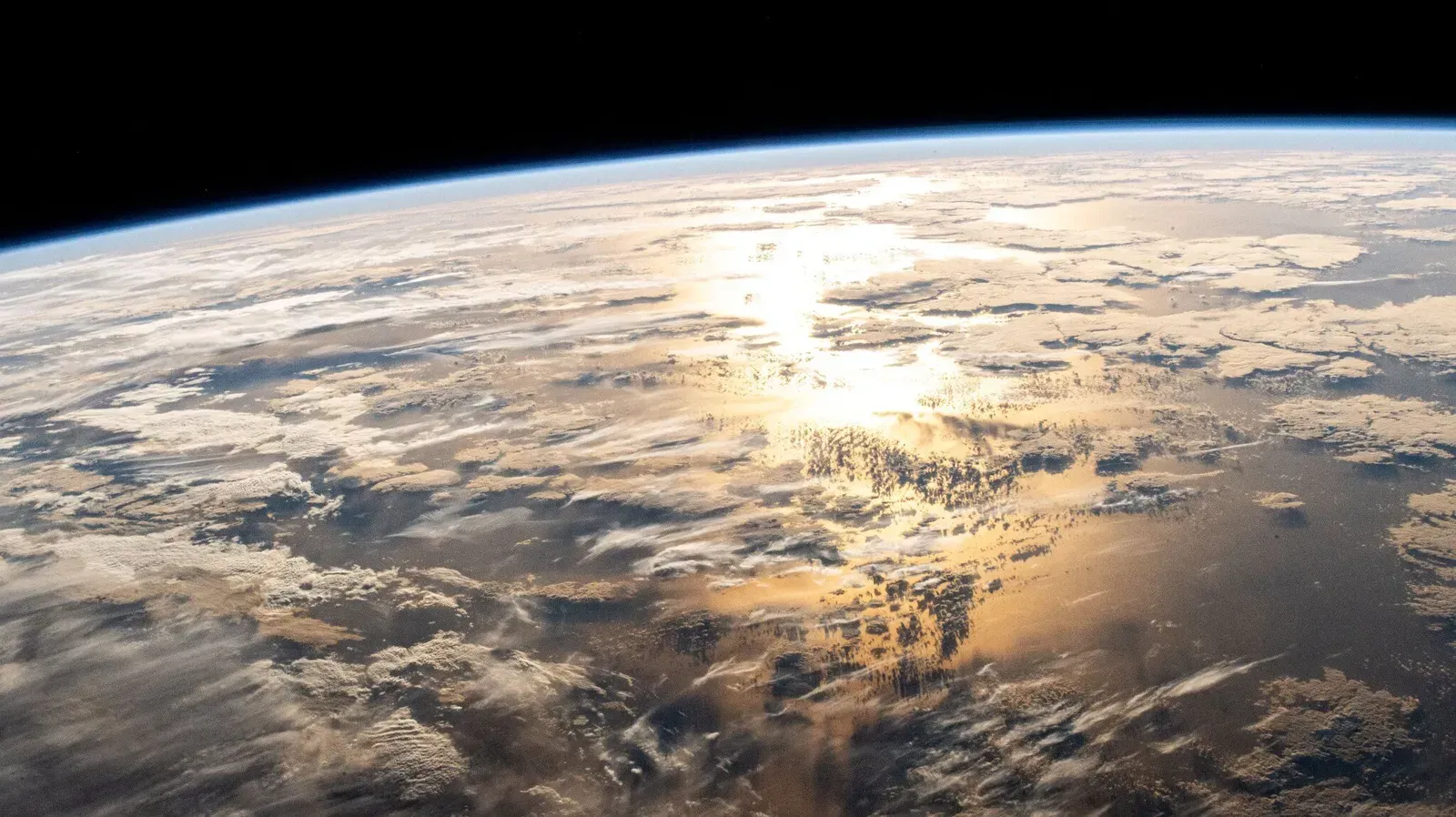
A remarkable image of the Atlantic Ocean recently caught the attention of the scientific community, showing an unusually expansive sunglint pattern stretching across a massive portion of the ocean surface. This image was captured by an Earth-observing satellite, and the sheer scale of the reflective region immediately raised eyebrows among researchers. It was not just pretty, it was packed with information waiting to be decoded.
Images like this are rarely just accidental aesthetics. The shape, intensity, and texture of the glint zone can reveal a surprising amount about what is happening at and just below the ocean surface. Calm waters reflect differently than rough ones, and that contrast is visible from space.
What Ocean Surface Roughness Has to Do With All of This
One of the most useful things sunglint reveals is ocean surface roughness, which is essentially a measure of how wavy or calm the water is at a given moment. Smoother surfaces produce sharper, more intense glint patterns, while choppier waters scatter the reflection and create a more diffuse glow. Think of it like the difference between looking at your reflection in still bathwater versus a stirred-up bathtub.
This roughness data is incredibly valuable because it connects directly to wind conditions near the ocean surface. Winds create waves, and wave patterns encode wind speed and direction in ways that satellites can read through sunglint analysis. It is a surprisingly elegant feedback loop between atmosphere and ocean, all visible from orbit.
Sunglint as a Window Into Ocean Currents and Surface Films
Beyond roughness, sunglint also helps scientists detect surface slicks and films on the water, including natural ones produced by biological activity like phytoplankton blooms. These organic films dampen small surface waves, creating smoother patches that appear noticeably brighter in glint imagery. They stand out clearly against the surrounding rougher water, making them easy to spot from hundreds of kilometers up.
Ocean currents also leave their fingerprints in sunglint images. Boundaries between different water masses, known as fronts, often have distinct roughness signatures. A skilled interpreter looking at a sunglint image can essentially read the ocean’s circulation patterns like a kind of visual map, which is pretty remarkable when you think about it.
The Role of Satellite Technology in Capturing These Images
Modern Earth observation satellites are extraordinarily capable instruments, and their ability to capture sunglint in high resolution has opened entirely new avenues of research. Sensors like those onboard the Copernicus Sentinel satellites or NASA’s MODIS instruments can record sunglint across enormous swaths of ocean in a single pass. The spatial coverage is something no ship-based or aerial survey could ever realistically match.
The timing and orbit of these satellites are carefully designed so that certain passes over the ocean occur when sunglint conditions are likely. Rather than being an unwanted artifact, sunglint has been increasingly embraced as a deliberate observational strategy. Scientists now plan observation campaigns specifically to capture it.
Challenges and Limitations That Researchers Have to Navigate
Let’s be real, sunglint is not without its complications. The very brightness that makes it useful also tends to saturate sensors if the reflectance is too intense, which can wash out finer details and create data gaps. Researchers have to carefully calibrate and correct for this in their processing pipelines, and it is not always straightforward work.
There is also the challenge of distinguishing between different sources of smooth-water signatures. An oil spill, a natural biogenic slick, and a region of low wind can all produce similar-looking features in sunglint imagery. Separating them requires additional data sources and careful cross-referencing, making interpretation more of an art form than a purely mechanical process.
Why This Matters for Climate and Ocean Monitoring
The broader significance of sunglint science sits squarely within the growing urgency around climate monitoring. Oceans cover more than two thirds of the Earth’s surface and play an absolutely central role in regulating the planet’s temperature, absorbing carbon dioxide, and driving weather systems. Having fast, wide-coverage tools to monitor ocean surface conditions is not a luxury, it is a necessity.
Sunglint-based remote sensing adds a crucial layer to this monitoring toolkit, especially for tracking how ocean surface dynamics are changing over time. Shifts in wind patterns, alterations in biological productivity, changes in circulation, all of these have potential climate signatures that can be detected through consistent satellite observation. It is hard to say for sure just how transformative this data will become in the next decade, but the trajectory looks genuinely promising.
The Ocean Is Telling Us Something
There is something deeply poetic about the fact that sunlight, bouncing off the ocean at just the right angle, can tell us so much about the health and behavior of our planet’s most vital ecosystem. What began as an optical curiosity in satellite imagery has matured into a legitimate and powerful scientific discipline. Sunglint is no longer a glitch. It is a gift.
I think what makes this story so compelling is that it reminds us how much information is hiding in plain sight, sometimes literally glittering on the surface of the sea. The Atlantic Ocean is one of the most studied bodies of water on Earth, and it still finds ways to surprise us. The next time you see one of those eerily brilliant satellite images of a silver ocean, you will know it is not just beautiful. It is the ocean speaking, and scientists are finally fluent enough to listen. What do you think is still hidden beneath those glittering surfaces that we have yet to decode?