Florida’s relationship with hurricanes is one of the most complex and dramatic natural stories on Earth. For centuries, these massive storms have hammered the Sunshine State’s extensive coastline, carving new channels, erasing entire beaches, and fundamentally altering the geographic landscape that millions call home. The power unleashed by these tropical giants doesn’t just destroy buildings and infrastructure – it literally moves mountains of sand, reshapes barrier islands, and redraws the map of coastal Florida with each devastating pass.
The Great Labor Day Hurricane of 1935: When the Keys Were Forever Changed
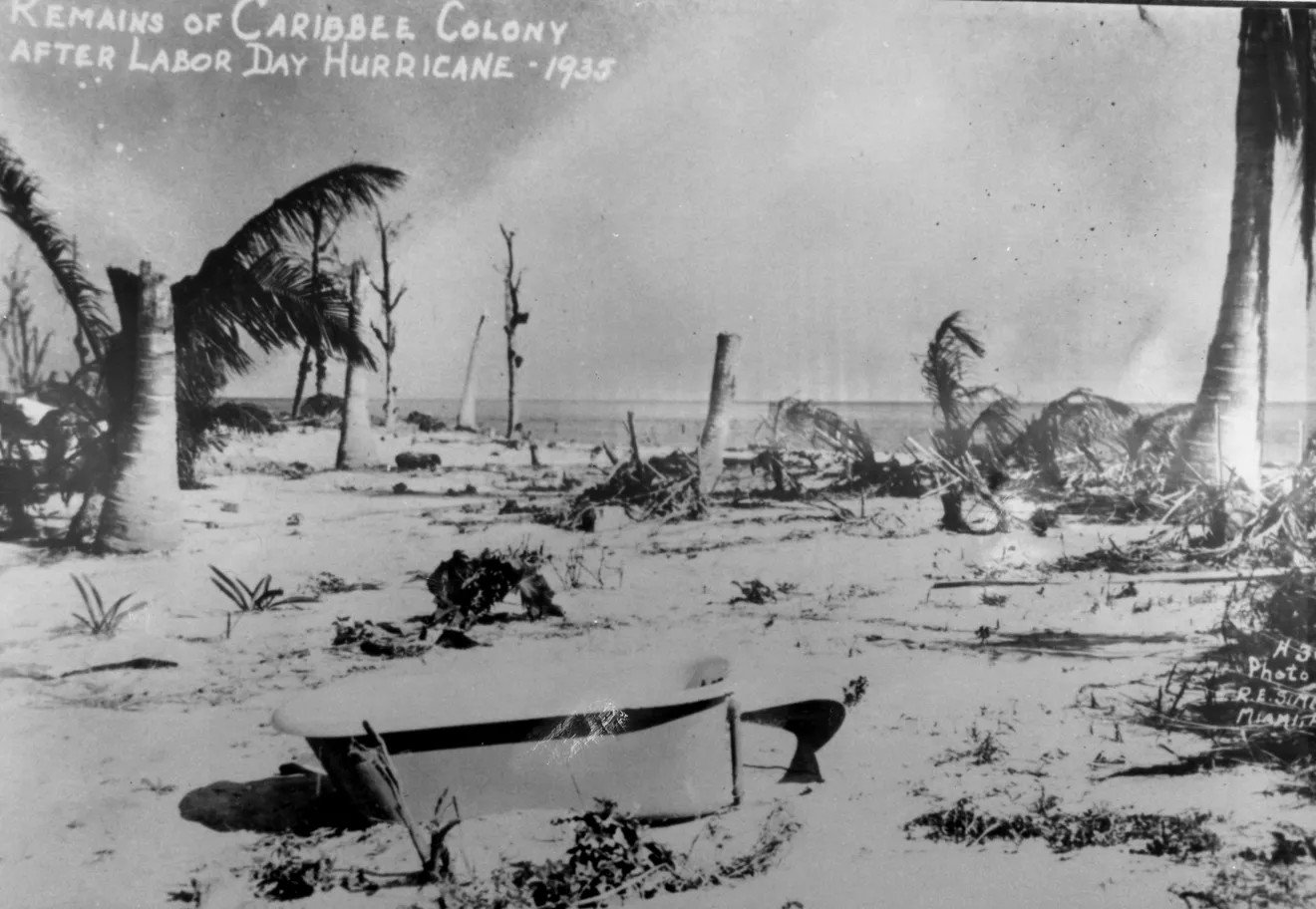
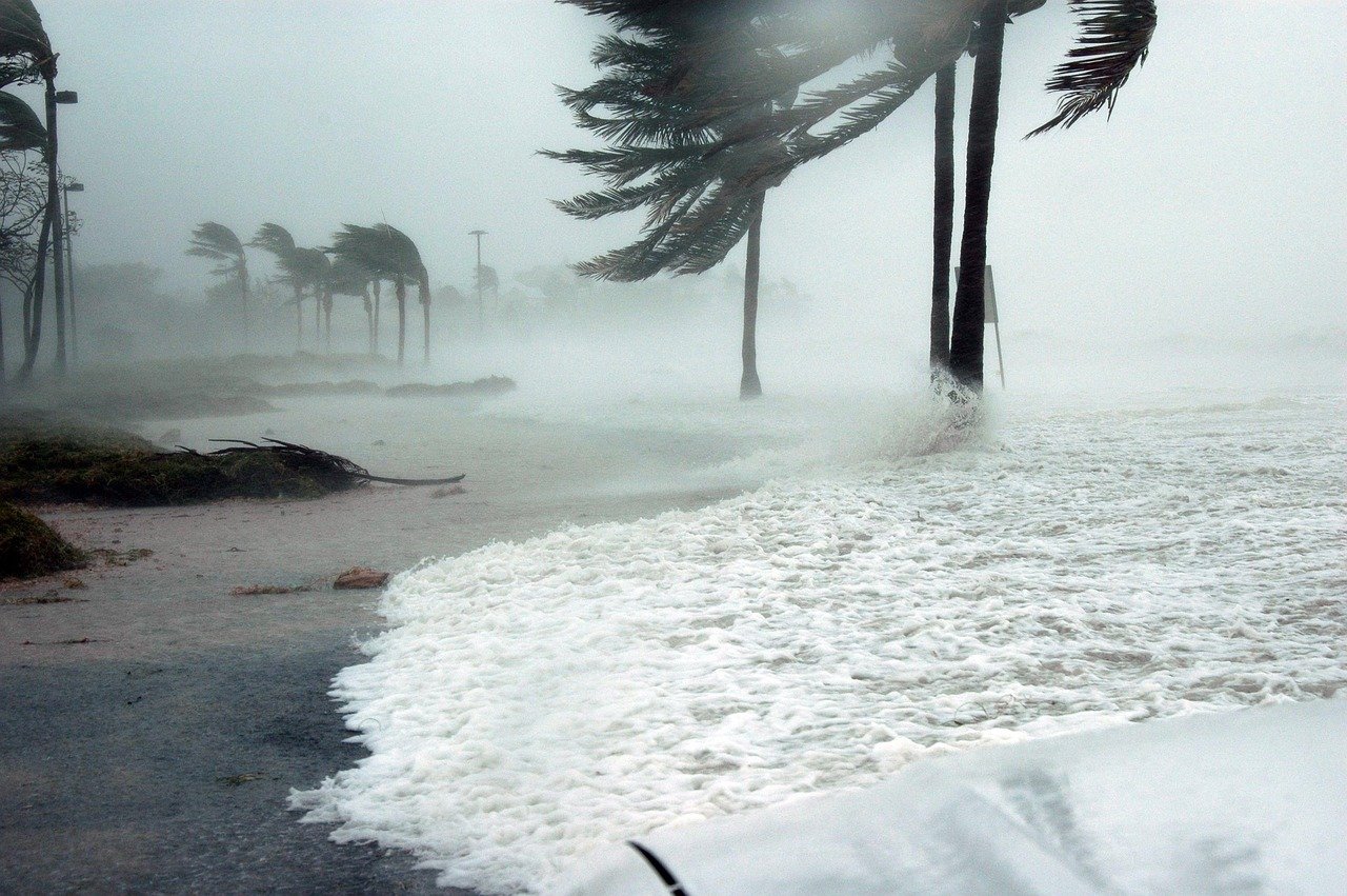
The strongest tropical cyclone to make landfall on the state was the 1935 Labor Day hurricane, which crossed the Florida Keys with a pressure of 892 millibars (26.3 inHg). This monster storm didn’t just hit the Florida Keys – it completely reshaped them. The hurricane’s winds exceeded 185 mph, making it one of only a handful of storms to achieve such terrifying intensity at landfall.
The storm surge that accompanied this behemoth was nothing short of catastrophic. Entire sections of the Keys were submerged under walls of water that reached heights of nearly 20 feet above normal sea level. When the waters finally receded, islanders discovered that familiar landmarks had vanished entirely, while new channels and inlets had been carved through previously solid ground. It is also the strongest hurricane on record to strike the United States. Out of the ten most intense landfalling United States hurricanes, four struck Florida at peak strength.
Hurricane Andrew’s Devastating Transformation of South Florida

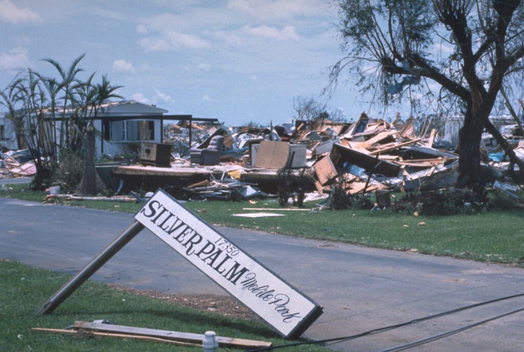
When Hurricane Andrew slammed into South Florida in 1992, it didn’t just break records for destruction – it fundamentally altered the coastal landscape for generations to come. When it made landfall, Andrew was a Category 5 hurricane, with maximum sustained winds of 165 mph and a minimum central pressure of 922 millibars. It’s one of only four hurricanes to make landfall in the United States as a Category 5 since 1900. The storm’s compact but incredibly powerful core created a narrow swath of total devastation across Miami-Dade County.
Andrew’s impact on the coastline was particularly severe in areas like Homestead and Florida City. In the marine environment, the major effects of the hurricane were changes in nearshore water quality, patches of intense bottom scouring, and beach overwash. The storm’s ferocious winds and storm surge scoured away protective dune systems that had taken decades to form naturally. The storm surge impacted portions of Miami-Dade County, peaking at around 16.9 feet (5.2 m) just north of Homestead near the Burger King International Headquarters. This unprecedented surge height completely overwashed low-lying areas, depositing massive amounts of sand and debris miles inland from the normal shoreline.
The Mangrove Catastrophe: Biscayne Bay’s Ecological Reshaping
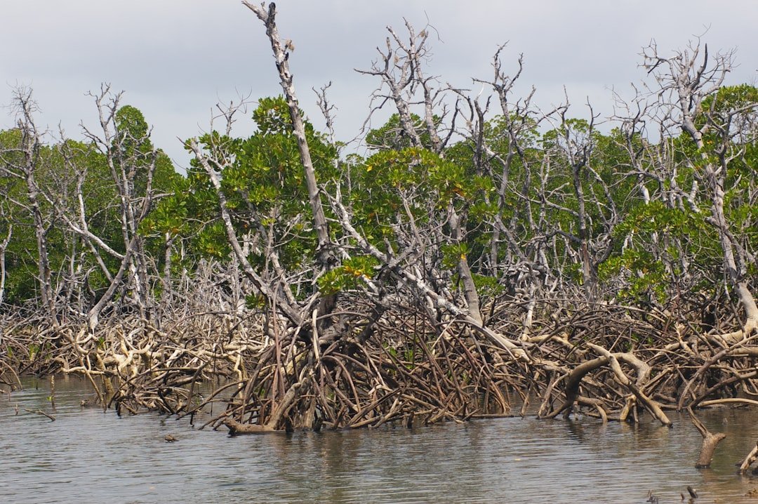
Hurricane Andrew’s assault on Florida’s coastline extended far beyond just moving sand around. The storm devastated the critical mangrove ecosystems that serve as natural barriers against storm surge and coastal erosion. The storm passed directly over Biscayne and Everglades national parks, knocking down or severely damaging mangrove trees on about 70,000 acres (28,329 ha) of wetlands. Mangrove and other wetland tree species are important to the aquatic and dry land parts of the park environment: they are instrumental in absorbing the force of hurricanes and they help build land by trapping silt and sand in their roots.
The destruction of these mangrove forests had cascading effects that continued for years after the storm. Without these natural coastal defenders, the areas became far more vulnerable to future storm surge and everyday wave action. Dramatically increased turbidity persisted in some areas for at least 30 days, particularly in western Biscayne Bay where mangrove peat soils continued to break down and enter the water. In northeastern Florida Bay, at the southern edge of the affected area, concentrations of ammonia, dissolved phosphate, and dissolved organic carbon increased dramatically.
Hurricane Charley’s Swift Strike and Lasting Changes
While Hurricane Andrew crawled across Florida at a relatively slow pace, Hurricane Charley took a completely different approach in 2004, racing across the state at nearly twice the typical speed of a landfalling hurricane. Hurricane Charley in 2004 moved through the state at 25 mph (nearly twice the typical speed of a landfalling hurricane) and brought hurricane-force winds to Orlando, which was nearly 100 miles away from the point of landfall.
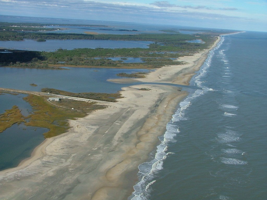
This rapid movement created a unique pattern of coastal damage. Instead of the prolonged battering that slower storms inflict, Charley’s quick passage meant that storm surge had less time to build up in some areas, but the intense winds created different types of coastal change. The storm carved new channels through barrier islands and reshaped inlet configurations along Florida’s southwest coast. Many of the changes were so dramatic that navigation charts had to be completely redrawn in the storm’s aftermath.
The Hurricane Season from Hell: 2004’s Quad Storm Assault
The year 2004 stands out as one of the most devastating periods for Florida’s coastline, when four major hurricanes – Charley, Frances, Ivan, and Jeanne – hammered the state within a span of just six weeks. Eight cyclones affected the state in both 2004 and 2005, which were the years with the most tropical cyclones impacting the state. Each storm hit different sections of the coast, creating a cumulative effect that was far greater than the sum of its parts.
The repeated pounding from these storms created a phenomenon that coastal scientists call “coastal fatigue.” Each successive hurricane found beaches and dune systems already weakened from previous storms, making the damage exponentially worse. Barrier islands that had survived individual storms for decades were suddenly being reshaped by multiple hurricanes within weeks of each other.
Hurricane Dora’s Historic Breakthrough in Northeast Florida
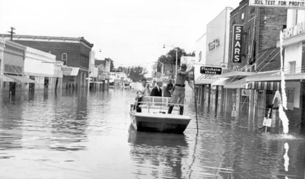
Hurricane Dora made history in 1964 as the first recorded hurricane to make landfall on Florida’s northeast coast. Hurricane Dora makes landfall and does much damage. In the Matanzas Inlet, both continual, gradual change and punctuated storm damage (the Hurricane Dora break through and subsequent southward retreat of Summer Haven Island) were highlighted. In the case of the hurricane damage, though much more initially obvious coastal damage occurred from Hurricane Dora, this is an example of how storm damage can lead to a subsequent period of change and readjustment of the coastline.
The storm’s most dramatic impact was the creation of new inlets and the permanent alteration of Anastasia Island’s configuration. Dora literally punched through barrier islands, creating channels that remain visible today. The hurricane’s storm surge and waves carved out new waterways while filling in others, fundamentally changing the navigation patterns and coastal dynamics of the region for decades to come.
Hurricane Ian’s Record-Breaking Coastal Devastation
Hurricane Ian’s landfall in September 2022 created some of the most dramatic coastal changes ever recorded in Florida. Ian’s winds reached a maximum sustained speed of 150 mph, just shy of a Category 5 storm, driving 12 to 18 feet of storm surge – the highest recorded in Southwest Florida in the past 150 years. The storm made direct hits on Fort Myers Beach and Sanibel Island, areas that bore the full brunt of Ian’s fury.
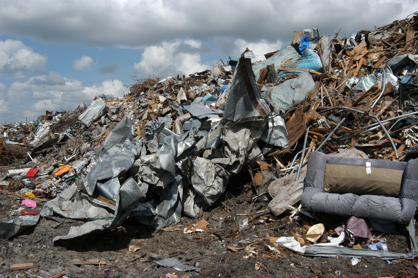
The area endured severe damage and coastal change from the storm including overwashed sand, coastal flooding, and in some places, erosion. Some areas sustained significant erosion of sand and dunes, while other areas were overrun with sand and debris. The transformation was so complete that satellite images taken before and after the storm showed areas that were virtually unrecognizable. Nearly every structure on the Island was impacted in some way. This storm has been described as being in the top five of most catastrophic natural disasters in the world.
The Science of Storm Surge and Coastal Reshaping
Understanding how hurricanes reshape Florida’s coastline requires grasping the incredible physics at work during these storms. Intense storms reshape the coastal landscape when they cause large waves or storm surges that erode the beach and dune system, the USGS noted. On top of this, the rise in sea level, coastal development and the construction of navigation channels and inlets, have exacerbated the issue.
Storm surge is the primary mechanism by which hurricanes reshape coastlines. Storm surge is the term used to describe the wall of water that is pushed toward the shoreline as a hurricane moves onshore. Storm surge combines with the local tide and the battering wind-driven waves to push a large volume of water onto the shore, often resulting in significant damage. In the strongest hurricanes, this storm surge can be as high as 25 feet above normal water levels. This massive wall of water doesn’t just flood coastal areas – it picks up enormous quantities of sand and sediment, moving them far inland or out to sea.
Overwash and Inundation: Nature’s Bulldozers
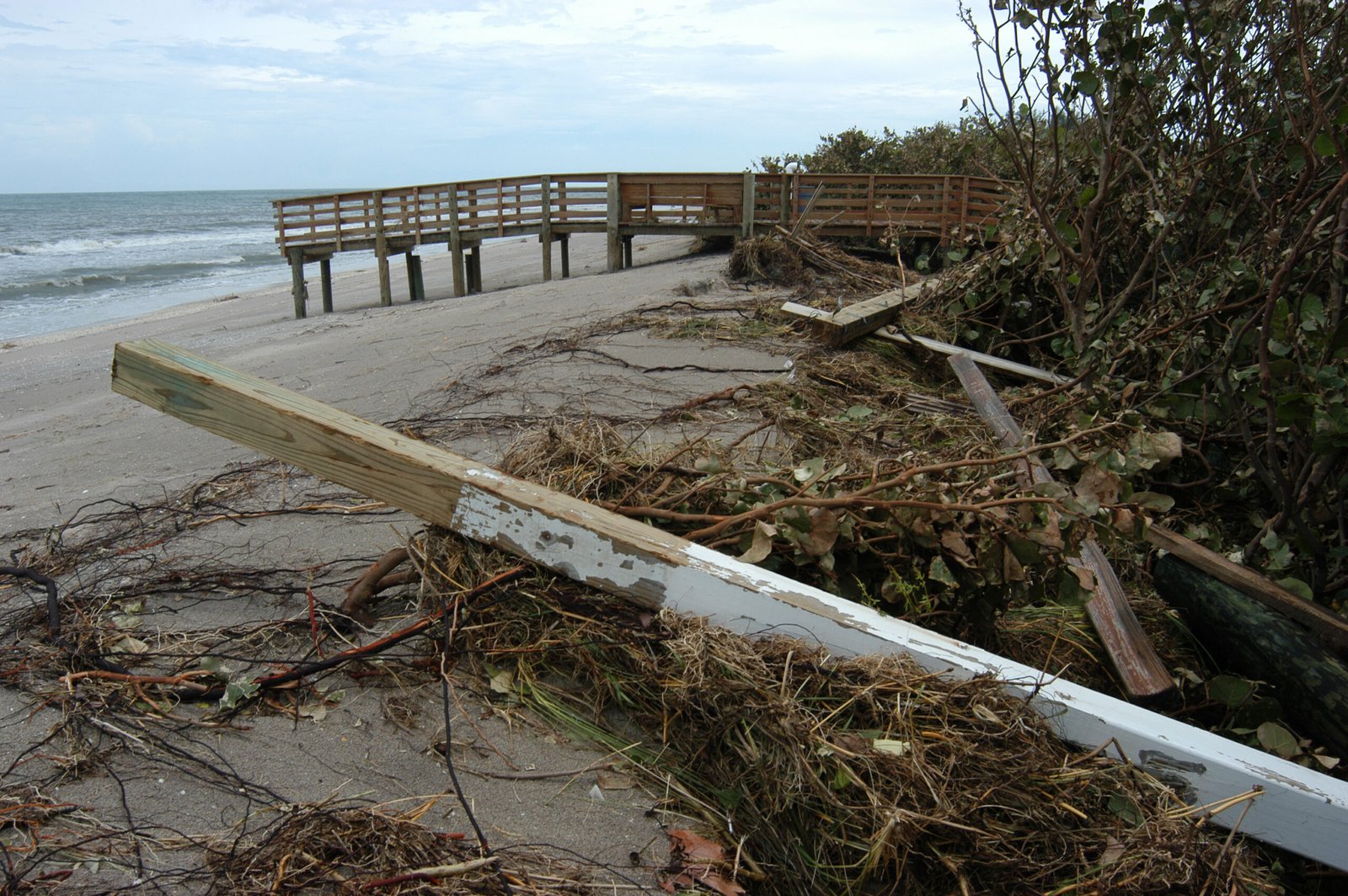
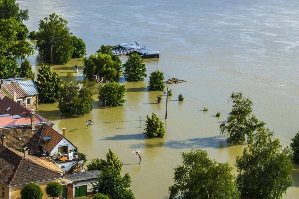
Two of the most powerful coastal reshaping processes during hurricanes are overwash and inundation. Overwash occurs when water rises higher than the dunes, pushing sand inland. The process can dramatically reshape the coastal areas, block roads, and degrade protective dunes, making these areas more vulnerable to future storms. During major hurricanes, these processes can move millions of tons of sand in a matter of hours.
Recent examples of this dramatic reshaping were seen during Hurricane Milton’s approach to Florida’s west coast. Currently, 95 percent of the sandy beaches on Florida’s west coast are forecasted to become inundated – meaning continuously covered by ocean water – from Milton, according to a USGS coastal change forecast issued Monday. This is the most severe level of coastal change and can cause flooding behind sand dunes that may impact coastal communities. The forecasts for Milton demonstrated just how vulnerable Florida’s already storm-battered coastline had become after previous hurricanes.
Florida’s Eternal Dance with Hurricane-Driven Change
The Florida coast is a dynamic place that is constantly changing because of the wave energy that impacts it. One big storm event can reshape the coastline over night. Still, on longer timescales waves and currents that flow parallel to the coast (longshore currents) continually move sand and reshape the coastline. This constant change means that Florida’s coastline exists in a perpetual state of flux, with hurricanes serving as the dramatic punctuation marks in an ongoing story of geographic evolution.
Since 1850, all of Florida’s coastline has been impacted by at least one hurricane. With its long coastline and location, Florida frequently finds itself in the path of these intense storms. This universal exposure means that no part of Florida’s coast remains untouched by hurricane-driven change. From the Panhandle to the Keys, every stretch of beach, every barrier island, and every coastal wetland bears the fingerprints of these powerful storms. The hurricanes that have reshaped Florida’s coastline represent far more than just weather events – they’re the primary sculptors of one of America’s most economically and ecologically important coastal regions.