
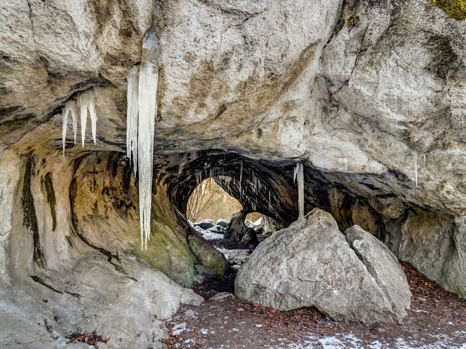
Picture this: You’re standing on a mountain pass in the Western Caucasus, surrounded by nothing but endless green peaks and jagged limestone cliffs. The air is crisp, the silence almost deafening. Then you look down at what appears to be just a crack in the earth—measuring a mere 10 by 13 feet. You have no idea that beneath your feet lies an abyss so profound that it could swallow six Empire State Buildings stacked on top of each other and still have room for more.
The Unassuming Portal to Earth’s Deepest Realm

At 2,209 meters (7,247 ft) deep, Veryovkina Cave is the deepest-known cave on Earth. It’s located in the Arabika Massif, in the Gagra mountain range of the Western Caucasus, on the pass between the Krepost and Zont mountains, close to the slopes of Mount Krepost. Its entrance is 2,285 meters (7,497 ft) above sea level. The entrance itself is deceptively modest, almost like nature’s version of a hidden doorway. What makes this discovery even more remarkable is that the entrance of the cave has a cross section of 3 m × 4 m (9.8 ft × 13.1 ft), and the depth of the entrance shaft is 32 m (105 ft). It’s as if Earth decided to keep its deepest secret behind the most ordinary-looking door.
From S-115 to World Record: A Half-Century Journey

In 1968, cavers from Krasnoyarsk discovered this Cave while searching for another underground cavern nearby and marked it as S-115 on their map after reaching a depth of 377 feet (115 m). Think about that for a moment—they thought they’d found just another cave. In 1968, the cave was assigned the name S-115, which was later replaced by P1-7, and in 1986 it was renamed after caver and cave diver Alexander Verëvkin. Verëvkin died in 1983 while exploring a siphon in the cave Su-Akan, located in the Sary-Tala massif, now Kabardino-Balkaria, Russia. What began as routine exploration would evolve into one of the most challenging and dangerous cave mapping projects in human history.
The Moscow Team That Changed Everything

Pavel Yevgenyevich Demidov was a Russian speleologist, most known for his work in extreme cave exploration, especially as the leader of the Perovo-speleo team expeditions to Veryovkina Cave on Arabika massif in Abkhazia, from 2017 the deepest cave in the world. The Perovo-Speleo team became the driving force behind Veryovkina’s exploration, but their journey wasn’t without setbacks. In 2009 while they traveled to the cave from Gagra, on a track high in the mountain the jeep, a GAZ-66 capsized and two explorers were injured, one badly. So Perovo speleoclub discontinued explorations in Veryovkina, until 2012. This wasn’t just scientific exploration—it was a test of human endurance and determination.
The Revolutionary Breakthrough of 2015

In August 2015, members of the Perovo Speleo Club discovered a new shaft. The fact that no rope was available prevented them from entering it then. However, this discovery would later lead to further exploration and findings by other cavers. Sometimes the most significant discoveries happen when you’re least prepared for them. In 2015 they decided to try the meander with draft and with little digging they reached another shaft, at an estimated depth of 360 m, where they stopped because of lack of rope and time. It’s like finding a door to another world but forgetting to bring the key—except in this case, the key was several kilometers of specialized rope.
The Babatunda Discovery That Changed Everything

At the bottom of the last, 30 m shaft, Yevgeny Kuzmin discovered a continuation, Babatunda, the biggest hall in the cave, 155 m deep. The discovery of Babatunda was like finding a cathedral hidden inside a mountain. In June 2016, cavers known as Perovo-speleo began exploring a pit about 30 meters deep. They found tunnels leading to larger rooms below the surface from which they could continue further into the cave system. The day after Evgenyj Kuzmin climbed over the wall of boulders, he found the head of the Babatunda’s pit. He later determined its depth to be about 300 feet (91 m). This single discovery opened the floodgates to the deepest reaches of our planet.
Advanced Mapping Technologies in Extreme Conditions
Advanced technologies, such as 3D mapping and remote sensing, are being employed to explore the cave’s most inaccessible regions, pushing the boundaries of human knowledge and endurance. Mapping Veryovkina isn’t like mapping your local hiking trail—it’s more like trying to create a detailed blueprint of an underground skyscraper while hanging from ropes in total darkness. A huge system of more than 6,000 m (20,000 ft) of subhorizontal passages below −2,100 m (−6,900 ft) was discovered and surveyed. March 2018 – another expedition of the same team added more than a kilometer of tunnels to the cave map. Each survey required teams to carry heavy equipment through passages so narrow that sometimes only one person could fit at a time.
The Complex Underground City Structure
Due to the enormous depth of the cave, it is necessary to use multiple underground camps to reach the cave’s deepest point at -2,212 meters. The camps are at -600m, -1,350m, and the final one lies at –2,100m. The process of getting to the bottom of this remarkable cave is similar to a camp-to-camp ascent of an 8,000 metre peak, except you’re going down instead of up. There’s an average travel time of eight hours between each of the camps for a caver carrying two or three bags weighing 20-30kg each. Imagine trying to map a building where each floor takes eight hours to reach, and you have to carry all your surveying equipment on your back through corridors barely wide enough for your body.
The Life-and-Death Mapping Mission of 2018

During an expedition in March 2018, Demidov and his comrades had reached a terminal sump at the water table—a depth of 7,257 feet (2,212 meters). The low point was a new record, knocking the neighboring Krubera cave, at 7,208 feet (2,197 meters), into second place. But mapping the absolute bottom came with unprecedented risks. After achieving this record, the Perovo-Speleo team returned in September to explore a number of promising horizontal leads at the bottom of Veryovkina; collect samples of rare, possibly new species of shrimp and scorpion; and leverage Shone’s photographic skills to create a series of still images documenting the entire cave, including its extraordinary terminus. “A beautiful turquoise lake, about 15 meters long and 8 meters wide, surrounded by jet-black limestone,” Shone says, describing Veryovkina’s terminal siphon.
When Nature Nearly Claimed the Mapping Team

In September 2018, a team of explorers at the bottom of the world’s deepest cave had their breakfast interrupted by a dire warning. Two colleagues over 3,000 feet above spotted a flood pulse caused by heavy rainfall surging on its way to their friends far below. The team received the warning just in the nick of time, fighting their way up through the deluge in a race against the rising waters. Picture this: you’re mapping the deepest point on Earth when suddenly the cave becomes a raging underwater tunnel. We received a radio call from two cavers higher up in the system to say that there was a flood pulse coming through. The three of us continued to the next camp at -1,900m and waited there. Everyone had survived, though we learnt that as the others had left camp, they were swimming above the tents.
The Precision Measurement Revolution

August 2024 – during another expedition of the PSC the cave depth was decreased to 2,209 meters (7,247 ft). The previously established connection between the stream at the bottom of the cave and the Blue Lake on the surface enabled the precise measurement of the cave depth by taking into account the difference in heights between the entrance and the bottom siphon using a high-precision GNSS receiver EFT M3. This isn’t just about being accurate to the nearest meter—when you’re dealing with extreme depths like this, every centimeter matters. The connection between the underground stream and a surface lake provided mappers with a way to verify their measurements using cutting-edge satellite technology, something that would have been impossible just decades ago.
The Mysterious Terminal Siphon
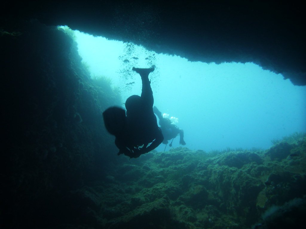
They also measured the depth of The Last Nemo Station terminal siphon lake. It was 8.5 m (28 ft) and so the total cave depth reached 2,212 m (7,257 ft). Named after Jules Verne’s famous submarine captain, this underwater chamber represents the current limit of human exploration. Up until this expedition, this siphon is undived and nobody knows what lies beneath. This is the deepest point in the deepest cave in the world! I was able to photograph the outlandish terminal sump: this is the first photo ever taken of the deepest point in the deepest cave on Earth. Think about it—we’ve sent robots to Mars, but we still don’t know what lies beneath this underwater passage in our own planet.
The Underground Ecosystem Mapping Challenge
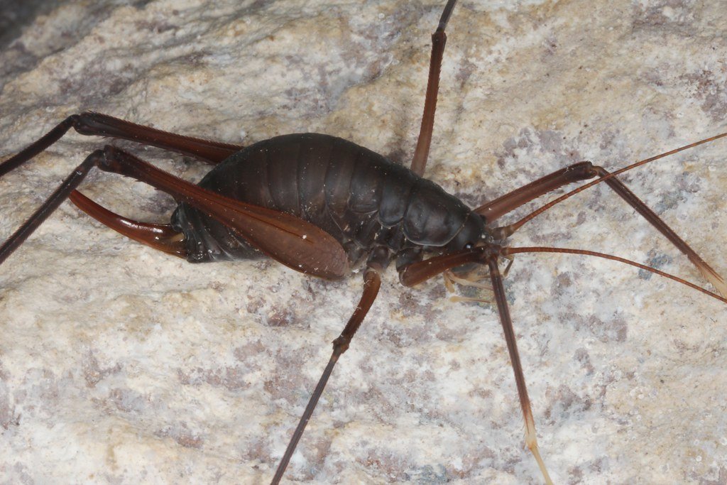
The Cave contains 15 species of invertebrates, but there are most likely more. Among these creatures is a sponge belonging to the Dina genus, an endemic species that lives only in Arabika Massif’s deepest caves. In addition, other organisms include pseudoscorpions, amphipods (a type of shrimp-like crustacean), daddy longlegs, spiders, and ticks, all belonging to scarce species that are found only in some nearby caves. The shrimp Xiphocaridinella Demidovi is a species that has only been found in Veryovkina Cave and can be found only at the deepest point of Nemo Lake, the Last Camp. Mapping these creatures is like discovering aliens on our own planet—they’ve evolved in complete isolation, creating their own unique evolutionary pathways.
The Dangers That Make Mapping Nearly Impossible

During an expedition in 2021, PST found the body of a caver, who died exploring on his own, at −1,100 meters (−3,600 ft). He was later identified as Sergei Kozeev, who left his home in Sochi (Russia) on 1 November 2020 and began descent into Veryovkina, where he spent around a week at a −600 meters (−2,000 ft) permanent camp. Then he continued his descent down to technically challenging parts at −1,100 meters (−3,600 ft) where he got stuck, and died of hypothermia. He did not bring stirrups necessary to climb out of the lower, perpetually wet, regions of the cave. The body was eventually recovered after a complex retrieval operation on 17 August 2021. This tragic incident illustrates why mapping Veryovkina requires teams of world-class experts—the margin for error is essentially zero.
The Technology Gap That Keeps Secrets Hidden

However, any super-deep caves are probably inaccessible from the surface and would require some drilling to reach them, provided that scientists can locate them. Remote sensing, such as electrical resistivity, seismic activity, and ground-penetrating radar only work up to a relatively shallow depth or don’t have the necessary resolution to identify an underground passageway only a few feet in width. Current technology can map the surface of Mars in incredible detail, but when it comes to mapping what’s directly beneath our feet, we’re surprisingly limited. That honor belongs to Georgia’s Veryovkina Cave, a 2.2-kilometer-deep incursion formed when sea levels in the neighboring Black Sea dropped dramatically millions of years ago. In 2016, researchers using a remotely operated vehicle estimated the Hranice Abyss to be 473.5 meters deep. However, the vehicle’s fiber optic communication cable kept it from going deeper, and the true extent of the cave system remained a mystery.
The Geological Time Machine Underground

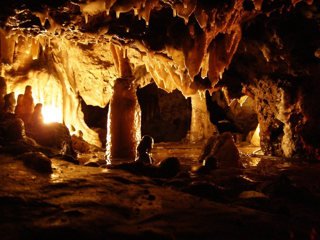
The geological formations within Veryovkina Cave are as awe-inspiring as its depth. The cave’s walls are adorned with intricate patterns of mineral deposits, formed over millions of years. These formations, including stalactites, stalagmites, and flowstones, provide valuable insights into the Earth’s geological history. The cave’s stratified layers are a testament to the natural processes that have shaped our planet. Mapping these formations is like reading a book written in stone—each layer tells a story spanning millions of years. Veryovkina Cave offers a unique window into the Earth’s geological past. The layers of rock and sediment found within the cave can help scientists understand the historical climate conditions and the processes that led to the cave’s formation. The study of speleothems (cave formations) within Veryovkina can also reveal information about past seismic activity and the hydrological history of the region.
The Horizontal Surprise That Defied Expectations

Early August 2017 – the PSC explored the cave to a depth of 2,151 m (7,057 ft). An ancient collector of the karst aquifer system with extensive horizontal tunnels, not typical for the Arabika Massif, was discovered. Veryovkina became the second super deep cave (over 2 km (1.2 mi)) and the deepest accessible without diving equipment. Most caves in this region plunge straight down like vertical shafts, but Veryovkina surprised everyone by branching out horizontally at its deepest levels. A huge system of more than 6,000 m (20,000 ft) of subhorizontal passages below −2,100 m (−6,900 ft) was discovered and surveyed. It’s like discovering that what you thought was a simple elevator shaft actually connects to an underground airport terminal.
The Future of Deep Cave Mapping

As exploration continues, Veryovkina Cave holds the promise of new discoveries. Scientists and spelunkers hope to uncover more about the cave’s formation, its unique ecosystem, and its potential for further depth. Advanced technologies, such as 3D mapping and remote sensing, are being employed to explore the cave’s most inaccessible regions, pushing the boundaries of human knowledge and endurance. The potential for new discoveries within Veryovkina Cave is vast. Future expeditions may reveal additional passages and chambers, extending the known depth of the cave even further. We’re only scratching the surface—or rather, barely penetrating the depths—of what these underground worlds might contain.
Why the Bottom Might Still Be Waiting

The only limit is how far down groundwater can seep into limestone before the pressure becomes too great, and we know from the Soviet-era Kola Superdeep Borehole that this limit is far from being reached by a known cave. The Kola Superdeep Borehole, the deepest hole in the world, drilled into the Earth from 1970 to 1994 until it reached a staggering depth of 12,262 meters (40,230 ft). Soviet geologists found water still circulating at depths of 6.9 km (4.3 miles), which is more than three times deeper than Veryovkina’s cave floor.