Imagine gazing up at the night sky, knowing that hundreds of miles above you, satellites are quietly watching Earth’s frozen giants—glaciers—as they creep, crack, and melt. It sounds like science fiction, but it’s real. And as climate change throws everything out of balance, keeping tabs on these icy rivers from space has never been more urgent—or more challenging. Our planet’s glaciers are vanishing before our eyes, and the technology we use to watch them is racing to keep up.
The Importance of Glaciers: More Than Just Ice

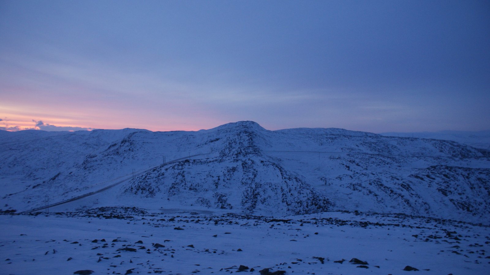
Glaciers aren’t just beautiful backdrops for postcards—they’re the lifeblood for millions. They feed rivers, regulate global sea levels, and even influence weather patterns. When these ancient ice masses change, the ripple effects stretch far beyond mountain valleys. Tracking them isn’t just about curiosity; it’s about predicting floods, understanding droughts, and even safeguarding communities. Losing track of glaciers would be like flying a plane with no instruments: dangerous and blind.
Why Track Glaciers From Space?
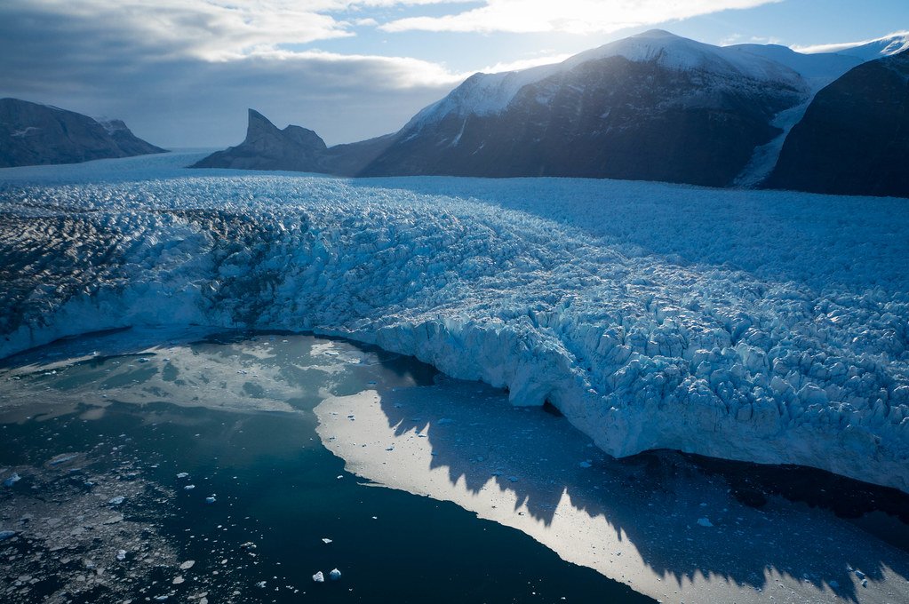
Glaciers sprawl across some of the planet’s most remote, hostile terrain. In places like Antarctica or the Himalayas, setting foot on the ice is risky, expensive, and sometimes impossible. Satellites, on the other hand, can sweep over these vast, frozen landscapes in minutes, capturing snapshots and data that would take humans months to collect. The view from space gives scientists a global perspective, letting them compare glaciers from Alaska to Patagonia in a single dataset.
The Magic of Remote Sensing
Remote sensing is the backbone of glacier monitoring from orbit. It’s like giving scientists superpowered eyes, letting them “see” not just visible light but also infrared, radar, and even microwave signals bouncing off the ice. These different signals help reveal how thick the ice is, how quickly it’s moving, and where it’s melting. Each satellite pass is another piece of a giant, ever-changing puzzle.
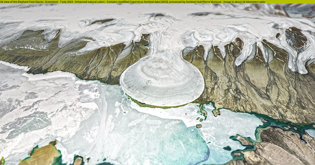
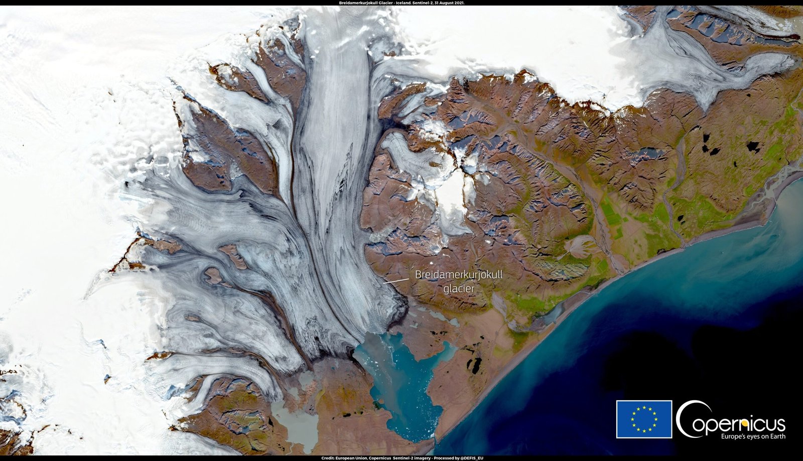
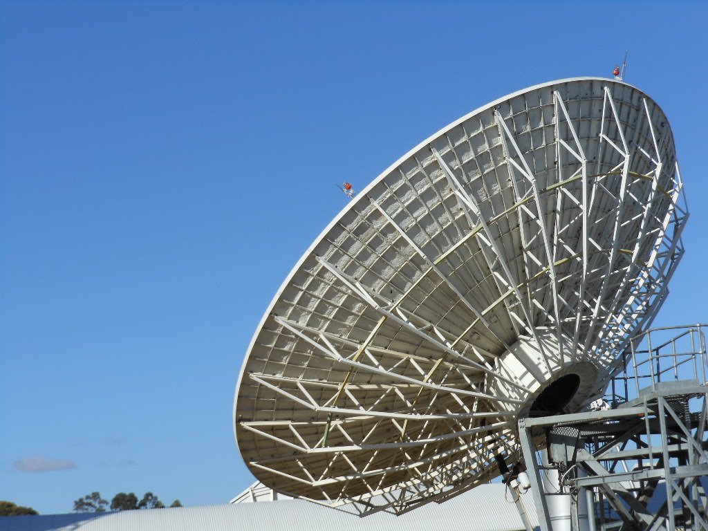
How Satellites Take Glacial Snapshots
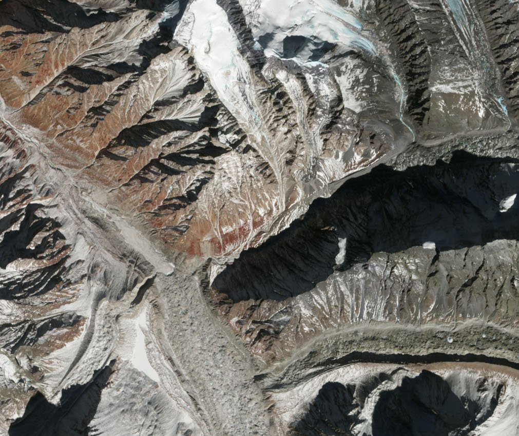
Satellites use cameras and sensors to capture images and measure the earth’s surface. Instruments like Landsat’s multispectral camera have been snapping pictures of glaciers since the 1970s, showing how their size and shape morph over decades. Other satellites, like Sentinel-1, use radar to pierce through clouds and darkness, creating detailed maps of glacier movement—even in the polar night.
Measuring Glacier Movement: Radar to the Rescue

Glaciers don’t just shrink; they move. Some slide slowly, while others surge with surprising speed. Synthetic Aperture Radar (SAR) satellites are the secret agents here. By firing radio waves at the ice and measuring the echoes, SAR can detect tiny shifts—sometimes just centimeters—in glacier flow. It’s like tracking a snail’s crawl from hundreds of miles in the sky.
Laser Altimetry: Taking the Glacier’s Pulse

Imagine using a laser pointer to measure the height of a mountain—from space. That’s what laser altimetry satellites like ICESat-2 do. They shoot laser pulses at the surface and time how long it takes for the light to bounce back. This reveals the glacier’s elevation and, over time, how much it’s losing to melt. Altimetry is crucial for spotting thinning glaciers, a key warning sign of trouble.
Peering Beneath the Surface: Gravity Detectives

Some satellites, like the GRACE mission, track changes in Earth’s gravity field. When a glacier melts and loses mass, the pull of gravity in that region weakens ever so slightly. By measuring these subtle shifts, scientists can estimate how much ice has vanished—even if it’s hidden beneath snow or clouds. It’s a bit like weighing the planet’s icy suitcases from orbit.
Thermal Imaging: Sensing the Glacier’s Temperature

Thermal cameras on satellites can “see” heat, even where our eyes can’t. By mapping the temperature of glaciers, scientists can spot melting zones, track freeze-thaw cycles, and even detect hidden streams of meltwater. It’s a powerful tool, especially as warming temperatures create hotspots on the ice that move and change with the seasons.
The Challenge of Cloud Cover

Here’s a frustrating reality: many glaciers live in places that are almost always cloudy. Optical satellites, which rely on visible light, can be blinded for weeks on end. That means missing crucial moments—like a sudden surge or collapse. Radar and thermal sensors help, but no single tool is perfect. Cloudy skies are a stubborn hurdle for space-based glacier watchers.
Seasonal Darkness in Polar Regions
The poles spend months each year in darkness, making it impossible for satellites that need sunlight to work. While radar can “see” in the dark, other sensors are left in the cold. This seasonal blackout creates gaps in the record, forcing scientists to piece together the story with incomplete chapters. It’s like trying to follow a movie with entire scenes missing.
Rapid Glacier Changes: Keeping Up With Chaos

Glacier change is speeding up. Some are melting so quickly that by the time one satellite passes over, the landscape has already shifted. This rapid transformation can outpace the slow, scheduled orbits of satellites, leaving scientists scrambling to keep up. The faster the glaciers change, the harder it is to capture their story in real time.
Technological Hurdles and Aging Satellites

Many of the satellites in orbit were launched decades ago. As they age, their sensors wear out, and newer replacements are not always ready in time. Budget cuts, technical glitches, and the sheer cost of launching new missions make it tough to maintain a consistent, high-quality record. Every lost satellite is like losing a pair of eyes on the ice.
Data Overload: Too Much of a Good Thing?

With newer satellites, the data keeps pouring in—so much that scientists sometimes struggle to keep up. Each day, terabytes of images and measurements need to be processed, analyzed, and stored. It’s a bit like opening a firehose and trying to drink from it. Making sense of this digital avalanche requires supercomputers, smart algorithms, and a lot of patience.
Interpreting the Data: Not Always Straightforward

Glacier data can be tricky to interpret. Snow can hide changes in the ice, shadows can confuse sensors, and mountains can block the view. Even with the sharpest technology, scientists must double-check and cross-reference their findings. Sometimes, what looks like a shrinking glacier in a photo is actually just a seasonal snow melt. Careful analysis is key.
The Role of Artificial Intelligence

Artificial intelligence (AI) is becoming a game-changer. By training computers to recognize patterns in glacier images, scientists can speed up the analysis and spot changes that humans might miss. AI can even predict future glacier behavior based on past trends, giving researchers a head start in the race against time. But AI is only as good as the data it learns from.
International Collaboration: A Team Effort

No single country can watch all the world’s glaciers alone. International partnerships—like those between NASA, ESA, and space agencies in Asia and South America—allow scientists to pool resources, share data, and fill in the gaps. Collaboration turns a patchwork of images into a global tapestry, making the glacier story clearer for everyone.
Citizen Science and Crowdsourcing

Surprisingly, everyday people are helping track glaciers, too. Projects invite volunteers to classify satellite images, spot changes, or even submit their own photos from remote hikes. This crowdsourced data adds extra eyes and insights, making the job a little less lonely for the scientists in the lab. It’s science, but with a human touch.
Why It’s Getting Harder: The Climate Wildcard
Climate change is rewriting the rules. Glaciers are responding in unpredictable ways—some shrinking, others surging, and many behaving in ways never seen before. That unpredictability makes it tough to model, forecast, and even spot trends. The old tools and methods don’t always work in this new, chaotic reality.
The Human Impact: Why It Matters to Us All

The fate of glaciers isn’t just a scientific curiosity—it’s a human story. When glaciers disappear, entire communities lose their water sources. Coastal cities face rising seas. Wildlife habitats vanish. Tracking glaciers from space is about protecting our future, not just recording a vanishing past. Every pixel of satellite data could mean lives saved, homes protected, or disasters averted.
The Future: Innovation on the Horizon
Despite the obstacles, hope shines through. New satellites with sharper eyes, faster computers, and better international partnerships are in the works. Scientists are experimenting with constellations of tiny satellites to capture every detail, every day. The race is on, and the next generation of technology could be the breakthrough we need to keep up with Earth’s changing glaciers.
Satellites soaring above us may seem distant, but their mission is deeply connected to our lives on the ground. As glaciers fade and technology evolves, the story of tracking these icy titans becomes more urgent—and more inspiring. Will we keep pace with the changes, or will we lose sight of these frozen sentinels forever?