On moonless autumn nights, the Atlantic sky becomes a moving river of wings – mostly invisible to the eye, but suddenly legible to machines. Biologists and data scientists are fusing radar, tiny sensors, and machine learning to follow that river across thousands of miles. The puzzle is urgent: many migratory species are declining, and the routes they depend on are shifting in a warming world. The new solution leans on pattern-hungry algorithms that can hear a single chip note in a noisy city and see a migration surge inside a storm. Together, they’re turning scattered clues into maps that update in near real time and point to places where conservation can still change the story.
The Hidden Clues

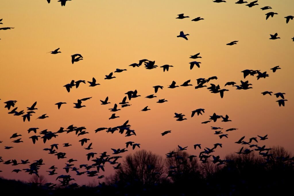
Migration is famously secretive – most songbirds travel at night, and a flock can pass over without a single person noticing. AI changes the visibility of that moment by reading signals we used to ignore: the shape of echoes on weather radar, the fingerprints of flight calls, the timing of arrivals at coastal stopovers. I still remember the first time I watched a radar screen bloom across the Northeast after sunset; the algorithms translated that sudden glow into estimated bird counts, directions, and altitudes. The numbers gave that shimmer a heartbeat. They also flagged hotspots forming along the coast, where birds tend to funnel before crossing water.
Microphones tucked into dunes and city rooftops add another stream of truth, catching upward-spiraling calls as birds pass in the dark. Machine learning models trained on spectrograms can now separate a thrush from a warbler by the briefest syllable, even when there’s traffic, wind, or distant sirens. That skill turns the night sky into a ledger of species and timing. And it gives coastal managers a heads-up when peak passage is coming – often just in time to dim lights or adjust construction schedules.
From Ancient Tools to Modern Science

Tracking birds once meant hand-placed bands and hours of patient observation at lighthouse points, beautiful work that produced narrow slices of truth. Then came radio telemetry towers, satellite tags, and GPS loggers, each shrinking in size while growing in precision. AI ties these pieces together by spotting broader patterns across instruments and time, so what used to be siloed datasets now talk to each other. A tower’s ping can be linked with radar flow, local wind fields, and citizen science reports, producing a storyline rather than isolated dots.
That integration matters as much as raw computational speed. It allows researchers to ask not only where a bird was, but why it moved when it did and what came next. The Atlantic Flyway is a living system, and AI’s strength is to capture its moving parts at once – shoreline weather, horseshoe crab spawning, urban light at night, ship traffic, and more. When old and new tools are stitched together like this, we get both the historical memory and the predictive edge that conservation needs.
Inside the Atlantic Flyway

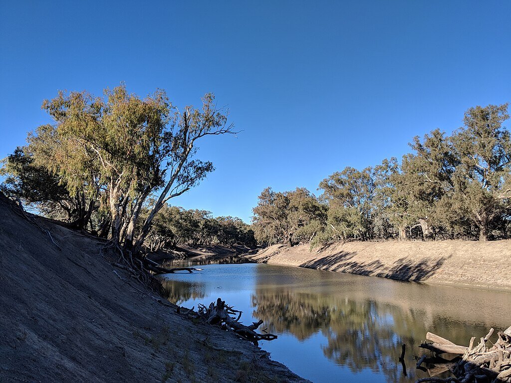
The Atlantic Flyway stretches from Arctic tundra through the Canadian Maritimes and U.S. Eastern Seaboard to the Caribbean and deep into South America. It’s a chain of stepping-stones: barrier islands, salt marshes, city parks, and river deltas where birds refuel before tackling long water crossings. Delaware Bay’s late-spring spectacle of shorebirds arriving to feast on horseshoe crab eggs is a classic pivot point; AI now helps forecast those arrivals and measure whether birds hit their stopovers in sync with food pulses. Farther south, coastal Florida and the Bahamas become critical launch pads for journeys into the Caribbean basin.
Across this corridor, AI-assisted radar models trace nightly “rivers” flowing along the coast and inland ridges, while sensor networks register which species are riding the current. The result is a moving weather map for wildlife, highlighting where winds, habitat, and human lights shape the stream. Managers can see when a cold front will trigger a high-volume flight and where spillover into urban skylines might drive window strikes. In a system this long and complex, timing is the invisible currency – and these tools track it down to the hour.
Training the Algorithms

Bird sounds and radar smears are messy, and the Atlantic is a loud stage: surf, insects, engines, and rain all compete with delicate calls. To cope, scientists convert audio into images called spectrograms, then train convolutional and transformer-based models to recognize subtle patterns that mark species identity. The models improve as they ingest more annotated examples from different habitats, microphones, and seasons, which reduces bias toward common birds and popular recording spots. False positives – like mistaking a squeaky gate for a warbler – are pruned through active learning loops and human review.
Data fusion is the secret spice. A radar pulse suggesting heavy movement becomes more trustworthy if microphones below confirm thrush calls and ground observers log fresh arrivals at dawn. Edge devices now handle some of that filtering in the field, storing only informative clips and saving battery life. When everything syncs – radar, audio, weather, and ground truth – the confidence in a nightly migration forecast jumps, and so does the usefulness for people trying to protect birds on the fly.
Why It Matters

North America has lost billions of birds since the 1970s, and many migrants are under pressure from habitat loss, glass collisions, and climate-driven mismatch with food. The Atlantic Flyway feels those stressors acutely because coastal development and light pollution compress safe routes and rest stops. AI helps by revealing where and when risks spike, so limited resources can be targeted with precision rather than spread thin. Compared with traditional monitoring alone, this approach scales faster, updates nightly, and captures the silent nocturnal pulse we used to miss.
- On peak nights, hundreds of millions to over a billion birds can be aloft across the United States, and AI-enhanced radar turns that surge into maps managers can act on.
- Nighttime light reduction in cities during forecasted migration peaks has been linked to fewer window strikes, and real-time predictions make those actions timely.
- Early alerts for mass departures or arrivals help align conservation with weather windows, reducing guesswork for coastal projects and wind-energy operations.
The payoff is practical: fewer collisions, better-timed habitat protections, and smarter planning for offshore infrastructure. The broader value is cultural, too – people can follow live forecasts and feel connected to a continental event that once slipped by in darkness.
The Future Landscape

The next leap lands in three places: smaller tags, smarter edges, and broader equity across the flyway. Solar-assisted micro-GPS units will push into warbler-sized territory, especially when paired with ultra-efficient chips that run recognition models on-device. Neuromorphic hardware – systems that mimic brain-like processing – could cut power needs dramatically, letting sensors listen for weeks in remote marshes. At the same time, satellite coverage is expanding, lowering the barrier for retrieving tiny packets of data from trackers over open ocean.
The scientific frontier is social as well as technical. Filling gaps in the Caribbean and northern South America will require investment in local networks, data sovereignty, and training so benefits are shared, not exported. Robust privacy standards are also key to keep nests and roosts safe from misuse, especially as maps become more precise. If those pieces come together, nightly migration forecasts could become as routine as weather – actionable, localized, and part of how coastal communities plan their evenings.
Global Perspectives

What works along the Atlantic Flyway is rippling across other hemispheric routes, from the East Asian–Australasian corridors to trans-Saharan pathways. The core idea – merge radar-like sensing, bioacoustics, and movement tags with machine learning – translates wherever birds ride seasonal winds. In some regions, insect swarms or sandstorms confuse the signal, but models adapt by learning new background patterns just as they did with traffic noise along the U.S. coast. Shared standards for labeling audio, handling uncertainty, and validating forecasts make these systems portable.
There’s also a philosophical shift: migration is no longer treated as a local curiosity but as planetary infrastructure, the wild equivalent of an international highway system. With comparable tools, nations can coordinate to protect the rungs of a flyway ladder rather than a single rung. That reframing helps align policies – like offshore wind siting or port lighting – with the actual timing of birds in motion. The Atlantic has become a proving ground for that cooperative model, and lessons learned there will travel with the birds.
Conclusion

You don’t need a lab to help; a few small habits scale when thousands of people adopt them. Turn off or dim nonessential outdoor lights during peak migration nights each spring and fall, especially in tall buildings and along the coast. Make windows safer with patterned films or screens in problem spots, keep cats indoors during migration waves, and plant native shrubs that fuel birds on arrival. If you like data, submit checklists to community science platforms and monitor nightly migration forecasts to time your efforts.
Support local land trusts and coastal refuges that maintain the stopovers birds depend on, and encourage city leaders to integrate migration alerts into lighting policies. The Atlantic Flyway is a shared space; the tools are new, but the responsibility is old. When millions of travelers pass overhead, a little foresight on the ground goes an awfully long way.

Suhail Ahmed is a passionate digital professional and nature enthusiast with over 8 years of experience in content strategy, SEO, web development, and digital operations. Alongside his freelance journey, Suhail actively contributes to nature and wildlife platforms like Discover Wildlife, where he channels his curiosity for the planet into engaging, educational storytelling.
With a strong background in managing digital ecosystems — from ecommerce stores and WordPress websites to social media and automation — Suhail merges technical precision with creative insight. His content reflects a rare balance: SEO-friendly yet deeply human, data-informed yet emotionally resonant.
Driven by a love for discovery and storytelling, Suhail believes in using digital platforms to amplify causes that matter — especially those protecting Earth’s biodiversity and inspiring sustainable living. Whether he’s managing online projects or crafting wildlife content, his goal remains the same: to inform, inspire, and leave a positive digital footprint.