If you’ve ever stood on the edge of the Grand Canyon, you know the strange mix of awe and vertigo it triggers. Your brain tries to process nearly two billion years of exposed rock stacked in colored layers, while your body just thinks, “Wow, that’s a long way down.” Even if you’ve only seen it in photos, it feels almost unreal, like someone sliced the planet open to show you its insides.
The question that nags at you is simple but enormous: how on Earth did this happen? The Grand Canyon didn’t appear overnight, and despite what the dramatic views suggest, it’s not the result of a single event. It’s the outcome of water, rock, time, and tectonic forces all working together over vast spans of time that are almost impossible to really imagine. Let’s pull that story apart and see how this gigantic scar in the Earth became one of the most famous landscapes on the planet.
The Ancient Rocks Beneath the Rim: A Deep-Time Foundation

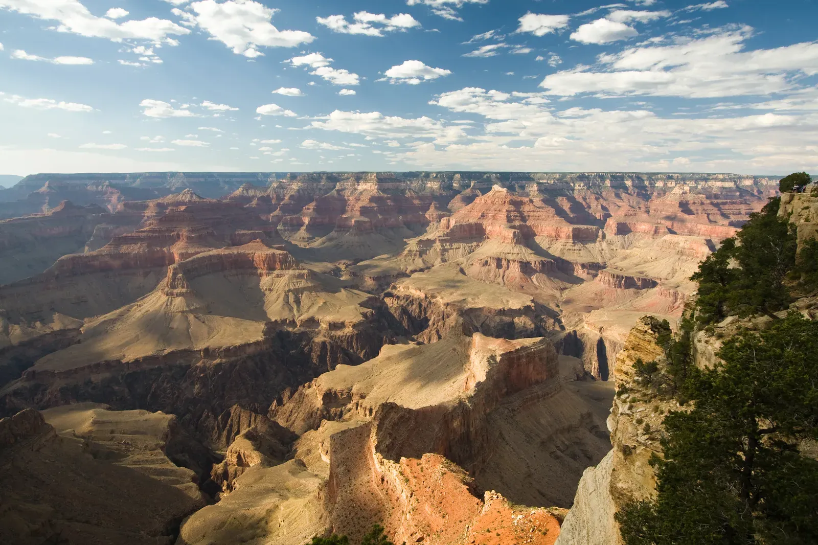
The Grand Canyon looks like a canyon carved in a plateau, but the story actually starts with the rocks long before the carving began. Deep in its walls, near the river, you find some of the oldest exposed rocks in North America, formed roughly about one and three quarter billion to nearly two billion years ago. These ancient rocks, mostly dark metamorphic and granite, are the hardened remains of long-gone mountains and ocean basins, compressed, heated, and stitched together as early continental pieces collided.
Above those ancient basement rocks sit younger sedimentary layers, laid down in flat sheets over hundreds of millions of years. Imagine deserts, shallow seas, coastal swamps, rivers, and beaches coming and going across this region, each leaving behind sand, mud, or lime-rich shells that later turned into rock. Over deep time, this stack of layers became like a cake with each layer preserving a different environment and era. When you look across the canyon walls, you’re literally seeing time in cross‑section, not just a random pile of stone.
From Seas to Deserts: Building the Layered Cake of Rock

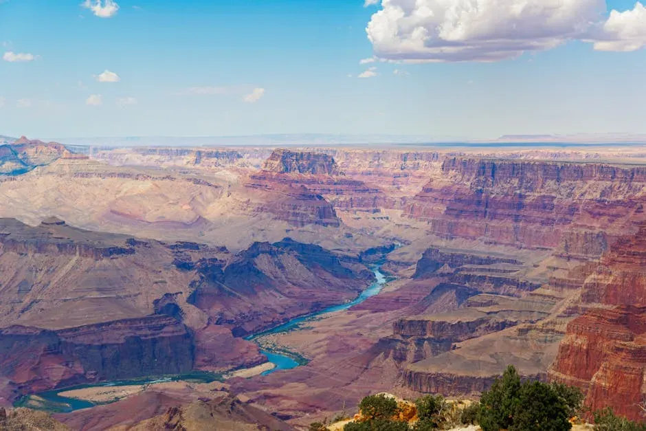
One of the most surprising things about the Grand Canyon is how many ancient environments are frozen into its walls. Some layers formed in warm, shallow seas where countless tiny sea creatures lived and died, leaving behind thick limestone deposits. Other layers, like the famous red sandstones, came from giant desert dune fields, where wind piled sand into huge ridges that later turned to rock. Between them you find mudstones and shales that formed in floodplains, deltas, or offshore marine settings.
Over time, these sediments were buried, compacted, and cemented into the layers we see today: Kaibab Limestone on top, then Toroweap, Coconino, Hermit, Supai, Redwall, and many more below. Each one tells a specific story about sea-level changes, climate swings, and shifting landscapes across hundreds of millions of years. What’s mind-bending is that these layers didn’t form anywhere near the huge chasm we see now; they were originally flat and continuous, covering a far wider region. The canyon would only come much later, slicing through this pre-built geological archive.
Uplift of the Colorado Plateau: Raising a Future Canyon

For a river to carve deeply, the whole landscape has to be lifted up, and that’s where the Colorado Plateau comes in. The Grand Canyon sits on this broad, high region of the American Southwest, which stands far higher than surrounding lowlands. Over roughly the last seventy million years or so, tectonic forces related to plate movements raised this area thousands of feet, but in a surprisingly gentle way. The rocks were pushed upward mostly without being heavily folded or shattered, like a huge, stiff table being lifted rather than crumpled paper.
This uplift tilted the odds in favor of erosion. Once the land rose higher, rivers had more potential energy to cut down toward sea level, like water starting from the top of a taller slide. That extra elevation made the Colorado River faster and more powerful, especially where it had to drop steeply through the plateau. So before the canyon itself really took shape, tectonics quietly primed the landscape, turning a flat, layered surface into a high, elevated platform just waiting to be carved open.
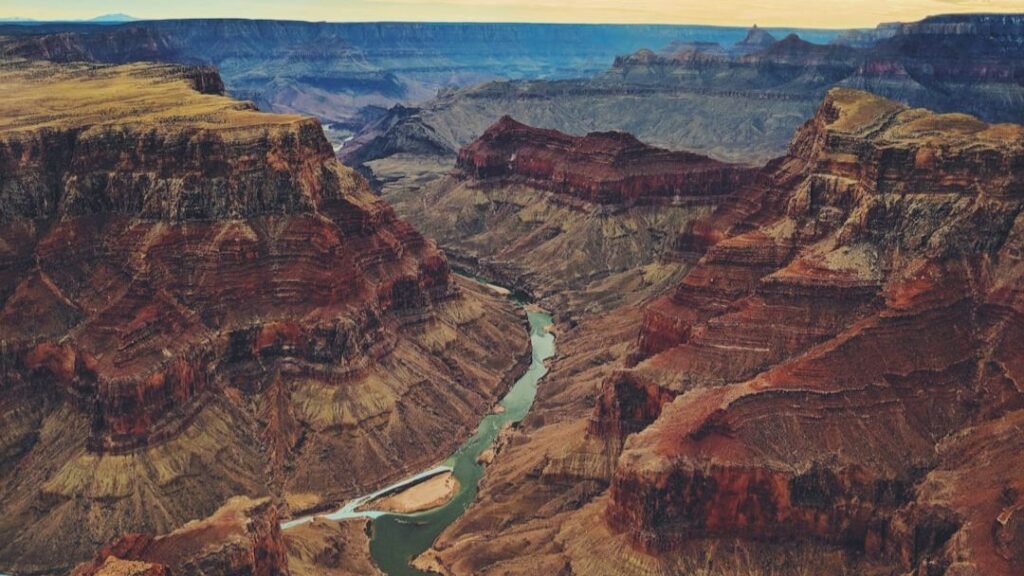
The Colorado River: Nature’s Relentless Sculptor

When people say the Colorado River carved the Grand Canyon, that’s mostly accurate – but it’s not the full story. The river is the main sculptor, no question, but it worked together with uplift, climate, and countless smaller streams. As the plateau rose and the river flowed toward lower ground, it began to cut into the rock, grain by grain, year after year. Over millions of years, this downward cutting, called incision, turned from a shallow valley into a deep gorge and eventually into the vast canyon we know.
Scientists still debate exactly when the modern Colorado River system linked up and began carving the canyon in its current form, but a strong consensus points to most of the major incision happening roughly within the last five to six million years. That sounds like forever to us, but in terms of Earth history, it’s surprisingly recent and remarkably fast. The river’s power comes from its long journey and steep drop across the plateau, plus sediment carried from far upstream that acts like sandpaper on the bedrock. Picture a saw that never stops moving, always loaded with fresh grit – that’s what a big river does to solid rock given enough time.
Water, Ice, and Gravity: Erosion Working as a Team

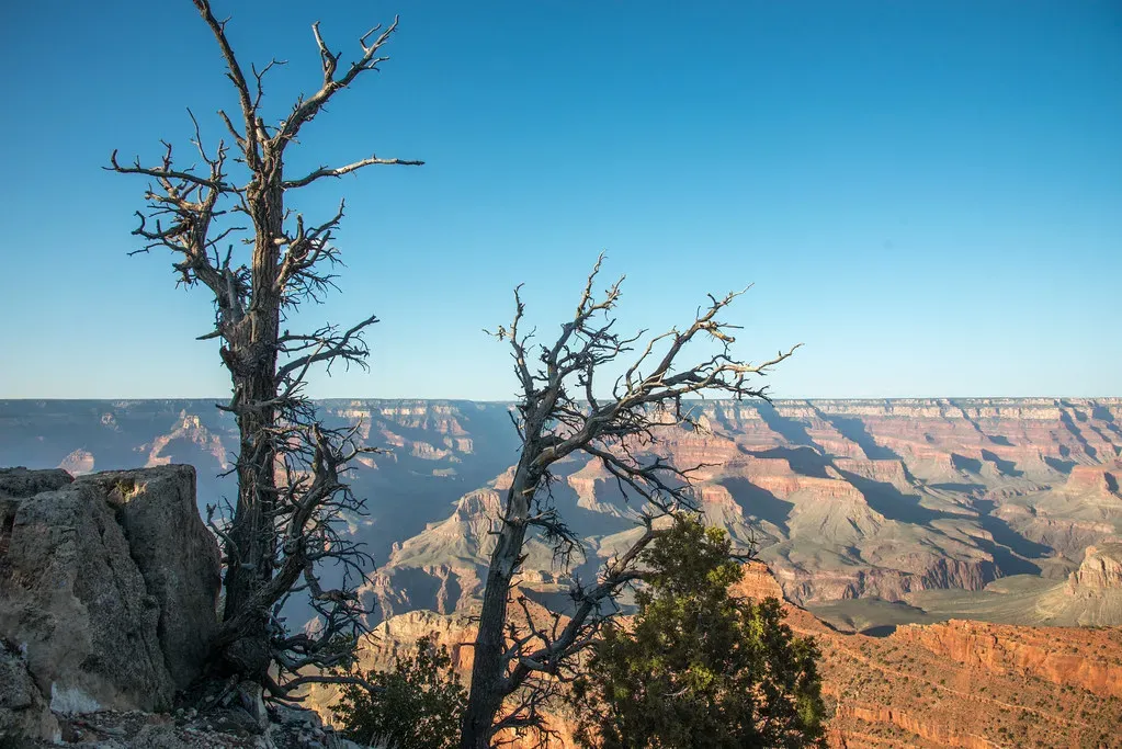
The river cut down, but the canyon widened and shaped itself thanks to a whole toolbox of erosional processes. Rain and snowmelt soaked into cracks and then froze in colder conditions, expanding and prying the rock apart; over time, this freeze–thaw action broke chunks off the cliffs. Gravity then pulled those loosened blocks downslope, sometimes slowly as rockfalls and slides, sometimes in sudden, dramatic collapses. Side canyons, carved by smaller streams, gnawed their way back toward the main canyon, creating the branching pattern you see on maps and in aerial photos.
Over geologic time, this combination of vertical incision by the Colorado River and sideways erosion by tributaries and weathering sculpted the stair-step walls and complex shapes along the canyon. Different rock layers erode at different speeds: softer mudstones and shales recede quickly, while harder limestones and sandstones form ledges and cliffs. That contrast in strength is what creates the tower-like buttes, mesas, and terraces that make the canyon look like a stone city. The end result is not just a chasm, but a three-dimensional masterpiece carved by water, ice, and gravity working together.
Climate Swings and Ancient Lakes: Changing the Pace of Carving
The Grand Canyon didn’t erode at a steady, gentle pace like a clock; its rate of carving sped up and slowed down as climate changed. During cooler, wetter ice age periods over the last couple of million years, there was more precipitation, more runoff, and more powerful flows in the Colorado River and its tributaries. Those higher flows could move larger sediment loads and cut the canyon floor more aggressively. In drier spells, river incision slowed, and weathering and mass wasting shaped the walls more than the river deepened the channel.
There’s also evidence that natural dams formed at times, like when lava flows crossed the river or landslides blocked it, creating temporary lakes that later drained catastrophically. When those dams failed, powerful flood waves surged through parts of the canyon, scouring and rearranging sediment on a huge scale. These bursts of intense erosion likely helped carve knickpoints and deepen certain sections. So while the big picture is millions of years of steady work, the canyon’s history also includes episodes that were sudden, violent, and transformative on a human timescale.
Reading the Canyon’s Walls: A Timeline Written in Stone
One of the reasons geologists love the Grand Canyon is that it’s like an open book of Earth history with the pages spread out in front of you. Every distinct layer has its own age, composition, fossils, and story, and together they bracket nearly two billion years. The youngest rocks at the rim are still hundreds of millions of years old, while the oldest at the bottom formed long before plants colonized land. By dating minerals, studying fossils, and tracing layers across the region, scientists have pieced together a timeline that connects local rocks to global events like ancient supercontinents and long-vanished oceans.
For non-scientists, this rock record is still surprisingly readable once someone points out a few key clues. You can learn to recognize a marine limestone layer and imagine a tropical sea, or spot cross-bedded sandstone and picture desert dunes marching in the wind. When I first hiked partway down the Bright Angel Trail, it hit me that every switchback was not just changing elevation, but jumping back millions of years in time. The canyon turns abstract numbers into something you can literally touch, which makes deep time feel less like a concept and more like a physical place.
The Canyon Today: A Landscape Still in Motion
It’s tempting to think of the Grand Canyon as finished, like a completed sculpture in a museum, but it’s still changing every day. The Colorado River continues to carry sediment, cut its bed, and shift its channel in small ways, especially during high flows. Rockfalls and landslides still reshape the walls and close trails; every year, fresh debris piles appear at the base of cliffs. Even tiny processes like plant roots widening cracks and wind-blown sand abrading surfaces quietly contribute to the canyon’s ongoing evolution.
At the same time, human actions are now part of the story. Dams upstream, especially Glen Canyon Dam, have changed the river’s flow, temperature, and sediment supply, altering how it erodes and deposits material within the canyon. Conservation efforts, research, and controlled flood releases are attempts to balance energy use, ecosystem health, and the preservation of this extraordinary landscape. The Grand Canyon is both ancient and very much alive, a reminder that even Earth’s most iconic features are just snapshots in a much longer story of change over time.