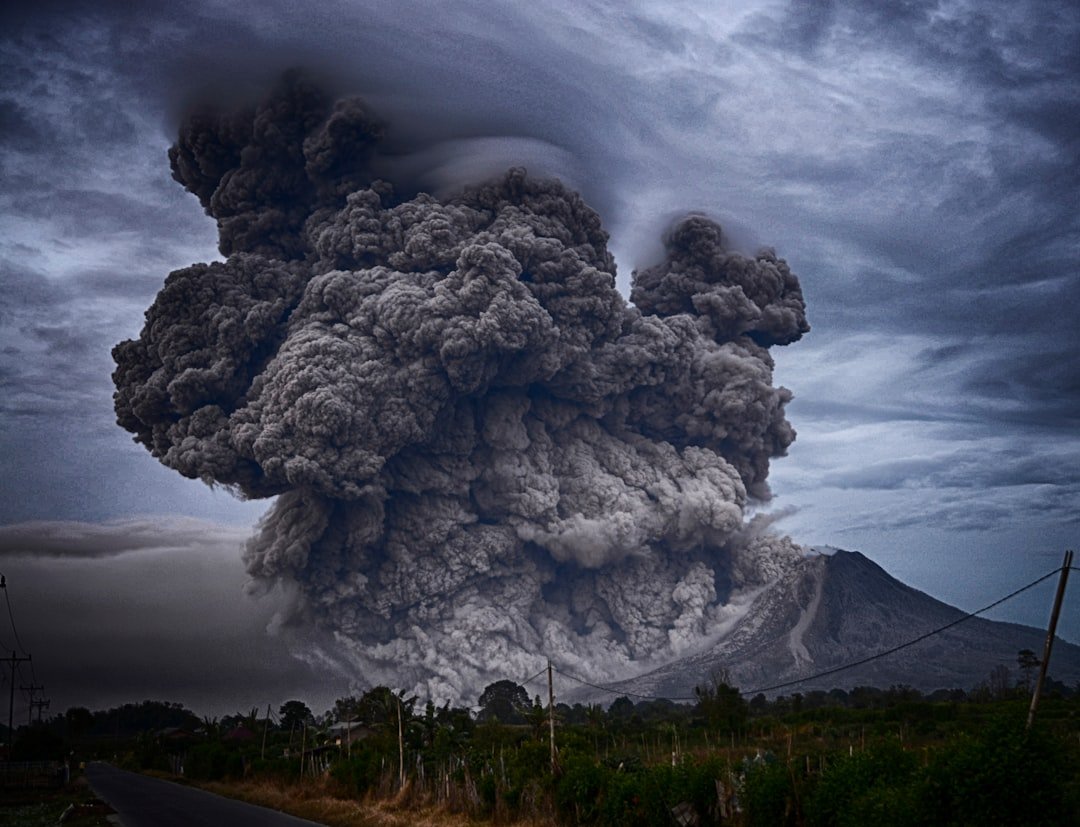
Picture a sleeping giant under a national park, a ski town, or a quiet bay – and then imagine its breath, once in many lifetimes, drifting as a gray veil across a continent. The question of how close you are to a supervolcano isn’t just about miles on a map; it’s about wind, ash, water, and the long memory of the Earth. Scientists use a plain term – large caldera systems – for what headlines call supervolcanoes, but the scale is the same: rare eruptions that can move landscapes and economies. The good news is that these events are extraordinarily uncommon; the challenge is that their impact can stretch far beyond the crater rim. So the real story blends geography with monitoring, and personal risk with global consequences, a puzzle where distance is only one piece.
The Hidden Clues
Start with a twist: you can be hundreds of miles away and still be “close” in a practical sense. For ash, closeness follows the wind, not the road network, and a plume can ride the jet stream like a red-eye flight. Water makes you close too, since many cities drink from reservoirs that can be clogged by ash and fine grit during a major event. And because modern life is stitched together by supply chains, a distant eruption can still shut down flights, delay medical supplies, and interrupt food distribution.
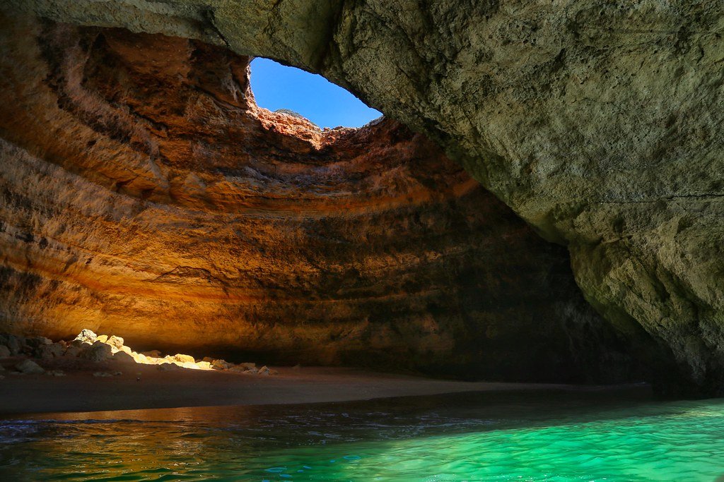
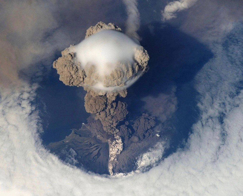
When scientists talk about “super,” they’re thinking about eruptions capable of spreading thousands of times more ash than a typical volcano, the kind that leaves a caldera tens of miles wide. Those scars are the fingerprints you can see today: basins, lakes, and ring-shaped mountain arcs. The clues are there if you know how to read the landscape, and they reach into places far beyond the postcard view of a steaming geyser.
Where the Giants Actually Are
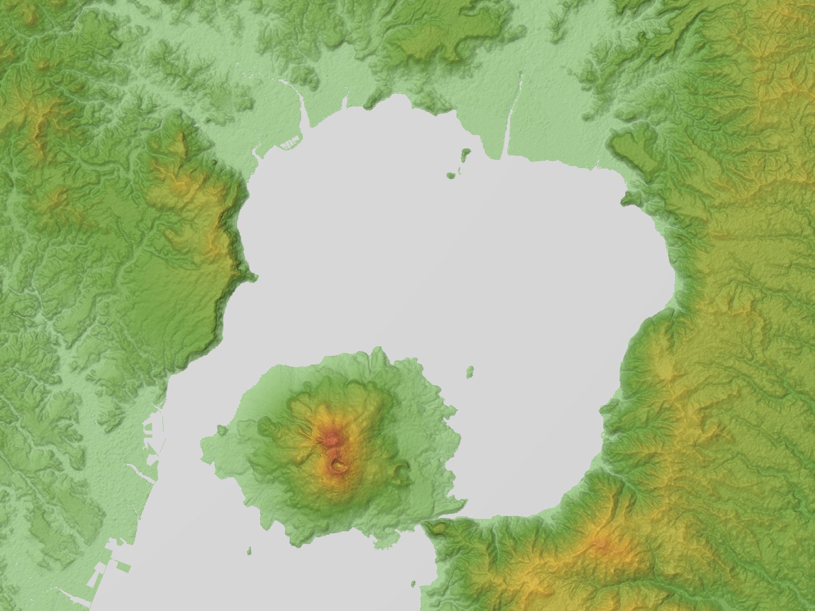
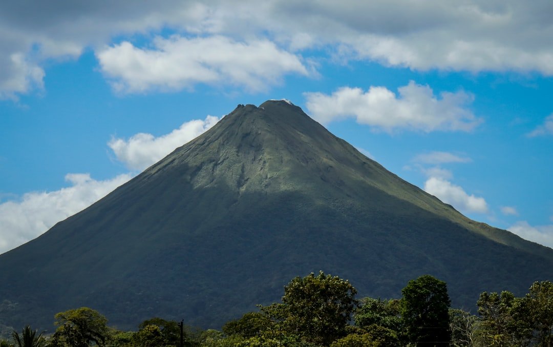
In the United States, the most famous large caldera is Yellowstone, straddling Wyoming, Montana, and Idaho, with a living hydrothermal system humming beneath. California hosts Long Valley near Mammoth Lakes, a vast depression created by an ancient ash flow that blanketed the West. New Mexico’s Valles Caldera is quieter, but it’s another chapter in North America’s caldera story. Abroad, New Zealand’s Taupō, Indonesia’s Toba, and Italy’s Campi Flegrei anchor the global map of outsized systems that scientists watch closely.
If you live in the American West, you may be within a day’s drive of at least one caldera, even if you’ve never noticed the rim. In Europe, millions live within a short commute of Campi Flegrei near Naples, where everyday life unfolds atop restless ground. And across Southeast Asia and the Pacific, volcanic arcs knit through densely populated islands and coasts. Geography matters, but so does how often you fly, where your food is grown, and which direction the wind prefers to blow.
Reading the Signs Beneath Your Feet
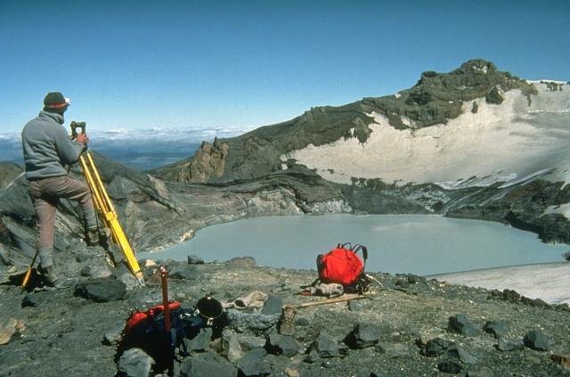
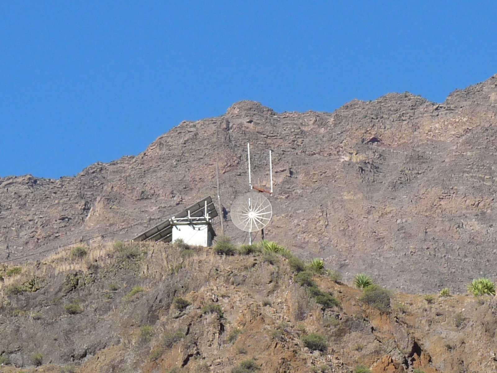
Volcano observatories track what the ground and gases are whispering. Arrays of seismometers listen for swarms of tiny quakes that signal hot fluids and magma shifting at depth. GPS and satellite radar measure uplift and subsidence with inch-level precision, catching the slow inhale and exhale of a caldera’s floor. Gas sensors watch for changes in carbon dioxide and sulfur emissions, the volcanic equivalent of changes in a heartbeat.
None of these signals alone calls a shot; it’s the pattern that matters. Swarms can rise and fade without an eruption, and uplift can reverse as fluids redistribute. That’s why scientists use multi-parameter dashboards rather than single alarms, cross-checking noisy natural systems the way pilots scan instruments in turbulence. The goal isn’t prediction with a date stamp – it’s forecasting trends, narrowing the uncertainty, and buying time.
From Ancient Tools to Modern Science
Long before satellites, people read ash in lake mud and ice, mapping ancient blasts by tracing microscopic glass shards. That detective work, called tephrochronology, stitches together a timeline of past behavior, showing how a volcano tends to cycle between quiet and restless. Today, orbiting radar satellites pass overhead every few days, turning calderas into living topographic maps that rise and fall like slow tides. Ground networks add context, capturing pressure changes in boreholes, temperature in hot springs, and chemistry in gas vents.
Newer tools are pushing the edge: fiber-optic cables repurposed as dense arrays can detect tiny vibrations across long distances, and machine-learning models sift terabytes of data for patterns humans might miss. The best forecasts blend this old and new – ash shards in a microscope, pixels from space, and lines of code hunting for precursors. It’s less crystal ball and more weather report, updated as the instruments learn more each month.
Why It Matters
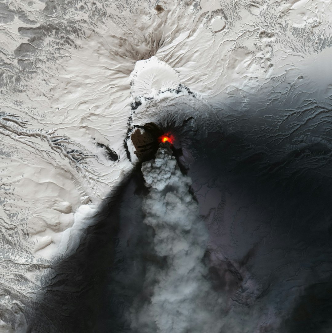
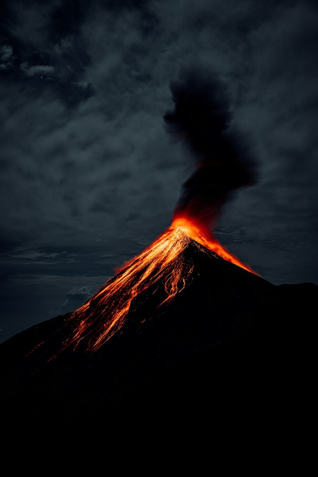
The risk isn’t just ash on cars – it’s the cascade. Even a moderate explosive eruption can disrupt air travel, foul water treatment, and burden hospitals with respiratory cases, especially for people with preexisting conditions. Agriculture feels it next: thin ash blankets reduce sunlight and can damage crops and machinery, while grazing animals struggle with muddy, abrasive pastures. Power grids are vulnerable to wet ash, which conducts electricity and can short out insulators. And for a super-scale event, those impacts stretch from local to continental.
Compared with the past, we now have denser monitoring, faster communication, and better models to anticipate who will face the heaviest ash and when. That evolution turns what used to be a sudden catastrophe into a managed emergency with staged responses. Preparedness doesn’t eliminate the hazard, but it shrinks the surprise. In practical terms, that can mean fewer flight cancellations, safer water supplies, and quicker recovery times when the sky finally clears.
Global Perspectives
Italy’s Campi Flegrei sits within a metropolis, making land uplift and swarms a public conversation as much as a scientific one. In Indonesia, volcanic arcs thread through daily life, where fishermen, farmers, and airports share the same coastlines as lava domes and calderas. New Zealand treats its volcanic heartland as both a natural treasure and a living system, pairing tourism with robust monitoring and frequent public updates. The United States spreads responsibility across multiple observatories that coordinate during unrest, leaning on standard alert levels and common playbooks.
Every country builds resilience in its own way, but the most effective approaches share themes: transparent communication, regular drills, and clear thresholds for raising alert levels. Strong local journalism and trusted science agencies help inoculate the public against rumor cycles. Community memory – the stories of grandparents who saw ash fall – matters too, guiding common-sense decisions when official updates arrive. It’s a patchwork, but it’s improving.
The Future Landscape
Forecasting will hinge on integrating more data with fewer false alarms. Expect constellations of small radar satellites to deliver near-daily deformation maps, while ground sensors stream in real time over resilient networks. Fiber-optic listening along highways and undersea cables could turn infrastructure into scientific arrays, multiplying our ears where building new stations is tough. Better ash-dispersion models, tuned with machine learning, will translate wind forecasts into hour-by-hour plume maps that emergency managers can act on.
There are hurdles: more sensitivity can mean more noise, raising the risk of over-warning. Data must be shared quickly without sowing panic, and models need continuous testing against reality. Funding cycles rarely match geologic time, so sustaining long-term monitoring is a policy challenge, not just a technical one. But the trajectory is clear – smarter, faster, and more connected.
The Human Factor
I remember walking near Mammoth Lakes one autumn and catching the faint scent of sulfur on a cold breeze; nothing dramatic, just a reminder that the ground underfoot is alive. That’s the paradox of caldera country – beauty and heat living side by side. For local communities, the question isn’t fear, it’s familiarity: knowing which alerts to follow, which roads to avoid in ash, and how to keep water clean when the sky turns gray. Tourists come and go, but residents build practical habits, and those habits scale when the stakes rise.
Being “close” is partly mindset. If you pay attention to seasonal winds, the locations of reservoirs, and the routes of major highways and power lines, you’ll understand your real proximity. You don’t need to live on a crater rim to be touched by a big eruption, and you don’t need to panic to be prepared. Awareness, practiced over time, turns a rare threat into a manageable risk.
What You Can Do Now
Check your regional volcano observatory and sign up for official alerts so you’re not relying on rumor during unrest. Keep basic supplies that help with ash: sturdy masks for dusty cleanup, spare air filters for vehicles and HVAC, and a plan to protect electronics and water inlets. Talk with family about a simple shelter-in-place routine for heavy ashfall, including when to stay off the roads and how to keep gutters clear once it’s safe. If you fly often, know that aviation advisories are based on ash concentrations; plan for flexible itineraries during regional eruptions, even far from home.
Support science where you live: local geology programs, museum exhibits, or community talks that demystify the hot ground we love to hike. Encourage leaders to invest in continuous monitoring and open data, because clarity during a crisis is built years in advance. Your distance to a supervolcano is measured in miles, yes – but also in knowledge, trust, and the small preparations that make big differences when the sky changes color.

Suhail Ahmed is a passionate digital professional and nature enthusiast with over 8 years of experience in content strategy, SEO, web development, and digital operations. Alongside his freelance journey, Suhail actively contributes to nature and wildlife platforms like Discover Wildlife, where he channels his curiosity for the planet into engaging, educational storytelling.
With a strong background in managing digital ecosystems — from ecommerce stores and WordPress websites to social media and automation — Suhail merges technical precision with creative insight. His content reflects a rare balance: SEO-friendly yet deeply human, data-informed yet emotionally resonant.
Driven by a love for discovery and storytelling, Suhail believes in using digital platforms to amplify causes that matter — especially those protecting Earth’s biodiversity and inspiring sustainable living. Whether he’s managing online projects or crafting wildlife content, his goal remains the same: to inform, inspire, and leave a positive digital footprint.