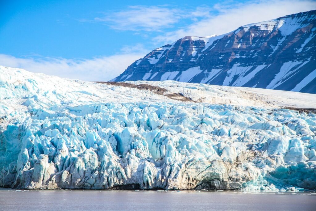
Some glaciers don’t just melt or creep; they lurch. In a matter of months, a quiet river of ice can accelerate from a snail’s pace to a thundering, valley-filling wave that bulldozes forward like a slow-motion tsunami. Scientists call this behavior a surge, and it shatters our intuition about how ice should behave. The mystery is urgent because surging glaciers can dam rivers, spawn floods, and hurl ice into shipping lanes – yet their triggers are hidden deep under the ice. The story of surges is part detective case, part physics lesson, and part warning about a planet rearranging its frozen furniture.
The Hidden Clues
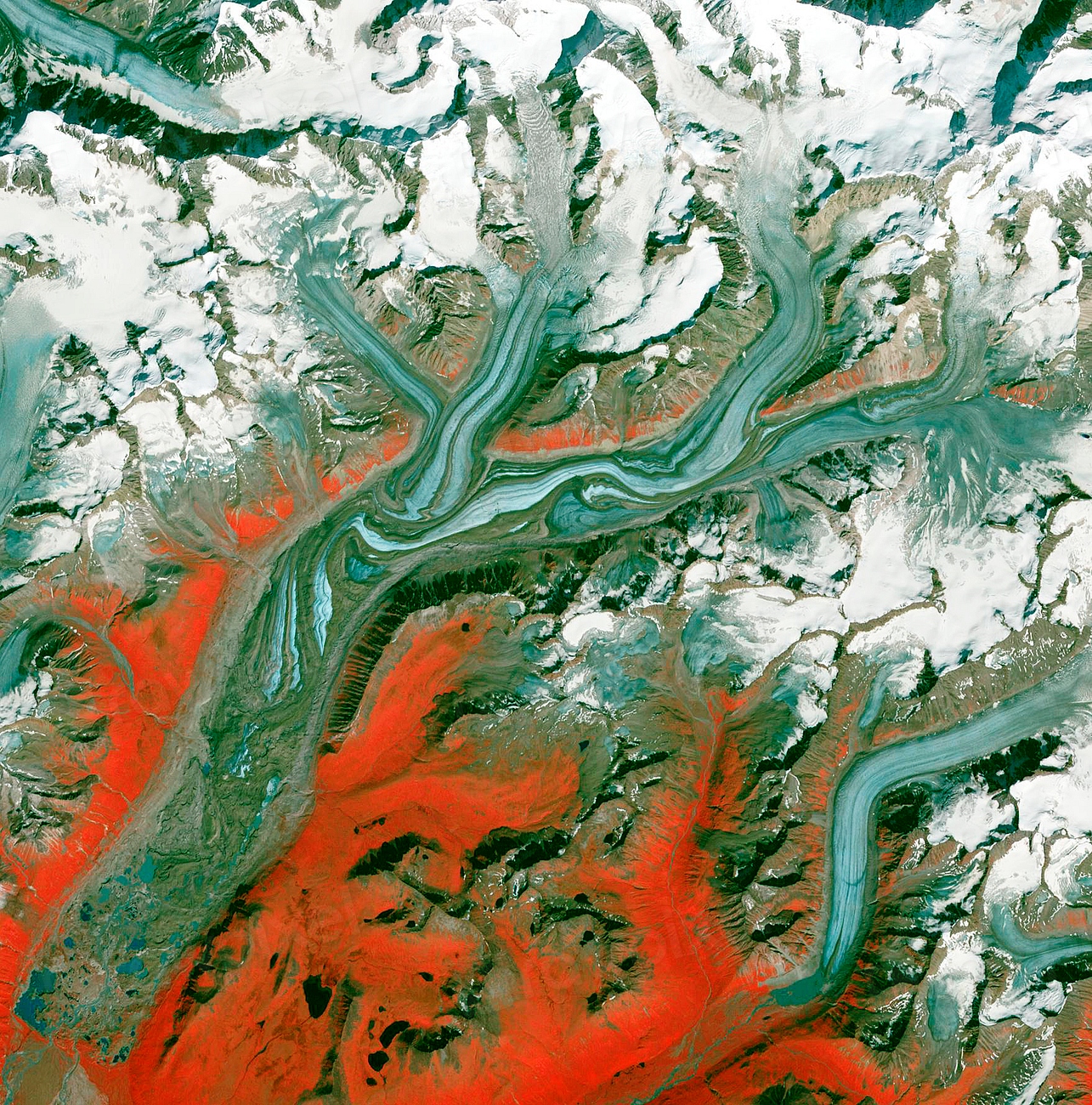
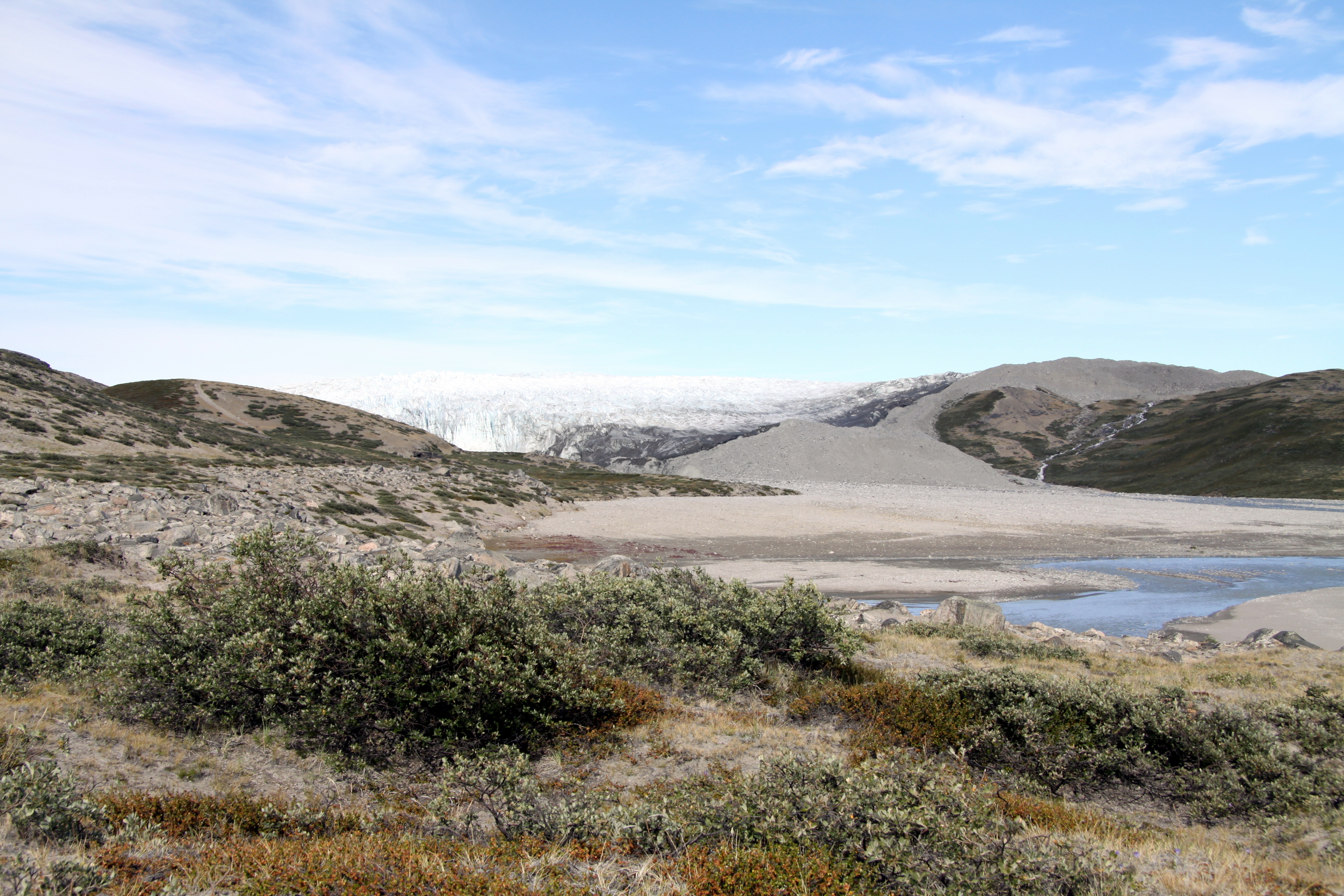
Surge-type glaciers spend long, sleepy years in a “quiescent” phase, then suddenly race ahead, sometimes moving meters per day instead of mere centimeters. The visual clues often appear first at the surface: crevasses flowering into chaotic patterns, bulges rippling down-glacier, and dark stripes of debris bending like taffy. From the ground, it can feel like the landscape has shifted into a higher gear without telling anyone.
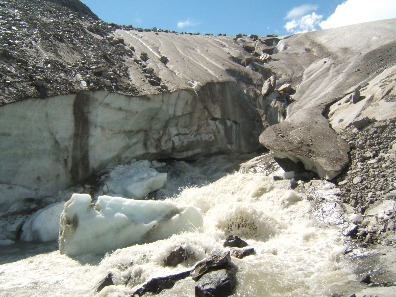
What you can’t see is just as dramatic. Beneath the ice, water pressure can spike, lubricating the bed and letting the glacier slide faster over rock and sediment. In some valleys, soft, water-soaked till deforms like wet clay, amplifying the motion. The result is a traveling pulse of mass that transfers ice from the high, snow-gathering zone to the lower, melt-prone reaches where the surge eventually stalls.
From Ancient Tools to Modern Science
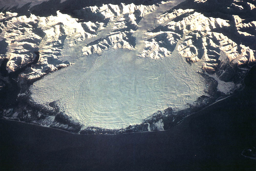
Early explorers tracked glacier fronts with cairns and painted marks, catching only glimpses of their tempo. Aerial photos later offered snapshots, revealing how entire tongues of ice had advanced dramatically between flights.
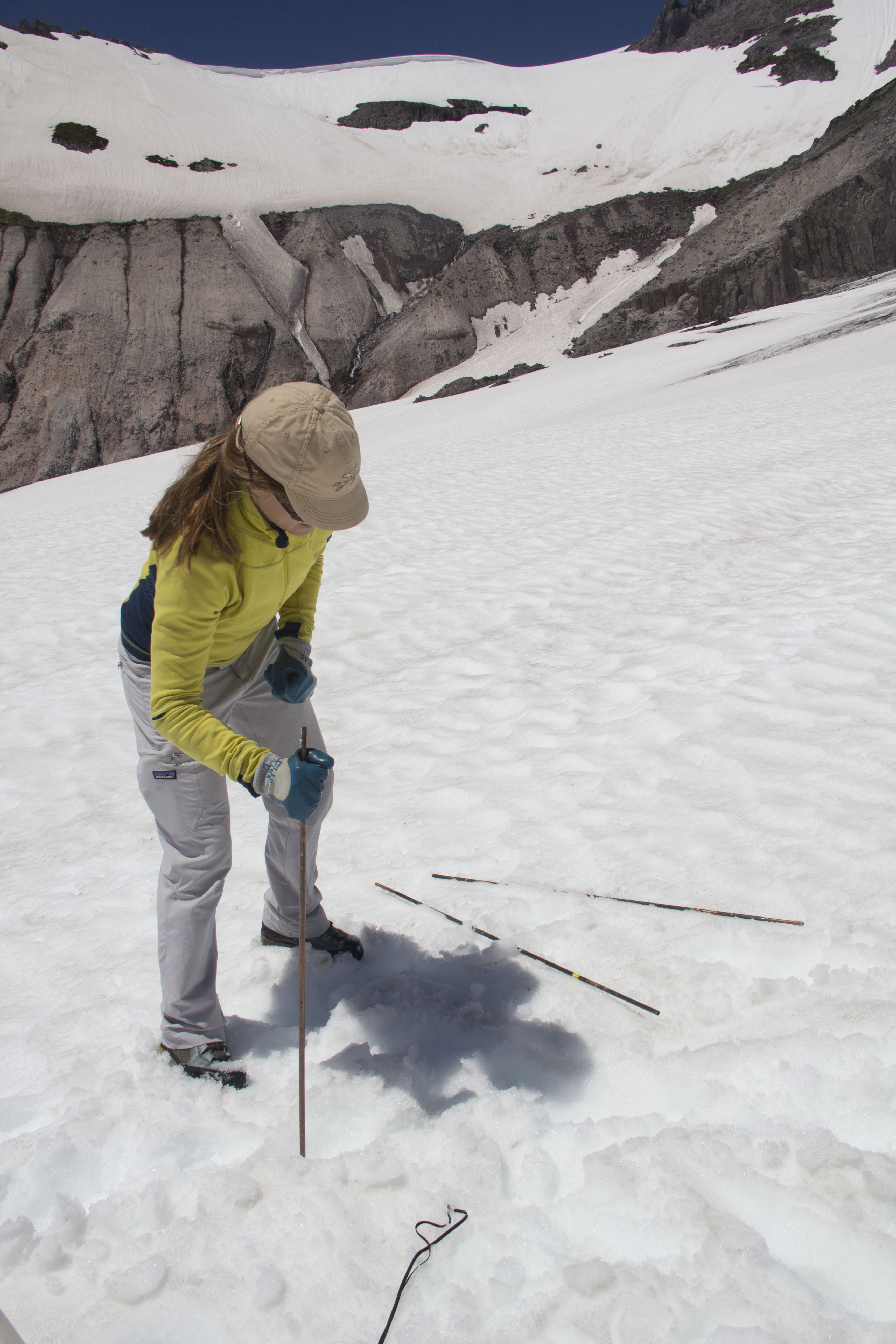
Today, satellites knit those snapshots into a near-continuous film. Radar interferometry measures motion through clouds and darkness, laser altimeters capture centimeter-scale elevation changes, and optical constellations provide weekly mosaics that map crevasse patterns like fingerprints. Drones and GPS stakes validate these views from the ground, rounding out a toolkit that can spot a surge in its opening act. Put together, it’s like switching from a flipbook to high-definition time-lapse.
Anatomy of a Surge
A surge is not a simple on-off switch; it’s a cascading sequence. First, the glacier quietly stores mass in its upper reaches over years or decades, thickening like a reservoir behind a dam. Then a threshold is crossed – often tied to subglacial water routing – prompting a rapid shift from efficient, channelized drainage to a more widespread, pressurized system that reduces friction and unleashes motion.
Surface speeds climb, crevasses open, and the glacier’s snout can advance kilometers, bulldozing moraines and swallowing shrubs that had colonized a previously stable front. Eventually, drainage reorganizes, friction increases, and the engine winds down. The ice redistributed to lower elevations is exposed to warmer air and meltwater, thinning the glacier even as the upper reservoir begins to refill. Think of it as a heartbeat you can see from space, with long rests and short, powerful contractions.
Not all surges look alike, though. Some are explosive and short; others simmer for years. The common thread is an internal reset of the glacier’s plumbing and mechanics rather than a simple response to a warm day or cold snap.
The Human Footprint at the Glacier’s Edge
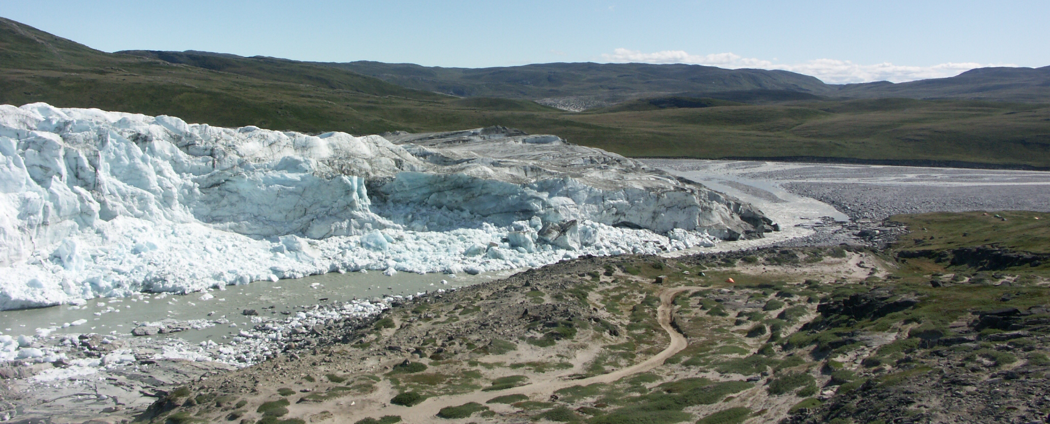
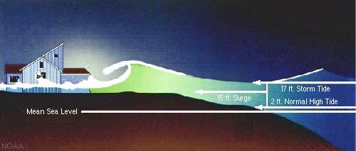
For communities living beside surge-prone glaciers, the difference between a quiet decade and a turbulent season can be measured in road closures and emergency briefings. Surging ice can dam rivers, forming temporary lakes that later drain in sudden outburst floods, sending walls of water downstream. In fjords, a rapidly advancing front may increase iceberg calving and churn local currents, complicating fishing and navigation.
I’ve felt that tension firsthand on a field trip when helicopter pilots weighed the odds of flying past an advancing front that had changed shape overnight. Rangers, engineers, and scientists often find themselves improvising around moving targets, rerouting trails and reinforcing bridges in a race against ice that no one commanded to start. Local economies that depend on scenic stability – glacier vistas, ferry routes, seasonal roads – learn to plan with contingency baked in. A surge is not just a geophysical event; it’s a civic stress test.
Global Perspectives
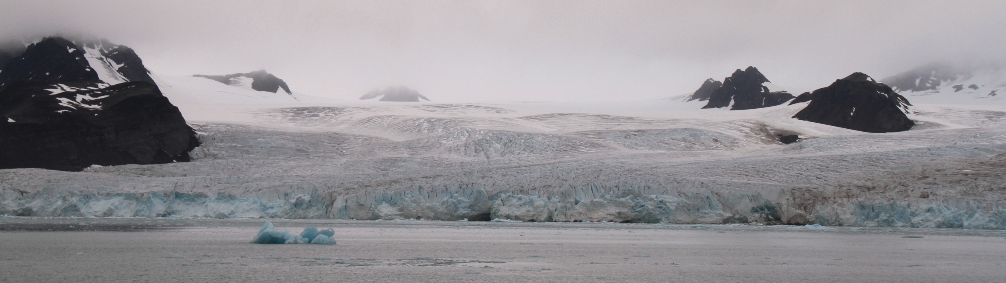
Surge behavior clusters in certain regions where glacier beds, climate, and geology conspire: high Arctic archipelagos, rugged Asian ranges, and subarctic mountain belts. Polythermal glaciers – those with a patchwork of cold and temperate ice – appear particularly prone to surging, likely because their mixed internal temperatures make the plumbing more susceptible to pressure swings. That helps explain why some cold places host a surprising number of these fast-forward episodes.
Still, global patterns are messy. While many glaciers are shrinking in a warming world, surges can persist or even appear in places with complex snowfall and temperature trends, complicating the narrative. For shipping planners, conservationists, and hazard managers, that variability is the point: local context matters as much as global averages. The planet may be warming overall, but individual glaciers still dance to their own internal rhythms.
Why It Matters
Surges primarily shuffle ice downslope; they are not a direct climate signal in the way that long-term retreat is. Yet the consequences of that shuffling can be profound. By delivering thick ice quickly to lower, warmer zones, surges can set the stage for years of extra melt and calving, nudging sea-level contributions upward compared with a steady creep.
They also generate hazards that classic glacier models – built for gradual change – often fail to anticipate. Flood risks downstream of temporary ice dams, destabilized valley walls as the ice bulks up and recedes, and abrupt shifts in sediment delivery all ripple through ecosystems and infrastructure. In risk terms, it’s the difference between a steady drizzle and a sudden cloudburst. Planning that ignores surges is planning for a world that doesn’t exist.
The Future Landscape
As the cryosphere warms, the mechanics of surging will not stand still. Some scientists expect warmer, more efficient drainage systems to reduce the frequency or intensity of surges in certain regions because better plumbing means less basal pressure buildup. Others point to evidence that thicker snowfall, shifting monsoons, or changing ocean contact can keep the phenomenon alive or reshape its timing.
Emerging tools promise earlier warnings. Daily radar snapshots, machine-learning velocity trackers, and dense networks of low-cost sensors could spot the subtle prelude – minute uplifts, faint seismic tremors, odd meltwater pulses – before the surge crests the hill. Pair those with rapid hazard mapping and you get lead time measured in weeks instead of days. The challenge is turning that foresight into action plans, especially in remote valleys where a good road counts as high technology.
In short, the next decade is likely to bring fewer surprises for those watching closely, but the surprises that remain will be larger where people and infrastructure sit in harm’s way. Preparing for that asymmetry is the sensible bet.
From Ancient Tools to Modern Science
Scientists are also revisiting archives to ground-truth today’s rapid monitoring. Old expeditions left sketches and diaries that, when georeferenced, reveal which glaciers have surged for centuries and which only started acting up recently. That historical context helps separate internal cycles from climate-driven shifts.
Blending the past with the present is changing the questions we ask. Instead of only asking when the next surge will start, teams now ask how far it might go, which valleys it could dam, and how much mass it will deliver to warmer zones. Those are the answers communities need to prepare, and they hinge on both physics and history.
What You Can Do
Engagement starts with awareness. If you live near glacier-fed rivers or plan travel in surge country, pay attention to seasonal advisories and park bulletins that flag unusual ice motion. Local science centers and universities often share open dashboards that track surface speeds and lake levels.
Support the institutions that make early warning possible: public satellite programs, hazard mapping agencies, and field crews who keep sensors alive through brutal winters. Citizen photos with precise dates and locations can help researchers confirm changes between satellite passes. For those far from ice, supporting emissions cuts and resilient infrastructure is still part of the surge story, because every fraction of a degree steers how much ice ends up in harm’s way and how quickly it melts once it gets there.

Suhail Ahmed is a passionate digital professional and nature enthusiast with over 8 years of experience in content strategy, SEO, web development, and digital operations. Alongside his freelance journey, Suhail actively contributes to nature and wildlife platforms like Discover Wildlife, where he channels his curiosity for the planet into engaging, educational storytelling.
With a strong background in managing digital ecosystems — from ecommerce stores and WordPress websites to social media and automation — Suhail merges technical precision with creative insight. His content reflects a rare balance: SEO-friendly yet deeply human, data-informed yet emotionally resonant.
Driven by a love for discovery and storytelling, Suhail believes in using digital platforms to amplify causes that matter — especially those protecting Earth’s biodiversity and inspiring sustainable living. Whether he’s managing online projects or crafting wildlife content, his goal remains the same: to inform, inspire, and leave a positive digital footprint.