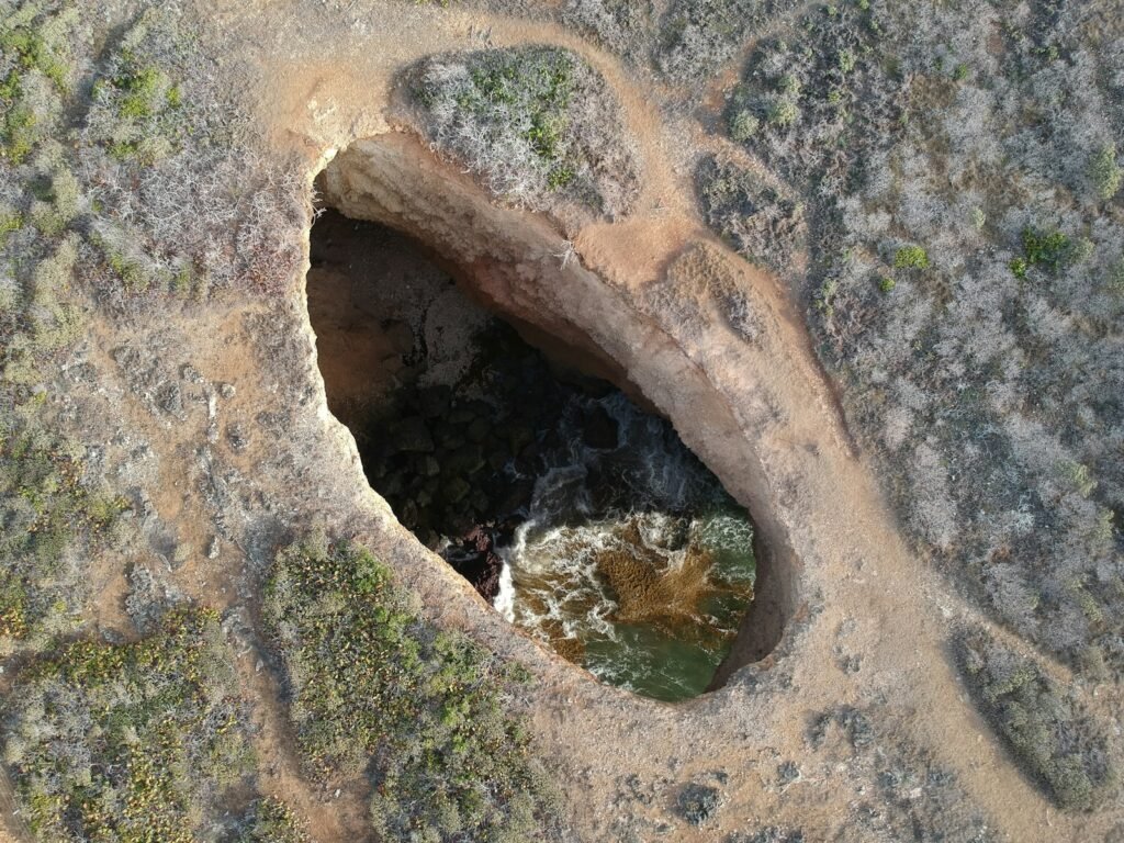
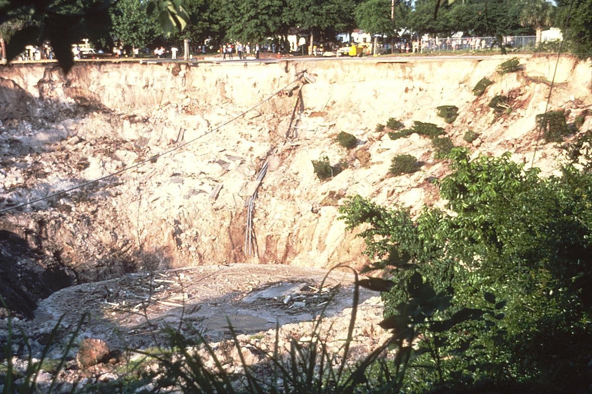
Somewhere between the whisper of longleaf pines and the steady hum of cicadas, the ground gives way and a circle of vanishes. The scene feels cinematic, but in Florida’s karst country it’s a real and recurring drama with deep scientific roots. A sinkhole does not arrive from nowhere; it arrives from below, from rock dissolved grain by grain until the roof fails. Today’s story is more than a startling hole in the woods – it’s a window into the slow chemistry and fast physics that shape the peninsula. Understanding that hidden machinery is how we keep people safe, protect drinking water, and decide what should grow, or be built, on the land.
The Hidden Clues
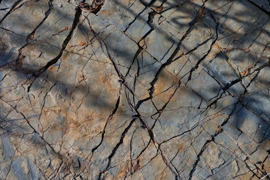
Before a collapse makes the evening news, the landscape often whispers warnings. Subtle sags collect rain after a storm, forming shallow rings that look like halos in the leaf litter. Oaks lean ever so slightly, their roots exposed on one side as soil slides toward a center point you can’t quite see. Fences pucker into gentle arcs, and new cracks lace across sandy trails like dry riverbeds. Even the sound can change; a bootstep that once thudded begins to thump hollow, a clue that air, not solid earth, lies beneath.
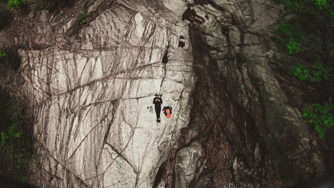
In forests, these signs are easy to miss because plants quickly reclaim small slumps, smoothing edges with ferns and palmetto. Animal paths reroute overnight, and fresh pine needles erase yesterday’s footprints. A trained eye looks for circles – nature’s telltale geometry – repeating across a slope. On a field day years ago, I watched a mosquito-dimple in sugar sand widen after a burst of rain, the tiniest preview of a much bigger process. That memory taught me to read the ground the way mariners read ripples: nothing dramatic at first glance, but everything meaningful just below.
Karst 101: How Florida’s Rock Dissolves Beneath Our Feet
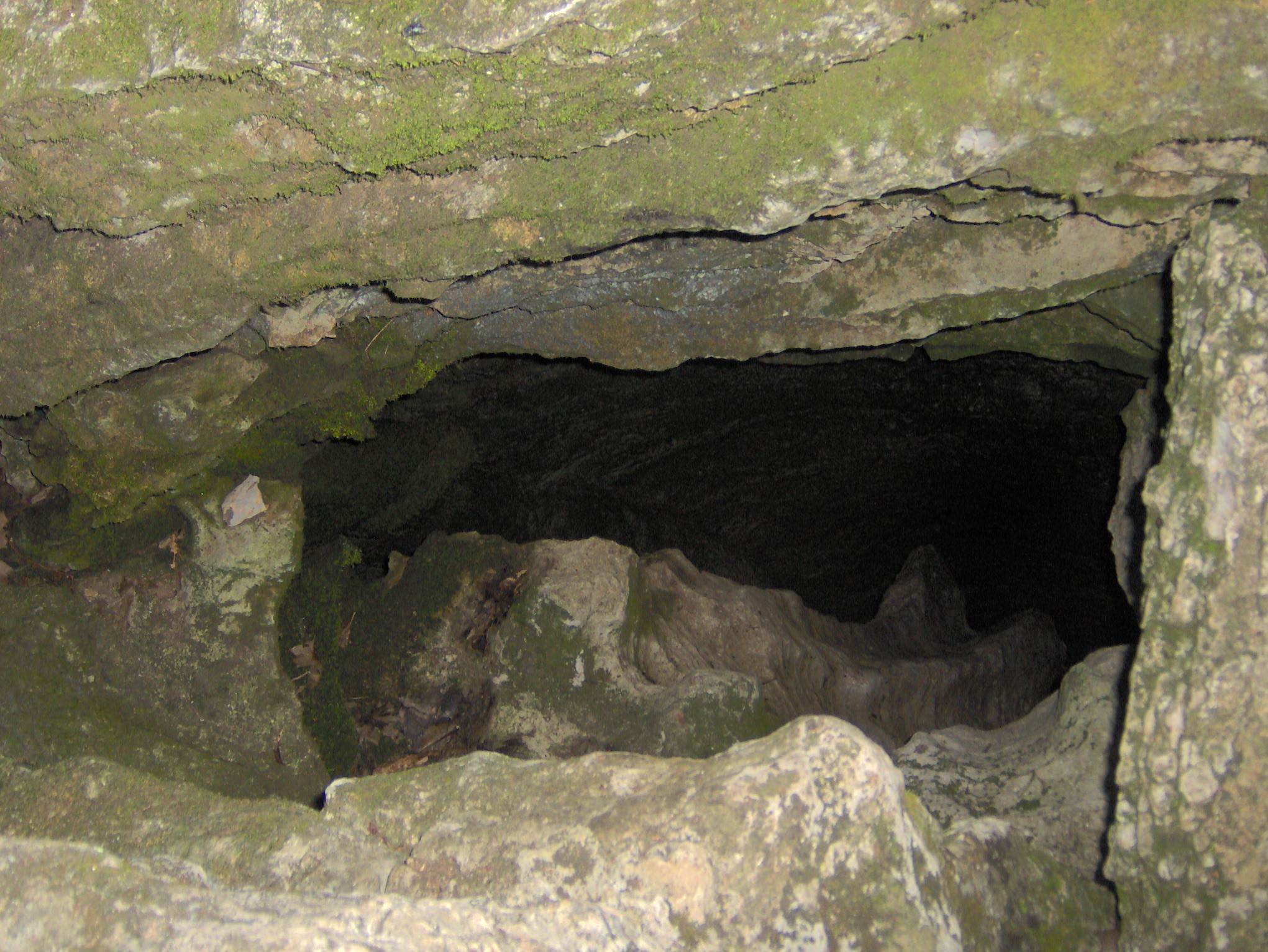
Florida rests on a thick platform of limestone and dolostone, rocks born in warm, shallow seas and built from ancient shells. Rain pulls carbon dioxide from the air and soil, turns slightly acidic, and seeps downward through fractures, where it slowly eats the carbonate minerals. Over decades to millennia, fractures widen into conduits and conduits into caves, leaving a Swiss-cheese architecture inside the bedrock. The zone closest to the surface, called the epikarst, becomes a leaky sponge that stores and funnels water. Beneath that, the aquifer moves water swiftly enough that a dye could sprint through miles of rock faster than a creek on the surface.
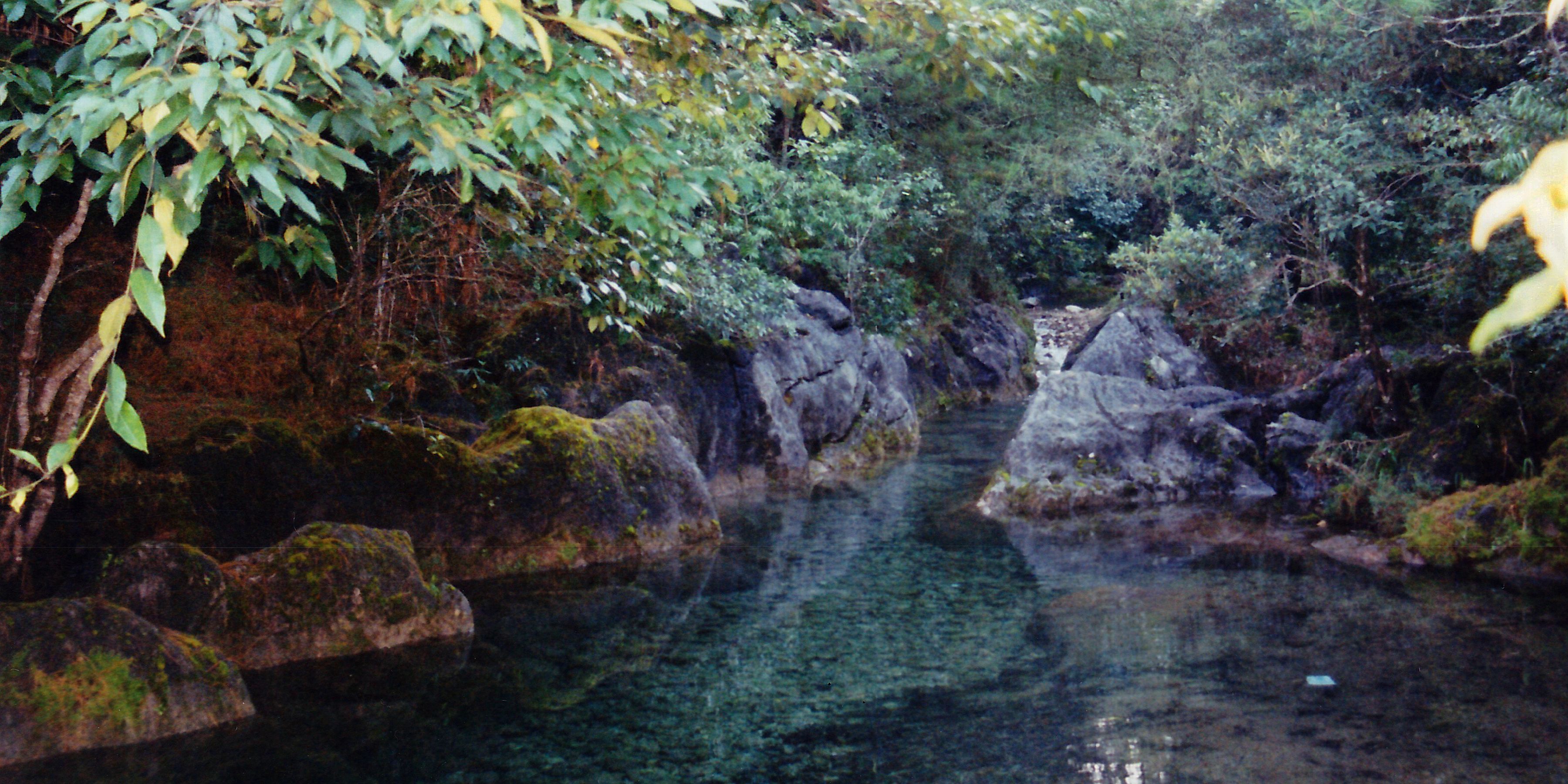
In this terrain, voids are normal and often beneficial; they feed springs and sustain wetlands during dry spells. The risk arrives when soil on top of those voids loses its support. If the soil is sandy, the surface tends to settle gradually as grains sift downward, creating broad, bowl-shaped depressions. If the soil includes a cohesive clay layer, it can bridge across the void for years, holding up yards, trees, or even a road – until the day the bridge fails. That is why karst can feel boringly stable for a long time, then suddenly dramatic.
The Slow Unraveling: From Sinkhole Seeds to Sudden Collapse
Most collapses start as tiny pathways where water drips into a cavity, carrying sand or silt with each drop. The pathways enlarge like an hourglass neck, and the soil arch above stretches thinner and thinner. Drought can accelerate the process by lowering the groundwater level, removing buoyant support that once propped up the cavity roof. Heavy rain after drought adds weight to the soil and flushes loose sediment, a one-two punch that pushes the system past its tipping point. Pumping groundwater for agriculture or construction dewatering can play a similar role by changing pressures faster than the underground fabric can adjust.
When failure comes, it can occur in minutes. The clay arch fractures, edges crumble inward, and overlying trees slide as if pulled by an invisible plug. Root balls tilt, the forest floor wrinkles, and what was a flat clearing becomes a steep-sided throat. Some collapses keep growing as material funnels down, while others stabilize quickly once the arch gives way. To an observer, it looks like a surprise; to the ground, it’s simply a long conversation ending mid-sentence.
From Ancient Tools to Modern Science
Humans first mapped caves with candles, twine, and guesswork, but the core strategy was the same as today: follow the water. Modern teams add drones, laser scanners, and dye tracers that reveal swift, subterranean shortcuts. Airborne lidar strips away vegetation in the data, exposing faint circular depressions and old sinkhole rings hidden inside the canopy. Ground-penetrating radar sketches shallow layers, while electrical resistivity tomography maps deeper contrasts between saturated zones, solid rock, and empty space. Microgravity surveys detect tiny reductions in gravitational pull where the subsurface is less dense, a quiet clue that a void may lurk below.
Even satellites join the search. Interferometric radar, known as InSAR, can detect millimeter-scale ground motion over large areas, revealing places that sag or heave with seasonal water changes. Where the signal is noisy in thick forest, repeat drone flights and precise GPS pick up the slack. Engineers combine these tools with borehole cameras and small test pits to confirm what the instruments suggest. The outcome isn’t a perfect crystal ball, but a risk map – an honest, data-backed way to prioritize monitoring and smarter building choices. In sinkhole country, that map can be the difference between routine maintenance and an emergency evacuation.
Why It Matters
Sinkholes are not just geological curiosities; they are infrastructure stories, drinking-water stories, and neighborhood stories. Florida’s aquifer, housed in that same dissolving rock, supplies many communities with tap water, so every collapse is a reminder that surface spills can bypass natural filters. Roads, pipelines, and stormwater ponds built without karst-savvy design can accelerate small problems into large ones. Repairs are costly, and insurance coverage often hinges on precise definitions that differ between cosmetic settling and structural collapse. Ignoring the science shifts those costs from prevention to reaction, which rarely ends well.
There is also ecology to consider. Many forested sinkholes become seasonal ponds that host amphibians, rare plants, and a burst of insect life that feeds birds and bats. When collapses connect directly to the aquifer, debris, fertilizers, and oils can rush underground in hours, not months. A cautious approach – buffer zones, careful grading, and stormwater designs that respect natural flow paths – keeps both habitats and human investments intact. Compared with the old method of filling a hole and hoping for the best, informed management is steadier, cheaper over time, and far kinder to the landscape.
Global Perspectives
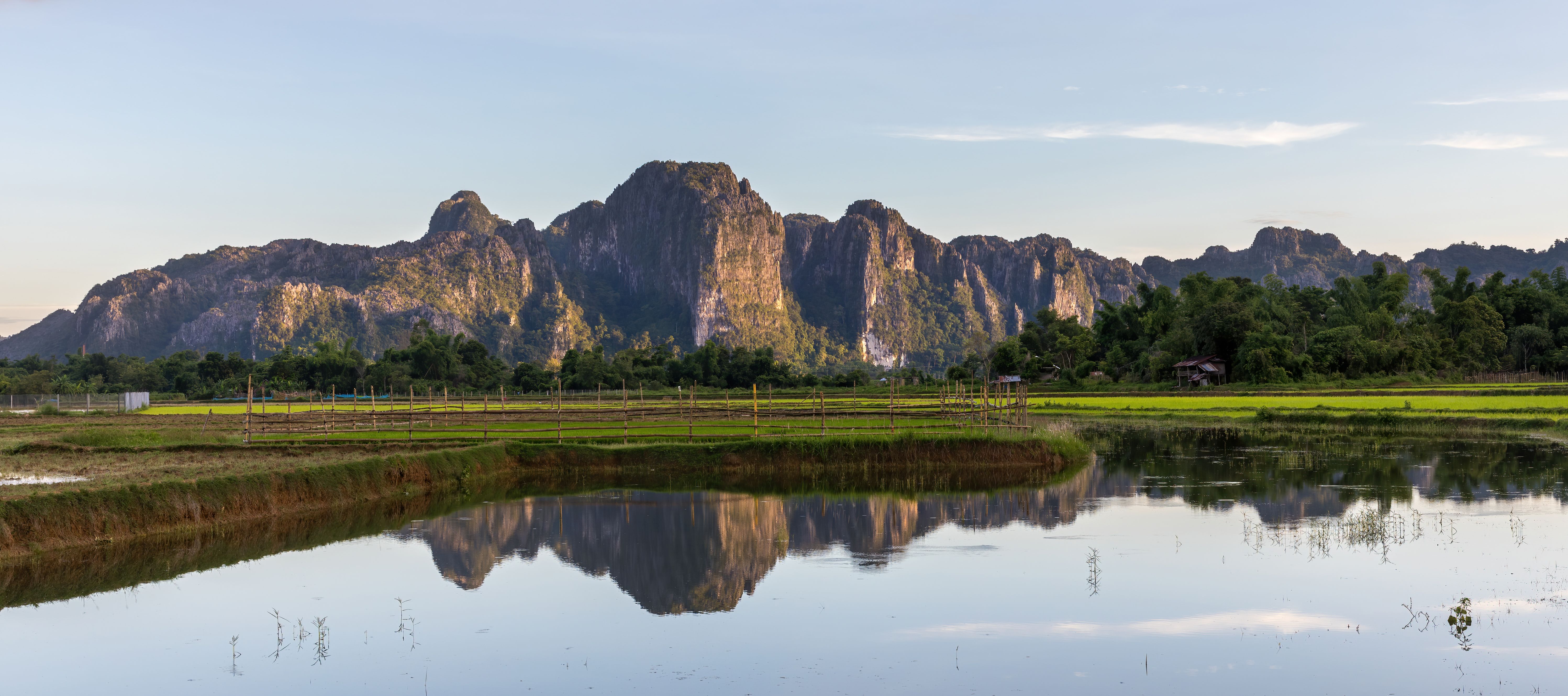
Karst is a worldwide pattern with local accents. In the Yucatán, limestone collapses form dazzling cenotes; in southern China, tower karst rises like a skyline built by water and time. Across the Balkans and the Dinaric Alps, caves knit regions together hydrologically in ways that ignore borders. Closer to home, Kentucky and Missouri live with long cave systems, while parts of Texas and Tennessee juggle fast-draining storms and sudden dolines. In the northern Plains, gypsum dissolves faster than limestone, producing shallow, quick-forming sinkholes with different hazards.
What ties these places together is reliance on karst aquifers for everyday life. On the order of about one fifth of people globally depend on water that moves through such systems, a stunning reminder of how common hidden voids really are. That dependence invites both opportunity and risk: abundant springs and swift recharge paired with vulnerabilities to contamination. When we see a collapse, we’re also seeing a familiar process playing out in other languages of rock. The specifics change, but the script remains remarkably consistent.
The Future Landscape
Looking ahead, climate swings are poised to stress karst terrains in new ways. Longer dry spells can lower water tables and unbrace cavity roofs, while intense rain bursts load the soil and flush channels faster than before. Sea-level rise along Florida’s coasts nudges groundwater levels upward and alters chemistry, shifting where dissolution and support compete. Urban growth adds more weight, more stormwater, and more underground utilities that can leak and trigger localized washing-out. None of these drivers act alone; together they push already delicate systems toward more frequent surprises.
Technology will help us keep pace if we choose to use it well. Public lidar datasets, routine radar passes, and community-based reporting can stitch a wider net of early warnings. Building codes that require karst-aware site studies, plus incentives for low-impact stormwater design, will reduce failures before they start. Stabilization techniques – such as compaction grouting and micropile underpinning – work best when targeted by good data rather than guesswork. The smartest future is not sinkhole-proof, but sinkhole-ready: fewer shocks, quicker recoveries, and landscapes that still feel like Florida.
What You Can Do
If you live, hike, or work in karst country, a little awareness goes a long way. Learn the local signs: new cracks, sticking doors, circular depressions that collect water where they didn’t before. Keep heavy water flows away from suspected depressions, and never dump debris into a sinkhole, which only masks a problem and can pollute the aquifer. If you suspect active subsidence, report it and step back; professionals can evaluate and stabilize sites before they widen. When choosing insurance or a contractor, ask specific questions about karst experience and what is covered under different forms of ground movement.
Support the science that keeps communities safer. Advocate for springs and aquifer protection, because clean water and stable ground are twins in this landscape. Encourage local leaders to fund lidar mapping, monitoring wells, and karst-aware stormwater upgrades near schools, roads, and utilities. Stay on marked trails in sinkhole-prone preserves, where subtle edges can fail without warning after storms. The forest will always keep some secrets, but with patient attention and smart tools, we can hear the ground before it shouts – did you expect that?

Suhail Ahmed is a passionate digital professional and nature enthusiast with over 8 years of experience in content strategy, SEO, web development, and digital operations. Alongside his freelance journey, Suhail actively contributes to nature and wildlife platforms like Discover Wildlife, where he channels his curiosity for the planet into engaging, educational storytelling.
With a strong background in managing digital ecosystems — from ecommerce stores and WordPress websites to social media and automation — Suhail merges technical precision with creative insight. His content reflects a rare balance: SEO-friendly yet deeply human, data-informed yet emotionally resonant.
Driven by a love for discovery and storytelling, Suhail believes in using digital platforms to amplify causes that matter — especially those protecting Earth’s biodiversity and inspiring sustainable living. Whether he’s managing online projects or crafting wildlife content, his goal remains the same: to inform, inspire, and leave a positive digital footprint.