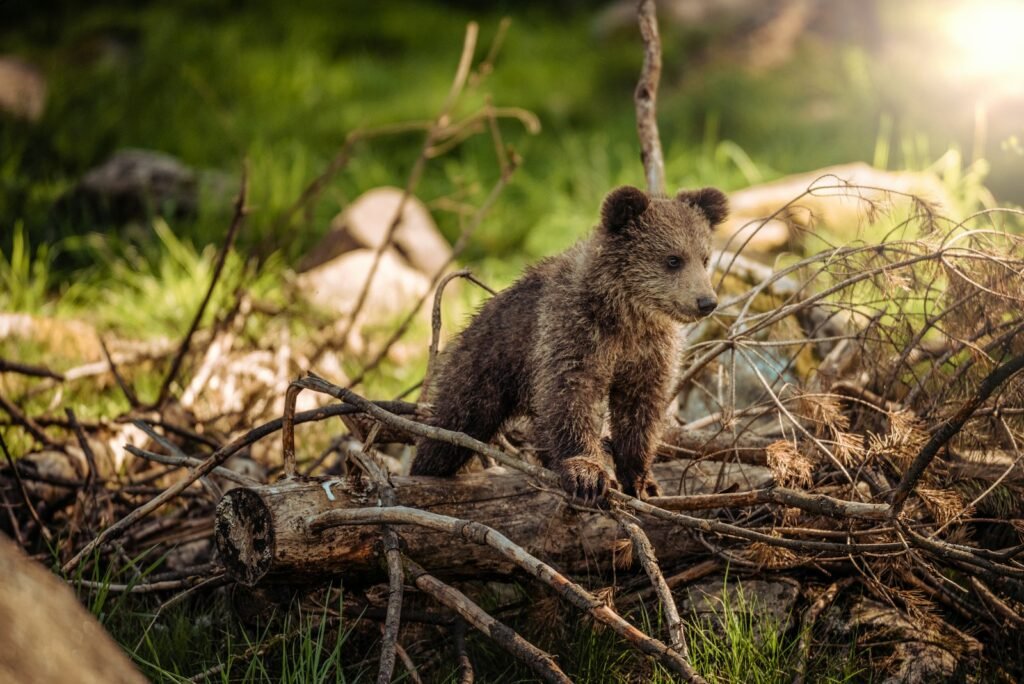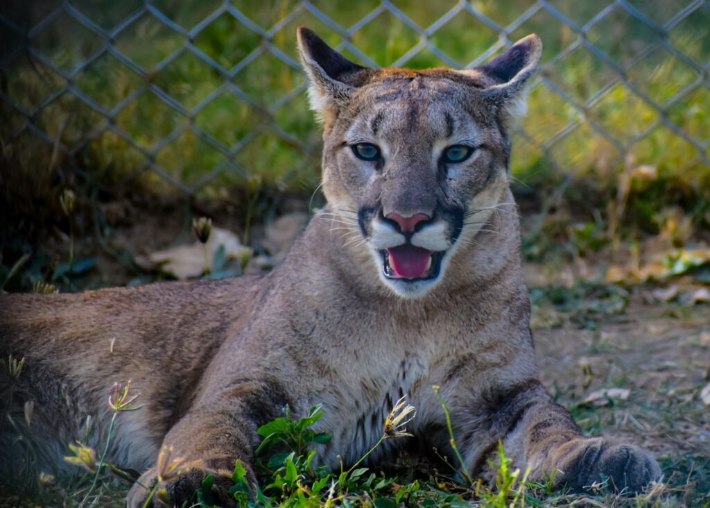
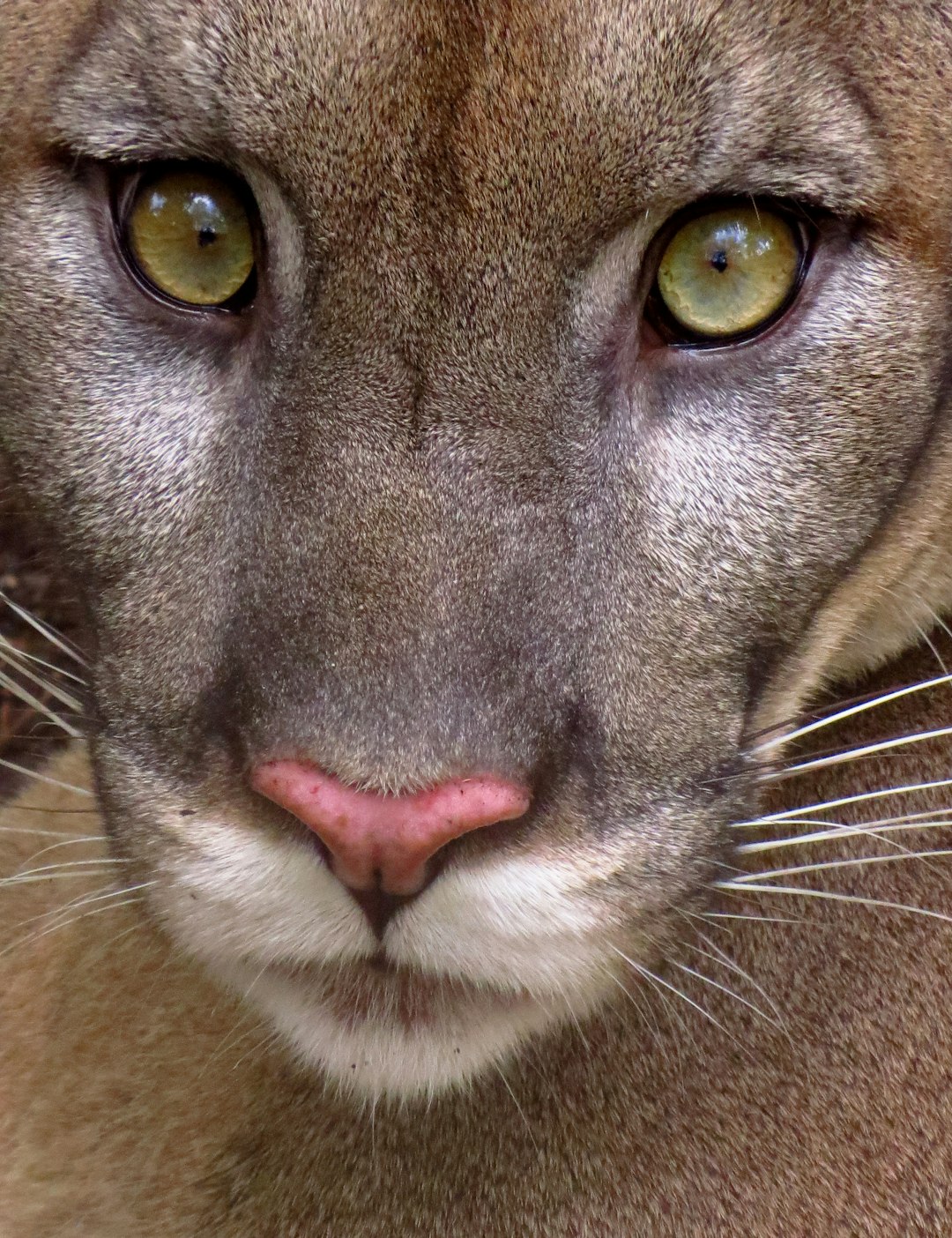
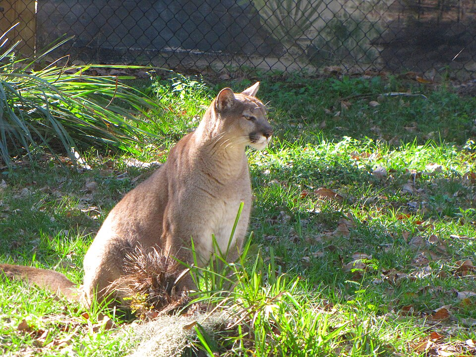
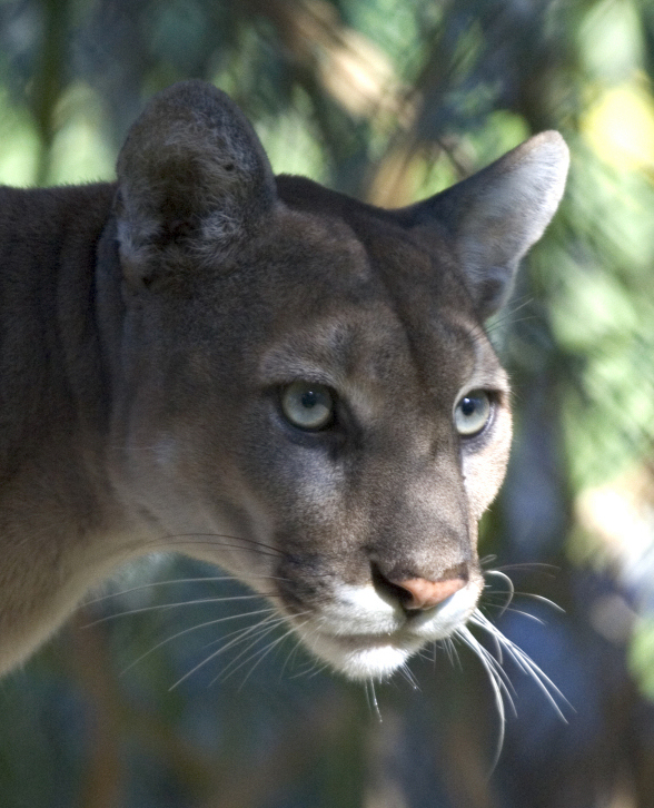
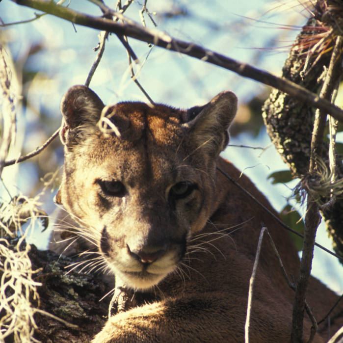
I remember stepping onto a sandy trail at dawn and finding a single paw print as neat as a stamp – four toes, no claw marks, the calling card of a ghost. For decades, the Florida panther felt like a rumor, an echo prowling the swamps at the edge of memory. Now, that rumor is turning back into a presence you can track, measure, and – cautiously – celebrate. Scientists and land stewards are knitting habitat back together, upgrading roads for wildlife, and following cats by satellite pings and camera flashes. The is fragile, messy, and very human, but the data tell a hopeful story that’s still being written.
The Hidden Clues
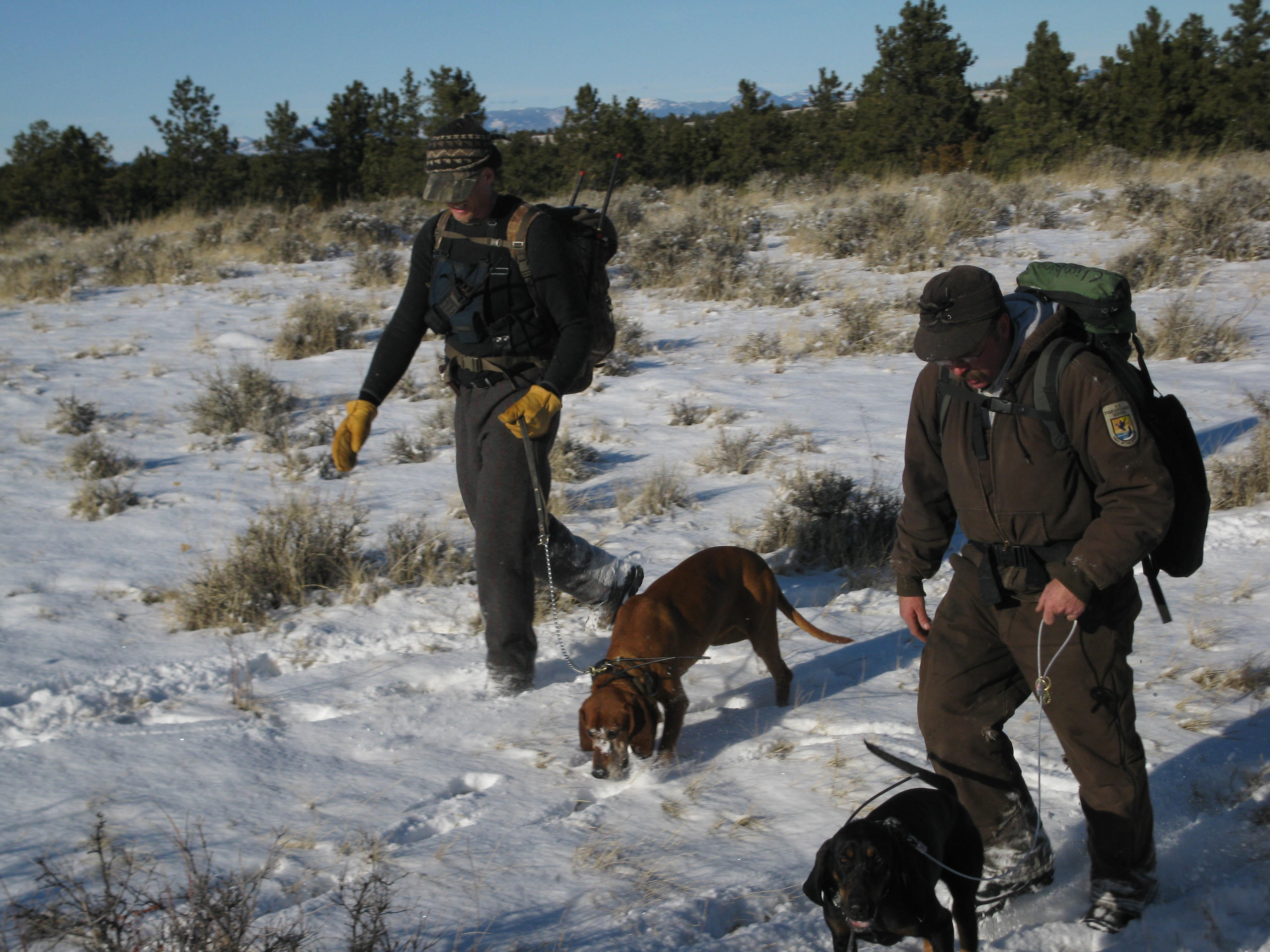
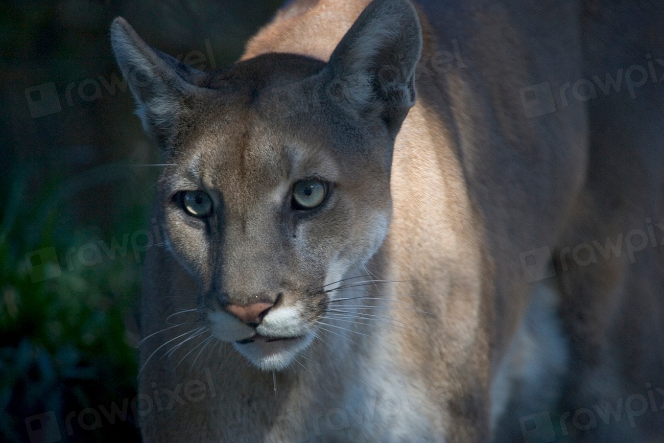
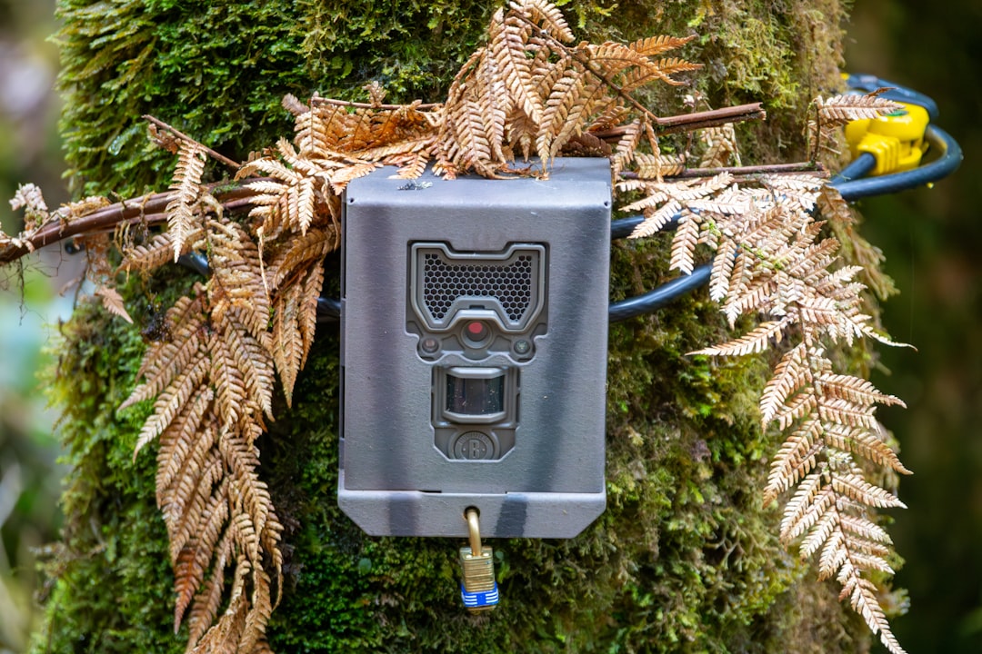
Recovery starts with finding what most people never see: tracks softened by dew, a scraped patch of earth under a palmetto, the quiet geometry of a deer carcass cached beneath leaves. Biologists read these signs like a diary, piecing together routes, behavior, and the pulse of a territory that often stays invisible by day. Camera traps then add faces to footprints, logging whisker patterns, ear nicks, and the presence of kittens that validate breeding success.
In dense cypress and sawgrass, sound travels poorly and visibility is measured in feet, so the best clues are motion-triggered photos and collared-location dots stitched across a map. Those dots reveal where panthers hesitate, where they sprint, and where they never cross at all – usually busy highways. Each clue flips the old narrative from guesswork to evidence, and evidence can be defended, funded, and built upon.
From Ancient Tools to Modern Science

Early panther surveys relied on plaster casts of tracks and hand-drawn maps pinned with thumbtacks and hope. Today, GPS-VHF collars sample location fixes in tight intervals, accelerometers hint at hunting bursts, and mortality sensors ping alerts if a collar stays still too long. Drones with thermal cameras skim above marsh at dawn, verifying dens without crowding them, while AI helps sort tens of thousands of camera-trap images overnight.
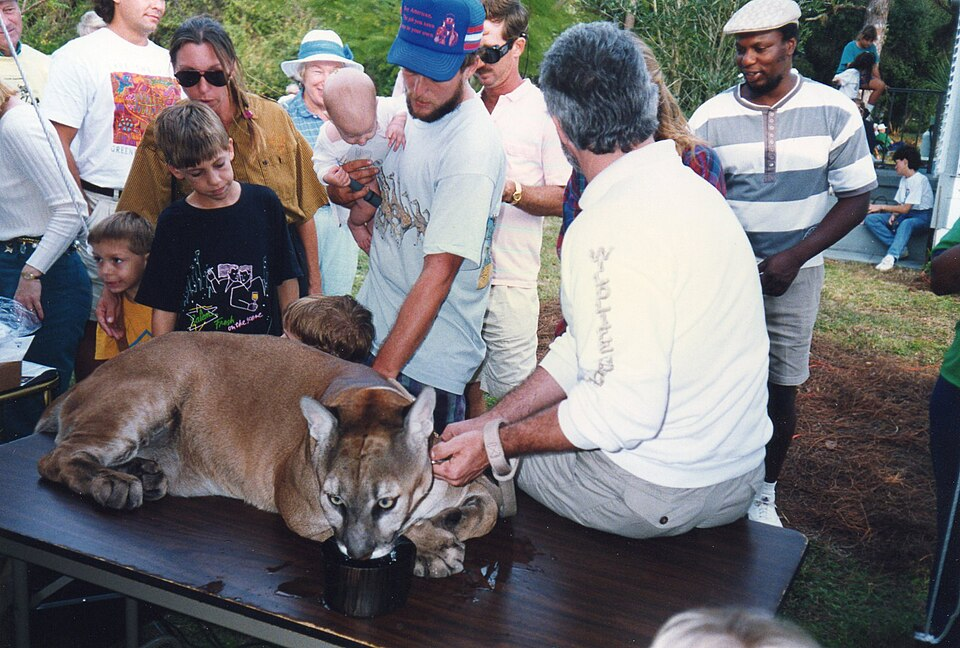
Genetics adds a deeper time scale, showing how a famous 1990s genetic rescue – pairing Florida’s isolated cats with closely related Texas cougars – boosted diversity and reduced inherited defects. Fecal DNA and hair snares now extend that monitoring to shy individuals that never touch a trap or collar. What started as crisis triage has matured into a full clinical workup for an ecosystem predator.
Reading the Numbers
No one pretends counting panthers is simple; the cats are secretive, the terrain is swampy, and the population fluctuates with births, dispersal, and road mortality. Still, multiple survey streams converge on a cautiously optimistic picture: a population that climbed from just a few dozen in the late twentieth century to the low hundreds today. The ceiling is set not by biology but by space – how much connected habitat remains within a state that’s growing fast.
A quick snapshot of the monitoring toolbox helps explain the trend lines:
– Collared adults: location fixes reveal home ranges spanning dozens to more than a hundred square miles, with males ranging wider than females.
– Camera-trap clusters: kitten photographs confirm recruitment hot spots in some western Everglades units.
– Roadkill logs: roughly about two dozen panthers are lost to vehicles in some recent years, with seasonal spikes during dispersal.
– Genetic assays: rising heterozygosity since the 1990s indicates healthier mixing, though continued vigilance is needed.
These measures, cross-checked year after year, are why scientists describe progress with careful confidence rather than wishful thinking.
Why It Matters
Panthers are an apex thread woven through the fabric of South Florida; tug that thread and other strands shift – deer browsing, mesopredator behavior, even vegetation that responds to changes in herbivore pressure. Protecting them forces us to protect water flow, fire regimes, and the broad green corridors that keep everything moving. It’s conservation that doubles as infrastructure, like strengthening a bridge that thousands of other species also need to cross.
Compared with traditional single-park strategies, a corridor-driven approach treats ranchlands, wetlands, and suburbs as a connected living system. It acknowledges that a cat’s daily commute may cross public refuges and private pastures in the same afternoon. In a warming, flood-prone peninsula, that connectivity is climate adaptation made real – routes to higher ground and seasonal refuges mapped in advance rather than improvised after disaster.
The Human Footprint
Roads are the hardest edge a panther faces, and the fix is wonderfully practical: fences that guide cats to wildlife underpasses and bridges that move them beneath speeding traffic. Along Alligator Alley and across key state highways, new crossings and longer fencing sections are reducing collisions and reconnecting habitat that was severed for decades. Drivers might never notice the difference, but the data show fewer red flags on the map where the concrete meets the swamp.
On the land side, conservation easements keep family ranches working while locking in open space that panthers and prey need. Urban planning that clusters development and protects floodplains essentially buys time and distance for cats on the move. Each zoning decision, speed reduction, and fence panel becomes part of a larger living machine designed to keep a wide-ranging predator on the landscape.
Setbacks and Surprises
Wildlife recovery is never a straight line, and Florida’s cats have faced scares from disease and mysterious neurological illness that left some animals stumbling. Investigations have probed pathogens, toxins, and nutritional stress, while field teams quietly vaccinated, tested, and triaged as needed. Those efforts blend lab science with swamp logistics, the kind of work that rarely makes headlines but often makes the difference.
Storms add another variable; hurricanes can shuffle prey, flood dens, and alter vegetation for a season or two. Yet panthers evolved with disturbance and often exploit the new edges created by blowdowns and fire. The lesson is humility: build buffers into the plan, expect surprises, and keep monitoring tight enough to catch small problems before they scale.
Global Perspectives
The Florida story is watched far beyond the peninsula because few places squeeze a top predator into such a busy, watery, hurricane-prone landscape. Corridor science here informs cougar planning in the West, lynx routes in the Northeast, and even big-cat coexistence in crowded parts of Latin America. The central insight – that an apex carnivore will persist if we give it connected room and safer roads – travels well across continents.
Florida’s blend of public refuges, private easements, and highway retrofits offers a template for regions where landownership is patchwork and budgets are tight. The work proves that cattle and panthers can share a county line if we manage crossing points and safeguard calving pastures. In policy circles, the case demonstrates that biodiversity gains and flood mitigation can be purchased with the same corridor dollar.
The Future Landscape
New tools are arriving fast: environmental DNA sampled from creek water to detect a passing cat, machine learning models that predict where crossings will save the most lives, and higher-resolution satellite imagery that sees habitat change almost in real time. Thermal drones will keep reducing disturbance at dens, while better collar batteries extend study windows from months to years. Even vehicle technology – smart signage and connected car alerts – could nudge drivers to slow down in the right mile at the right minute.
The bigger challenge is social, not technical: staying ahead of sprawl, pricing in the true value of floodplains, and keeping political will steady over decades. Sea-level rise will squeeze coastal habitat, making upland corridors and ranch partnerships even more critical. If the next phase succeeds, the map of panther range will look less like an archipelago and more like a continent.
Conclusion
If you live or drive in panther country, the simplest help is also the most effective: slow down in signed zones, especially at dawn and dusk, and report injured wildlife when you see it. Support local land trusts and statewide corridor initiatives that keep ranches working and wetlands intact, because those acres are the arteries of recovery. Backyard choices matter too – secure attractants, keep pets vaccinated, and use outdoor lighting sparingly to preserve nighttime movement.
Teachers and students can fold real data into classwork using open wildlife datasets and community science platforms that flag tracks, trail-cam sightings, and roadkill hot spots. Voters can back bond measures and ordinances that fund crossings, easements, and floodplain protection, then hold leaders to the map. The is happening, but momentum only lasts if we carry it forward together.

Suhail Ahmed is a passionate digital professional and nature enthusiast with over 8 years of experience in content strategy, SEO, web development, and digital operations. Alongside his freelance journey, Suhail actively contributes to nature and wildlife platforms like Discover Wildlife, where he channels his curiosity for the planet into engaging, educational storytelling.
With a strong background in managing digital ecosystems — from ecommerce stores and WordPress websites to social media and automation — Suhail merges technical precision with creative insight. His content reflects a rare balance: SEO-friendly yet deeply human, data-informed yet emotionally resonant.
Driven by a love for discovery and storytelling, Suhail believes in using digital platforms to amplify causes that matter — especially those protecting Earth’s biodiversity and inspiring sustainable living. Whether he’s managing online projects or crafting wildlife content, his goal remains the same: to inform, inspire, and leave a positive digital footprint.