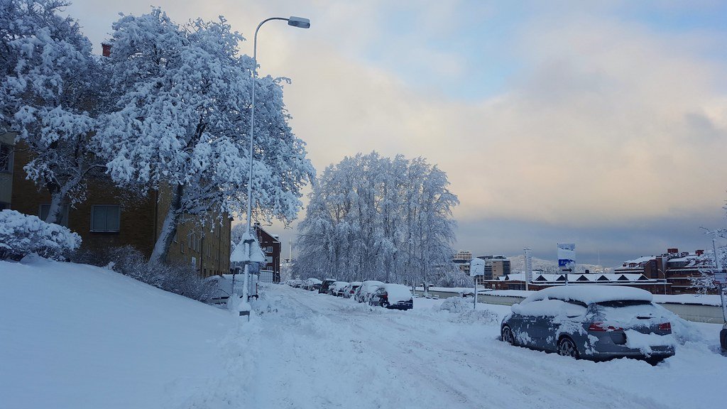

Record-Breaking Chill Looms Large (Image Credits: Flickr)
The weekend winter storm that blanketed much of the Eastern United States in heavy snow and ice has moved offshore, yet frigid air masses promise to deliver prolonged subzero challenges through the workweek.[1][2]
Record-Breaking Chill Looms Large
Forecasters at the Weather Prediction Center highlighted the severity of the incoming cold. “Some areas are going to be well, well below average to record-breaking cold over the next few days,” meteorologist Frank Pereira stated.[1]
Temperatures plunged well below normal across the Central and Eastern United States on Monday. Light snow lingered in the Northeast, while lake-effect bands produced heavy showers near the Great Lakes. Conditions remained dry in most central regions later in the day. Gusty winds amplified the freeze, pushing wind chills to minus 50 degrees in the Northern Plains.[2]
Snowfall Tallies and Regional Impacts
The storm left at least a foot of snow in 17 states, from New Mexico to New Hampshire. New York City’s Central Park recorded 11.4 inches, while spots in Pennsylvania and Connecticut saw up to 20 inches. Airports in Boston, New York, and Washington faced massive disruptions, with over 4,000 flights canceled nationwide on Monday alone.[2]
New York City public schools shifted to remote learning for 500,000 students amid hazardous travel. Power outages persisted in areas like Mississippi, where ice storms toppled trees and lines. Transit systems in the Northeast operated on reduced schedules. Cleanup efforts slowed under the persistent freeze.
- Pittsburgh: Over 12 inches
- Newark: More than a foot
- St. Louis: Heavy accumulations
- Boston: Significant snow
- Toronto: Near-record 18 inches
Temperature Outlook by Region
Mornings brought subzero readings from the Northern Plains through the Ohio Valley and Northeast. Single-digit lows hit the Central Plains, Mid-South, and Mid-Atlantic. Even the Gulf Coast faced below-freezing nights through week’s end. Daytime highs struggled to reach the teens centrally and the 20s to 30s southward.[1]
| Region | Expected Lows | Wind Chill |
|---|---|---|
| Northern Plains | Below zero | As low as -50°F |
| Northeast/Ohio Valley | Below zero mornings | Below zero through Tuesday |
| Central Plains to Mid-Atlantic | Single digits | Hazardous |
| Gulf Coast | Below freezing nights | Daytime 20s-30s |
Moderate snow threatened the New England coast, with 6 to 8 inches possible. Light rain cleared the Southeast by mid-afternoon Monday.
Health Risks and Warnings Dominate
Officials warned of hypothermia and frostbite amid the extreme conditions. Prolonged exposure posed dangers up to 30 degrees below normal in spots. Over 85 million people fell under extreme cold alerts. Recovery from storm damage faced delays due to the unrelenting chill.[2]
Wind chills stayed below zero across much of the Central and Eastern United States through Tuesday. Hazardous values likely endured through Friday. Forecasters noted modest warming later in the week. Still, the deep freeze marked a stubborn post-storm reality.
Key Takeaways
- Subzero mornings persist through much of the Eastern and Central U.S. this week.
- Wind chills drop to life-threatening lows, especially in the Plains.
- Modest relief arrives late week, but travel and health risks remain elevated.
America’s recent brush with winter fury underscores the power of Arctic outbreaks. As cleanup continues, vigilance against the cold proves essential. What impacts have you noticed in your area? Share in the comments below.