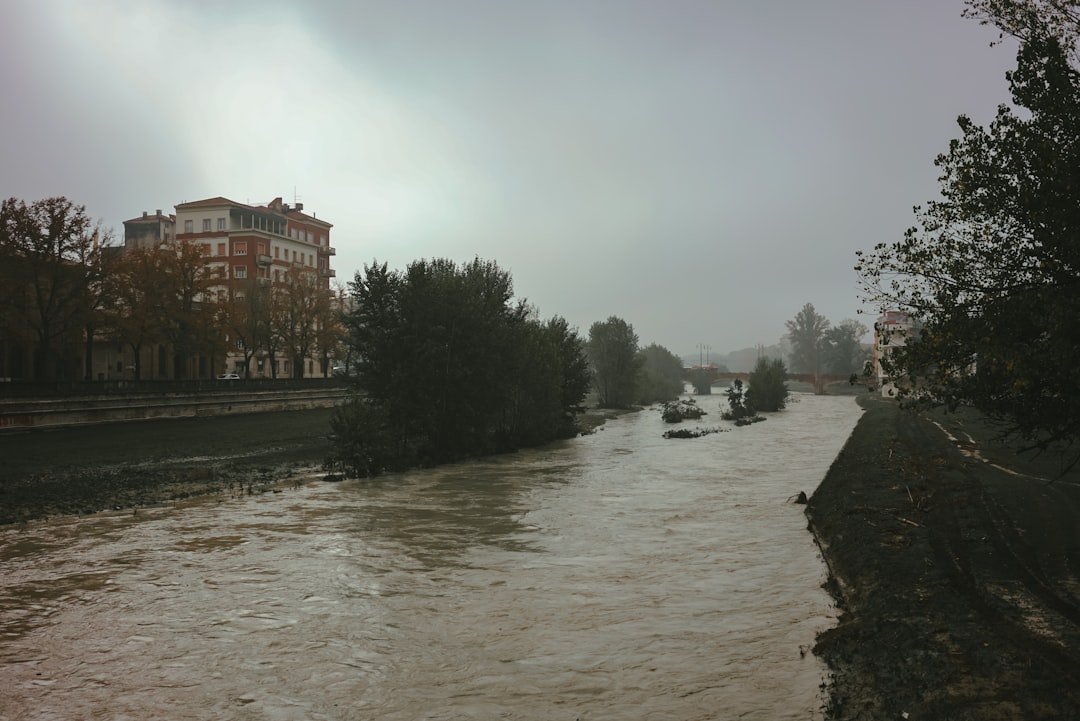
The specter of truly catastrophic flooding has been haunting scientists across North America as our climate continues to shift in unprecedented ways. From California’s Central Valley turning into an inland sea to entire coastal communities in the Pacific Northwest being swallowed by rising waters, the question isn’t if megafloods will return, but when they’ll strike with a vengeance that makes our worst nightmares look like puddle splashing. These aren’t your average spring floods or hurricane storm surges – we’re talking about geological game-changers that could reshape the continent as we know it. What makes this particularly unsettling is that our ancestors witnessed these water giants before, yet most of us remain blissfully unaware of their destructive potential. So let’s dive in and explore how our changing world is setting the stage for floods of biblical proportions.
California’s Ticking Water Bomb
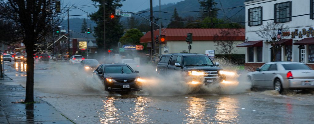
Picture California’s Central Valley transformed into a massive lake stretching nearly three hundred miles long and up to thirty feet deep. This isn’t science fiction – it’s what happened during the Great Flood of 1862, and climate change has already doubled the chances of a disastrous flood happening in California in the next four decades. Scientists studying this phenomenon have discovered something truly alarming about our modern situation. Runoff in the future extreme storm scenario is 200 to 400% greater than historical values in the Sierra Nevada because of increased precipitation rates and decreased snow fraction. This dramatic shift means that instead of snow gradually melting throughout spring and summer, massive amounts of water will rush down mountainsides all at once. The implications are staggering when you consider the population difference. About 380,000 people lived in California in 1862. Now, the state’s population is over 39 million. Modern cities sit directly on top of ancient flood deposits, putting millions of people in harm’s way during a megaflood event that could cause nearly one trillion dollars in economic damage.
The Pacific Northwest’s Double Threat
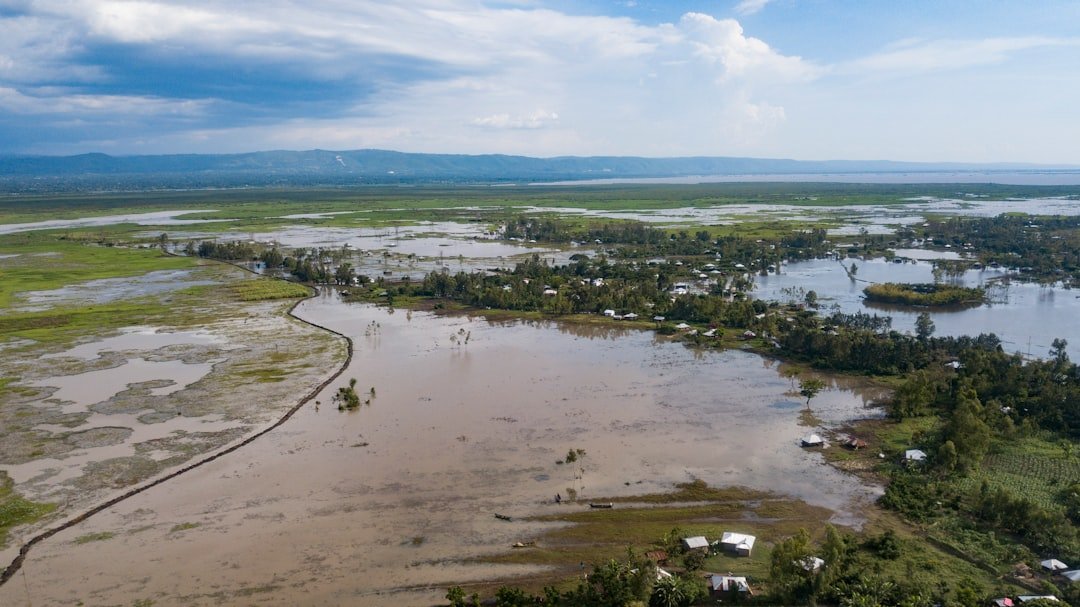
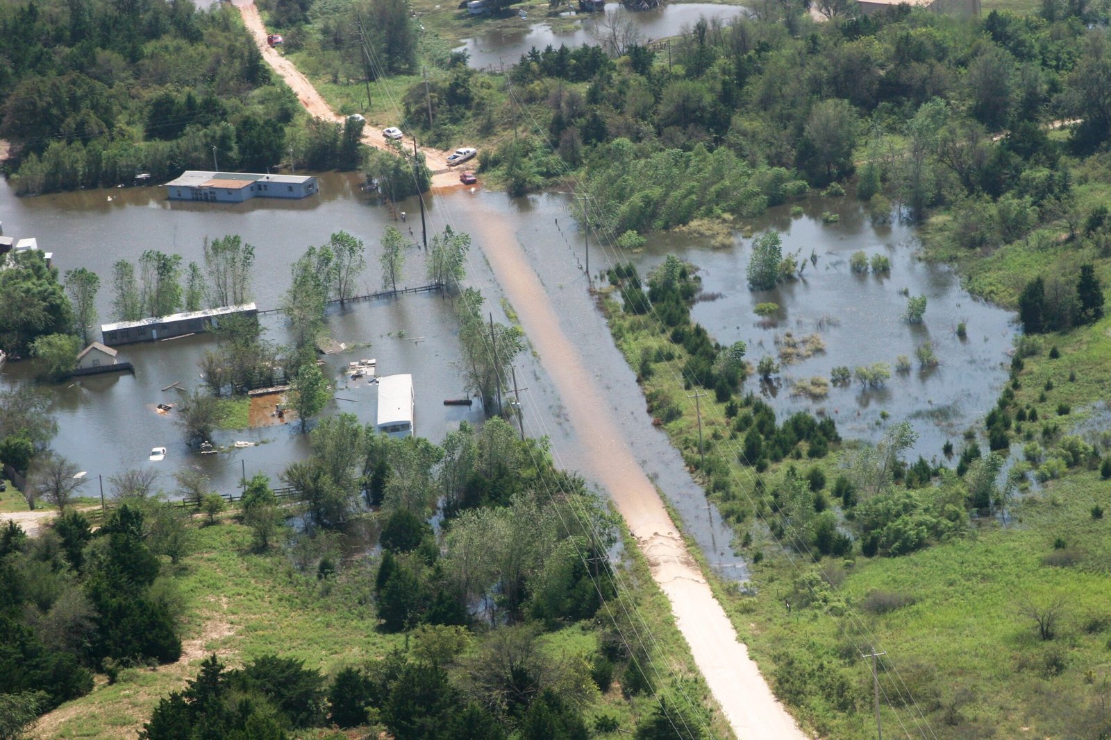
While California grabs headlines, the Pacific Northwest faces an even more complex flood scenario. Recent research has uncovered a terrifying one-two punch: the next great earthquake will likely cause 0.5 to 2 m of sudden subsidence and associated sea-level rise, dramatically expanding coastal floodplains. This earthquake-driven land sinking could happen in minutes, permanently altering the coastline. A major earthquake could cause coastal land to sink up to 6.5 feet, expanding the federally designated 1 percent coastal floodplain by 35 to 116 square miles. That’s like adding an area the size of Fresno to the flood-prone zones overnight. The human cost would be devastating. Following an earthquake today, an additional 14,350 residents, 22,500 structures, and 777 miles of roadway would fall within the post-earthquake floodplain, more than doubling flood exposure. Critical infrastructure including airports, hospitals, and wastewater treatment plants would suddenly find themselves in flood zones.
When Atmospheric Rivers Turn Deadly
The key driver behind California’s megaflood risk comes from atmospheric rivers – those narrow corridors of concentrated water vapor that stretch across the Pacific Ocean like fire hoses in the sky. The primary physical mechanism responsible for this projected regional intensification of extreme precipitation is an increase in the strength of cool-season atmospheric river events. These weather phenomena have become supercharged by climate change. Climate change increases the amount of rain the atmosphere can hold and causes more water in the air to fall as rain, which can lead to immediate flooding. When multiple atmospheric rivers hit in succession, they create the perfect storm for catastrophic flooding. The warming atmosphere acts like a sponge that can hold increasingly more water vapor. When that sponge gets wrung out over California’s mountains and valleys, the result is precipitation rates that dwarf anything in our recorded history. Scientists warn that these atmospheric rivers will become more frequent and more intense as global temperatures continue to rise.
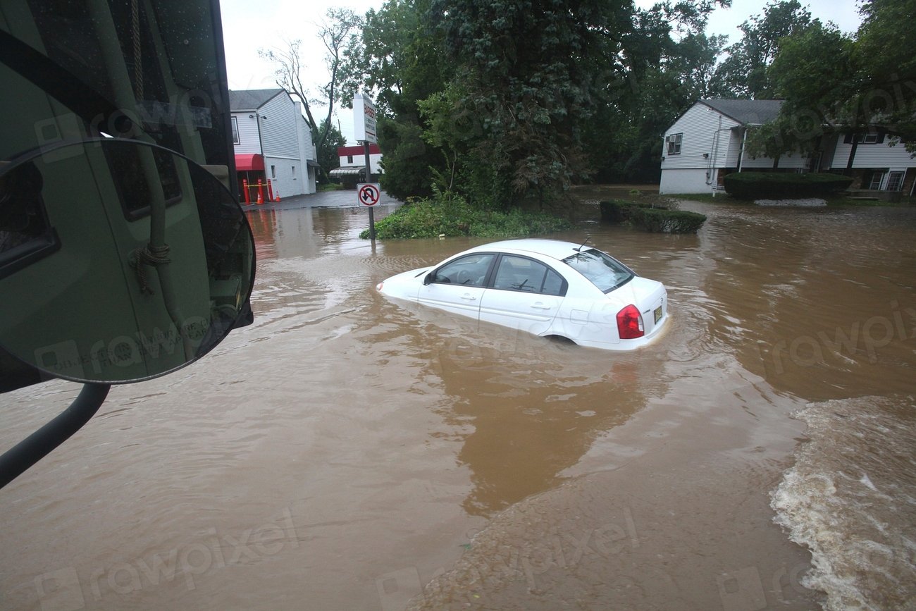
The Economics of Catastrophic Flooding
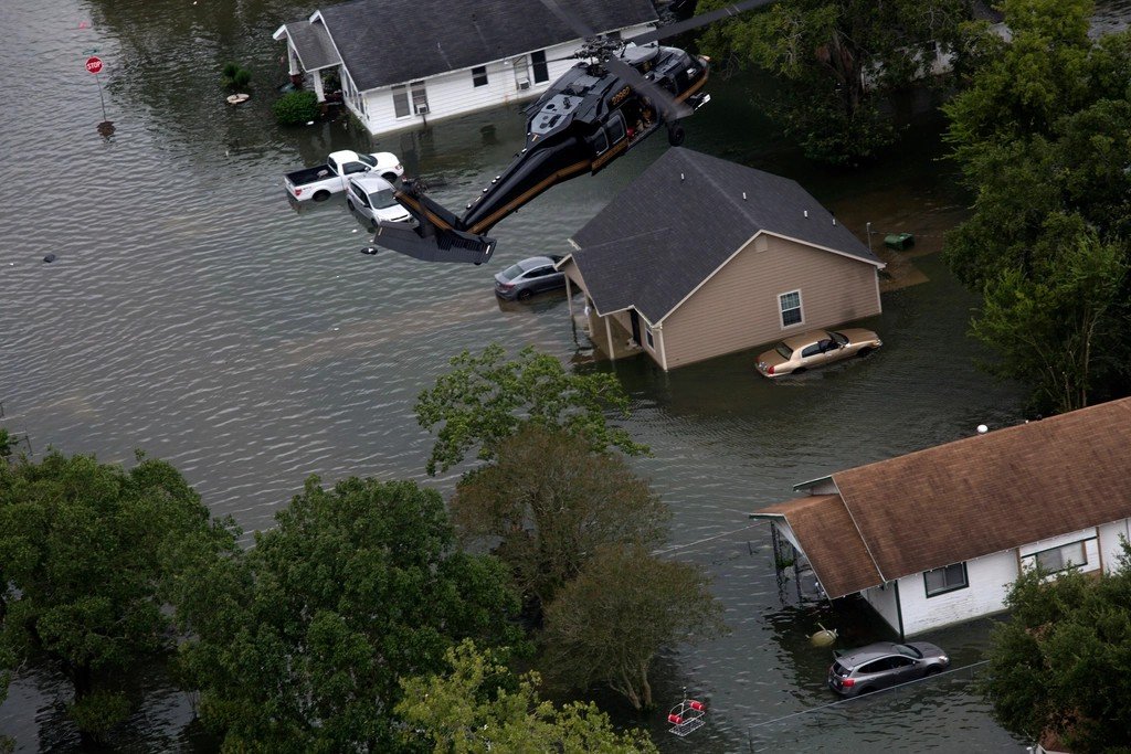
The financial implications of megafloods stretch far beyond immediate damage costs. More than one third of the estimated $230 billion of damage caused by inland flooding in the U.S. between 1988 and 2021 would not have happened without human-caused climate change. This represents a massive shift in how we need to think about flood risk and insurance. Consider that just one inch of flooding could cost the average homeowner $25,000 in damage. But typical homeowners’ and renters’ insurance fails to cover flooding and less than 4 percent of homeowners have flood coverage. During a megaflood, these numbers become astronomical when multiplied across millions of affected properties. The economic ripple effects would devastate entire regions. California’s Central Valley, which produces one-fourth of the nation’s food, will be ravaged by a megaflood. The disruption to America’s food supply chain alone could trigger nationwide price increases and shortages lasting months or years.
Climate Change as a Flood Accelerator
The connection between our warming planet and increased flood risk isn’t just theoretical – it’s already happening. Incorporating recent developments in inundation modelling, here we show a 26.4% increase in US flood risk by 2050 due to climate change alone. This represents a fundamental shift in how we understand flood patterns. The physics behind this change are relatively straightforward. Climate change is driving more extreme rain storms across much of the U.S., which drop more water in shorter periods of time and make dangerous floods more likely. Warmer air holds more moisture, and when that moisture gets released, it falls harder and faster than historical patterns suggest. Scientists have documented this trend across multiple regions. Climate change is causing heavier rain across the United States. What used to be once-in-a-century events are becoming once-in-a-decade occurrences, fundamentally altering the risk landscape for communities nationwide.
Historical Precedents That Terrify Scientists

North America has experienced megafloods before, leaving geological fingerprints that scientists can read like a disaster playbook. The last such megaflood, caused by weeks of winter storms in 1861-62, transformed the Sacramento and San Joaquin valleys into a temporary inland sea nearly 300 miles in length and up to 30 feet deep. The 1862 event bankrupted the state of California and forced the government to relocate from Sacramento to San Francisco. The governor, state legislators, and state employees were not paid for 18 months after the flood. This gives you a sense of the economic devastation that a similar event would cause today. Beyond California, the geological record reveals even more massive floods. As ice-dam configurations failed, a series of great floods were released from Lake Agassiz, resulting in massive pulses of freshwater added to the world’s oceans. The Missoula Floods of Oregon and Washington states were also caused by breaking ice dams. These prehistoric megafloods carved landscapes and moved boulders the size of houses across hundreds of miles.
The Wildfire Connection Nobody Talks About
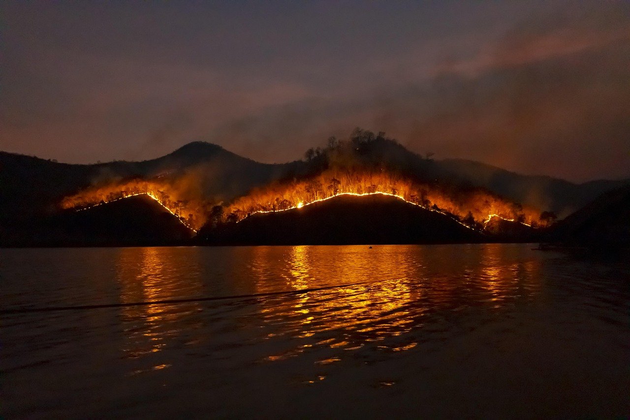
Here’s a terrifying connection that amplifies flood risk: wildfires. California’s mountainous terrain and wildfire risk make it especially vulnerable to flooding. Lingering burn scars from wildfires can create a steep, slick surface for water and debris to flow off. With wildfires becoming larger and burning more area thanks to climate change, more areas are susceptible to these debris flows. Burned landscapes lose their natural ability to absorb water, turning mountainsides into massive water slides. When heavy rains hit these areas, the result is devastating debris flows that carry trees, boulders, and mud at highway speeds down into populated valleys. This creates a vicious cycle where climate change increases both fire risk and flood risk simultaneously. The post-fire flood risk can persist for years after the flames are extinguished. Vegetation takes time to regrow, and until it does, these areas remain hydrological hazards waiting for the right storm to trigger catastrophic flooding downstream.
Coastal Communities on Borrowed Time
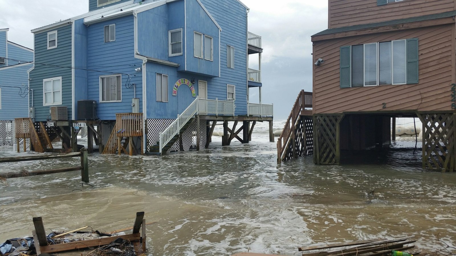
The Pacific Northwest’s coastal communities face a unique threat that combines earthquake-driven land subsidence with climate-driven sea level rise. By 2100, earthquake subsidence amplified by projected climate-driven sea-level rise could more than triple the flood exposure of residents, structures, and roads. This isn’t a gradual process communities can adapt to over decades. The immediate effect of earthquake-driven subsidence will be a delay in response and recovery from the earthquake due to compromised assets. Long-term effects could render many coastal communities uninhabitable. The Cascadia Subduction Zone hasn’t produced a major earthquake since 1700, but scientists know it’s not a matter of if, but when. The Cascadia Subduction Zone has an estimated 10-15% chance of producing a major earthquake in the next 50 years. When that happens, entire communities could find themselves permanently below sea level.
Infrastructure Overwhelmed and Obsolete
Our flood control systems were designed for a climate that no longer exists. Many communities around the country are still not planning for more intense rainstorms as they build roads, floodways and storm infrastructure. That’s in part because local governments around the country rely on historical rainfall records from NOAA to plan flood control systems. But in some places, the records are decades old, meaning they don’t reflect how rainstorms have already gotten more intense. This creates a dangerous situation where our defenses are calibrated for yesterday’s weather, not tomorrow’s reality. Levees, storm drains, and flood control channels that seemed adequate just decades ago are now routinely overwhelmed by storms that would have been considered extraordinary in the past but are becoming increasingly common. The infrastructure deficit is staggering. During Hurricane Harvey, nearly three-quarters of Houston’s flood-damaged buildings sat outside of FEMA’s identified high-risk area. This shows how outdated our flood maps have become in the face of rapidly changing climate conditions.
The Domino Effect Nobody Sees Coming
Perhaps the most frightening aspect of megafloods is their potential to trigger cascading failures across multiple systems. When a region experiences catastrophic flooding, the impacts ripple outward in ways that are difficult to predict or prepare for. Transportation networks shut down, cutting off supplies and emergency services. Power grids fail, leaving millions without electricity for weeks or months. Water treatment facilities become contaminated, creating public health emergencies that persist long after floodwaters recede. Agricultural areas suffer soil contamination that can render them unusable for years. Economic disruption spreads far beyond the flooded areas as supply chains collapse and businesses relocate permanently. The psychological and social impacts may be the most lasting. Communities that have existed for generations can be wiped off the map, forcing mass relocations that break apart social networks and cultural connections that took centuries to develop.
Conclusion
The evidence is overwhelming and terrifying: megafloods aren’t just possible in North America – they’re inevitable. Climate change has fundamentally altered the hydrological cycle, supercharging storms and creating conditions that make catastrophic flooding increasingly likely. From California’s atmospheric river bombs to the Pacific Northwest’s earthquake-flood double threat, we’re facing water disasters of unprecedented scale. The question that should keep us all awake at night isn’t whether these megafloods will happen, but whether we’ll be ready when they do. Our infrastructure is outdated, our emergency plans are inadequate, and millions of people live in harm’s way without even knowing it. The clock is ticking, and Mother Nature isn’t known for giving second chances. What do you think – are we sleepwalking into a disaster that could reshape the continent? Tell us in the comments.

Jan loves Wildlife and Animals and is one of the founders of Animals Around The Globe. He holds an MSc in Finance & Economics and is a passionate PADI Open Water Diver. His favorite animals are Mountain Gorillas, Tigers, and Great White Sharks. He lived in South Africa, Germany, the USA, Ireland, Italy, China, and Australia. Before AATG, Jan worked for Google, Axel Springer, BMW and others.