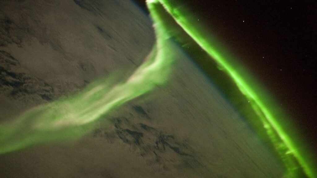
Storm-stirred legends and sonar stripes don’t often share a page, yet the Caribbean keeps forcing them into the same conversation. Over the last two decades, deep-ocean mapping has transformed swaths of blue emptiness into textured landscapes of canyons, terraces, and scars – features that some enthusiasts argue whisper of a drowned civilization. Scientists counter with a quieter story: shifting plates, rising seas, and carbonate platforms sculpted by time. Between those two narratives lives the real intrigue, a mystery that can’t be solved by romance alone – or by knee‑jerk skepticism. If Atlantis ever had a chance anywhere, the Caribbean offers both the most dramatic stage and the toughest scientific audience.
The Hidden Clues
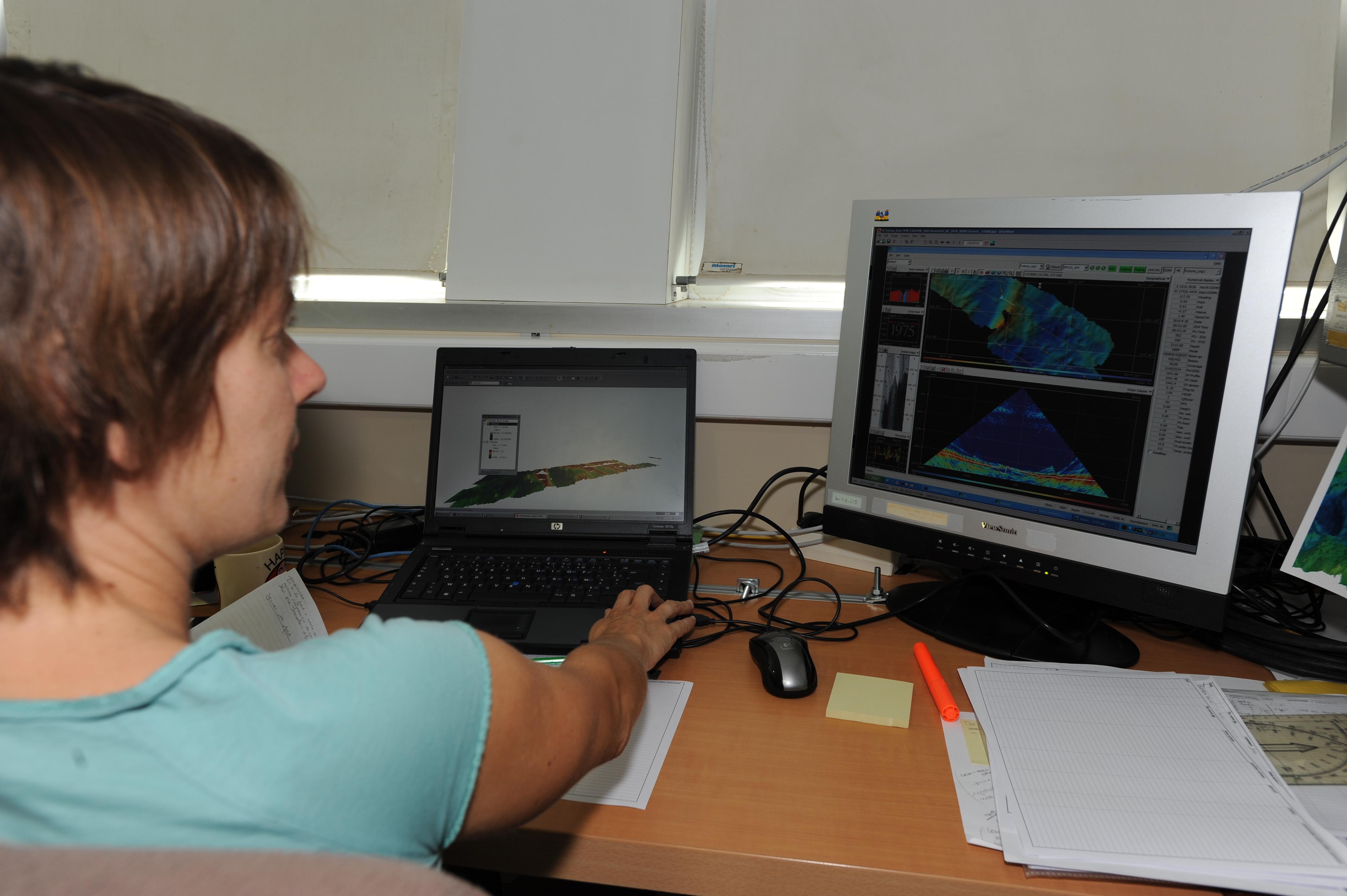
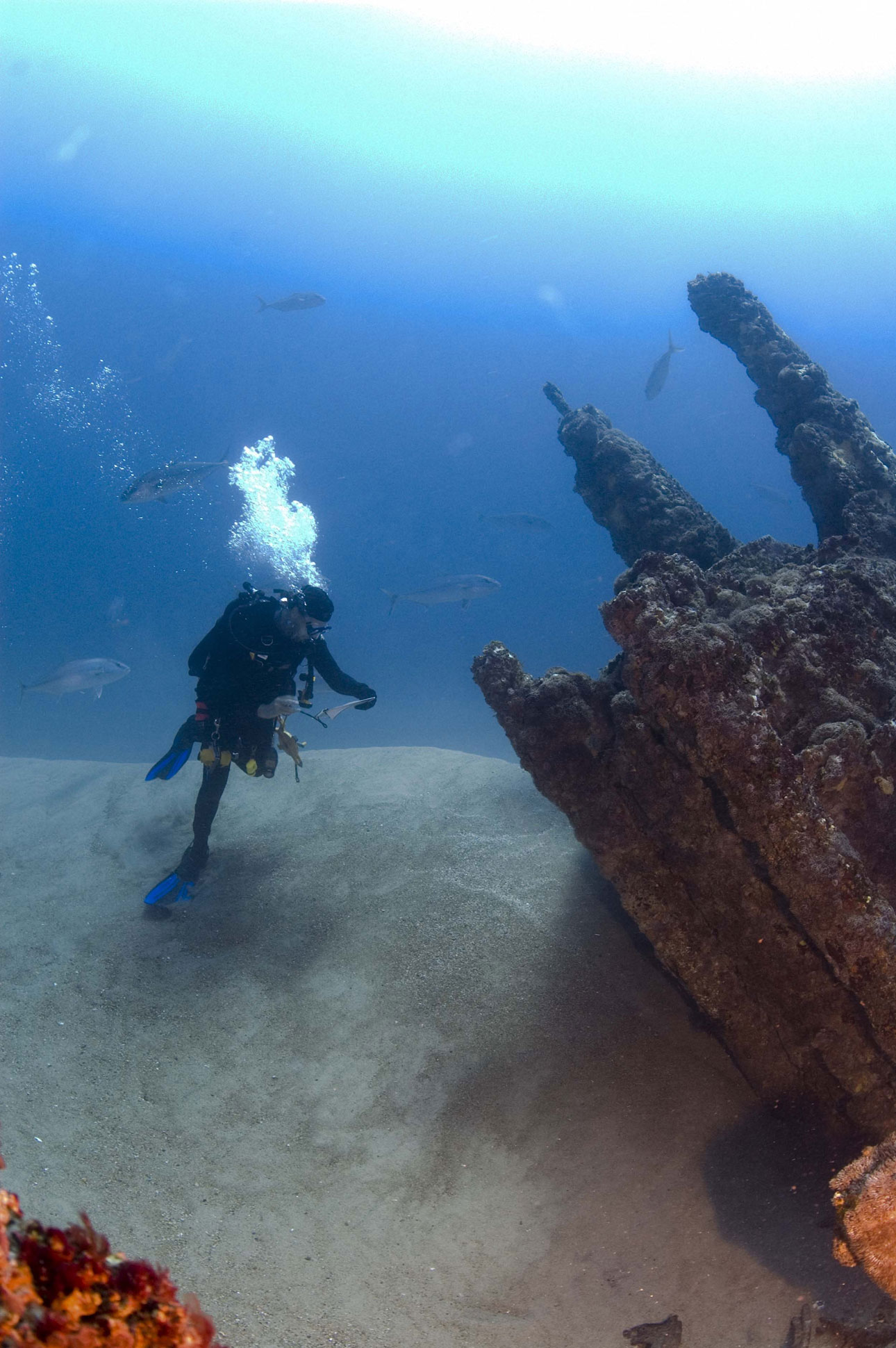
Start with the seafloor’s handwriting. Multibeam sonar reveals knife‑edged escarpments north of Puerto Rico, long run‑out landslides on the trench slopes, and lonely volcanic cones punctuating otherwise smooth carbonate benches. To a tuned eye, those shapes read like a logbook of earthquakes and slow‑motion collapses, not city blocks. Still, the human brain loves straight lines: repeated ledges mimic streets; slump blocks fall into suggestive rectangles; lava pillows break in ways that look uncomfortably architectural. I’ve watched a live shipboard sonar feed do that magic trick – turn physics into pattern – and felt the tug of possibility before the geologist in me cleared its throat. The ocean, it turns out, is a very good illusionist.
From Ancient Maps to Multibeam Sonar
For centuries, speculation rode on travelers’ tales and ambiguous charts; today it rides on sensor suites with unromantic names. State‑of‑the‑art multibeam systems map seafloor relief at resolutions measured in meters across waters thousands of meters deep, while chirp sub‑bottom profilers peer a short distance beneath the seabed to outline buried layers. Off Puerto Rico and the U.S. Virgin Islands, modern expeditions have stitched together high‑quality mosaics over vast areas, filling in the blank spaces that once acted like Rorschach tests for the imagination. Those maps don’t show boulevards or amphitheaters; they show fault‑controlled valleys, carbonate terraces, and headwall scarps where slopes failed catastrophically. In the raw data room, the drama isn’t mythic – it’s mechanical – and that’s precisely why it’s compelling. When the physics lines up, the story gets harder to romanticize and easier to trust.
The Bimini Puzzle: Natural Beachrock or Harbor Wall?
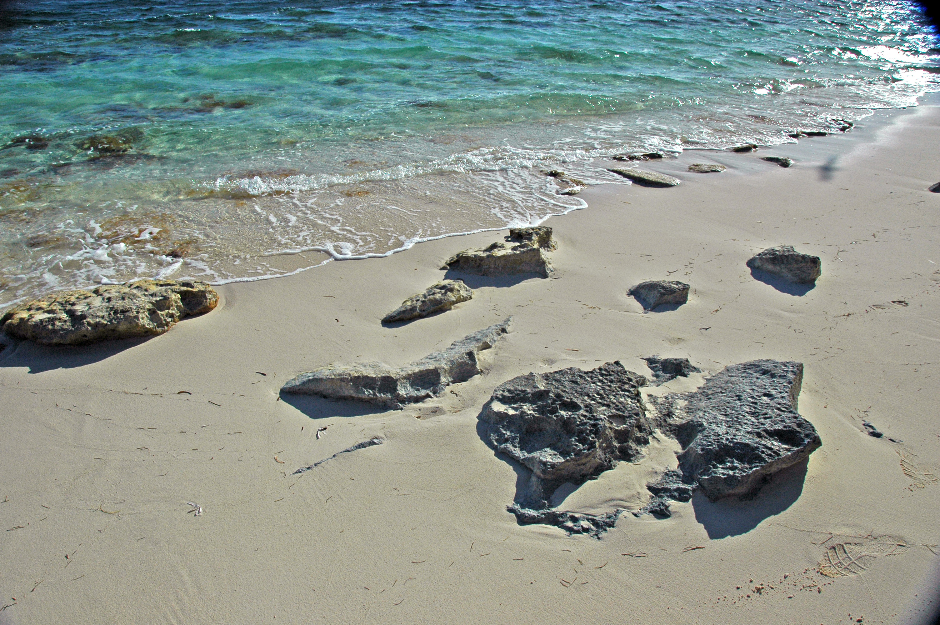
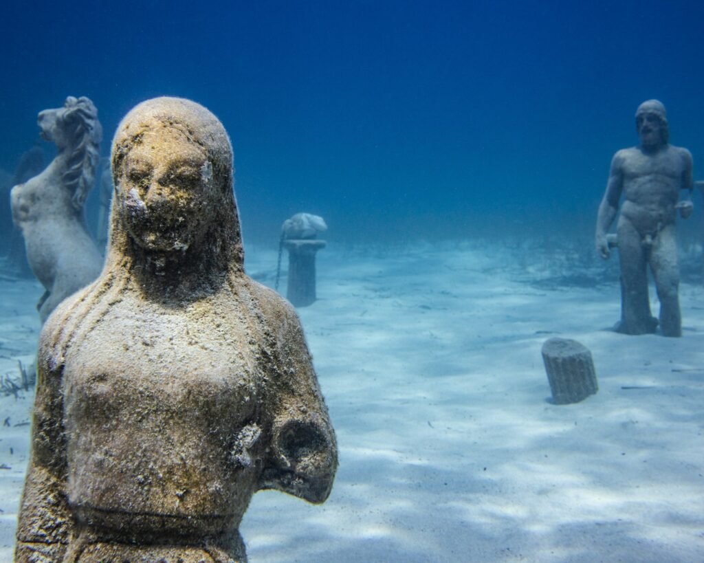
Few Caribbean features have courted more controversy than the Bimini Road, a neat scatter of blocky stones just offshore in the Bahamas. The arrangement is tempting: large, rectangular slabs aligned like a causeway. But close inspection and coring work show a textbook case of beachrock – young carbonate sands cemented in place, fractured, and then eroded into straight‑edged blocks that slid downslope. The ages come out in the “recent but ancient enough” window for natural formation: thousands of years, not tens of millennia, and certainly not the deep prehistory a lost empire would demand. Beachrock forms fast in tropical settings and breaks into shapes our brains delight in misreading. If this were a harbor, it would be the only one in the world built by seasons, tides, and chemistry alone.
Deep Riddles off Cuba’s West Coast
Far more dramatic are reports from the early 2000s of geometric sonar returns at roughly six to seven hundred meters off the Guanahacabibes Peninsula, western Cuba. At that depth, the sea floor is beyond recreational diving and even many research ROVs of that era struggled to get definitive imagery, leaving ambiguous side‑scan pictures to carry the narrative. Here the physics sets a tough constraint: the last glacial maximum pushed global sea level down by approximately 120 meters, not the many hundreds needed to expose those depths to ancient builders. Tectonic subsidence can move crust, but there’s no robust evidence for a rapid, civilization‑timed drop of several hundred meters on a stable carbonate margin like western Cuba’s shelf edge. The site deserves modern, high‑resolution follow‑up, but until we see ground‑truthed rocks, the parsimonious explanation is geology, not city planning.
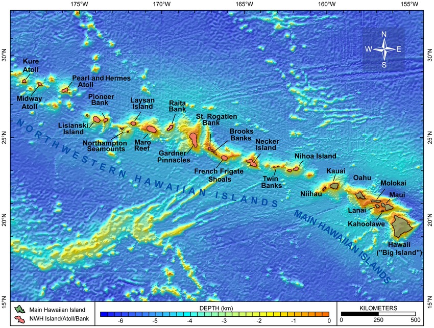
Reading the Caribbean’s Tectonic Script
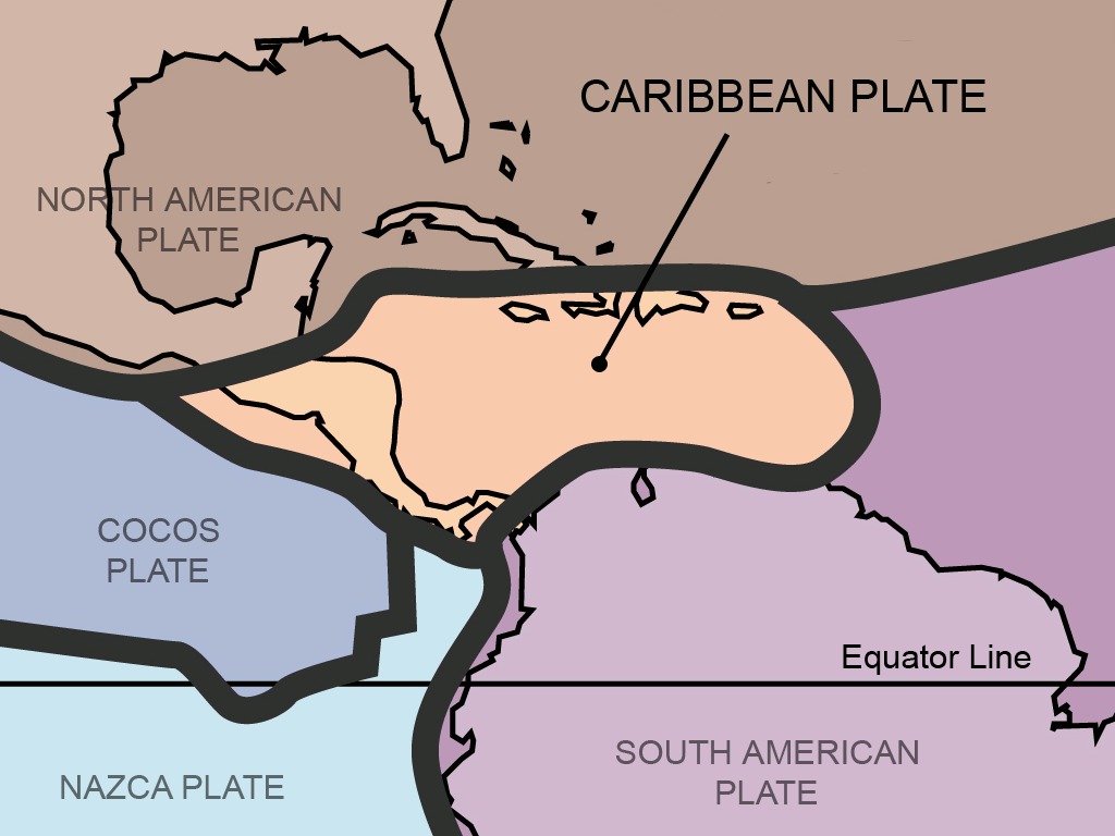
The Caribbean is a meeting ground of plates and processes that scribble bold strokes across the seafloor. North of Puerto Rico, a transform boundary with an oblique hint of subduction has carved the Atlantic’s deepest trench while flexing the surrounding crust, tilting platforms and loading slopes to failure. Around the Bahamas, by contrast, a broad carbonate platform has built up over millions of years, repeatedly exposed and drowned as ice ages came and went, leaving stair‑stepped benches and karstic scars that can mimic engineered edges. In places, rapid vertical motions do occur – uplifted blocks here, subsiding forearcs there – but they are recorded in tilted strata and gravity anomalies, not neat neighborhoods under the waves. When you overlay sonar maps with the region’s tectonic history, the patterns snap into focus as natural architecture. It’s less poetic, perhaps, but far more predictive.
Why It Matters
This isn’t just a parlor debate about a glamorous myth; it’s a stress test for how we read evidence in a noisy world. Submerged‑landscape archaeology thrives on the same tools that hazard scientists use, and the line between discovery and misinterpretation is razor thin. If we call every right angle a ruin, we waste ship time chasing mirages; if we dismiss every anomaly as folly, we risk sailing past real history. Compared with traditional digs, the ocean forces humility: you rarely touch the site first, you model it. That’s why transparent methods, open data, and cross‑disciplinary teams matter – geologists to read the layers, engineers to vet the signals, archaeologists to ask the human questions. The payoff is bigger than a single legend; it’s a sharper, shared way of seeing.
Global Perspectives
Across the planet, coastlines swallowed since the last ice age hold real human stories – think of North Sea’s Doggerland plains or the shallow shelves of the Black Sea – so the Caribbean is hardly an outlier in promise. What sets it apart is geology that can imitate intention: carbonate benches that fracture with crisp geometry, slump fields that tile themselves, and reef rims that look suspiciously like foundations when viewed at a glance. Elsewhere, careful re‑mapping has reclassified supposed cities as natural steps, while genuine archaeological sites tend to sit in water shallow enough to match known sea‑level histories. That contrast offers a simple rule of thumb: the deeper the claim, the harder the math. In that light, shallow Bahamian flats and drowned river mouths around the Greater Antilles may be the more likely places to find the region’s true sunken settlements.
The Future Landscape
The next wave of exploration will be faster, smarter, and frankly, less forgiving of myths. Autonomous vehicles towing synthetic‑aperture sonars can paint sub‑meter mosaics; compact ROVs can ground‑truth in hours what once took weeks; machine‑learning classifiers can flag genuine rectilinear anomalies from long, dull swaths of natural patterns. Open bathymetry portals now let anyone – students, divers, skeptics – zoom into seafloor datasets that were once locked away, shrinking the gap between sensational claims and verifiable evidence. The hurdles are real: permitting in politically complex waters, weather windows in hurricane seasons, and finite budgets that prioritize hazards and habitats over legends. But even if “Atlantis” remains a story device, the technologies built to test it will keep finding things we did not expect. And that’s the best kind of plot twist.
How You Can Engage
Curiosity needs fuel and good habits. Follow ongoing ocean mapping efforts and compare claims against freely available seabed maps before you hit share; it’s amazing how often a “temple” becomes a terrace when you change the scale. Support expeditions that publish their data and methods, because transparency is the antidote to wishful thinking. If you dive or boat in the region, contribute observations through citizen‑science portals that accept geotagged imagery tied to mapped features. And when a headline promises a lost city at improbable depths, ask the simple questions first: What’s the depth, what’s the context, and does the sea‑level history even allow it? The ocean rewards patient skeptics.

Suhail Ahmed is a passionate digital professional and nature enthusiast with over 8 years of experience in content strategy, SEO, web development, and digital operations. Alongside his freelance journey, Suhail actively contributes to nature and wildlife platforms like Discover Wildlife, where he channels his curiosity for the planet into engaging, educational storytelling.
With a strong background in managing digital ecosystems — from ecommerce stores and WordPress websites to social media and automation — Suhail merges technical precision with creative insight. His content reflects a rare balance: SEO-friendly yet deeply human, data-informed yet emotionally resonant.
Driven by a love for discovery and storytelling, Suhail believes in using digital platforms to amplify causes that matter — especially those protecting Earth’s biodiversity and inspiring sustainable living. Whether he’s managing online projects or crafting wildlife content, his goal remains the same: to inform, inspire, and leave a positive digital footprint.