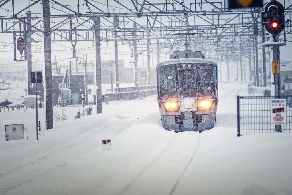

A Chilling New Year Begins with Heavy Snow (Image Credits: Pixabay)
Britain entered 2026 under a blanket of severe winter weather, with forecasts predicting intensified cold and snowfall across multiple regions.
A Chilling New Year Begins with Heavy Snow
The arrival of the new year coincided with a powerful snowstorm that set the stage for an extended period of extreme cold. Up to 12 inches of snow fell in vulnerable areas, prompting immediate concerns over travel and daily routines. Meteorologists noted that this initial onslaught marked the beginning of a broader freeze, with temperatures plummeting toward -10 degrees Celsius in the coming days.
Arctic air masses dominated the weather pattern, driving blizzards that blanketed northern and eastern parts of the country. The Met Office issued multiple warnings for snow and ice, highlighting risks of disruption through at least the next two days. Sub-zero gales exacerbated the conditions, making exposed locations particularly hazardous. Officials urged residents to prepare for potential power outages and road closures as the system intensified.
Northerly Winds Fuel Widespread Frost and Showers
Met Office meteorologist Alex Burkill described the evolving situation as one where conditions would grow even harsher. “Things are set to turn even colder as we go into the new year, with some snow in parts, and areas exposed to the northerly wind will have the most frequent showers,” Burkill stated. This northerly flow brought gales to northern and eastern Scotland, along with strong winds along England’s North Sea coast.
By Friday, the cold air had fully engulfed the nation, leading to widespread harsh frosts over the weekend. Snow showers concentrated in the north, though southern regions faced a small chance of flurries. A unique weather phenomenon, known as the Pembrokeshire Dangler, arose from moist winds over the Irish Sea, potentially delivering heavy snow to the west coast of Wales and southwest England. These bands of showers threatened to push the wintry weather farther south than initially expected.
Regional Variations in the Big Freeze
Scotland bore the brunt of the storm, with blizzard-like conditions in elevated and coastal zones. Eastern England experienced biting winds that amplified the chill factor, while the west coast braced for unexpected dumps from Atlantic influences. The Met Office outlined specific risks in its alerts, focusing on ice formation overnight and during morning commutes.
To illustrate the scope, here are key affected areas based on current forecasts:
- Northern Scotland: Frequent snow showers and gales up to 50 mph.
- Eastern England: Strong North Sea winds leading to wind chills below -10C.
- Southwest England and Wales: Potential for 4-6 inches from Irish Sea bands.
- Central regions: Harsh frosts with temperatures dipping to -8C inland.
- Southern areas: Low-lying snow risks but widespread ice warnings.
These variations underscored the need for localized preparations, from gritting roads in urban centers to securing livestock in rural districts.
Extended Forecast Signals Ongoing Cold Battle
Long-range predictions indicated the deep freeze would linger well into the second week of January, with no immediate relief in sight. A contest between encroaching high pressure systems and persistent polar winds would determine the duration of the snap. Meteorologist Jim Dale, from British Weather Services, emphasized the stability of the cold air mass. “The cold is then going to stay in situ through the start of the month, and there is as yet nothing to show this shifting back to a milder, westerly regime,” Dale observed.
If the polar influence prevailed, another round of wintry precipitation could strike during the second weekend. Coastal mild spells might trigger additional snowfall rather than thaw the landscape. Experts monitored this atmospheric tug-of-war closely, advising against complacency amid the prolonged low temperatures. The overall pattern suggested one of the more severe starts to a year in recent memory.
Key Takeaways
- Expect up to 12 inches of snow in northern areas, with ice warnings nationwide.
- Temperatures could reach -10C, driven by northerly gales and Arctic air.
- Disruptions likely through mid-January; monitor Met Office updates for travel.
As Britain navigates this formidable cold spell, the focus remains on safety and resilience against nature’s extremes. Staying informed could prevent mishaps in the days ahead – what steps are you taking to prepare? Share your thoughts in the comments below.