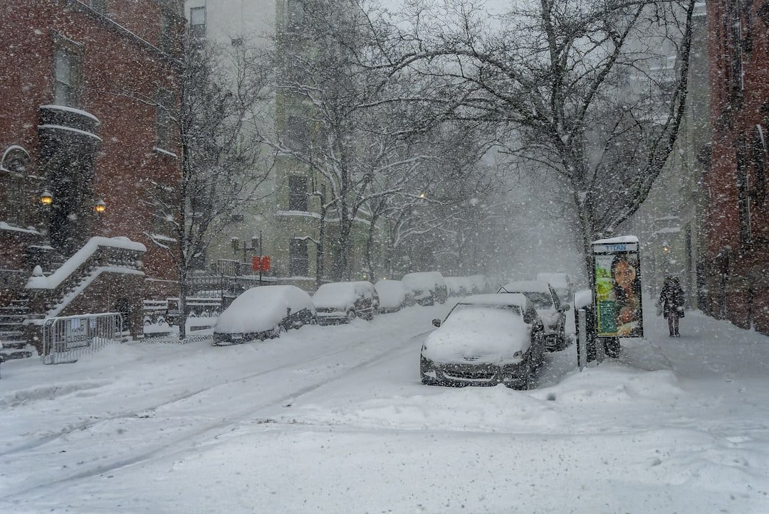
Record-Breaking Snowfall Rates Shock Forecasters (Image Credits: Unsplash)
Northeast and Mid-Atlantic – A powerful nor’easter intensified into a bomb cyclone on February 23, 2026, blanketing millions under blizzard warnings with relentless snow and hurricane-force winds.[1][2]
Record-Breaking Snowfall Rates Shock Forecasters
Snowfall rates reached 2 to 3 inches per hour in some spots, far exceeding typical winter storms and creating near-whiteout conditions.[1] Parts of New England already reported accumulations topping 2 feet, while the New York City area braced for at least 18 inches.[3] Philadelphia faced up to 18 inches as well, with lower totals expected farther south toward Washington, D.C.[4]
The National Weather Service issued warnings for over 40 million people stretching from Maryland to Maine, highlighting the storm’s rapid strengthening off the Mid-Atlantic coast.[5] Wet, heavy snow complicated plowing efforts, and wind gusts surpassing 70 mph in New York turned flurries into blinding blasts.[6] Officials described the event as one of the most intense in recent memory.
Travel Chaos Ensues Across Major Hubs
New York City imposed a full travel ban, stranding residents and halting all non-essential movement as snow piled up rapidly.[7] Airports from Boston to Philadelphia canceled thousands of flights, with rates at LaGuardia and JFK hitting 1 to 2 inches per hour.[8] Rail services ground to a halt, leaving commuters with few options amid the onslaught.
Highways turned treacherous, prompting states like New Jersey and Massachusetts to urge drivers to stay off roads. Power outages spread as gusts downed lines, affecting tens of thousands. Coastal flooding added to the misery in low-lying areas.
Snowfall Forecast by Key Cities
Forecasters provided detailed projections to help residents prepare for the worst.
| City | Expected Snow (inches) | Wind Gusts (mph) |
|---|---|---|
| New York City | 18-24 | 50-70 |
| Philadelphia | Up to 18 | 60+ |
| Boston | 24+ | 70-80 |
| Washington, D.C. | 6-12 | 40-60 |
These estimates drew from National Weather Service models updated on February 23.[9] Higher totals appeared likely in elevated New England terrain.
Safety Measures and Community Response
Authorities activated emergency protocols, including snow removal teams working around the clock. Residents stocked up on essentials before the storm peaked, heeding calls to avoid travel. The storm, dubbed Winter Storm Hernando, prompted states of emergency in several areas.[8]
- Stay indoors during peak blizzard hours.
- Check on vulnerable neighbors.
- Prepare for potential power loss with backup heat sources.
- Monitor local alerts for updates.
- Avoid driving until roads clear.
Utilities deployed crews to restore service swiftly, though full recovery could take days in hardest-hit zones.
This nor’easter reminded the region of winter’s raw power, disrupting routines but showcasing community resilience. As cleanup begins, forecasters watch for lingering effects. What are your snowstorm survival tips? Share in the comments below.