A thousand years ago, glaciers carved out the valleys we now hike and shaped the rivers that nourish our cities. Today, these ancient giants are vanishing before our eyes, melting away at a pace that feels both surreal and terrifying. The world turns to cutting-edge technology—AI, drones, and climate models—in a desperate, hope-fueled race to understand, and maybe even slow, this incredible loss. But can silicon brains and buzzing machines really turn the tide? Or are we simply documenting the decline of the world’s frozen treasures, powerless to intervene? Let’s pull back the curtain on this high-stakes drama, where science fiction meets harsh reality, and discover how technology is both our brightest hope and our most sobering disappointment.
The Glacier Crisis: Why Every Degree Matters
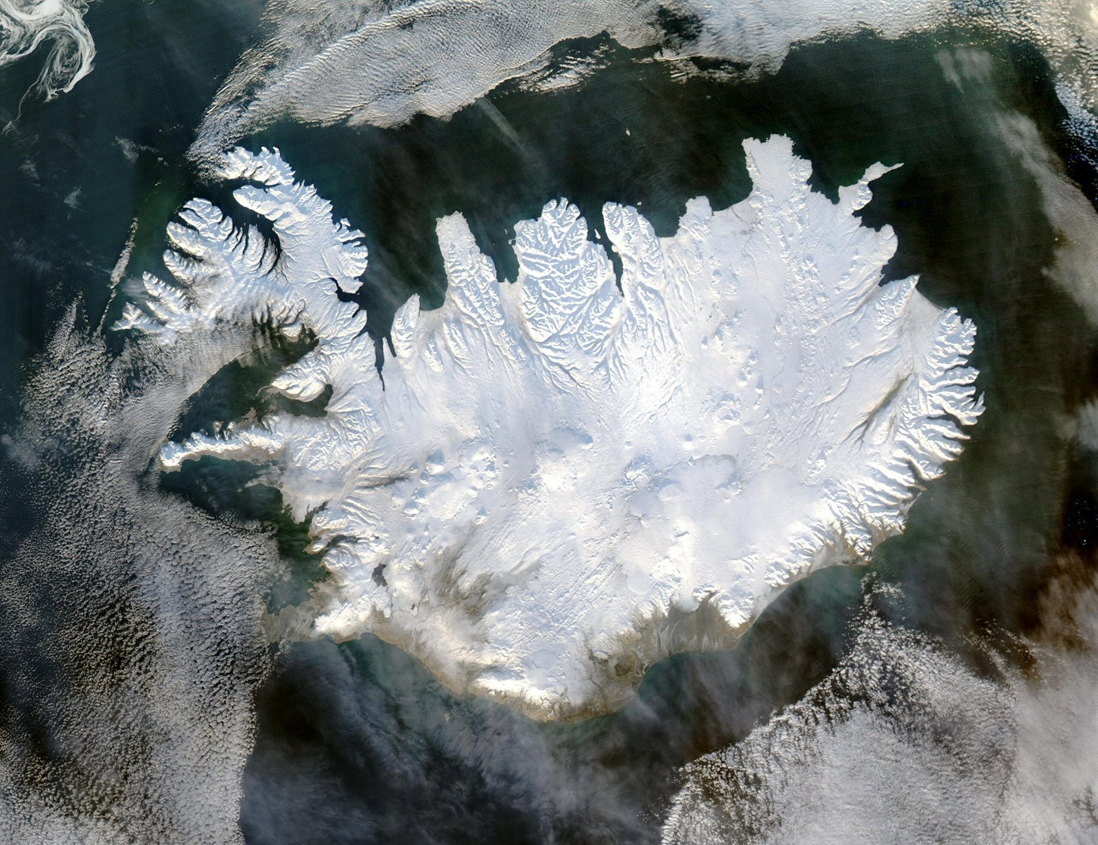
Glaciers are more than just beautiful backdrops for postcards—they’re lifelines for millions of people. When they shrink, entire communities downstream face water shortages, unpredictable floods, and even hunger. Every fraction of a degree in global temperature rise accelerates their melt, turning the climate crisis into a ticking time bomb. The urgency is stark: scientists warn that, at current warming rates, many of the world’s glaciers could disappear within this century. What’s truly shocking is how quickly this change is unfolding. Just a few decades ago, the idea of losing iconic glaciers like those in the Himalayas or the Alps seemed almost unthinkable. Now, it’s a chilling reality that technology is scrambling to keep up with.
The Rise of Artificial Intelligence in Glacier Research
Artificial intelligence has burst onto the glaciology scene with the energy of a rock star at a quiet folk concert. Gone are the days of hand-drawn maps and painstaking manual measurements. AI algorithms now sift through mountains of satellite images, tracking subtle changes in ice cover that the human eye would miss. These machines can spot patterns in melting, predict future loss, and even flag areas at risk of sudden collapse. But there’s a catch: AI is only as good as the data it’s fed. In regions where satellite coverage is sparse or weather conditions obscure the view, even the smartest algorithm can stumble. Still, the speed and precision AI brings are revolutionizing how we monitor Earth’s frozen frontiers.
Drones: Eyes in the Sky Over Ice
If you ever wondered what it’s like to soar like a bird over a glacier, drones are making that dream a reality—for scientists, at least. Tiny, buzzing, and surprisingly tough, drones can fly low over treacherous ice fields, capturing high-resolution images and 3D maps. They’ve helped researchers explore dangerous crevasses, monitor the flow of meltwater, and even measure ice thickness in places too risky for humans. The images drones gather can be stitched together to create detailed models that reveal how glaciers are changing week by week. Yet, drones face limits: battery life drains fast in the cold, and high winds or snow can ground even the most advanced models. Still, their ability to go where humans can’t has transformed the field.
Climate Models: Predicting the Unpredictable
Climate models are the crystal balls of science, built not from glass but from math, physics, and millions of data points. These models simulate how glaciers should respond to rising temperatures, shifting rainfall patterns, and even volcanic eruptions. They’re used to forecast everything from global sea level rise to local water supplies. The most advanced models—powered by AI and supercomputers—now include details like how soot from wildfires darkens ice or how shifting weather patterns bring more or less snowfall. But glaciers are notoriously tricky to predict. They’re sensitive to local quirks—like a change in wind direction or a sudden landslide—that models often miss. This means forecasts sometimes paint a fuzzier picture than we’d like.
The Data Dilemma: Garbage In, Garbage Out

One hard truth about technology is that it’s only as reliable as the information we give it. In the remote, wind-scoured regions where many glaciers live, collecting accurate data is a constant struggle. Satellites may miss key details under cloud cover, while ground sensors sometimes freeze up or are buried by snow. When AI and climate models are forced to fill in the blanks, their predictions can swing wildly. For example, a single missed melt event can throw off a glacier’s projected lifespan by years. Scientists are racing to plug these data gaps, but the sheer scale and inaccessibility of the world’s ice make the task daunting—and sometimes heartbreaking.
Real-World Wins: When Tech Makes the Difference

Despite the challenges, there have been exhilarating victories. In Greenland, drones and AI-powered models helped predict a sudden glacial lake outburst—a massive, potentially deadly release of meltwater—giving communities precious time to prepare. In the Andes, satellite data combined with machine learning helped map previously unknown glaciers, allowing local governments to better manage water resources. These stories offer a glimpse of what’s possible when humans and machines team up, blending curiosity with computational muscle. Each success story feels like a tiny rebellion against the seemingly inevitable march of climate change.
Unexpected Failures: Tech’s Limits Exposed

But not every mission ends in triumph. In Alaska, a drone survey went awry when a sudden blizzard grounded the fleet, forcing scientists to abandon their equipment. At other times, AI models have wildly overestimated glacier melt, leading to public confusion and costly policy missteps. Sometimes, the sheer unpredictability of nature—like a hidden pocket of warm water beneath the ice—can send even the best simulations off the rails. These failures are painful reminders that, for all our technological wizardry, glaciers still hold secrets that can’t be cracked by code alone.
The Human Touch: Why Scientists Still Matter

It’s easy to imagine a future where machines do all the heavy lifting, but the reality is far messier—and more inspiring. Scientists still trek across glaciers with heavy backpacks, drilling ice cores and setting up weather stations by hand. Their instincts, honed by years of frozen fingers and close calls, often spot problems that machines miss. For example, researchers in Svalbard noticed subtle color changes in the ice that signaled a shift in melt patterns—something no algorithm had flagged. The best science happens when technology and human experience work hand in hand, each compensating for the other’s blind spots.
Citizen Science: Ordinary People, Extraordinary Impact

Not all glacier research is the work of professionals. Across the world, volunteers armed with smartphones and simple cameras are helping to document glacier change. In places like Switzerland, hikers snap photos of retreating ice and upload them to online databases, creating a crowdsourced record stretching back decades. These contributions fill in crucial gaps—especially in remote areas too costly or dangerous for frequent scientific visits. Citizen science projects also foster a sense of personal connection to the crisis, turning observers into stewards and advocates.
Big Data: Making Sense of a Melting World

The sheer volume of information pouring in from satellites, drones, sensors, and citizen scientists is staggering. Sorting through this data is like trying to find patterns in a blizzard. That’s where powerful computers and clever algorithms shine, crunching numbers to reveal trends invisible to the naked eye. For example, big data analysis has enabled scientists to link glacier melt rates to specific weather events or even to global trade patterns that influence pollution. Still, not all patterns are easy to interpret, and false positives can mislead even the most seasoned analysts.
Mapping the Invisible: Thermal and Radar Imaging

Some of the most dramatic changes in glaciers happen out of sight, deep beneath the surface. Drones equipped with thermal cameras can spot hidden streams of meltwater, while radar imaging from satellites peels back the ice to reveal shifting layers and cavities. These tools have uncovered vast networks of subglacial rivers and even lakes lurking kilometers below the surface. Such discoveries have reshaped our understanding of how glaciers move and melt, showing that what’s invisible may be just as important as what we can see.
Machine Learning: Teaching Computers to See Patterns
Machine learning, a branch of AI, excels at finding subtle patterns in messy, complex data. In glacier research, this means teaching computers to recognize early warning signs of collapse or acceleration. For example, algorithms can analyze thousands of images to spot cracks or bulges that precede dramatic break-offs, allowing earlier intervention. These systems get better with each new dataset, learning from past mistakes and surprises. But they’re not infallible—sometimes, a rare event or unexpected weather can still trip them up.
Predicting Sea Level Rise: The Glacial Contribution
One of the most pressing questions for humanity is how much sea levels will rise as glaciers shrink. Advanced models now combine satellite observations, drone surveys, and AI forecasts to estimate the contribution of melting glaciers to global oceans. These predictions are crucial for coastal cities planning for flooding, infrastructure, and migration. Yet, uncertainties remain, especially for so-called “tipping points,” where a small change could trigger runaway melt. The stakes are enormous—just a few centimeters of sea level rise can mean the difference between safety and disaster for millions.
Ice Cores and Ancient Climate Clues

To understand where glaciers are headed, scientists look deep into the past. Ice cores—long cylinders drilled from ancient ice—trap bubbles of air, dust, and pollen dating back thousands of years. Analyzing these records requires both meticulous lab work and sophisticated computer models to reconstruct past climates. Recent advances in AI have made it possible to spot tiny shifts in chemical signatures that hint at ancient droughts or volcanic eruptions. These insights help scientists put today’s rapid changes into a longer-term context, revealing just how extraordinary—and alarming—current trends truly are.
Ethical Questions: Who Owns Glacial Data?

As technology races ahead, new ethical dilemmas emerge. Who has the right to access and use the flood of data pouring in from drones and satellites? In some regions, indigenous communities are pushing back against outside researchers, demanding a say in how their ancestral lands—and data—are used. There are also privacy concerns: high-resolution imagery can sometimes capture people or property without consent. Navigating these issues requires sensitivity, collaboration, and a willingness to share both knowledge and power.
Cost and Accessibility: The Digital Divide in Glaciology
Not every country or research group can afford the latest drones, AI software, or supercomputers. This digital divide means that some of the most vulnerable glaciers—often in poorer regions—remain understudied. Even when the technology is available, training and maintenance can be major hurdles. Some scientists rely on international collaborations to bridge the gap, pooling resources and expertise. Others are developing low-cost solutions, like open-source drone designs or simple smartphone apps, to democratize glacier monitoring.
The Power of Visualization: Bringing Glaciers to Life
One of the most inspiring uses of new technology is creating vivid, interactive visualizations of glacier change. Using data from drones, satellites, and climate models, artists and scientists can now build immersive 3D maps or animations that show glaciers advancing, retreating, and even collapsing in real time. These visualizations make the invisible visible, helping the public grasp the scale and urgency of the crisis. They can spark powerful emotions—wonder, sadness, even outrage—and mobilize action.
Hope in Innovation: New Frontiers in Glacier Protection

Despite the daunting challenges, there are glimmers of hope for the world’s glaciers. Researchers are experimenting with reflective blankets to slow summer melting, or seeding clouds to boost snowfall in critical areas. AI is helping identify the most vulnerable glaciers for targeted conservation efforts. While these approaches are still in their infancy and not without controversy, they show a willingness to try anything and everything to buy time for nature to heal. The very act of innovation keeps hope alive, even in the face of overwhelming odds.
A Call to Action: Our Shared Responsibility

Standing on the edge of a retreating glacier, it’s hard not to feel both awe and grief. Technology gives us powerful tools, but it can’t replace the collective will to change course. Every data point, every drone flight, every AI model is a reminder: the fate of glaciers isn’t just a scientific issue, but a test of our shared humanity. Will we act in time, or will we watch these wonders slip away, pixel by pixel, degree by degree?