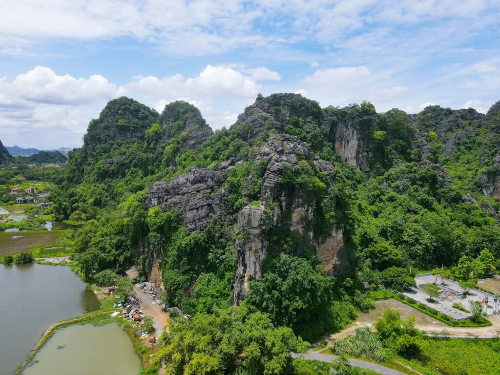
One moment the ground looked ordinary, the next it dropped away – opening a raw window into an older Texas most of us never picture. Beneath ranch grass and caliche sits a story written in carbonate, carved by water, and sealed for ages. A sudden collapse can feel like loss, yet it can also solve a mystery: why seashell patterns and reef textures appear hundreds of miles from the modern shoreline. Here, fossil-rich limestone holds the cast remains of a vanished ocean, including coral-like structures and their reef-building partners. This discovery forces a simple, thrilling question: how much of ancient sea life still sleeps under our feet?
The Hidden Clues
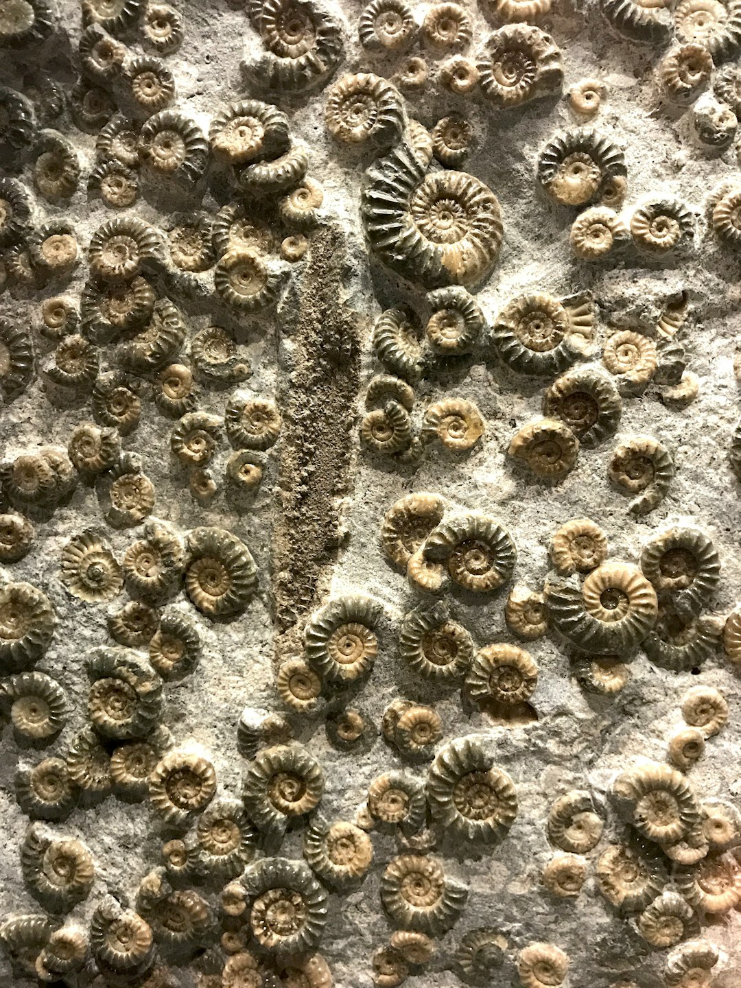
What looks like chaos at the surface is, underground, surprisingly orderly: a stack of marine layers that once lay beneath warm, shallow seas. In Texas, those seas left behind limestones brimming with fossils – corals, sponges, bryozoans, echinoids, and the shells of tiny foraminifera that bound the reef together. When a sinkhole tears open the ceiling of a limestone chamber, it can peel back time in a single afternoon.
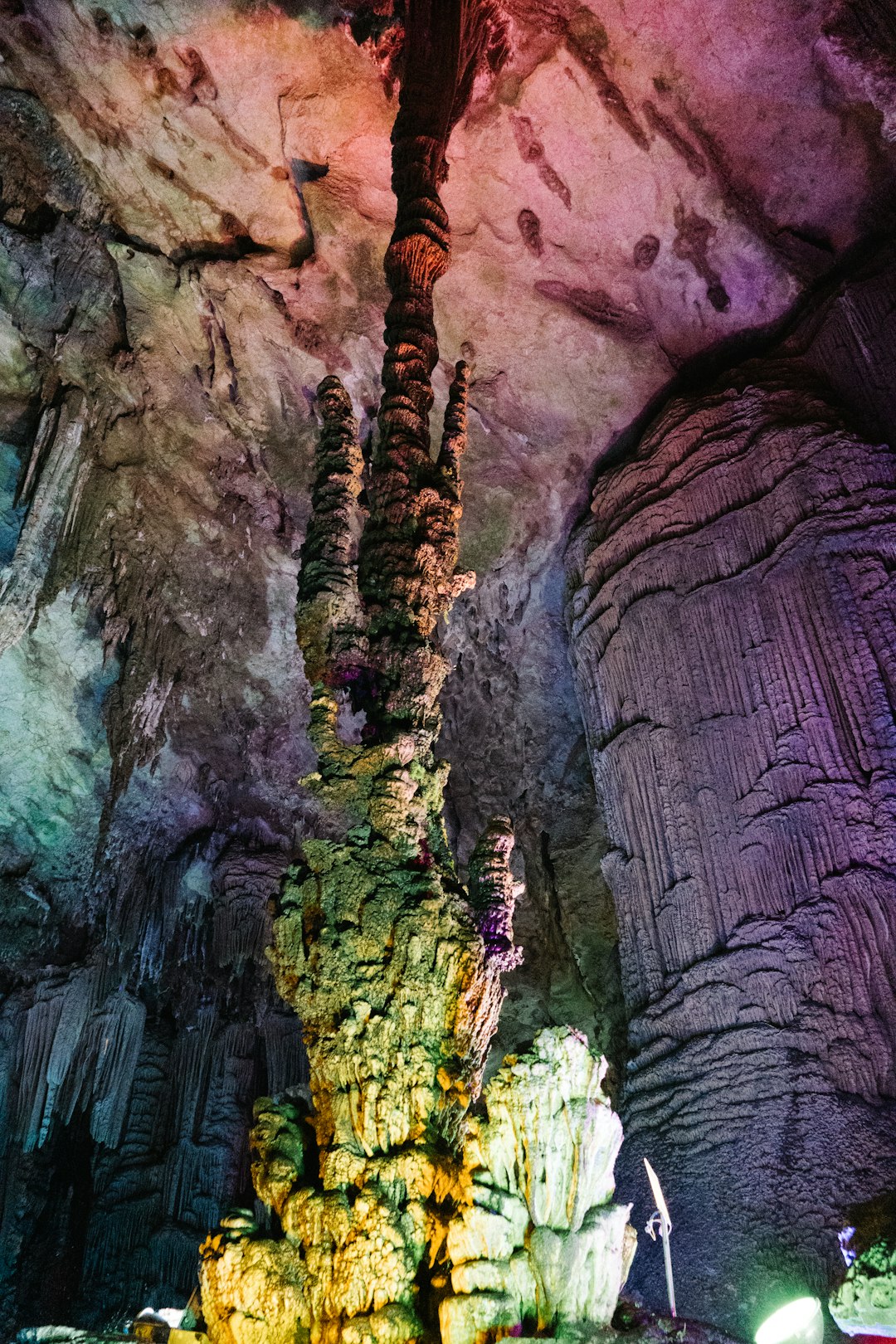
Standing at a safe distance, the walls read like pages: pale bands of lime mud, fragments of reef framework, and pockets where groundwater etched honeycomb voids. I grew up driving Hill Country backroads, staring at roadcuts that quietly announced this watery past, and I still feel a jolt when these layers appear in the wild. The surprise isn’t that we find marine fossils here; it’s how vivid and intact some of them are when the earth splits without warning.
What Collapsed, and Why
Most Texas sinkholes fall into two families: karst collapses in limestone and dolomite, and subsidence in areas where buried salt or gypsum dissolves. Rainwater picks up carbon dioxide, turns slightly acidic, and patiently widens fractures until roofs of underground cavities can no longer hold. Eventually, rock gives way, sediments tumble in, and daylight pours down a shaft that didn’t exist yesterday.
Here’s what typically flags a karst collapse to geologists on site:
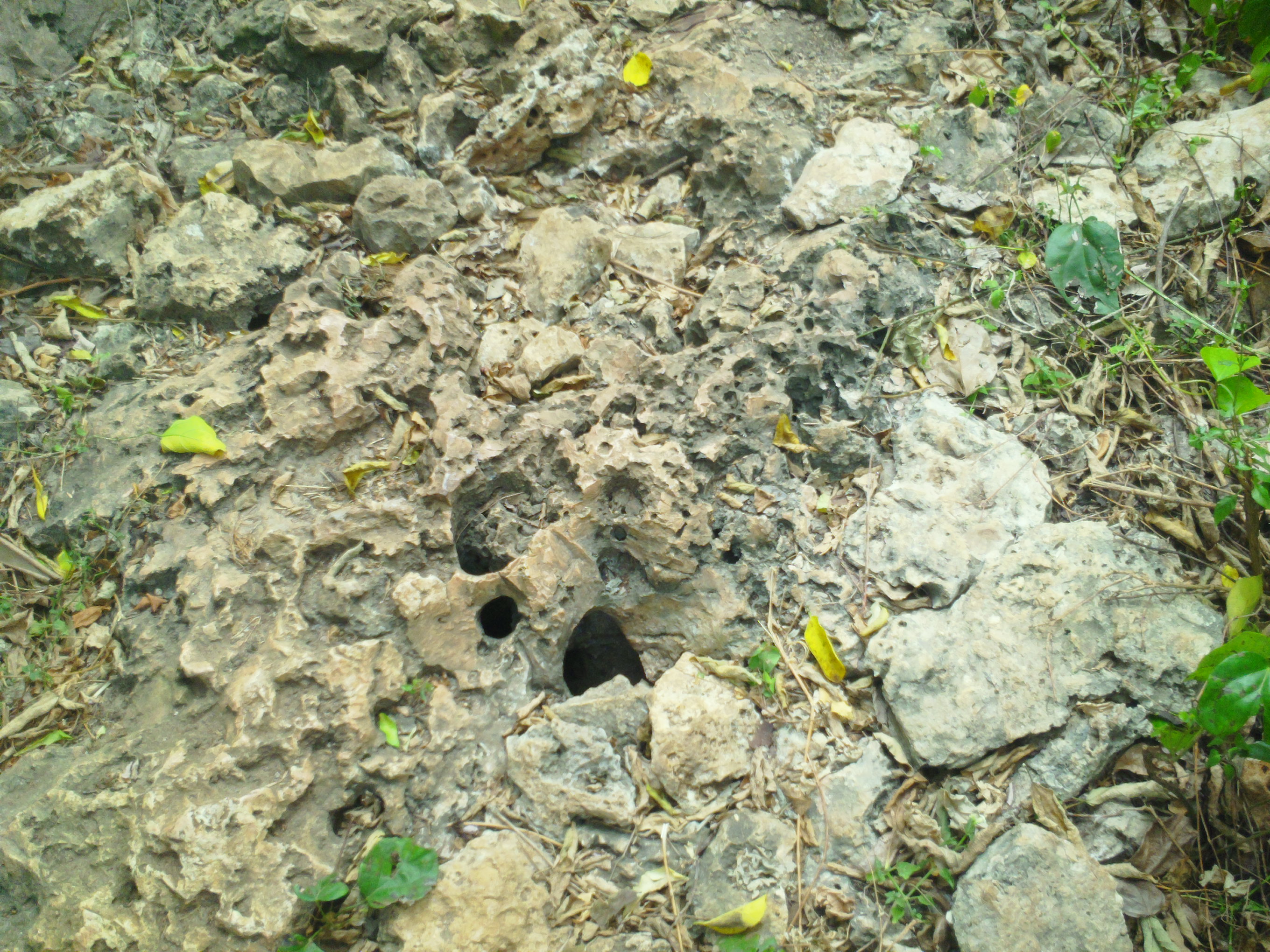
– Circular or oval depressions with steep edges and fresh tension cracks
– Exposed limestone showing solution pockets, dripstone coatings, or flowstone
– Fossil-bearing layers aligned with bedding planes rather than jumbled fill
These clues help teams decide whether they’re looking at a natural limestone failure or something driven by buried evaporites or human infrastructure.
From Ancient Tools to Modern Science
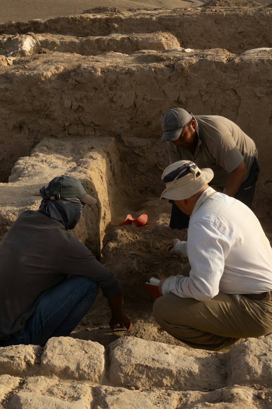
The first rule at a new collapse is simple: document before you touch. Researchers now deploy drones for photogrammetry, stitching thousands of images into high-resolution 3D models that capture every ledge and fossil texture. Ground‑penetrating radar maps cavities beyond the hole’s lip, while handheld LiDAR scans preserve dangerous walls in a few cautious passes.
In the lab, thin sections reveal the reef’s micro-architecture under polarized light – skeletal grains, lime mud, cements, and the microscopic pores where seawater once flowed. Geochemists analyze oxygen and carbon isotopes to bracket temperatures and water chemistry, then compare strontium signatures against global seawater curves to narrow the rock’s age. The result isn’t just a collection of beautiful fossils; it’s a time-stamped environment, frozen mid‑story.
Reading an Ancient Reef
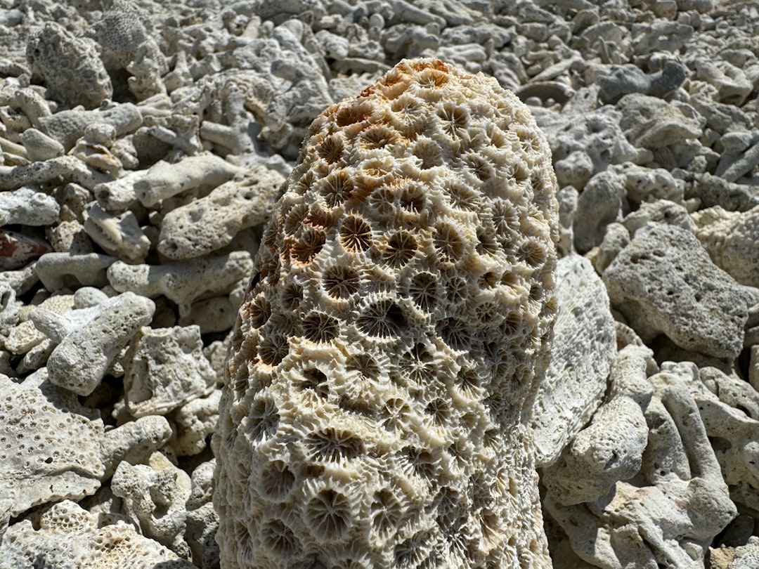
Texas hosts one of the world’s classic fossil reef provinces, a record that stretches from Paleozoic seas to Cretaceous shorelines. Not every reef here was coral‑dominated – many ancient frameworks were held together by sponges, algae, and bryozoans – but corals and coral‑like builders threaded through the ecosystem in patches and pockets. When a sinkhole intersects that architecture, you can see the reef’s grammar: frameworks, binders, and the sediment that pooled between them.
Look closely and you’ll notice broken reef debris sloping into deeper layers, the signature of waves that once battered a living margin. Elsewhere, calm back‑reef deposits preserve delicate shells pressed flat in fine lime mud. This isn’t just pretty stone; it’s a map of currents, habitats, and day‑to‑day reef life captured in exquisite relief.
Why It Matters
Fossil reefs are time machines that let us test ideas about sea‑level rise, storm intensity, and biodiversity under warmer oceans. They show how communities reorganize when chemistry and temperature shift – lessons we need as modern reefs around the world face heat stress and acidification. A carefully studied sinkhole can add a precise datapoint to that global story.
Consider the practical payoffs as well:
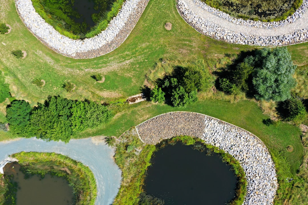
– Reef limestones are aquifers; understanding their fractures protects drinking water
– Collapse mapping guides safer land use and infrastructure planning
– Provenance and age data refine regional geologic maps used by engineers and planners
In a state where groundwater sustains cities and farms, these aren’t abstract wins – they’re everyday necessities.
Global Perspectives
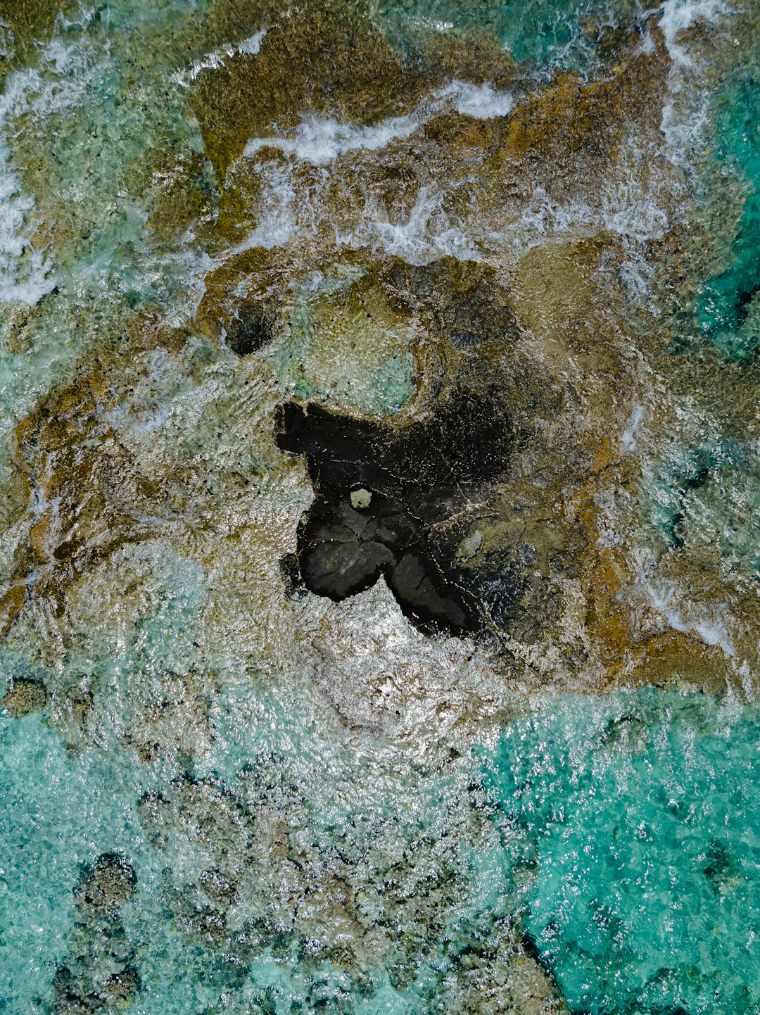
Texas isn’t alone in learning from sudden openings into deep time. Across the Yucatán, water‑filled sinkholes slice through reef limestones, revealing layered histories of climate and sea level. Florida’s karst windows do similar work, exposing Pleistocene life where aquifers breathe at the surface.
What sets Texas apart is how neatly its reef story is displayed at the scale of landscapes: towering fossil reef escarpments in the west, broad carbonate plateaus in the center, and marine fossils scattered like breadcrumbs through roadcuts and creek beds. A single hole can bridge those terrains, offering a compact cross‑section that would take days to hike above ground. It’s a classroom built by water and gravity, with lessons written in stone.
The Science Beneath Our Feet
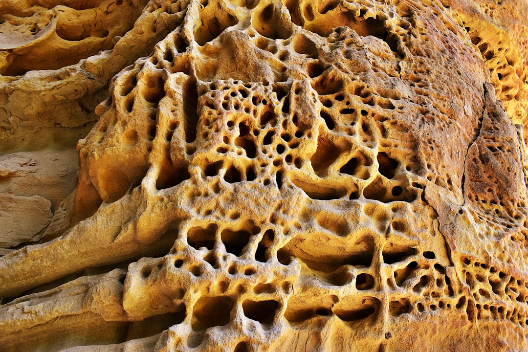
Corals, sponges, and their companions leave more than shapes – they leave chemistry we can read. Trace elements in fossil skeletons hint at past seawater composition, while growth bands record seasonal pulses like tree rings embedded in carbonate. Even void‑filling cements tell a tale, precipitating in stages as groundwater changed through time.
Pair those records with regional stratigraphy and you can follow shoreline migrations, storm regimes, and abrupt ecological turnovers. The beauty of a sinkhole exposure is continuity: layers remain in place, so relationships are preserved rather than mixed by machinery. It’s the difference between a shuffled deck and a neatly stacked one when you’re trying to reconstruct a game in progress.
The Future Landscape
Expect the next round of discoveries to come with better eyes and lighter feet. Ultraportable mass spectrometers are moving from big labs to field tents, speeding up age and chemistry calls from months to days. Drone swarms can map unstable rims without putting people near the edge, and AI segmentation now picks out fossil textures in point clouds that once took weeks to label by hand.
Challenges remain: protecting sites on private land, stabilizing dangerous collapses without erasing science, and balancing curiosity with community safety. Digital twins – full 3D, metrically accurate models – offer a workable compromise, preserving every contour before crews backfill or cap. If we get that balance right, the next sinkhole won’t be just a hazard; it will be a documented chapter in a much larger book.
Conclusion
If you encounter fresh ground cracks, sudden depressions, or a new opening after heavy rain, keep clear and alert local officials – safety first, science second. Share observations with regional cave and karst groups, who often coordinate with universities and landowners to document sites responsibly. Support museum and university field programs that train the next generation to read rocks with care.
For curious minds, visit public fossil reef trails and show caves where you can see the same story in stable settings, and consider backing conservation groups that safeguard aquifers flowing through these ancient limestones. Report suspected fossils to professionals rather than collecting; context matters more than any single specimen. What hidden sea might be sleeping under your street?

Suhail Ahmed is a passionate digital professional and nature enthusiast with over 8 years of experience in content strategy, SEO, web development, and digital operations. Alongside his freelance journey, Suhail actively contributes to nature and wildlife platforms like Discover Wildlife, where he channels his curiosity for the planet into engaging, educational storytelling.
With a strong background in managing digital ecosystems — from ecommerce stores and WordPress websites to social media and automation — Suhail merges technical precision with creative insight. His content reflects a rare balance: SEO-friendly yet deeply human, data-informed yet emotionally resonant.
Driven by a love for discovery and storytelling, Suhail believes in using digital platforms to amplify causes that matter — especially those protecting Earth’s biodiversity and inspiring sustainable living. Whether he’s managing online projects or crafting wildlife content, his goal remains the same: to inform, inspire, and leave a positive digital footprint.