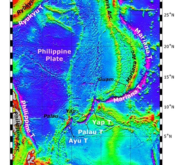

You live on a planet where most of the world is water, yet you know more about the surface of Mars than the bottom of your own oceans. That’s not an exaggeration. Modern sonar and satellite data let scientists map the seafloor in broad strokes, but when technology finally drops into the darkest trenches, it often breaks, loses power, or is crushed before you get the full story. That makes every partial dive feel a bit like reading a thriller and having the last chapter torn out.
In this article, you’re going to walk trench by trench through seven of the deepest, most hostile places on Earth that have been mapped but not truly conquered. For each one, you’ll see what was actually detected or filmed near its known or estimated deepest point right before the gear gave out – whether it was a crushed lander, a failed camera, or an exhausted battery. You will not get neat, tidy endings here, but you will get glimpses: strange sounds, fragile animals, inexplicable sediments, and data that raise more questions than they answer.
1. Mariana Trench (Western Pacific) – The Deepest Known Point on Earth
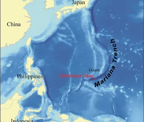
When you think of the deepest place on the planet, you probably picture the Challenger Deep in the Mariana Trench, dropping down almost eleven kilometers into the dark. Thanks to repeated expeditions, rough mapping is pretty good here, but that does not mean the entire trench, or even the very bottom, is consistently and fully explored. In multiple missions, autonomous landers and remotely operated vehicles have reached the approximate deepest point, recorded a short burst of data and video, then suffered power loss, communication dropouts, or mechanical issues that forced an early end.
Right before failure, the instruments typically show you a surprisingly busy seafloor for such a hostile place. You see fine, pale sediment that looks like a snowy desert, littered with tiny tracks and burrows, plus translucent snailfish, shrimp-like amphipods, and other small scavengers moving slowly across the mud. Chemical sensors have picked up hints of complex organic material in the sediment and in the water just above the bottom, suggesting that sinking marine snow and decomposing life from far above keep this pit from being truly dead. Then, just as you start to wonder what else might live there, the images stutter, pressure strains the housing, and the data feed cuts out, leaving the true diversity and layout of the very deepest patch still uncertain.
2. Tonga Trench (Southwest Pacific) – A Violent, Quaking Abyss
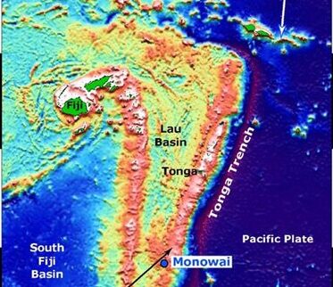
The Tonga Trench is one of the narrowest yet deepest scars on Earth’s surface, dropping close to the depth of the Mariana in a region hammered by some of the strongest earthquakes on record. Bathymetric mapping gives you a good outline of its jagged shape and steep inner walls, but when vehicles have tried to reach the deepest parts, the same forces that built this trench have made staying there incredibly hard. Seafloor shaking, small submarine landslides, and strong currents near the bottom have all contributed to equipment damage and shortened missions.
In a few dives that came close to the known maximum depth, cameras captured a slope coated in thick sediment with patches disturbed as if something had recently slumped or slid. You see scattered rocks, occasional deep-sea holothurians (sea cucumbers), and scavenging amphipods clustering around whatever organic scraps reach this depth. Acoustic instruments have also picked up faint, low-frequency rumbles, likely small quakes or rockfalls, reminding you that the ground itself is unstable. Before engineers could reposition the landers or ramp up sampling, telemetry dropped or moving parts jammed, cutting short attempts to see how life copes with this constantly shifting, crushing environment.
3. Philippine Trench (Philippine Sea) – Deep, Steep, and Chemically Mysterious
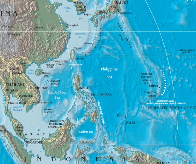
The Philippine Trench is sometimes overshadowed by its more famous neighbor, but it reaches comparable depths and has some of the steepest slopes in the ocean. Large-scale mapping has traced its long, narrow shape and highlighted dramatic cliffs, yet the deepest inner floor remains only sparsely visited. When probes have descended toward its lowest point, they have often encountered stronger-than-expected currents and complex layers of water with different temperatures and chemistry, which complicate descent and hovering near the seafloor.
On dives that managed a brief landing near the depth record before systems failed, sensors detected unusually high concentrations of organic-rich particles in the near-bottom water. The cameras showed a dark, fine-grained seafloor with scattered burrows, small invertebrates, and what looked like delicate microbial mats or films spreading across the sediment in patches. Some instruments hinted at lower oxygen levels right at the sediment–water interface, suggesting intense microbial activity that consumes what little oxygen drifts down. Just as teams started planning longer station times to sample these layers, power systems hit their limits or communication links dropped, forcing a retreat and leaving you with more questions than answers about the chemistry sustaining these deep communities.
4. Kermadec Trench (Southwest Pacific) – The Trench of Giants and Fragile Gear
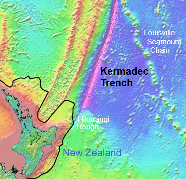
The Kermadec Trench stretches north of New Zealand and rivals the other big trenches in depth, but what really stands out here is the size of some of the animals recorded on the way down. Broad mapping has sketched the trench as a long, curving feature, but only a few missions have tried to touch its deepest floor. During those dives, baited cameras descending through the darkness have sometimes revealed large amphipods and snailfish, animals that seem oversized compared with their shallow-water relatives, gliding in from the edges of the frame.
At or near the deepest surveyed spots, right before the landers failed, you see a bottom that looks strangely smooth from a distance but reveals tracks, mounds, and feeding pits when the cameras get close. Animals appear adapted to intense pressure and low energy: thin-walled bodies, slow movements, and a readiness to swarm any fresh food source. On more than one occasion, the same pressure that the resident life tolerates effortlessly has pushed support structures and housings of the instruments to their limits. Seals started to deform, housings developed leaks, and electronics shut down early, ending attempts to capture long-duration footage of how these giants and scavengers actually live over hours and days.
5. Kuril–Kamchatka Trench (Northwest Pacific) – Cold, Dark, and Poorly Sampled
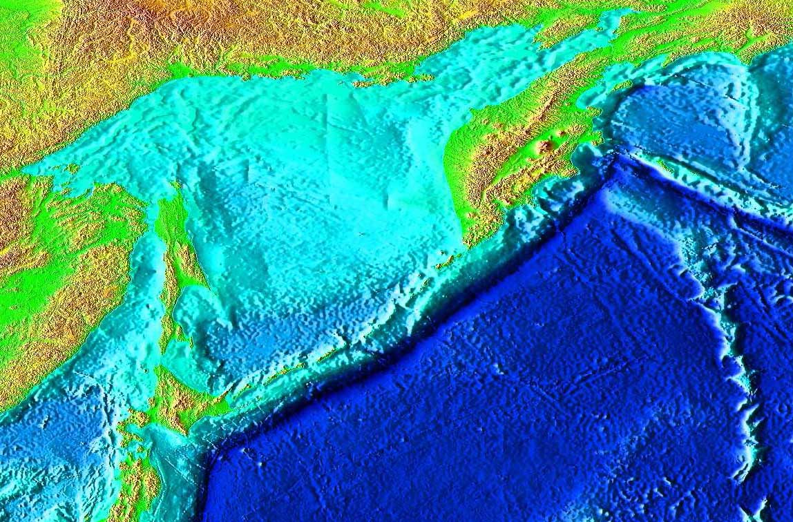
Far to the north, the Kuril–Kamchatka Trench arcs off Russia and Japan, combining deep water with colder temperatures and rough weather at the surface. Ship time in this region is harder to secure and more dangerous, so while sonar mapping has given you a general picture of its depth and layout, close-up exploration is rare. The deepest parts have only been visited briefly by a handful of robotic missions, many of which were cut short by technical trouble in the harsh conditions.
When those vehicles reached the seafloor near the deepest known point, cameras captured a dim, grainy view of a gently sloping bottom dotted with small invertebrates and occasional larger scavengers drawn to the deployed bait. The sediment here looks thicker and more disturbed in patches, as if currents or slow-moving slumps occasionally reshape the landscape. Some instruments recorded higher-than-expected levels of certain dissolved nutrients, hinting that deep currents might be funneling chemical-rich waters along the trench axis. Before additional samples could confirm this pattern, cold-induced battery issues and communication failures forced an early ascent, leaving the detailed chemistry and ecology of this northern abyss largely uncharted in practice.
6. South Sandwich Trench (Southern Atlantic) – A Deep Frontier Wrapped in Ice and Storms
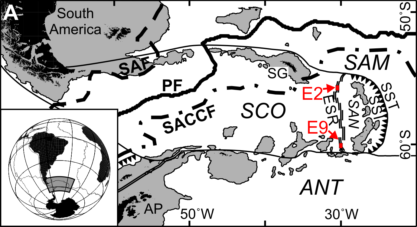
The South Sandwich Trench lies in a remote, stormy corner of the South Atlantic near the Antarctic front, where sea states can be brutal and ice is never far away. Satellite and shipboard mapping have revealed a long, curved trench with one of the planet’s deepest points outside the Pacific, but very little time has been spent on its actual bottom. The combination of rough surface weather and challenging logistics makes it hard for expeditions to stay on station long enough to run many deep dives, and that means each short mission carries enormous pressure to succeed.
In the few dives that have approached its deepest reaches, you see a very dark, fine sediment plain with scattered tracks and small, soft-bodied animals that appear adapted to both pressure and cold. The water column right above the seafloor shows low temperatures and signs that Antarctic-influenced deep waters flow through the trench, supplying oxygen but not a lot of food. Some cameras showed occasional passing fauna – likely amphipods and other scavengers – but the footage is limited, often ending as storms above forced early recovery or as systems reached their pressure or time limits. You walk away with the sense that this trench is one of the least observed major depths on Earth, mapped in shape but almost untouched in day-to-day ecological detail.
7. Java (Sunda) Trench (Eastern Indian Ocean) – Deep Water Near Densely Populated Coasts
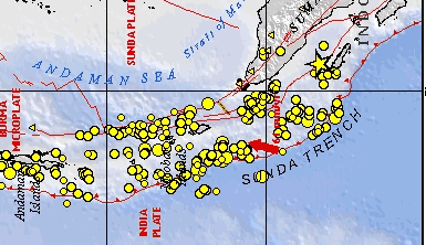
The Java, or Sunda, Trench runs along Indonesia and the eastern Indian Ocean and is tied to some of the most destructive earthquakes and tsunamis in modern history. Its basic form is well mapped because of the huge interest in seismic risk, but the deepest patches of the trench itself have only seen limited dives. Strong currents, high sediment input from nearby islands, and the constant risk of earthquakes make it a challenging place to operate delicate equipment, even though you are not that far from populous coastlines.
In dives that reached near the deepest mapped points before technical issues intervened, sensors and cameras revealed a thick, muddy seafloor, often with signs of recent disturbance from slumps or turbidity flows. You might see sparse, hardy deep-sea animals – sea cucumbers, crustaceans, and worms – living in or on the mud, with scavengers homing in quickly when baited landers are used. Chemical readings hint at an environment where fresh sediment and organic material periodically arrive in pulses, reshaping the bottom and altering conditions for life. Unfortunately, instrument failures, sediment clogging moving parts, or communication interruptions have consistently cut short these missions, so your view of how earthquakes and rapid sediment flows shape biology down here remains fragmentary.
Conclusion: Mapped, But Far From Known
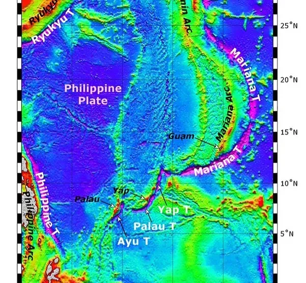
When you zoom out, these seven trenches remind you that having a map is not the same as having understanding. Sonar and satellites let you trace their outlines, estimate their depths, and even color them on a chart, but the true stories – how the sediments move, how animals feed and reproduce, how chemistry shifts over hours and seasons – are still mostly hidden. Again and again, instruments touch down, catch a glimpse of unexpected life or strange conditions at the deepest points, and then fail, leaving you with puzzle pieces but no full picture.
If you are honest with yourself, your planet’s deepest places are still largely frontiers, not well-trodden landscapes. These trenches are mapped enough to name the low spots, but not explored enough to say with confidence what really thrives or struggles there over time. As new generations of stronger, smarter vehicles come online, you may finally get to read those missing last chapters from the bottom of the sea. Until then, every failure at depth is also an invitation: what else might be living, changing, and evolving in those black, mapped lines you see on a screen – just out of reach for now?